Lulworth Common
Downs, Moorland in Dorset
England
Lulworth Common
![A short walk to Belhuish Farm [1] From the B3071 road, this track, a public footpath and permissive bridleway, runs alongside Burngate Wood towards Coombe Keynes.
From the B3071 road, the walk follows the long distance Hardy Way to the cluster of buildings at Belhuish Farm and returns the same way. Almost exactly 1 mile.](https://s2.geograph.org.uk/geophotos/07/26/01/7260186_994ce584.jpg)
Lulworth Common is a picturesque area located in Dorset, England. It is a vast expanse of land that encompasses both downs and moorland, offering a diverse and stunning natural landscape for visitors to explore. The common is situated near the famous Lulworth Cove and is part of the wider Lulworth Estate.
The downs of Lulworth Common are characterized by gently rolling hills covered in lush green grass. These hills provide breathtaking panoramic views of the surrounding countryside and are a popular spot for walking and picnicking. The moorland, on the other hand, is a more rugged and wild terrain, with heather-covered hills and rocky outcrops. This area is home to a variety of wildlife, including birds, reptiles, and small mammals, making it a haven for nature enthusiasts.
The common is crisscrossed by a network of well-maintained footpaths and bridleways, making it easy for visitors to explore the area on foot, bicycle, or horseback. It is also a great place for birdwatching, with several species of birds, such as skylarks and stonechats, known to frequent the area.
Lulworth Common is managed by the Lulworth Estate, which ensures that the natural beauty and biodiversity of the area are preserved. There are designated parking areas for visitors, as well as information boards and maps to help guide them around the common.
Overall, Lulworth Common is a stunning and diverse natural area that offers a range of outdoor activities and breathtaking vistas. Whether you are a nature lover, hiker, or simply looking for a peaceful escape, Lulworth Common is a must-visit destination in Dorset.
If you have any feedback on the listing, please let us know in the comments section below.
Lulworth Common Images
Images are sourced within 2km of 50.647843/-2.2475662 or Grid Reference SY8283. Thanks to Geograph Open Source API. All images are credited.
![A short walk to Belhuish Farm [2] A notice giving details of the access along the track seen at <a href="https://www.geograph.org.uk/photo/7260186">SY8383 : A short walk to Belhuish Farm [1]</a>.
From the B3071 road, the walk follows the long distance Hardy Way to the cluster of buildings at Belhuish Farm and returns the same way. Almost exactly 1 mile.](https://s0.geograph.org.uk/geophotos/07/26/01/7260188_79530c33.jpg)
![A short walk to Belhuish Farm [3] Looking across the B3071 road to the track leading to Belhuish Farm.
From the B3071 road, the walk follows the long distance Hardy Way to the cluster of buildings at Belhuish Farm and returns the same way. Almost exactly 1 mile.](https://s1.geograph.org.uk/geophotos/07/26/01/7260189_3a57f18f.jpg)
![A short walk to Belhuish Farm [4] Looking across the B3071 road to the track leading to Coombe Keynes.
From the B3071 road, the walk follows the long distance Hardy Way to the cluster of buildings at Belhuish Farm and returns the same way. Almost exactly 1 mile.](https://s0.geograph.org.uk/geophotos/07/26/01/7260192_c2ff5405.jpg)
![A short walk to Belhuish Farm [5] The view from the track, looking northwest.
From the B3071 road, the walk follows the long distance Hardy Way to the cluster of buildings at Belhuish Farm and returns the same way. Almost exactly 1 mile.](https://s1.geograph.org.uk/geophotos/07/26/01/7260193_15511430.jpg)
![A short walk to Belhuish Farm [6] These gates give access to the fields from the track. Seen from the same viewpoint as <a href="https://www.geograph.org.uk/photo/7260193">SY8383 : A short walk to Belhuish Farm [5]</a>, looking southwest.
From the B3071 road, the walk follows the long distance Hardy Way to the cluster of buildings at Belhuish Farm and returns the same way. Almost exactly 1 mile.](https://s3.geograph.org.uk/geophotos/07/26/07/7260759_16920a2a.jpg)
![A short walk to Belhuish Farm [7] The view from the track, looking southwest over the farmland.
From the B3071 road, the walk follows the long distance Hardy Way to the cluster of buildings at Belhuish Farm and returns the same way. Almost exactly 1 mile.](https://s2.geograph.org.uk/geophotos/07/26/07/7260762_37865b39.jpg)
![A short walk to Belhuish Farm [8] The extensive view from the track, looking north northwest.
From the B3071 road, the walk follows the long distance Hardy Way to the cluster of buildings at Belhuish Farm and returns the same way. Almost exactly 1 mile.](https://s1.geograph.org.uk/geophotos/07/26/07/7260765_83211973.jpg)
![A short walk to Belhuish Farm [9] The track starts to descend towards the farm in the valley bottom. Belhuish Barn and Belhuish Coppice are seen in the distance.
From the B3071 road, the walk follows the long distance Hardy Way to the cluster of buildings at Belhuish Farm and returns the same way. Almost exactly 1 mile.](https://s0.geograph.org.uk/geophotos/07/26/07/7260768_6a3d7a51.jpg)
![A short walk to Belhuish Farm [10] At this junction of tracks, the buildings of Belhuish Farm come into view.
From the B3071 road, the walk follows the long distance Hardy Way to the cluster of buildings at Belhuish Farm and returns the same way. Almost exactly 1 mile.](https://s2.geograph.org.uk/geophotos/07/26/07/7260770_bdd5c579.jpg)
![A short walk to Belhuish Farm [11] The track now nears Belhuish Farm.
From the B3071 road, the walk follows the long distance Hardy Way to the cluster of buildings at Belhuish Farm and returns the same way. Almost exactly 1 mile.](https://s0.geograph.org.uk/geophotos/07/26/07/7260772_6fa9b997.jpg)
![A short walk to Belhuish Farm [12] Tree planting has taken place on the slope of Lulworth Common. Seen from the track.
From the B3071 road, the walk follows the long distance Hardy Way to the cluster of buildings at Belhuish Farm and returns the same way. Almost exactly 1 mile.](https://s2.geograph.org.uk/geophotos/07/26/07/7260774_f3ac8cc1.jpg)
![A short walk to Belhuish Farm [13] Belhuish Cottage was built in the late 18th or early 19th century. Constructed of plastered rubble stone under a thatch roof. Listed, grade II, with details at: <span class="nowrap"><a title="https://historicengland.org.uk/listing/the-list/list-entry/1120433" rel="nofollow ugc noopener" href="https://historicengland.org.uk/listing/the-list/list-entry/1120433">Link</a><img style="margin-left:2px;" alt="External link" title="External link - shift click to open in new window" src="https://s1.geograph.org.uk/img/external.png" width="10" height="10"/></span>
From the B3071 road, the walk follows the long distance Hardy Way to the cluster of buildings at Belhuish Farm and returns the same way. Almost exactly 1 mile.](https://s1.geograph.org.uk/geophotos/07/26/07/7260777_fe9d45b4.jpg)
![A short walk to Belhuish Farm [14] Belhuish Farmhouse has 17th century origins but is mainly 19th century. Constructed partly of rubble stone, with brick quoins, some flint, partly rendered, all under a tile roof. Listed, grade II, with details at: <span class="nowrap"><a title="https://historicengland.org.uk/listing/the-list/list-entry/1120434" rel="nofollow ugc noopener" href="https://historicengland.org.uk/listing/the-list/list-entry/1120434">Link</a><img style="margin-left:2px;" alt="External link" title="External link - shift click to open in new window" src="https://s1.geograph.org.uk/img/external.png" width="10" height="10"/></span>
From the B3071 road, the walk follows the long distance Hardy Way to the cluster of buildings at Belhuish Farm and returns the same way. Almost exactly 1 mile.](https://s1.geograph.org.uk/geophotos/07/26/07/7260785_d1e4fe7b.jpg)
![A short walk to Belhuish Farm [15] The track, also a public footpath, continues southwards, past Belhuish Coppice towards West Lulworth. Belhuish Barn, seen in the distance, is 18th century. Built of stone and flint walls under a tile roof with stone eaves courses. There are various extensions. Listed, grade II, with details at: <span class="nowrap"><a title="https://historicengland.org.uk/listing/the-list/list-entry/1152427" rel="nofollow ugc noopener" href="https://historicengland.org.uk/listing/the-list/list-entry/1152427">Link</a><img style="margin-left:2px;" alt="External link" title="External link - shift click to open in new window" src="https://s1.geograph.org.uk/img/external.png" width="10" height="10"/></span>
From the B3071 road, the walk follows the long distance Hardy Way to the cluster of buildings at Belhuish Farm and returns the same way. Almost exactly 1 mile.](https://s2.geograph.org.uk/geophotos/07/26/07/7260790_60c8d722.jpg)
![A short walk to Belhuish Farm [16] One of the buildings of Belhuish Farm. Seen from the track.
From the B3071 road, the walk follows the long distance Hardy Way to the cluster of buildings at Belhuish Farm and returns the same way. Almost exactly 1 mile.](https://s0.geograph.org.uk/geophotos/07/26/07/7260792_406ef1d7.jpg)
![A short walk to Belhuish Farm [17] A look back to the junction of tracks. The one to the right leads to the B3071 road. The one to the left leads past Lulworth Common to Coombe Wood.
From the B3071 road, the walk follows the long distance Hardy Way to the cluster of buildings at Belhuish Farm and returns the same way. Almost exactly 1 mile.](https://s0.geograph.org.uk/geophotos/07/26/07/7260796_3360327e.jpg)
![Coombe Keynes hamlet [5] The curiously named Mini Nod is a cottage in a terrace, probably built in the early 19th century. Constructed of rubble stone with brick dressings under a thatch roof. Some original internal features remain. Listed, grade II, with details at: <span class="nowrap"><a title="https://historicengland.org.uk/listing/the-list/list-entry/1305228" rel="nofollow ugc noopener" href="https://historicengland.org.uk/listing/the-list/list-entry/1305228">Link</a><img style="margin-left:2px;" alt="External link" title="External link - shift click to open in new window" src="https://s1.geograph.org.uk/img/external.png" width="10" height="10"/></span>
Coombe Keynes is a hamlet, and depopulated village in Dorset, some 1½ miles south of Wool and about 5 miles southwest of Wareham. Extensive settlement remains have been found by excavation to the east of the church, indicating that once there were many more buildings. The area of earthworks, extending to some 20 acres, is a Scheduled Ancient Monument with details at: <span class="nowrap"><a title="https://historicengland.org.uk/listing/the-list/list-entry/1017260" rel="nofollow ugc noopener" href="https://historicengland.org.uk/listing/the-list/list-entry/1017260">Link</a><img style="margin-left:2px;" alt="External link" title="External link - shift click to open in new window" src="https://s1.geograph.org.uk/img/external.png" width="10" height="10"/></span>](https://s3.geograph.org.uk/geophotos/07/26/08/7260815_de05cc56.jpg)
Lulworth Common is located at Grid Ref: SY8283 (Lat: 50.647843, Lng: -2.2475662)
Unitary Authority: Dorset
Police Authority: Dorset
What 3 Words
///retailing.hang.tributes. Near Wool, Dorset
Nearby Locations
Related Wikis

Lulworth Camp
Lulworth Camp is a British Army base that is home to the Armoured Fighting Vehicle Gunnery School and runs the Lulworth Ranges on the southern coast of...

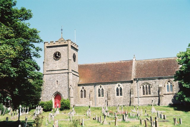
Holy Rood Church, Coombe Keynes
Holy Rood Church is a former Church of England church in Coombe Keynes, Dorset, England. Most of the church dates to a rebuild of 1860–61, but the tower...
Coombe Keynes
Coombe Keynes is a hamlet, civil parish and depopulated village in the Purbeck district of Dorset, England. The village is about 2 miles (3 km) south of...
West Lulworth
West Lulworth is a village and civil parish in the English county of Dorset, situated on the English Channel beside Lulworth Cove. In the 2011 census the...
Nearby Amenities
Located within 500m of 50.647843,-2.2475662Have you been to Lulworth Common?
Leave your review of Lulworth Common below (or comments, questions and feedback).