Caldwell Braes
Downs, Moorland in Kincardineshire
Scotland
Caldwell Braes
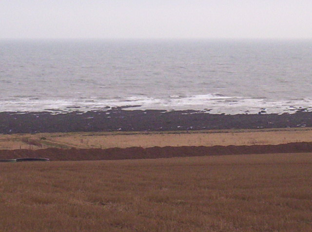
Caldwell Braes is a picturesque area located in Kincardineshire, Scotland. Known for its stunning downs and moorland landscapes, this region offers a unique blend of natural beauty and tranquility.
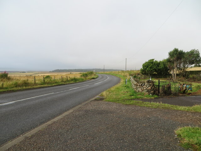
The downs of Caldwell Braes are characterized by gently rolling hills covered in lush green grasses and scattered with wildflowers. The undulating terrain provides breathtaking panoramic views of the surrounding countryside, making it a popular spot for hikers, nature enthusiasts, and photographers. The area is also home to a variety of wildlife, including deer, rabbits, and a diverse range of bird species.
Adjacent to the downs, the moorland of Caldwell Braes adds another layer of beauty to the landscape. The moors are characterized by vast expanses of heather, interspersed with patches of peat bog and scattered trees. This unique ecosystem supports a variety of plant and animal life, including heather bees, curlews, and various species of moss and lichen.
Caldwell Braes is not only a haven for nature lovers, but it also offers recreational activities for visitors to enjoy. The area has numerous walking and cycling trails, providing opportunities to explore the downs and moorland at one's own pace. Additionally, the nearby town of Stonehaven offers amenities such as cafes, restaurants, and accommodations for those looking to extend their stay in the area.
In summary, Caldwell Braes in Kincardineshire is a captivating destination, offering a blend of downs and moorland landscapes that are sure to leave visitors in awe of Scotland's natural beauty. Whether you seek a peaceful retreat or an adventure in the great outdoors, this region has something to offer for everyone.
If you have any feedback on the listing, please let us know in the comments section below.
Caldwell Braes Images
Images are sourced within 2km of 56.827369/-2.2919 or Grid Reference NO8270. Thanks to Geograph Open Source API. All images are credited.


Caldwell Braes is located at Grid Ref: NO8270 (Lat: 56.827369, Lng: -2.2919)
Unitary Authority: Aberdeenshire
Police Authority: North East
What 3 Words
///typified.adapt.names. Near Inverbervie, Aberdeenshire
Nearby Locations
Related Wikis
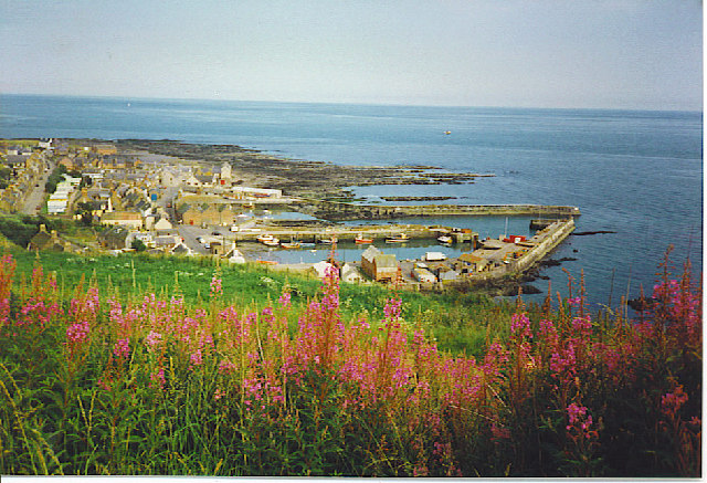
Gourdon, Aberdeenshire
Gourdon () nicknamed Gurdin by the population, is a coastal fishing village in Aberdeenshire, Scotland, south of Inverbervie and north of Johnshaven, with...

Gourdon railway station (NBR)
Gourdon railway station served the village of Gourdon, Aberdeenshire, Scotland from 1865 to 1951 on the Montrose and Bervie Railway. == History == The...

Inverbervie
Inverbervie (from Scottish Gaelic: Inbhir Biorbhaidh or Biorbhaigh, "mouth of the River Bervie") is a small town on the north-east coast of Scotland, south...

Inverbervie railway station
Bervie railway station served the town of Inverbervie, Aberdeenshire, Scotland from 1865 to 1966 on the Montrose and Bervie Railway. == History == The...

Inverbervie Town House
Inverbervie Town House is a municipal structure in Church Street in Inverbervie, Aberdeenshire, Scotland. The structure, which is primarily used as a public...

Bervie Water
Bervie Water (Scottish Gaelic: Uisge Bhiorbhaigh) is a river in Aberdeenshire, Scotland which rises in the Drumtochty Forest and flows across The Mearns...

Benholm Mill
Benholm Mill in Kincardineshire, Scotland, is a restored and fully working water-powered meal mill. It is sited in ancient woodland near Johnshaven (13...

Benholm
Benholm is a small settlement in Aberdeenshire, Scotland, UK. It is now a conservation area and is home to Benholm Mill.The A92 passes the eastern edge...
Nearby Amenities
Located within 500m of 56.827369,-2.2919Have you been to Caldwell Braes?
Leave your review of Caldwell Braes below (or comments, questions and feedback).