Wark Common

Downs, Moorland in Northumberland

England

Wark Common

Looking into England The only clue that this is the National Border is that the road surface changes colour !
Looking into England Credit: Hamish Bain

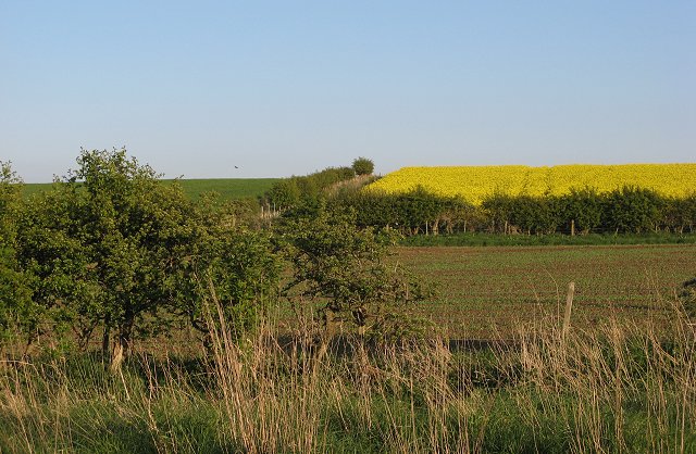
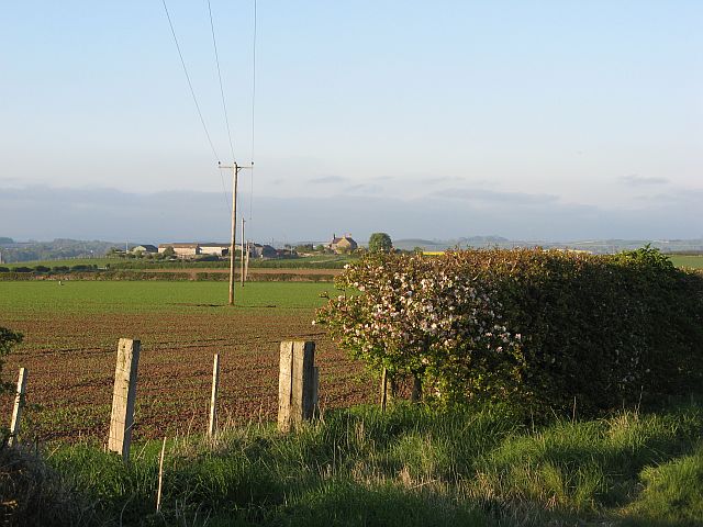
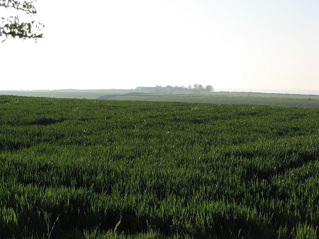
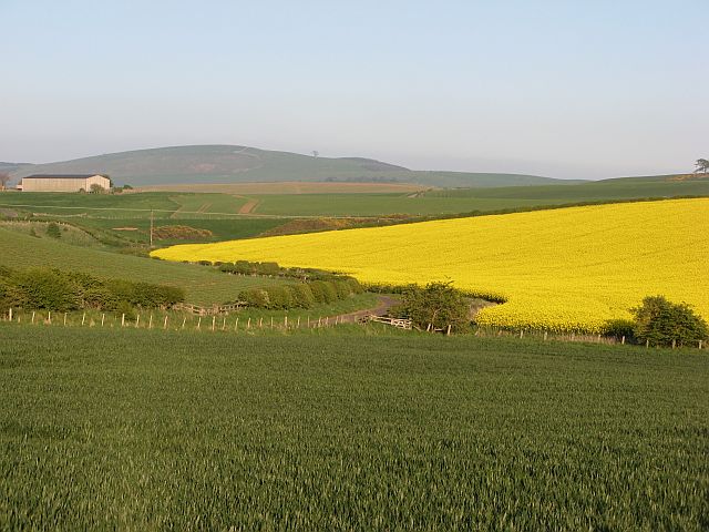
Wark Common is a vast expanse of open countryside located in Northumberland, England. Covering an area of approximately 2,500 acres, it encompasses a diverse range of landscapes, including downs and moorland. The common is situated just south of the village of Wark, and its proximity to the border with Scotland lends it a uniquely rugged and untamed atmosphere.

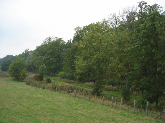
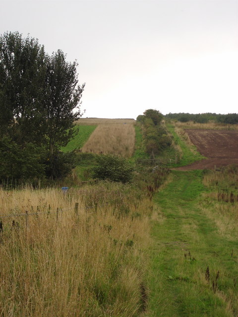
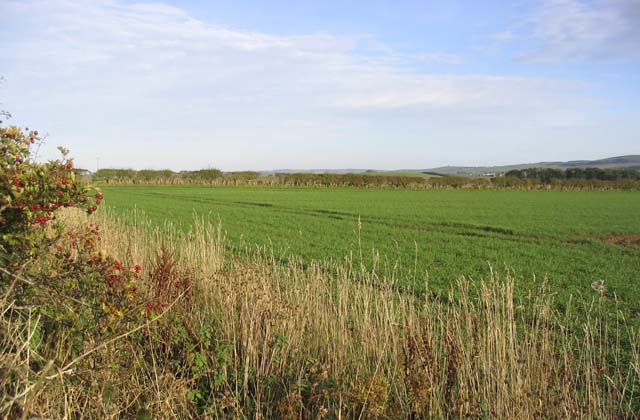
The downs of Wark Common are characterized by rolling hills and grassy plains, providing ample space for outdoor activities such as walking, picnicking, and horse riding. The landscape is dotted with clumps of trees and shrubs, offering sheltered spots for wildlife and a picturesque backdrop for visitors. The expansive moorland areas are dominated by heather and gorse, creating a vibrant purple and yellow carpet during the summer months.

Wark Common boasts a rich biodiversity, with various species of birds, mammals, and insects calling it home. Visitors may catch a glimpse of red grouse, curlews, or skylarks soaring through the skies, while rabbits and hares can often be seen darting across the open fields. The common is also known for its abundant wildflowers, including orchids and bluebells, which add splashes of color to the landscape.

The area is managed by the Northumberland National Park Authority, who work to preserve the natural beauty and wildlife of the common. Access is available to the public, with designated paths and trails allowing visitors to explore and experience the tranquility of this unspoiled countryside. Wark Common is a haven for nature enthusiasts, offering a peaceful retreat and a chance to connect with the great outdoors.

If you have any feedback on the listing, please let us know in the comments section below.
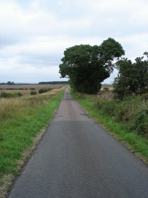
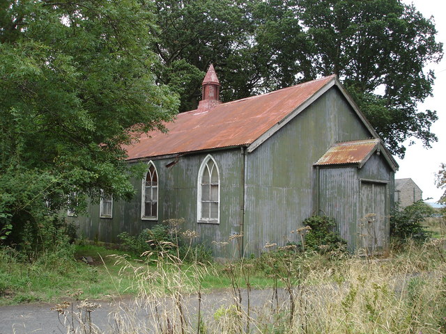
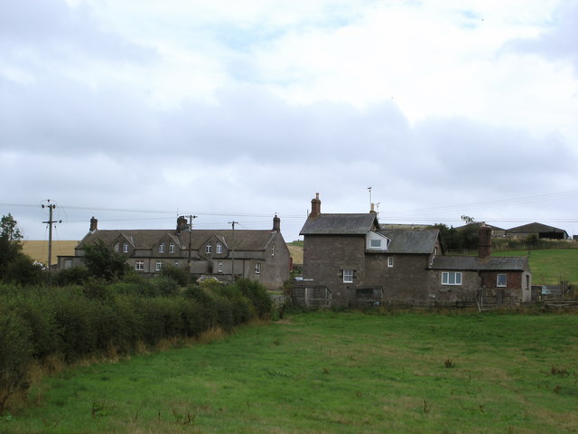
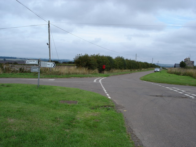
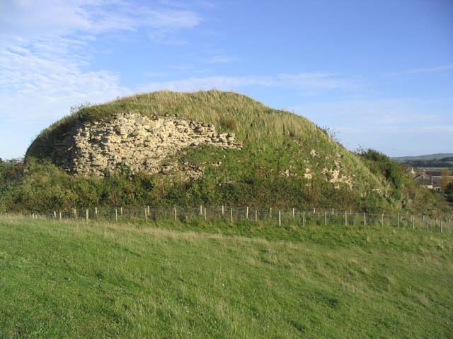
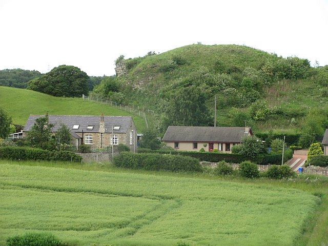
Wark Common Images

Images are sourced within 2km of 55.624215/-2.2882538 or Grid Reference NT8136. Thanks to Geograph Open Source API. All images are credited.

Looking into England The only clue that this is the National Border is that the road surface changes colour !
Looking into England
The only clue that this is the National Border is that the road surface changes colour !
Hall at Howburn This hall has seen better days and no longer seems to be in use
Hall at Howburn
This hall has seen better days and no longer seems to be in use
Sunilaws Station Former Station on the LNER Kelso & Berwick railway
Sunilaws Station
Former Station on the LNER Kelso & Berwick railway
Crossroads at Wark Common The 1: 50000 OS Map indicates that there used to be a phone box beside the post box.
Crossroads at Wark Common
The 1: 50000 OS Map indicates that there used to be a phone box beside the post box.
Looking North to England The photograph was taken from Scotland looking towards the former LNER Kelso Berwick railway. One of the quirks of the Border line is that at this point England is actually north of Scotland.
Looking North to England
The photograph was taken from Scotland looking towards the former LNER Kelso Berwick railway. One of the quirks of the Border line is that at this point England is actually north of Scotland.
The Border This unassuming hedge marks another section of the Border between Scotland and England.
The Border
This unassuming hedge marks another section of the Border between Scotland and England.
Wark Castle Early 12th century, rebuilt 1153-6, extended later Motte-and-bailey castle holding the Southern bank of the Tweed, with a huge keep, 75x50m on the motte. Wark's royal artillery left in 1633 after centuries of royal military activity, and the site was left to nature. (Source: Borders and Berwick, An Architectural Guide by Charles Alexander Strang)
Wark Castle
Early 12th century, rebuilt 1153-6, extended later Motte-and-bailey castle holding the Southern bank of the Tweed, with a huge keep, 75x50m on the motte. Wark's royal artillery left in 1633 after centuries of royal military activity, and the site was left to nature. (Source: Borders and Berwick, An Architectural Guide by Charles Alexander Strang)
Bridge over a disused railway line The Kelso to Coldstream branch railway line used to run below this bridge, 2km Southeast of Carham. The identification number marked on the bridge is BRB KLO 44.
Bridge over a disused railway line
The Kelso to Coldstream branch railway line used to run below this bridge, 2km Southeast of Carham. The identification number marked on the bridge is BRB KLO 44.
Pasture field This field is near Wark Westcommon.
Pasture field
This field is near Wark Westcommon.
The keep at Wark Castle This large keep on the motte of Wark Castle is now mostly rubble, barely defining the line of the keep walls below a blanket of scrub. The castle dates back to the early 12th century. (Source: Borders and Berwick, An Architectural Guide by Charles Alexander Strang)
The keep at Wark Castle
This large keep on the motte of Wark Castle is now mostly rubble, barely defining the line of the keep walls below a blanket of scrub. The castle dates back to the early 12th century. (Source: Borders and Berwick, An Architectural Guide by Charles Alexander Strang)
Pasture field near Wark This field is in England while Fireburnmill Farm in the background is in Scotland.
Pasture field near Wark
This field is in England while Fireburnmill Farm in the background is in Scotland.
Arable land, Wark Common Farm A mix of colourful crops.
Arable land, Wark Common Farm
A mix of colourful crops.
Gordon's Bridge Spring barley and oilseed rape either side of a burn and road at Pressen.
Gordon's Bridge
Spring barley and oilseed rape either side of a burn and road at Pressen.
Selby's Hill 2007 was a yellow year. Big subsidies for oil seed rape has led to many acres being planted. With biofuels being fashionable this is going to continue to be a familiar sight.
Selby's Hill
2007 was a yellow year. Big subsidies for oil seed rape has led to many acres being planted. With biofuels being fashionable this is going to continue to be a familiar sight.
Trailer and stubble West of Lightpipehall, a trailer, ideally sized for lugging round bales is parked amongst land not yet ploughed.
Trailer and stubble
West of Lightpipehall, a trailer, ideally sized for lugging round bales is parked amongst land not yet ploughed.
Sunilaws Looking across arable land on Wark Common.
Sunilaws
Looking across arable land on Wark Common.
Wark Common This cornfield is access land, it is a common. Here  in England, one arable field has been designated "open", while to the west in Scotland, to cross this field would be unlawful on account of damaging a growing crop.
I would dearly hope that folk wait until this is stubble before enjoying their hard won limited rights.
Wark Common
This cornfield is access land, it is a common. Here in England, one arable field has been designated "open", while to the west in Scotland, to cross this field would be unlawful on account of damaging a growing crop. I would dearly hope that folk wait until this is stubble before enjoying their hard won limited rights.
Pressen Looking down towards the How Burn and Gordon's Bridge.
Pressen
Looking down towards the How Burn and Gordon's Bridge.
Show me another place!

Wark Common is located at Grid Ref: NT8136 (Lat: 55.624215, Lng: -2.2882538)

Unitary Authority: Northumberland

Police Authority: Northumbria

What 3 Words

///soldiers.motored.fever. Near Coldstream, Scottish Borders

Related Wikis

Sunilaws railway station

Sunilaws railway station served the parish of Carham, Northumberland, England, from 1859 to 1965 on the Kelso Branch. == History == The station was opened...

Siege of Wark (1138)

The siege of Wark is a 1138 siege of Wark on Tweed Castle (Wark castle) conducted from May–November by Scottish forces under David I against the defending...

Wark on Tweed Castle

Wark on Tweed Castle, sometimes referred to as Carham Castle, is a ruined motte-and-bailey castle at the West end of Wark on Tweed in Northumberland. The...

Wark on Tweed

Wark or Wark on Tweed is a village in the English county of Northumberland. It lies about 15 mi (24 km) south west of Berwick-upon-Tweed. It is on the...

Nearby Amenities

Located within 500m of 55.624215,-2.2882538
Wark Common
Place: locality
Lat/Long: 55.6249444/-2.2862348
Post Box
Operator: Royal Mail
Ref: TD12 56
Lat/Long: 55.6218965/-2.2909348
Wark Common Farm
Place: hamlet
Lat/Long: 55.622406/-2.2879138
The data included in this document is from www.openstreetmap.org. The data is made available under ODbL.

Have you been to Wark Common?

Leave your review of Wark Common below (or comments, questions and feedback).