Callaw Moor

Downs, Moorland in Roxburghshire

Scotland

Callaw Moor

An old farmhouse by the Heatherhope Burn A repurposed farmhouse in this beautiful little valley in the Cheviot Hills, downstream from Heatherhope Reservoir.
An old farmhouse by the Heatherhope Burn Credit: James T M Towill

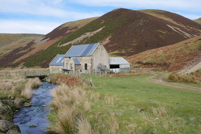
Callaw Moor is a picturesque area located in Roxburghshire, Scotland. It is known for its stunning downs and expansive moorland, attracting nature enthusiasts and outdoor adventurers alike.

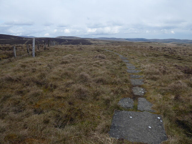
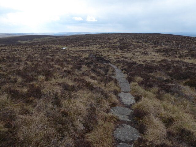
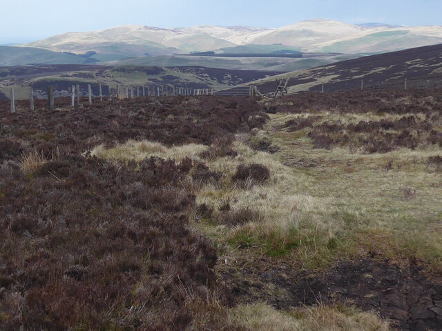
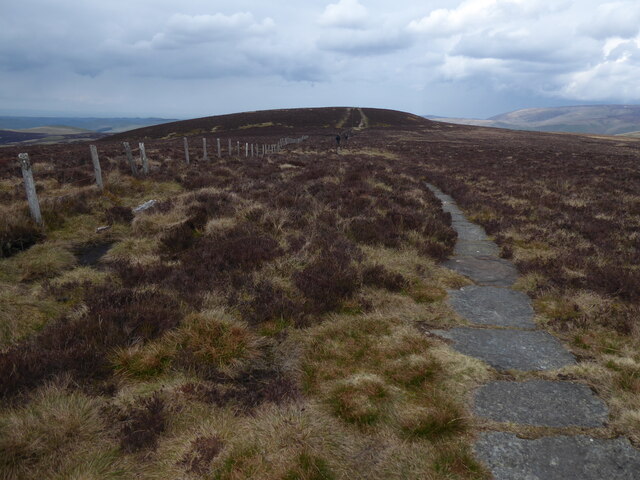
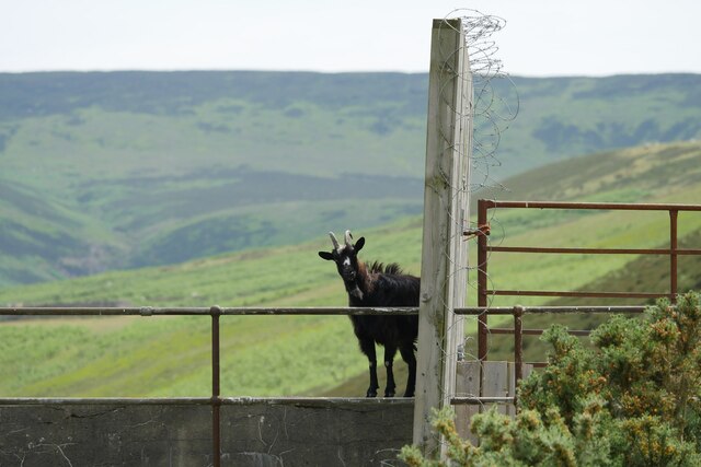
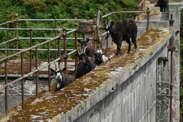
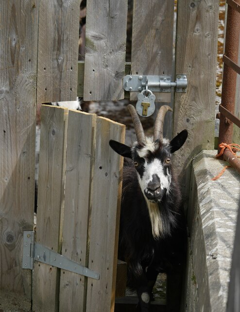
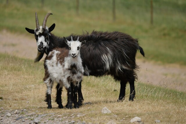
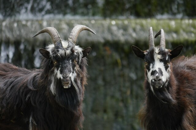
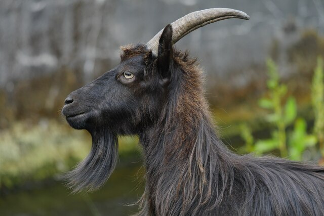
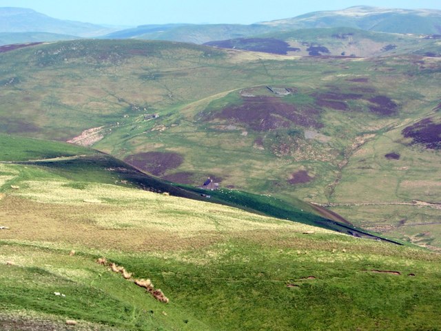
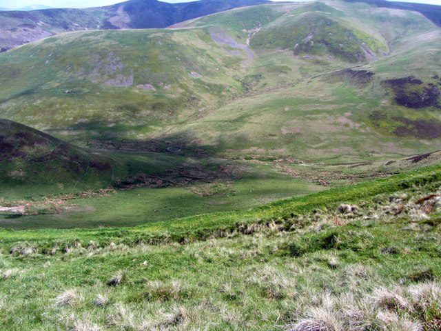
The moorland of Callaw Moor stretches across a vast area, characterized by its rolling hills, heather-covered landscapes, and clusters of ancient woodland. The terrain is largely untouched and offers a sense of tranquility and solitude to visitors. The moorland is home to a variety of plant and animal species, including heather, gorse, and various bird species such as curlews and lapwings.

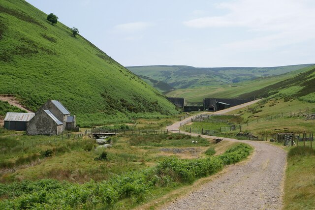
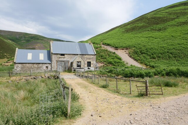
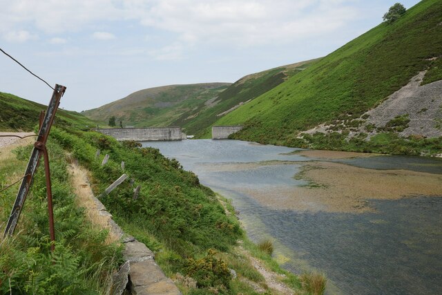
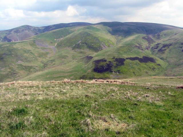
The downs of Callaw Moor provide breathtaking panoramic views of the surrounding countryside. From the highest points, visitors can enjoy stunning vistas of green fields, scattered farmhouses, and distant hills. The downs are a popular spot for hikers, walkers, and photographers, who are drawn to the area for its natural beauty and peaceful atmosphere.

The moorland and downs of Callaw Moor also have historical significance. They are believed to have been inhabited since ancient times, with evidence of Bronze Age settlements and burial sites in the area. The moorland has also played a role in local folklore and legends, adding to its cultural richness.

Overall, Callaw Moor in Roxburghshire offers visitors an opportunity to immerse themselves in the natural beauty of Scotland. Whether exploring the moorland or taking in the sweeping views from the downs, this area is a haven for those seeking a peaceful and scenic escape.

If you have any feedback on the listing, please let us know in the comments section below.

Callaw Moor Images

Images are sourced within 2km of 55.427662/-2.3055746 or Grid Reference NT8014. Thanks to Geograph Open Source API. All images are credited.

An old farmhouse by the Heatherhope Burn A repurposed farmhouse in this beautiful little valley in the Cheviot Hills, downstream from Heatherhope Reservoir.
An old farmhouse by the Heatherhope Burn
A repurposed farmhouse in this beautiful little valley in the Cheviot Hills, downstream from Heatherhope Reservoir.
The Pennine Way on Lamb Hill
The Pennine Way near Beefstand Hill
The Pennine Way near Mozie Law
Passing Heatherhope The view to Heatherhope Reservoir after passing Heatherhope, an isolated property in this little valley in the Cheviot Hills.
Passing Heatherhope
The view to Heatherhope Reservoir after passing Heatherhope, an isolated property in this little valley in the Cheviot Hills.
A former shepherd's cottage near Heatherhope This former shepherd's cottage over the Heatherhope Burn now appears to be used for storage.
A former shepherd's cottage near Heatherhope
This former shepherd's cottage over the Heatherhope Burn now appears to be used for storage.
Cheviot feral goat on the dam at Heatherhope Reservoir One of seven goats on this southern section of the dam which appeared to have gained access through a small door in the gate, seen here in profile.
Cheviot feral goat on the dam at Heatherhope Reservoir
One of seven goats on this southern section of the dam which appeared to have gained access through a small door in the gate, seen here in profile.
Goats on a dam Part of a loose herd of at least 30 Cheviot feral goats using the upper valley near Heatherhope Reservoir.
Goats on a dam
Part of a loose herd of at least 30 Cheviot feral goats using the upper valley near Heatherhope Reservoir.
A Cheviot feral goat leaving the dam at Heatherhope Reservoir Checking the coast is clear at Heatherhope Reservoir.
A Cheviot feral goat leaving the dam at Heatherhope Reservoir
Checking the coast is clear at Heatherhope Reservoir.
Heatherhope Reservoir on a warm June afternoon The waters at Heatherhope Reservoir are a little lower than normal after several weeks of very low rainfall.
Heatherhope Reservoir on a warm June afternoon
The waters at Heatherhope Reservoir are a little lower than normal after several weeks of very low rainfall.
Billy and a kid Cheviot feral goats on the track below Heatherhope Reservoir.
Billy and a kid
Cheviot feral goats on the track below Heatherhope Reservoir.
The upstream face of the dam at Heatherhope Reservoir Constructed in the early 1900s and long since redundant as the water supply for Kelso, it is now used for angling.
The upstream face of the dam at Heatherhope Reservoir
Constructed in the early 1900s and long since redundant as the water supply for Kelso, it is now used for angling.
Goats on the spillway Two Cheviot feral goats loitering at the spillway below the dam at Heatherhope Reservoir; five individuals appeared to get stuck but eventually one was able to jump up the bank whilst the others followed the Heatherhope Burn from the spillway.
Goats on the spillway
Two Cheviot feral goats loitering at the spillway below the dam at Heatherhope Reservoir; five individuals appeared to get stuck but eventually one was able to jump up the bank whilst the others followed the Heatherhope Burn from the spillway.
Profile of a Cheviot feral goat One of several Cheviot feral goats in the vicinity of Heatherhope Reservoir.
Profile of a Cheviot feral goat
One of several Cheviot feral goats in the vicinity of Heatherhope Reservoir.
Stell Rig above Dormount Hope The valley just to the right of the long ridge of Stell Rig is called Hymer's Gap. Its burn has a source just west of Lamb Hill on the England-Scotland Border.
Stell Rig above Dormount Hope
The valley just to the right of the long ridge of Stell Rig is called Hymer's Gap. Its burn has a source just west of Lamb Hill on the England-Scotland Border.
Peelinick from the south Huntford Hill with its hillfort and sheepfolds can be seen above the valley of Yett Burn.
Peelinick from the south
Huntford Hill with its hillfort and sheepfolds can be seen above the valley of Yett Burn.
Sheepfold in Dormount Hope
Show me another place!

Callaw Moor is located at Grid Ref: NT8014 (Lat: 55.427662, Lng: -2.3055746)

Unitary Authority: The Scottish Borders

Police Authority: The Lothians and Scottish Borders

What 3 Words

///competent.plunger.peach. Near Jedburgh, Scottish Borders

Related Wikis

Windy Gyle

Windy Gyle is a mountain in the Cheviot Hills range, on the border between England and Scotland. Like the other hills in the area, it is rounded and grass...

Hownam

Hownam or Hounam is a small village and parish situated 8 miles east of Jedburgh in the Scottish Borders area of Scotland, near the Anglo-Scottish border...

Pennymuir Roman camps

The Pennymuir Roman camps are situated southeast of Jedburgh in the Scottish Borders area of Scotland, near the Anglo-Scottish border, in the former Roxburghshire...

Mowhaugh

Mowhaugh is a hamlet and farm steading near the Calroust Burn and the Bowmont Water, near Morebattle, in the Scottish Borders area of Scotland, and in...

Nearby Amenities

Located within 500m of 55.427662,-2.3055746
Callaw Cairn
Ele: 507
Place: locality
Lat/Long: 55.4238372/-2.3026732
The data included in this document is from www.openstreetmap.org. The data is made available under ODbL.

Have you been to Callaw Moor?

Leave your review of Callaw Moor below (or comments, questions and feedback).