Harwood Common

Downs, Moorland in Durham

England

Harwood Common

Peat banks on north-west side of Harwood Common A hill walker following the Tees / Wear watershed on a perfect winter's day.
Harwood Common is a minor moorland hill along the watershed; other hills in the distance are High Field, Chapel Fell and Fendrith Hill.
Peat banks on north-west side of Harwood Common Credit: Trevor Littlewood

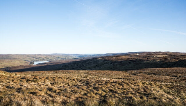
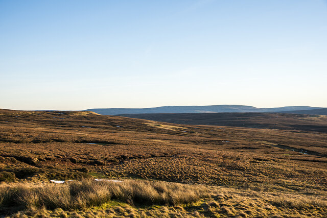
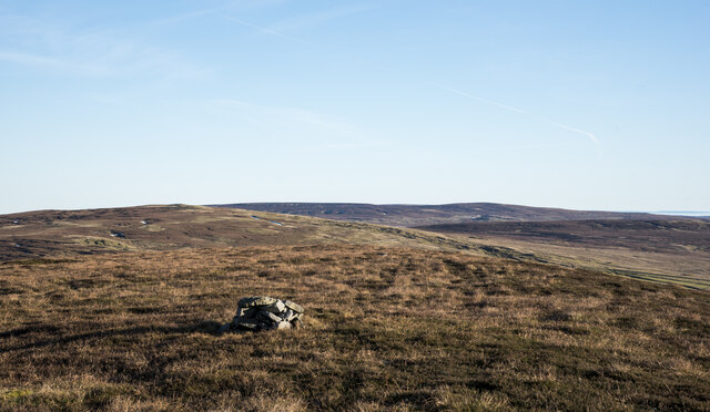
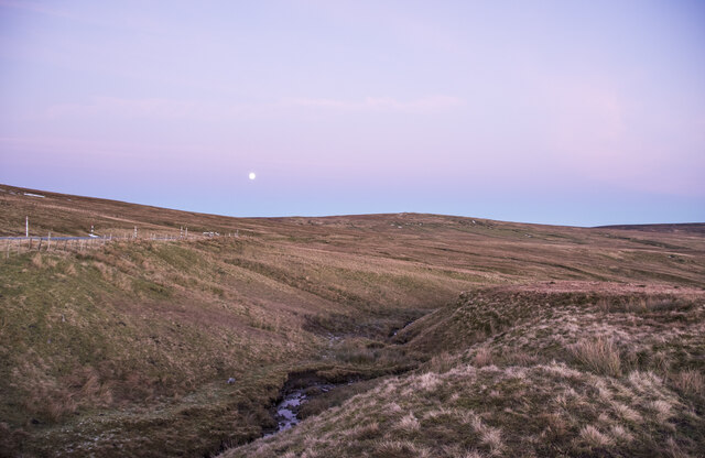
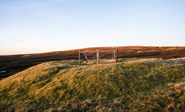
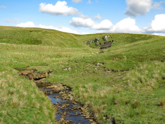
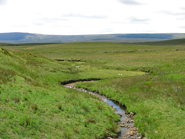
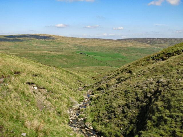
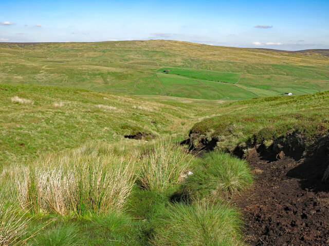
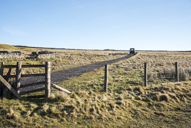
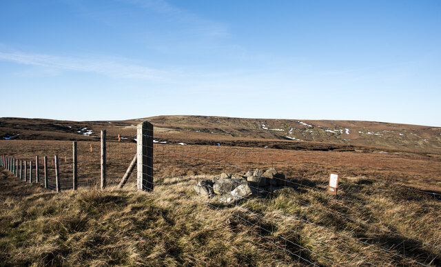
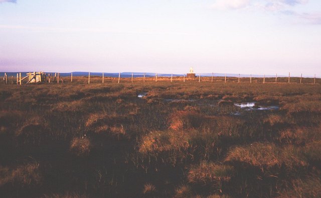
Harwood Common is a large expanse of open land located in Durham, England. Situated between the villages of Satley and Quebec, the common is characterized by its rolling hills, heathland, and scattered woodland areas. The landscape of Harwood Common is predominantly made up of rough grassland, heather, and gorse, giving it a rugged and natural appearance.

The common is home to a variety of wildlife, including birds, insects, and small mammals. Visitors to Harwood Common can enjoy walking, hiking, and birdwatching in this peaceful and unspoiled natural environment. The common also offers stunning views of the surrounding countryside, making it a popular destination for nature lovers and outdoor enthusiasts.

Harwood Common is a designated Site of Special Scientific Interest (SSSI), due to its importance for wildlife conservation and biodiversity. The common is managed by the Durham Wildlife Trust, which works to protect and preserve this unique natural habitat for future generations to enjoy. Overall, Harwood Common is a beautiful and tranquil area, perfect for those seeking to escape the hustle and bustle of city life and immerse themselves in the beauty of the English countryside.

If you have any feedback on the listing, please let us know in the comments section below.

Harwood Common Images

Images are sourced within 2km of 54.715229/-2.3152612 or Grid Reference NY7935. Thanks to Geograph Open Source API. All images are credited.

Peat banks on north-west side of Harwood Common A hill walker following the Tees / Wear watershed on a perfect winter's day.
Harwood Common is a minor moorland hill along the watershed; other hills in the distance are High Field, Chapel Fell and Fendrith Hill.
Peat banks on north-west side of Harwood Common
A hill walker following the Tees / Wear watershed on a perfect winter's day. Harwood Common is a minor moorland hill along the watershed; other hills in the distance are High Field, Chapel Fell and Fendrith Hill.
Hill slopes beyond valley of Scraith Burn The stream groove beyond the foreground moorland is that of the Scraith Burn which drains into Burnhope Reservoir, also in the image.
High Field is beyond the shadow of the stream slot.
Hill slopes beyond valley of Scraith Burn
The stream groove beyond the foreground moorland is that of the Scraith Burn which drains into Burnhope Reservoir, also in the image. High Field is beyond the shadow of the stream slot.
Heather moorland on south side of Burnhope Seat Low-angled heather moorland descending to the south on the southern side of Burnhope Seat which is the historic high point of County Durham. County boundary reorganisation in 1972, (enacted 1974), saw that change and now the county top is Mickle Fell, which is the distant dark ridge. Previously it had been the county top of Yorkshire.
Heather moorland on south side of Burnhope Seat
Low-angled heather moorland descending to the south on the southern side of Burnhope Seat which is the historic high point of County Durham. County boundary reorganisation in 1972, (enacted 1974), saw that change and now the county top is Mickle Fell, which is the distant dark ridge. Previously it had been the county top of Yorkshire.
Small cairn at summit of Harwood Common Harwood Common is a minor moorland hill along the Tees / Wear watershed. Most of the ground in the distance is along that same watershed - High Field is to the left with Chapel Fell and Fendrith Hill in the distance. To the right is Three Pikes: only the northern end of it can be considered to be along that watershed.
Small cairn at summit of Harwood Common
Harwood Common is a minor moorland hill along the Tees / Wear watershed. Most of the ground in the distance is along that same watershed - High Field is to the left with Chapel Fell and Fendrith Hill in the distance. To the right is Three Pikes: only the northern end of it can be considered to be along that watershed.
Long Gill Sike under moonlight Long Gill Sike drains part of the south side of Harwood Common, its southern slope rises to the left out of the image. The stream is a tributary of Harwood Beck, itself a major feeder of the River Tees.
The moon in the image is almost full - the full moon came the day after the photograph was taken.
The image  was made at 16:02; although there was residual light in the sky from the sun, it had dipped below the local horizon well before the actual sunset which on this day at Forest-in-Teesdale had been at 15:43.
Long Gill Sike under moonlight
Long Gill Sike drains part of the south side of Harwood Common, its southern slope rises to the left out of the image. The stream is a tributary of Harwood Beck, itself a major feeder of the River Tees. The moon in the image is almost full - the full moon came the day after the photograph was taken. The image was made at 16:02; although there was residual light in the sky from the sun, it had dipped below the local horizon well before the actual sunset which on this day at Forest-in-Teesdale had been at 15:43.
Fenced mine shaft north of Yad Moss OS mapping (1:25 000), indicates a number of old mine shafts in the vicinity of Yad Moss. The one in view has a prominent 'collar' of spoil about it and is fenced. The shaft isn't open and the top is grassed over with rocks protruding.
Sunset was close and sunlight was about to disappear from the vicinity of the shaft but to the north, the summit area of Burnhope Seat was still well lit.
Fenced mine shaft north of Yad Moss
OS mapping (1:25 000), indicates a number of old mine shafts in the vicinity of Yad Moss. The one in view has a prominent 'collar' of spoil about it and is fenced. The shaft isn't open and the top is grassed over with rocks protruding. Sunset was close and sunlight was about to disappear from the vicinity of the shaft but to the north, the summit area of Burnhope Seat was still well lit.
Crook Burn
Crook Burn
Crook Burn (2)
Crook Burn (2)
Moorland at the watershed between the rivers Tyne and Tees The Clargill Burn, in the valley in the foreground flows north into the River South Tyne, while John's Burn, which rises on the far slopes flows south into the River Tees. Streams rising in the high moorland beyond  the left hand part of the ridge flow north east into the River Wear.
Moorland at the watershed between the rivers Tyne and Tees
The Clargill Burn, in the valley in the foreground flows north into the River South Tyne, while John's Burn, which rises on the far slopes flows south into the River Tees. Streams rising in the high moorland beyond the left hand part of the ridge flow north east into the River Wear.
Peat haggs between John's Burn and Crook Burn
Bog west of Crook Burn
Bog west of Crook Burn (2)
Peat haggs west of Crook Burn
Shake hole above the Howl of Harwood
Greencomb Sike
Greencomb Sike
Slate Sike
Slate Sike
Landrover crossing from Teesdale to Weardale The hill road is a 'green lane' connecting an isolated location along the B6277 in Teesdale with Ireshopeburn in Weardale. It crosses the watershed between the valleys at a height of over 670 metres. The Landrover is a 1983 model.
Landrover crossing from Teesdale to Weardale
The hill road is a 'green lane' connecting an isolated location along the B6277 in Teesdale with Ireshopeburn in Weardale. It crosses the watershed between the valleys at a height of over 670 metres. The Landrover is a 1983 model.
Fence crossing Scaud Hill The summit of Scaud Hill has little prominence yet is an obvious location along the fence line following the Tees / Wear watershed. It's a clear high point made more noticeable by the small cairn beside the fence.
Burnhope Seat is the distant, central, moorland hill.
The small rectangle to the right of the cairn looks like a notice but it's just a metal plate fixed to the top wires of the fence to make the presence of the barrier apparent to low-flying grouse.
Fence crossing Scaud Hill
The summit of Scaud Hill has little prominence yet is an obvious location along the fence line following the Tees / Wear watershed. It's a clear high point made more noticeable by the small cairn beside the fence. Burnhope Seat is the distant, central, moorland hill. The small rectangle to the right of the cairn looks like a notice but it's just a metal plate fixed to the top wires of the fence to make the presence of the barrier apparent to low-flying grouse.
Show me another place!

Harwood Common is located at Grid Ref: NY7935 (Lat: 54.715229, Lng: -2.3152612)

Unitary Authority: County Durham

Police Authority: Durham

What 3 Words

///himself.oaks.midfield. Near Alston, Cumbria

Nearby Locations

Harwood Common

Related Wikis

Burnhope Seat

Burnhope Seat is a high moorland fell in the North Pennines Area of Outstanding Natural Beauty (AONB) in northern England. It lies between the heads of...

Moorhouse and Cross Fell

Moorhouse and Cross Fell is a Site of Special Scientific Interest covering an extensive area of moorland in the Wear Valley district of west County Durham...

Upper Teesdale

Upper Teesdale is a Site of Special Scientific Interest (SSSI) in the west County Durham, England. It encompasses an extensive upland area that includes...

Harwood, County Durham

Harwood is a small valley and village near the head of Teesdale. Harwood Beck is a tributary of the River Tees in County Durham which forms a short valley...

Nearby Amenities

Located within 500m of 54.715229,-2.3152612
Historic: milestone
Wikidata: Q26290899
Wikimedia Commons: File:Old Milestone by the B6277, Harwood Common (geograph 5624039).jpg
Lat/Long: 54.7121743/-2.3127473
Hunting Stand
Hunting Stand: grouse_butt
Lat/Long: 54.7182487/-2.3144701
Hunting Stand
Hunting Stand: grouse_butt
Lat/Long: 54.7178071/-2.3141617
Hunting Stand
Hunting Stand: grouse_butt
Lat/Long: 54.7173734/-2.3138532
Hunting Stand
Hunting Stand: grouse_butt
Lat/Long: 54.7168652/-2.3134831
Hunting Stand
Hunting Stand: grouse_butt
Lat/Long: 54.7163028/-2.3131612
Hunting Stand
Hunting Stand: grouse_butt
Lat/Long: 54.7158721/-2.3129252
Hunting Stand
Hunting Stand: grouse_butt
Lat/Long: 54.7154181/-2.3126864
Hunting Stand
Hunting Stand: grouse_butt
Lat/Long: 54.7149936/-2.3124558
Hunting Stand
Hunting Stand: grouse_butt
Lat/Long: 54.7145412/-2.3122144
The data included in this document is from www.openstreetmap.org. The data is made available under ODbL.

Have you been to Harwood Common?

Leave your review of Harwood Common below (or comments, questions and feedback).