Lower Moor

Downs, Moorland in Lancashire Rossendale

England

Lower Moor

Blue Slate's Cottage and the track onwards to Hambledon
Blue Slate's Cottage and the track onwards to Hambledon Credit: Peter Moore

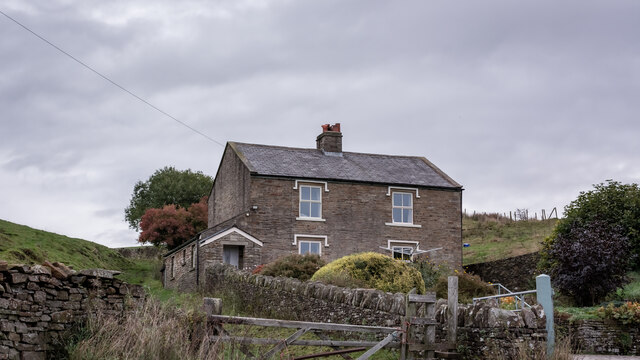
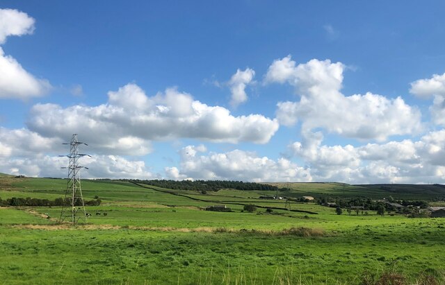
Lower Moor is a small village located in the county of Lancashire, England. Situated on the edge of the Lancashire Downs, it is known for its picturesque moorland landscape and tranquil atmosphere. The village is nestled amidst rolling hills and scattered with patches of heather and gorse, creating a stunning natural backdrop.

The area is rich in history, with evidence of human habitation dating back to prehistoric times. The moorland was once used for grazing livestock and for peat extraction, which was an important industry in the region. Today, the village retains its rural charm and is a popular destination for nature lovers and hikers.

Lower Moor offers a range of outdoor activities for visitors to enjoy. The surrounding moorland is crisscrossed with walking trails, allowing visitors to explore the stunning scenery and observe the diverse wildlife that inhabits the area. The village is also home to a small nature reserve, which protects and preserves the unique flora and fauna of the Lancashire Downs.

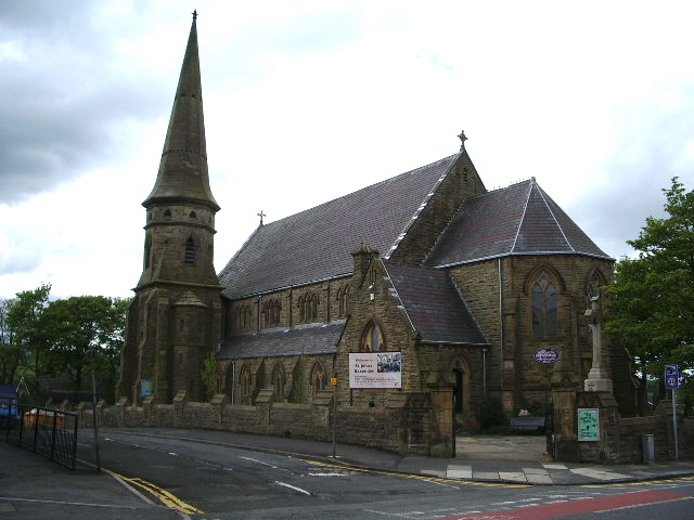
In addition to its natural beauty, Lower Moor boasts a close-knit community with a strong sense of local pride. The village is home to a handful of quaint cottages and a local pub, where residents and visitors can socialize and enjoy traditional British cuisine.

Overall, Lower Moor in Lancashire offers a peaceful and idyllic escape from the hustle and bustle of city life. With its stunning moorland landscapes, rich history, and welcoming community, it is a hidden gem for those seeking a tranquil retreat in the heart of the Lancashire Downs.

If you have any feedback on the listing, please let us know in the comments section below.
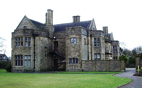
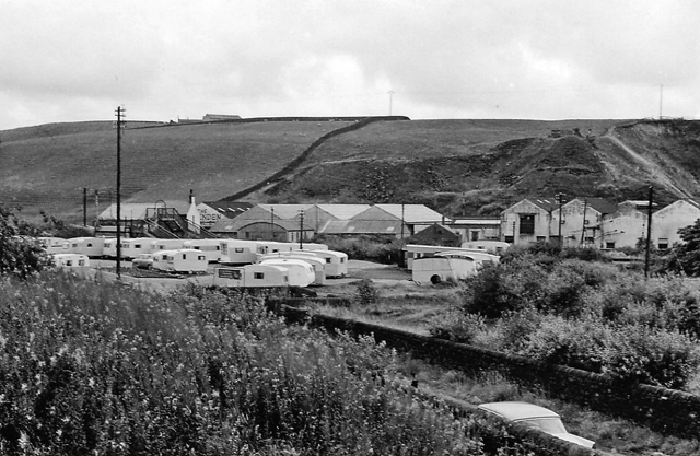
Lower Moor Images

Images are sourced within 2km of 53.745843/-2.3225707 or Grid Reference SD7827. Thanks to Geograph Open Source API. All images are credited.

Blue Slate's Cottage and the track onwards to Hambledon
Summit of Great Hambledon looking south
Farmland with pylons Between Accrington and Haslingden
Farmland with pylons
Between Accrington and Haslingden
Burnley Way on Hameldon Hill
Burnley Way Heading for the communications masts on the summit of Hameldon Hill.
Burnley Way
Heading for the communications masts on the summit of Hameldon Hill.
Great Hameldon Taken on the section of the Burnley Way which links Great Hameldon and Hameldon Hill, this path affords spectacular views on all sides, from Darwen Hill and Haslingden Grane to the west and south to Longridge Fell and Pendle Hill to the north and east.
Great Hameldon
Taken on the section of the Burnley Way which links Great Hameldon and Hameldon Hill, this path affords spectacular views on all sides, from Darwen Hill and Haslingden Grane to the west and south to Longridge Fell and Pendle Hill to the north and east.
Haslingden Grane from the Burnley Way Taken on the section of the Burnley Way linking Great Hameldon with Hameldon Hill, this is looking towards Haslingden with Haslingden Grane beyond.
Haslingden Grane from the Burnley Way
Taken on the section of the Burnley Way linking Great Hameldon with Hameldon Hill, this is looking towards Haslingden with Haslingden Grane beyond.
Pendle Hill from Hameldon Hill Taken on the section of the Burnley Way which links Hameldon Hill and Great Hameldon, this is looking across to the Forest of Pendle and its hill.
Pendle Hill from Hameldon Hill
Taken on the section of the Burnley Way which links Hameldon Hill and Great Hameldon, this is looking across to the Forest of Pendle and its hill.
To Higher Withins Taken from just below Great Hameldon, Burnley, Lancashire, and looking across towards Rising Bridge and Baxenden with Higher Withins off to the left in the middle distance. The wind farm above Haslingden Grane is discernible on the left-hand horizon.
To Higher Withins
Taken from just below Great Hameldon, Burnley, Lancashire, and looking across towards Rising Bridge and Baxenden with Higher Withins off to the left in the middle distance. The wind farm above Haslingden Grane is discernible on the left-hand horizon.
Longridge Fell Longridge Fell with the fells of the Forest of Bowland beyond, taken from the path linking Hameldon Hill and Great Hameldon, Burnley, Lancashire.
Longridge Fell
Longridge Fell with the fells of the Forest of Bowland beyond, taken from the path linking Hameldon Hill and Great Hameldon, Burnley, Lancashire.
Holcombe Moor and Harcles Hill The Peel Monument, Holcombe Moor and its neighbour, Harcles Hill, can be seen on the far horizon in this shot taken from the path linking Hameldon Hill and Great Hameldon.
Holcombe Moor and Harcles Hill
The Peel Monument, Holcombe Moor and its neighbour, Harcles Hill, can be seen on the far horizon in this shot taken from the path linking Hameldon Hill and Great Hameldon.
The Burnley Way to Great Hameldon This is the Burnley Way in Lancashire as it passes from Hameldon Hill, above Dunnockshaw, to Great Hameldon (to the left) and beyond to Huncoat and thence to Padiham.
The Burnley Way to Great Hameldon
This is the Burnley Way in Lancashire as it passes from Hameldon Hill, above Dunnockshaw, to Great Hameldon (to the left) and beyond to Huncoat and thence to Padiham.
Haslingden Moor Taken from the track connecting Hameldon Hill with Great Hameldon, Burnley, Lancashire, I am looking south west to Haslingden Moor and Musbury Heights.
Haslingden Moor
Taken from the track connecting Hameldon Hill with Great Hameldon, Burnley, Lancashire, I am looking south west to Haslingden Moor and Musbury Heights.
Thorny Bank Clough Taken on the Burnley Way linking Dunnockshaw with Pendle in Lancashire, I am between Hameldon Hill and Great Hameldon. Thorny Bank Clough drops down between the two to Hapton Park below. Padiham is in the middle distance.
Thorny Bank Clough
Taken on the Burnley Way linking Dunnockshaw with Pendle in Lancashire, I am between Hameldon Hill and Great Hameldon. Thorny Bank Clough drops down between the two to Hapton Park below. Padiham is in the middle distance.
Great and Little Hameldon I am on the Burnley Way looking west to Great Hameldon and across Hameldon Common northward to Little Hameldon. The Burnley Way drops down into Thorny Bank Clough to the right of shot.
Great and Little Hameldon
I am on the Burnley Way looking west to Great Hameldon and across Hameldon Common northward to Little Hameldon. The Burnley Way drops down into Thorny Bank Clough to the right of shot.
Hameldon to Pendle Taken on the Burnley Way as it runs along Hameldon Hill before dropping down Thorny Bank Clough to Padiham, I am looking north to Pendle Hill.
Hameldon to Pendle
Taken on the Burnley Way as it runs along Hameldon Hill before dropping down Thorny Bank Clough to Padiham, I am looking north to Pendle Hill.
The Burnley Way to Hameldon Taken at the point where Hameldon Hill merges with Hameldon Common above Burnley, Lancashire, I am looking north west towards Great Hameldon (left) and Little Hameldon (right).
The Burnley Way to Hameldon
Taken at the point where Hameldon Hill merges with Hameldon Common above Burnley, Lancashire, I am looking north west towards Great Hameldon (left) and Little Hameldon (right).
Haslingden and Holcombe from Hameldon Taken from the point where Hameldon Common merges with Hameldon Hill, Lancashire, I am looking south across Haslingden Moor to Holcombe Moor in the far distance (marked out by the Peel Monument).
Haslingden and Holcombe from Hameldon
Taken from the point where Hameldon Common merges with Hameldon Hill, Lancashire, I am looking south across Haslingden Moor to Holcombe Moor in the far distance (marked out by the Peel Monument).
Show me another place!

Lower Moor is located at Grid Ref: SD7827 (Lat: 53.745843, Lng: -2.3225707)

Administrative County: Lancashire

District: Rossendale

Police Authority: Lancashire

What 3 Words

///arena.horseshoe.coping. Near Hameldon Hill, Lancashire

Related Wikis

River Hyndburn

The River Hyndburn is a minor river in Lancashire, England. Beginning as Woodnook Water on the slopes of Goodshaw Hill, it passes through Stone Fold, Rising...
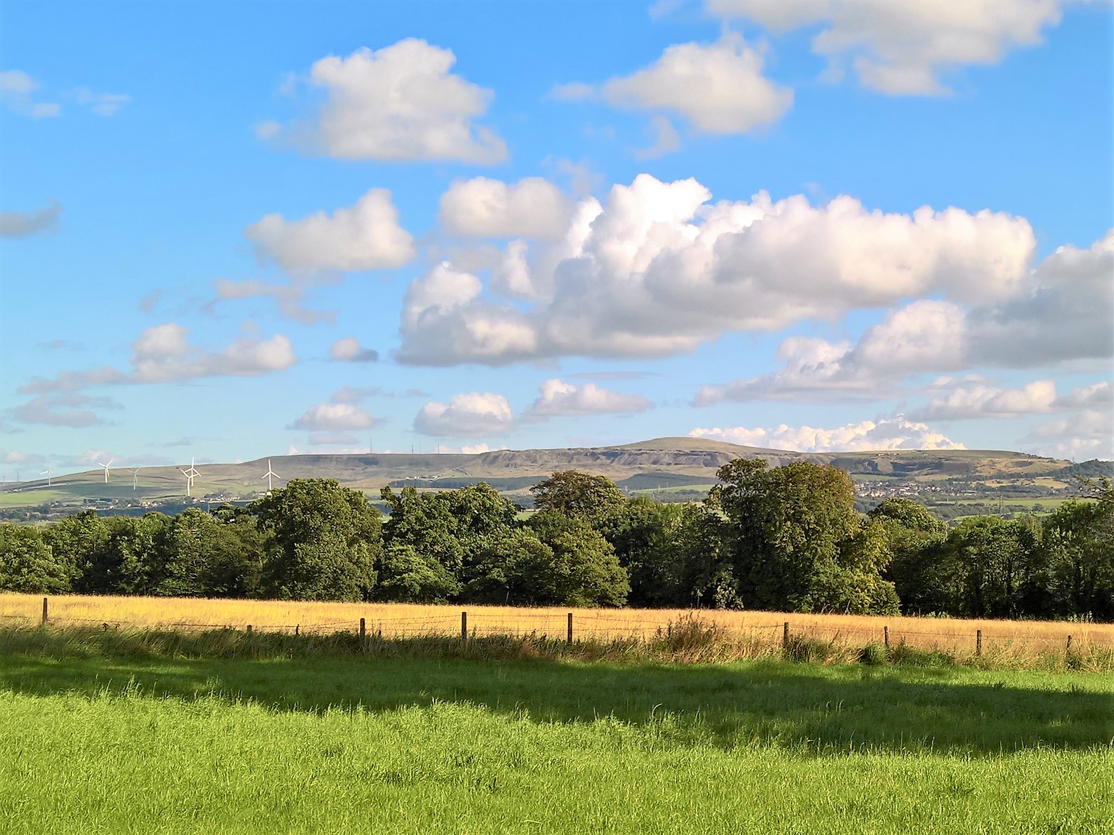
Hameldon Hill

Hameldon Hill is a Carboniferous sandstone hill with a summit elevation of 409 metres (1,342 ft), situated between the towns of Burnley and Accrington...

Baxenden

Baxenden is a village and ward in the Borough of Hyndburn in Lancashire, North-West England. The ward population taken at the 2011 census was 4,042. Baxenden...

Heathland School

Heathland School is an independent school situated in Accrington, Lancashire in England. The school accepts children from the age of three months in the...

Accrington and Rossendale College

Accrington and Rossendale College is a further education college based in Accrington, Lancashire, England. == The College == Accrington & Rossendale College...

Haworth Art Gallery

The Haworth Art Gallery is a public art gallery located in Accrington, Lancashire, northwest England, and is the home of the largest collection in Europe...

The Hollins

The Hollins (formerly known as The Hollins Technology College until 2017) is a coeducational secondary school located in Accrington in the English county...

Baxenden railway station

Baxenden railway station served the villages of Baxenden in Hyndburn and Rising Bridge in Rossendale. It was situated just inside the old boundary of Haslingden...

Nearby Amenities

Located within 500m of 53.745843,-2.3225707
Parking
Created By: Potlatch 0.10f
Description: Layby
Lat/Long: 53.7444513/-2.3285157
The data included in this document is from www.openstreetmap.org. The data is made available under ODbL.

Have you been to Lower Moor?

Leave your review of Lower Moor below (or comments, questions and feedback).