Calcott's Green
Downs, Moorland in Gloucestershire Tewkesbury
England
Calcott's Green

Calcott's Green is a small village located in the county of Gloucestershire in England. Situated in the heart of the Cotswolds, this charming village is surrounded by picturesque countryside, offering residents and visitors a tranquil and idyllic setting.
The village is known for its stunning Downs and Moorland landscapes, which provide a diverse range of habitats for a variety of wildlife. The Downs are characterized by rolling hills and expansive grasslands, providing breathtaking views of the surrounding countryside. The Moorland, on the other hand, offers a more rugged and wild terrain, with heather-covered hills and scattered woodland areas.
Calcott's Green is a haven for outdoor enthusiasts, with numerous walking and hiking trails crisscrossing the area. These trails offer the perfect opportunity to explore the natural beauty of the Downs and Moorland, with many routes leading to secluded spots and hidden gems. The village also boasts a lively equestrian community, with horse riding being a popular activity among locals.
Despite its rural setting, Calcott's Green is well-connected to neighboring towns and villages. The village itself is home to a small community of residents, with a handful of traditional cottages and farmhouses dotting the landscape. There are also a few amenities available, including a cozy village pub and a local shop for basic necessities.
Overall, Calcott's Green in Gloucestershire is a hidden gem for nature lovers and those seeking a peaceful retreat. With its stunning Downs and Moorland landscapes, it offers a haven of natural beauty and tranquility, making it a truly unique destination in the Cotswolds.
If you have any feedback on the listing, please let us know in the comments section below.
Calcott's Green Images
Images are sourced within 2km of 51.850638/-2.3191571 or Grid Reference SO7816. Thanks to Geograph Open Source API. All images are credited.


Calcott's Green is located at Grid Ref: SO7816 (Lat: 51.850638, Lng: -2.3191571)
Administrative County: Gloucestershire
District: Tewkesbury
Police Authority: Gloucestershire
What 3 Words
///sock.mute.doing. Near Gloucester, Gloucestershire
Nearby Locations
Related Wikis

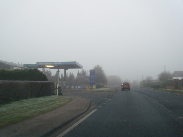
Minsterworth
Minsterworth is a village in Gloucestershire, England. It lies on the border of the City of Gloucester, on the north bank of the River Severn (effectively...

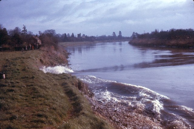
Severn bore
The Severn bore is a tidal bore seen on the tidal reaches of the River Severn in south western England. It is formed when the rising tide moves into the...

Churcham
Churcham is a small village and civil parish in the Forest of Dean District of Gloucestershire in England, located 4 miles (6.4 km) west of Gloucester...

Elmore, Gloucestershire
For other places with the same name, see Elmore (disambiguation). Elmore is a village and civil parish, in the Stroud district of Gloucestershire, England...
Nearby Amenities
Located within 500m of 51.850638,-2.3191571Have you been to Calcott's Green?
Leave your review of Calcott's Green below (or comments, questions and feedback).