Medbridge Covert

Wood, Forest in Gloucestershire Stroud

England

Medbridge Covert

Same gate, different sign, similar meaning Following up my last visit exactly five years ago see <a href="https://www.geograph.org.uk/photo/2213364">SO7816 : Bull in field?</a>.
Same gate, different sign, similar meaning Credit: Jonathan Billinger

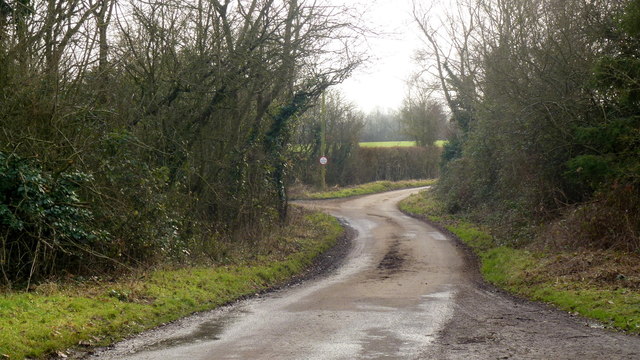
Medbridge Covert is a quaint woodland area located in the county of Gloucestershire, England. Situated within the larger Forest of Dean, it is a hidden gem for nature enthusiasts and those seeking tranquility away from the hustle and bustle of urban life.

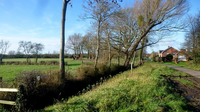
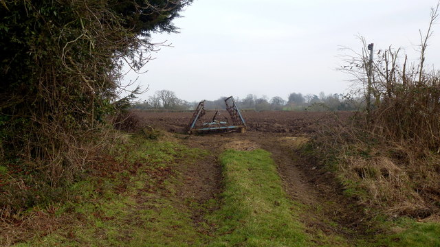
Covering an approximate area of 200 acres, Medbridge Covert is characterized by its dense and lush woodlands, comprising a variety of tree species such as oak, beech, and birch. The forest floor is adorned with a rich carpet of ferns, bluebells, and wildflowers, creating a picturesque landscape throughout the seasons.

The woodland is home to a diverse range of wildlife, including deer, foxes, badgers, and a plethora of bird species. Nature lovers can spot woodpeckers, owls, and even some rare migratory birds, making it a haven for birdwatching enthusiasts.

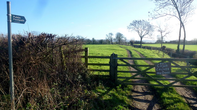
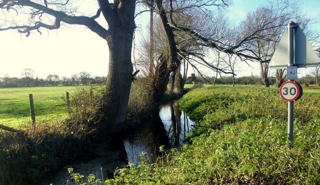
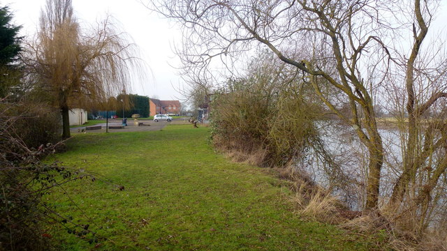
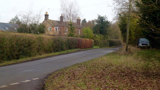
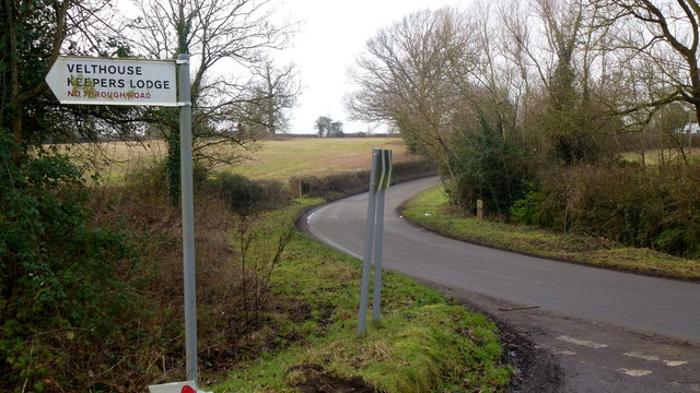
Medbridge Covert offers numerous walking trails and footpaths, allowing visitors to explore the beauty of the forest at their own pace. The paths wind through the woods, leading to picturesque viewpoints, charming streams, and serene picnic spots. The quiet ambiance makes it an ideal location for mindfulness and meditation practices.

The woodland is also of historical significance, with remnants of ancient settlements and archaeological sites scattered throughout. These provide a glimpse into the area's rich cultural heritage and offer opportunities for historical exploration.

Overall, Medbridge Covert in Gloucestershire is a natural haven, offering a peaceful retreat for those seeking solace amidst the beauty of nature.

If you have any feedback on the listing, please let us know in the comments section below.

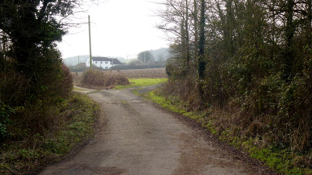
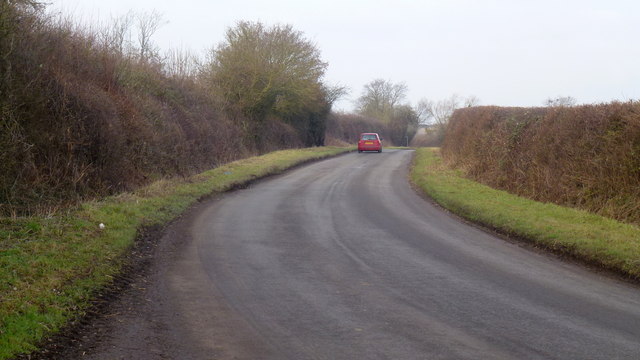
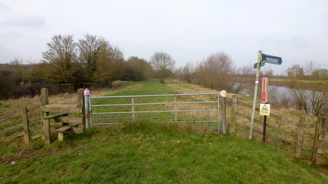
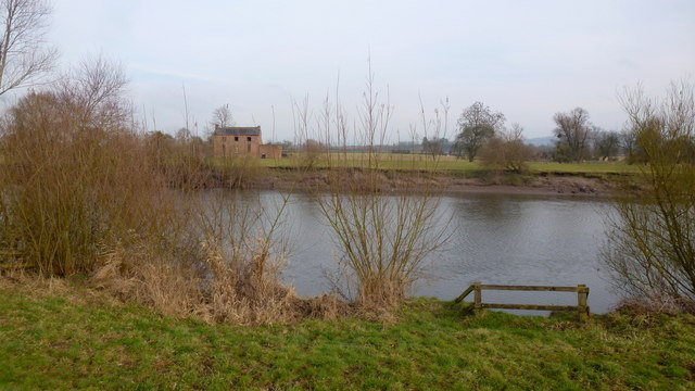
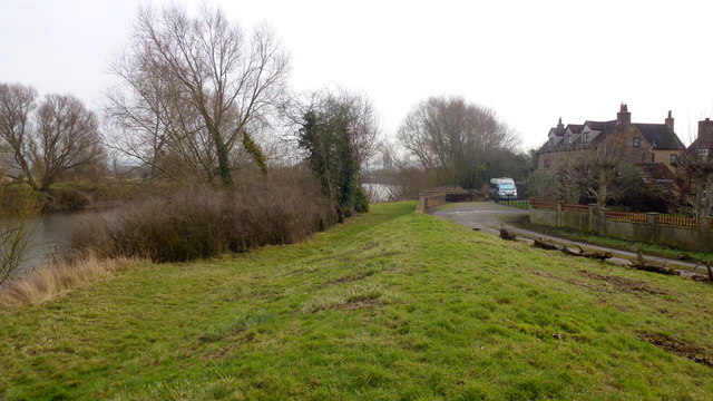
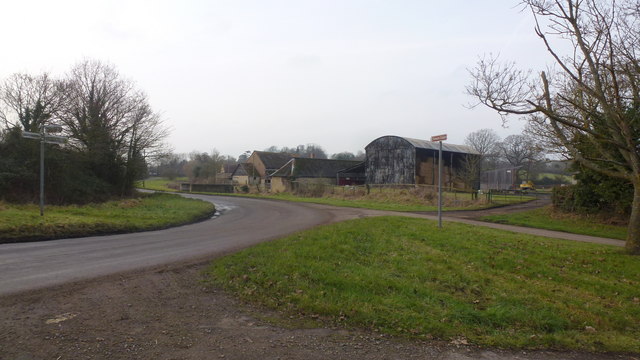
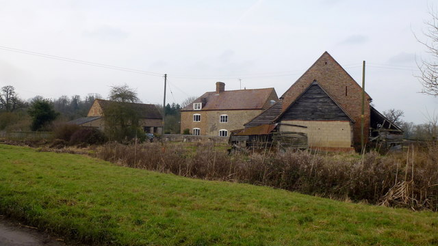
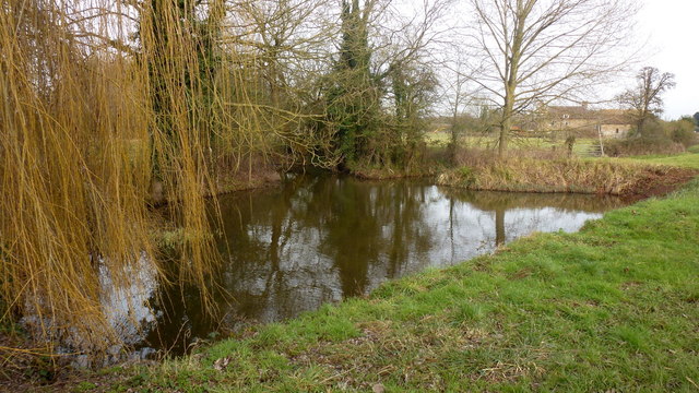
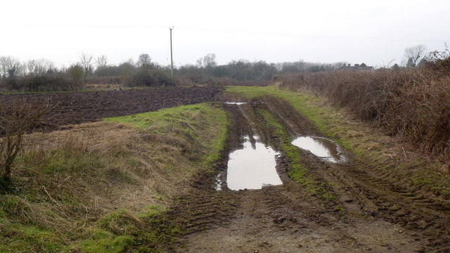
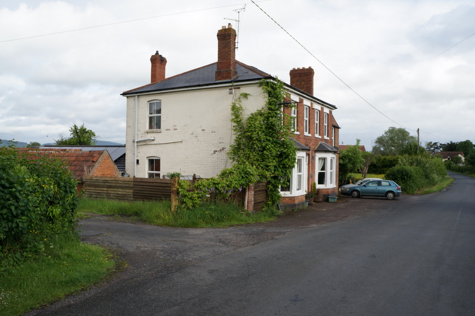
Medbridge Covert Images

Images are sourced within 2km of 51.843577/-2.3205586 or Grid Reference SO7816. Thanks to Geograph Open Source API. All images are credited.

Same gate, different sign, similar meaning Following up my last visit exactly five years ago see <a href="https://www.geograph.org.uk/photo/2213364">SO7816 : Bull in field?</a>.
Same gate, different sign, similar meaning
Following up my last visit exactly five years ago see SO7816 : Bull in field?.
Drain at Calcott's Green Edge of the Severn flood plain.
Drain at Calcott's Green
Edge of the Severn flood plain.
Calcott's Green The houses on the right appear to be just above the flood plain to the left.
Calcott's Green
The houses on the right appear to be just above the flood plain to the left.
Church Lane, Minsterworth
River Severn at Stonebench, 2 Looking downstream by Stonebench House. The business here is groundworks equipment and hire.
River Severn at Stonebench, 2
Looking downstream by Stonebench House. The business here is groundworks equipment and hire.
Track and footpath to Brookfield House The house can be seen in the distance.
Track and footpath to Brookfield House
The house can be seen in the distance.
Elmore Lane This road joins up the scattered farms and houses of the community within a big bend of the River Severn.
Elmore Lane
This road joins up the scattered farms and houses of the community within a big bend of the River Severn.
Severn Way LDF at Weir Green The path follows the embankment north, downstream.
Some wag has turned the sign to Elmore Back directly towards the river.
Severn Way LDF at Weir Green
The path follows the embankment north, downstream. Some wag has turned the sign to Elmore Back directly towards the river.
Looking across the Severn from Weir Green Highlay or Highley House is the ruin on the opposite bank.
Looking across the Severn from Weir Green
Highlay or Highley House is the ruin on the opposite bank.
Severn Way LDF at Weir Green Looking south, upstream, alongside houses just above the flood plain.
Severn Way LDF at Weir Green
Looking south, upstream, alongside houses just above the flood plain.
Elmore Lane at Weir Lane junction Looking west towards Elmore Farm.
Elmore Lane at Weir Lane junction
Looking west towards Elmore Farm.
Elmore Farm Plenty of barns for conversion here.
Elmore Farm
Plenty of barns for conversion here.
Ponds at Elmore Elmore Farm in the background. A willow to the left.
Ponds at Elmore
Elmore Farm in the background. A willow to the left.
Dead end lane to Velthouse A branch to the left heads south-east to Keeper's Lodge.
Dead end lane to Velthouse
A branch to the left heads south-east to Keeper's Lodge.
Kenton Green, Elmore, 1 By the junction with Velthouse Lane, looking east towards Gloucester.
Kenton Green, Elmore, 1
By the junction with Velthouse Lane, looking east towards Gloucester.
Kenton Green, Elmore, 2 Looking west towards Elmore church.
Kenton Green, Elmore, 2
Looking west towards Elmore church.
Footpath at Farley Corner. 1 The cultivator has been left in place ready for the next farming operation?
The path here heads east towards Elmore Court.
Footpath at Farley Corner. 1
The cultivator has been left in place ready for the next farming operation? The path here heads east towards Elmore Court.
Footpath at Farley Corner. 2 Path heads generally south towards Velthouse.
Footpath at Farley Corner. 2
Path heads generally south towards Velthouse.
Show me another place!

Medbridge Covert is located at Grid Ref: SO7816 (Lat: 51.843577, Lng: -2.3205586)

Administrative County: Gloucestershire

District: Stroud

Police Authority: Gloucestershire

What 3 Words

///certified.crass.rang. Near Gloucester, Gloucestershire

Related Wikis

Minsterworth

Minsterworth is a village in Gloucestershire, England. It lies on the border of the City of Gloucester, on the north bank of the River Severn (effectively...

Severn bore

The Severn bore is a tidal bore seen on the tidal reaches of the River Severn in south western England. It is formed when the rising tide moves into the...

Elmore, Gloucestershire

For other places with the same name, see Elmore (disambiguation). Elmore is a village and civil parish, in the Stroud district of Gloucestershire, England...

Churcham

Churcham is a small village and civil parish in the Forest of Dean District of Gloucestershire in England, located 4 miles (6.4 km) west of Gloucester...

Oakle Street railway station

Oakle Street railway station served the village of Oakle Street, Gloucestershire, England from 1851 to 1964 on the Gloucester-Newport line. == History... ==

School of the Lion

The School of the Lion was an independent school based in Churcham, Gloucestershire. The school was founded in by 1987 by a group of Gloucestershire-based...

Oakle Street

Oakle Street is a village in Gloucestershire, England. == External links == Media related to Oakle Street at Wikimedia Commons Churcham Village Website...

Severn Vale School

Severn Vale School is a secondary school with academy status in Quedgeley, Gloucester, England. Its students are aged from 11 to 16. The headmaster is...

Nearby Amenities

Located within 500m of 51.843577,-2.3205586
Created By: almien_coastlines
Source: PGS
Lat/Long: 51.8475578/-2.3235512
Created By: almien_coastlines
Source: PGS
Lat/Long: 51.8472442/-2.3203604
Source: PGS
Lat/Long: 51.8472841/-2.3211941
Source: PGS
Lat/Long: 51.847419/-2.3228131
Source: PGS
Lat/Long: 51.8479038/-2.3219771
Created By: almien_coastlines
Source: PGS
Lat/Long: 51.8477996/-2.3207537
Created By: almien_coastlines
Source: PGS
Lat/Long: 51.8472105/-2.3197334
Created By: almien_coastlines
Source: PGS
Lat/Long: 51.8471995/-2.3181823
Created By: almien_coastlines
Source: PGS
Lat/Long: 51.8472035/-2.3190093
Source: PGS
Lat/Long: 51.8477386/-2.3198225
Created By: almien_coastlines
Source: PGS
Lat/Long: 51.8477474/-2.318445
Created By: almien_coastlines
Source: PGS
Lat/Long: 51.8471659/-2.3176236
Created By: almien_coastlines
Source: PGS
Lat/Long: 51.8471865/-2.3164541
Created By: almien_coastlines
Source: PGS
Lat/Long: 51.8471693/-2.3171236
Power: tower
Source: Bing aerial imagery
Lat/Long: 51.8443396/-2.3247507
Power: tower
Source: Bing aerial imagery
Lat/Long: 51.8455556/-2.316857
Barrier: stile
Lat/Long: 51.8478997/-2.3198479
The data included in this document is from www.openstreetmap.org. The data is made available under ODbL.

Have you been to Medbridge Covert?

Leave your review of Medbridge Covert below (or comments, questions and feedback).