Selside Shaw

Downs, Moorland in Yorkshire Craven

England

Selside Shaw

Footbridge over Cam Beck, Nether Lodge near Selside
Footbridge over Cam Beck, Nether Lodge near Selside Credit: Colin Park

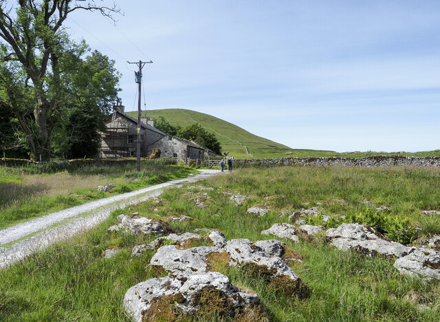
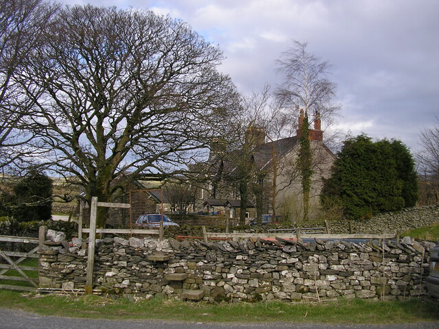
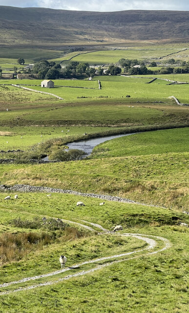
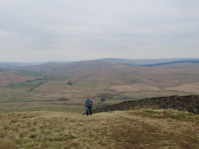
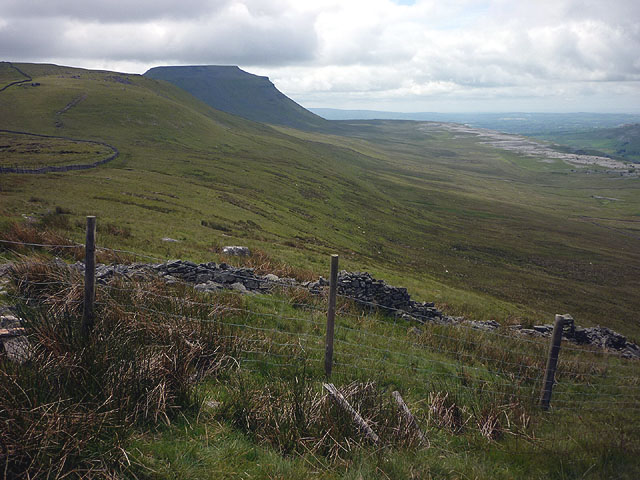
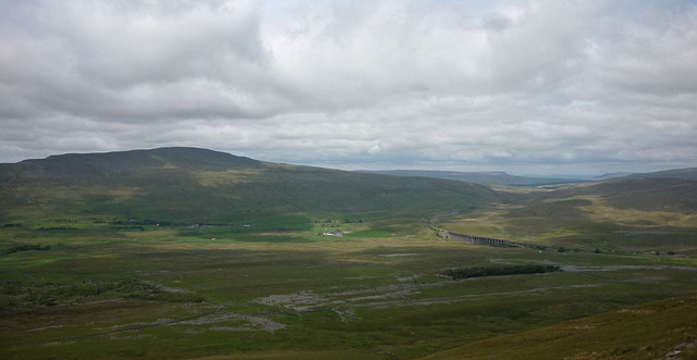
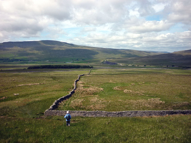
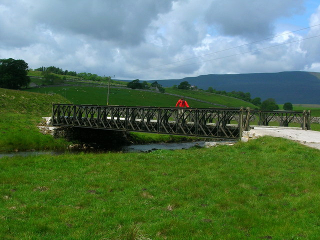
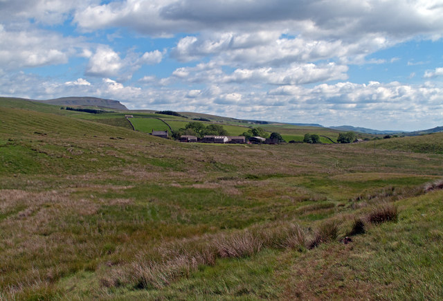
Selside Shaw is a picturesque area located in the county of Yorkshire, England. Nestled amidst the stunning Downs and Moorland, this region offers breathtaking natural beauty and a tranquil atmosphere. With its rolling hills, lush green meadows, and expansive moorlands, Selside Shaw is a haven for nature lovers and outdoor enthusiasts.

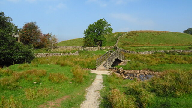
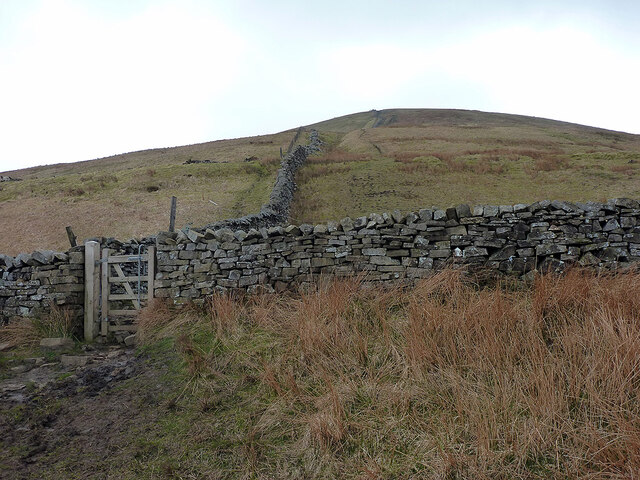
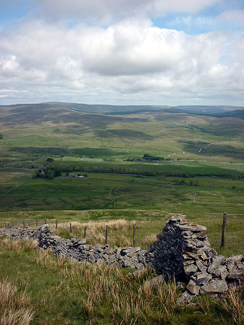
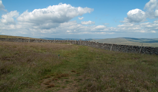
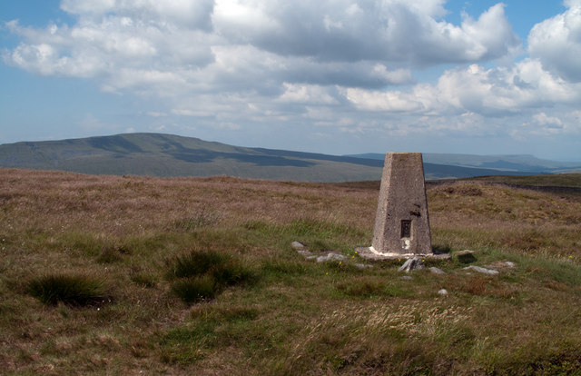
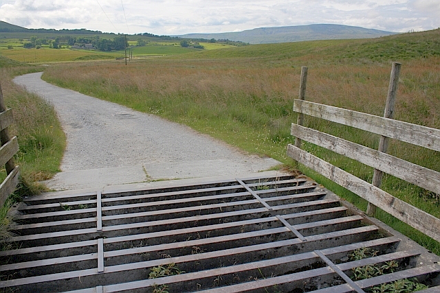
The Downs of Selside Shaw are characterized by their gentle slopes and stunning panoramic views. Visitors can enjoy long walks and hikes, taking in the fresh air and immersing themselves in the peaceful surroundings. The area is home to a diverse range of flora and fauna, making it a perfect spot for birdwatching and wildlife spotting.

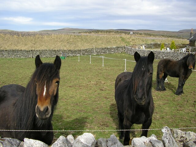
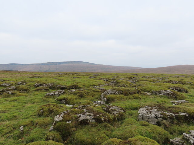
The Moorland in Selside Shaw is known for its rugged beauty and unique ecosystem. Visitors can explore the vast expanse of heather-covered moors, dotted with rocky outcrops and peat bogs. The moorland is also home to several rare species of plants and animals, making it a site of significant ecological importance.

Selside Shaw is a popular destination for those seeking a quiet and serene getaway. The area offers a range of accommodation options, including charming country cottages and cozy bed and breakfasts. Visitors can also enjoy traditional Yorkshire cuisine at the local pubs and restaurants, which often feature locally sourced ingredients.

In summary, Selside Shaw is a stunning region in Yorkshire, boasting beautiful Downs and Moorland landscapes. With its rich biodiversity and peaceful ambiance, this area is a must-visit for nature enthusiasts and those in search of a serene retreat.

If you have any feedback on the listing, please let us know in the comments section below.

Selside Shaw Images

Images are sourced within 2km of 54.184974/-2.3393592 or Grid Reference SD7776. Thanks to Geograph Open Source API. All images are credited.

Footbridge over Cam Beck, Nether Lodge near Selside
House at Colt Park The building at Colt Park with scaffolding erected.
House at Colt Park
The building at Colt Park with scaffolding erected.
Horses and Railway Embankment at Selside The horses were in a field between the B6479 and the Settle & Carlisle Railway, near the Railway Cottages at Selside. The embankment can be seen beyond the field.
Horses and Railway Embankment at Selside
The horses were in a field between the B6479 and the Settle & Carlisle Railway, near the Railway Cottages at Selside. The embankment can be seen beyond the field.
Stone Step Stile & Footpath Finger Post at Selside Located on the B6479, by the Railway Cottages at Selside. The finger post points to Low Moor.
Stone Step Stile & Footpath Finger Post at Selside
Located on the B6479, by the Railway Cottages at Selside. The finger post points to Low Moor.
Ford at Dale Mire Barn This ford is found on the track to Dale Mire Barn.
Ford at Dale Mire Barn
This ford is found on the track to Dale Mire Barn.
Path climbing Park Fell Up from Gauber and Ribblehead.
Path climbing Park Fell
Up from Gauber and Ribblehead.
Railway line overlooked by Whernside
Mossy limestone pavement
Summiting Park Fell
Summiting Park Fell
Fence and stone wall, Park Fell Looking back towards the summit of Ingleborough from its northern outlier.
Fence and stone wall, Park Fell
Looking back towards the summit of Ingleborough from its northern outlier.
Whernside and Ribblehead from Park Fell The Dales' highest mountain dwarfs the Ribblehead Viaduct.
Whernside and Ribblehead from Park Fell
The Dales' highest mountain dwarfs the Ribblehead Viaduct.
Coming off Park Fell Whernside and the Ribblehead Viaduct beyond.
Coming off Park Fell
Whernside and the Ribblehead Viaduct beyond.
Old dry stone wall, north flank of Park Fell Looking towards the drumlins of north Ribblesdale and the moors beyond.
Old dry stone wall, north flank of Park Fell
Looking towards the drumlins of north Ribblesdale and the moors beyond.
Bridge over the River Ribble Between Nether Lodge and Lodge Hall.
Bridge over the River Ribble
Between Nether Lodge and Lodge Hall.
Ribble Way crossing Swinesett Hill The vague bruised line footpath that is the Ribble Way crosses grassy moorland in the vicinity of Swinesett Hill. Nether Lodge is the farm in the middle distance; Pen-y-ghent rises above the slope at the left side of the image.
Ribble Way crossing Swinesett Hill
The vague bruised line footpath that is the Ribble Way crosses grassy moorland in the vicinity of Swinesett Hill. Nether Lodge is the farm in the middle distance; Pen-y-ghent rises above the slope at the left side of the image.
Wall corner on Park Fell Just north of the trig point of Park Fell, (itself north-east of Ingleborough), the grassy slope drops away gently to the wall corner in the image where there's a gate and from where a path approaches.
Wall corner on Park Fell
Just north of the trig point of Park Fell, (itself north-east of Ingleborough), the grassy slope drops away gently to the wall corner in the image where there's a gate and from where a path approaches.
Trig point of Park Fell Park Fell lies north-east from Ingleborough and is essentially part of it. The hill seen distantly is Whernside.
Trig point of Park Fell
Park Fell lies north-east from Ingleborough and is essentially part of it. The hill seen distantly is Whernside.
Cattle Grid On the access road to Nether Lodge.
Cattle Grid
On the access road to Nether Lodge.
Show me another place!

Selside Shaw is located at Grid Ref: SD7776 (Lat: 54.184974, Lng: -2.3393592)

Division: West Riding

Administrative County: North Yorkshire

District: Craven

Police Authority: North Yorkshire

What 3 Words

///undertone.fountain.dealings. Near Ingleton, North Yorkshire

Nearby Locations

Park Fell Selside Shaw

Related Wikis

Selside, North Yorkshire

Selside is a small village in Ribblesdale in North Yorkshire, England. It lies 2 miles (3 km) north west of Horton in Ribblesdale. Selside was mentioned...

Alum Pot

Alum Pot is a pothole with a large open shaft at a surface elevation of 343 metres (1,125 ft) on the eastern flanks of Simon Fell, North Yorkshire, England...

High Birkwith

High Birkwith is a hamlet in the Craven district of North Yorkshire, England. It is located north of the village of Horton in Ribblesdale and in the same...

Ribblehead Quarry

Ribblehead Quarry is a former limestone quarry next to Ribblehead railway station in the Yorkshire Dales National Park, North Yorkshire, England. It had...

Nearby Amenities

Located within 500m of 54.184974,-2.3393592
Selside Shaw Laids
Place: locality
Source: OS OD Historic
Lat/Long: 54.1826758/-2.3417809
Barrier: entrance
Source: EsriWorldImageryClarity
Lat/Long: 54.1838294/-2.3441782
Barrier: entrance
Source: EsriWorldImageryClarity
Lat/Long: 54.1811393/-2.3383985
Barrier: entrance
Source: EsriWorldImageryClarity
Lat/Long: 54.185417/-2.34421
Natural: sinkhole
Source: Bing
Lat/Long: 54.1850856/-2.3320919
Natural: sinkhole
Source: Bing
Lat/Long: 54.1849443/-2.3320275
Natural: sinkhole
Source: Bing
Lat/Long: 54.1846618/-2.332065
Natural: sinkhole
Source: Bing
Lat/Long: 54.1845865/-2.3319041
Natural: sinkhole
Source: Bing
Lat/Long: 54.1843197/-2.3319309
Natural: sinkhole
Source: Bing
Lat/Long: 54.1854527/-2.3320972
Natural: sinkhole
Source: Bing
Lat/Long: 54.1855281/-2.3320382
Natural: sinkhole
Source: Bing
Lat/Long: 54.1857385/-2.3319631
Natural: sinkhole
Source: Bing
Lat/Long: 54.1859928/-2.3319202
Natural: sinkhole
Source: Bing
Lat/Long: 54.1856444/-2.3319899
Natural: sinkhole
Source: Bing
Lat/Long: 54.185974/-2.3320436
Natural: sinkhole
Source: Bing
Lat/Long: 54.1854811/-2.3324084
Natural: sinkhole
Source: Bing
Lat/Long: 54.1844013/-2.3319524
Natural: sinkhole
Source: EsriWorldImageryClarity
Lat/Long: 54.1839238/-2.3335222
Natural: sinkhole
Source: EsriWorldImageryClarity
Lat/Long: 54.1831374/-2.3344674
Natural: sinkhole
Source: EsriWorldImageryClarity
Lat/Long: 54.1827577/-2.3346445
Natural: sinkhole
Source: EsriWorldImageryClarity
Lat/Long: 54.1826289/-2.3344191
Natural: sinkhole
Source: EsriWorldImageryClarity
Lat/Long: 54.1840462/-2.3335008
Natural: sinkhole
Source: EsriWorldImageryClarity
Lat/Long: 54.1846207/-2.3340157
Natural: sinkhole
Source: EsriWorldImageryClarity
Lat/Long: 54.183172/-2.3346284
Natural: sinkhole
Source: EsriWorldImageryClarity
Lat/Long: 54.1825694/-2.3351594
Natural: sinkhole
Source: EsriWorldImageryClarity
Lat/Long: 54.1819508/-2.3348966
Natural: sinkhole
Source: EsriWorldImageryClarity
Lat/Long: 54.1832632/-2.3346284
Natural: sinkhole
Source: EsriWorldImageryClarity
Lat/Long: 54.1831156/-2.3348912
Natural: sinkhole
Source: EsriWorldImageryClarity
Lat/Long: 54.1828141/-2.3344191
Natural: sinkhole
Source: EsriWorldImageryClarity
Lat/Long: 54.1829365/-2.334564
Historic: kiln
Product: lime
Source: OS sheet 96, publ. 1851;EsriWorldImageryClarity
Lat/Long: 54.1845201/-2.338447
Natural: sinkhole
Source: EsriWorldImageryClarity
Lat/Long: 54.1846741/-2.3340747
Natural: sinkhole
Source: EsriWorldImageryClarity
Lat/Long: 54.1846458/-2.334343
Natural: sinkhole
Source: EsriWorldImageryClarity
Lat/Long: 54.1828676/-2.3355349
Natural: sinkhole
Source: EsriWorldImageryClarity
Lat/Long: 54.182494/-2.3351648
Natural: sinkhole
Source: EsriWorldImageryClarity
Lat/Long: 54.18447/-2.3338441
Natural: sinkhole
Source: EsriWorldImageryClarity
Lat/Long: 54.1841938/-2.3336885
Natural: sinkhole
Source: EsriWorldImageryClarity
Lat/Long: 54.1842566/-2.3337153
Natural: sinkhole
Source: EsriWorldImageryClarity
Lat/Long: 54.1835518/-2.3345693
Natural: sinkhole
Source: EsriWorldImageryClarity
Lat/Long: 54.1827577/-2.3356744
Natural: sinkhole
Source: EsriWorldImageryClarity
Lat/Long: 54.1845204/-2.3338977
Natural: sinkhole
Source: EsriWorldImageryClarity
Lat/Long: 54.1832316/-2.3348376
Natural: sinkhole
Source: EsriWorldImageryClarity
Lat/Long: 54.1828141/-2.3348
Natural: sinkhole
Source: EsriWorldImageryClarity
Lat/Long: 54.1844041/-2.3338226
Natural: sinkhole
Source: EsriWorldImageryClarity
Lat/Long: 54.1824217/-2.3346981
Historic: kiln
Product: lime
Source: OS sheet 96, publ. 1851;EsriWorldImageryClarity
Lat/Long: 54.1861587/-2.3381252
Natural: cave_entrance
Source: OS sheet 96, publ. 1851
Lat/Long: 54.1868496/-2.3360969
Natural: cave_entrance
Source: OS sheet 96, publ. 1851
Lat/Long: 54.184828/-2.3409248
Historic: kiln
Product: lime
Source: OS sheet 96, publ. 1851;EsriWorldImageryClarity
Lat/Long: 54.1874381/-2.3452126
Barrier: entrance
Source: EsriWorldImageryClarity
Lat/Long: 54.1814039/-2.3400281
Natural: cave_entrance
Source: OS sheet 96, publ. 1851
Lat/Long: 54.1881983/-2.3403961
Rest Area
Lat/Long: 54.1863289/-2.3379097
Power: pole
Lat/Long: 54.1887965/-2.3360447
Power: pole
Lat/Long: 54.1880694/-2.3356569
Power: pole
Lat/Long: 54.1873379/-2.3352916
Power: pole
Lat/Long: 54.1866724/-2.3349376
Power: pole
Lat/Long: 54.1859342/-2.3345611
Power: pole
Lat/Long: 54.1851542/-2.3341581
Power: pole
Lat/Long: 54.1843785/-2.3337477
Power: pole
Lat/Long: 54.1836249/-2.3333598
Power: pole
Lat/Long: 54.1830343/-2.3330849
Power: pole
Lat/Long: 54.189279/-2.3402246
The data included in this document is from www.openstreetmap.org. The data is made available under ODbL.

Have you been to Selside Shaw?

Leave your review of Selside Shaw below (or comments, questions and feedback).