Park Fell

Downs, Moorland in Yorkshire Craven

England

Park Fell

Shaw House A now ruined farmhouse.
Shaw House Credit: Stephen Craven

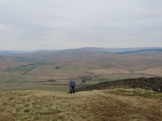
Park Fell is a prominent hill located in the Yorkshire Dales National Park, situated in the county of Yorkshire, England. It is part of a range of hills known as the Yorkshire Downs, which stretches across the region. Rising to an elevation of approximately 1,295 feet (395 meters), Park Fell offers breathtaking panoramic views of the surrounding countryside, making it a popular destination for nature enthusiasts and hikers alike.

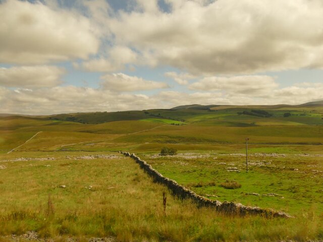
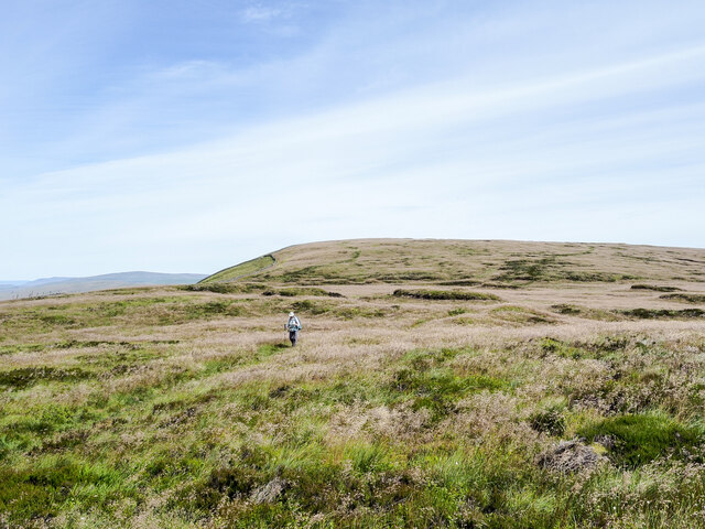
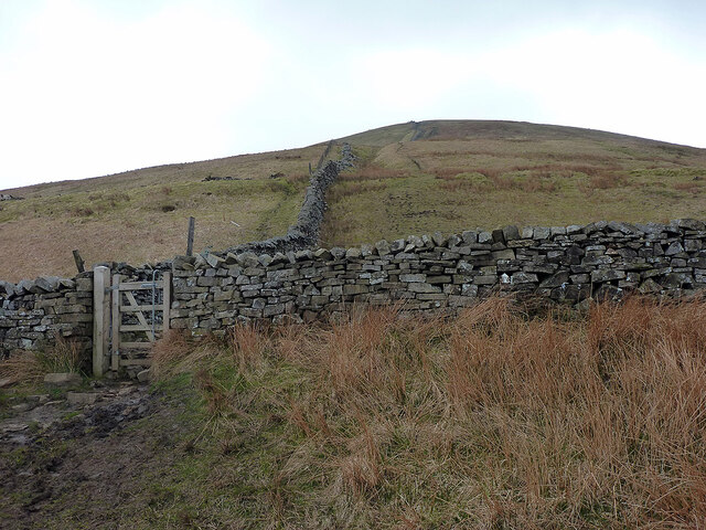
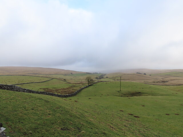
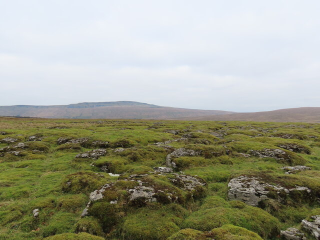
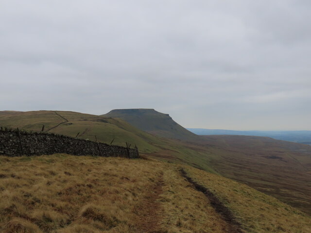
The terrain of Park Fell primarily comprises open moorland, characterized by rolling hills, heather-covered slopes, and scattered rocky outcrops. The moorland is home to a diverse range of plant and animal species, including wildflowers, heather, and various bird species such as curlews and golden plovers. The area is also known for its distinctive dry stone walls, which crisscross the landscape, providing boundaries for grazing livestock.

The hills of Park Fell offer several walking routes and trails, catering to different levels of difficulty and distance. Climbing to the summit of Park Fell rewards visitors with breathtaking views of the surrounding countryside, including the expansive valleys, neighboring hills, and distant peaks. On a clear day, it is even possible to catch a glimpse of the iconic Three Peaks: Pen-y-ghent, Ingleborough, and Whernside.

Due to its location within the Yorkshire Dales National Park, Park Fell is subject to conservation efforts, ensuring the preservation of its natural beauty and wildlife. It provides a serene escape from the bustling cities, allowing visitors to immerse themselves in the tranquility and charm of the Yorkshire countryside.

If you have any feedback on the listing, please let us know in the comments section below.

Park Fell Images

Images are sourced within 2km of 54.188124/-2.353315 or Grid Reference SD7776. Thanks to Geograph Open Source API. All images are credited.
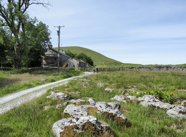
Shaw House A now ruined farmhouse.
Shaw House
A now ruined farmhouse.
Dry stone wall at Selside Along with the limestone pavement from which the stone was presumably taken, this is typical Ribblesdale scenery.
Dry stone wall at Selside
Along with the limestone pavement from which the stone was presumably taken, this is typical Ribblesdale scenery.
The Dalesman returns Locomotive 35018, “British India Line”, returns southwards at Ribblehead on the June 2022 steam special using the scenic Carlisle-Settle line.
The Dalesman returns
Locomotive 35018, “British India Line”, returns southwards at Ribblehead on the June 2022 steam special using the scenic Carlisle-Settle line.
Ribblehead Station, Northbound Platform and Goods Sidings Ribblehead Railway Station on the Settle and Carlisle Line, close to the southern end of the iconic Ribblehead Viaduct. It opened on 4 December 1876 as Batty Green but was later renamed Ribblehead in 1877.  Together with the other smaller stations on the line, Ribblehead was closed in May 1970. The station was reopened on 16 July 1986 by British Rail with only one platform (southbound) in place. The northbound platform had been demolished after the station's earlier closure to allow the construction of transfer sidings for a nearby quarry. The sidings still exist and have recently been restored to use for timber trains. A replacement second platform was opened on 28 May 1993, a short distance south of the original site.

There is a small visitor centre in the Ribblehead railway station woyj an exhibition about the history of the viaduct and the Settle to Carlisle railway line.
Ribblehead Station, Northbound Platform and Goods Sidings
Ribblehead Railway Station on the Settle and Carlisle Line, close to the southern end of the iconic Ribblehead Viaduct. It opened on 4 December 1876 as Batty Green but was later renamed Ribblehead in 1877. Together with the other smaller stations on the line, Ribblehead was closed in May 1970. The station was reopened on 16 July 1986 by British Rail with only one platform (southbound) in place. The northbound platform had been demolished after the station's earlier closure to allow the construction of transfer sidings for a nearby quarry. The sidings still exist and have recently been restored to use for timber trains. A replacement second platform was opened on 28 May 1993, a short distance south of the original site. There is a small visitor centre in the Ribblehead railway station woyj an exhibition about the history of the viaduct and the Settle to Carlisle railway line.
Barn at Gauber There are other buildings at Gauber on the north side of the B6479, near to Ribblehead, one of them a bunk barn; this barn hides them.
Barn at Gauber
There are other buildings at Gauber on the north side of the B6479, near to Ribblehead, one of them a bunk barn; this barn hides them.
House at Colt Park The building at Colt Park with scaffolding erected.
House at Colt Park
The building at Colt Park with scaffolding erected.
Grass flowers gone to seed The hill walker is on a path connecting Park Fell in the distance, with Ingleborough. The pale buff-coloured grass heads covering most of the ground in view have finished flowering and are now seeded.
Grass flowers gone to seed
The hill walker is on a path connecting Park Fell in the distance, with Ingleborough. The pale buff-coloured grass heads covering most of the ground in view have finished flowering and are now seeded.
Carlisle Train at Ribblehead A 3 Car Northern Rail Train (a 2 car Class 158 & a single car 153) with the 14.34 to Carlisle. This is the 13.15 departure from Leeds, due into Carlisle at 16.00. Next stop Dent.
Carlisle Train at Ribblehead
A 3 Car Northern Rail Train (a 2 car Class 158 & a single car 153) with the 14.34 to Carlisle. This is the 13.15 departure from Leeds, due into Carlisle at 16.00. Next stop Dent.
Gate on the path to Ingleborough Limestone pavement on Gauber High Pasture ahead, with Park Fell [hill] beyond.
Gate on the path to Ingleborough
Limestone pavement on Gauber High Pasture ahead, with Park Fell [hill] beyond.
Path climbing Park Fell Up from Gauber and Ribblehead.
Path climbing Park Fell
Up from Gauber and Ribblehead.
Rolling fields
Rolling fields
Railway line overlooked by Whernside
Mossy limestone pavement
Summiting Park Fell
Summiting Park Fell
Path to Ingleborough
Arrival at Ribblehead Whernside beyond.
Arrival at Ribblehead
Whernside beyond.
The 'down' platform at Ribblehead The platform is a 1993 replacement of the original which was removed in 1970, albeit in a position slightly to the south of the original. The sidings behind the platform were re-opened a few years ago for the handling of timber traffic, but now seem to be given over for shipment of aggregates.
The 'down' platform at Ribblehead
The platform is a 1993 replacement of the original which was removed in 1970, albeit in a position slightly to the south of the original. The sidings behind the platform were re-opened a few years ago for the handling of timber traffic, but now seem to be given over for shipment of aggregates.
Show me another place!

Park Fell is located at Grid Ref: SD7776 (Lat: 54.188124, Lng: -2.353315)

Division: West Riding

Administrative County: North Yorkshire

District: Craven

Police Authority: North Yorkshire

What 3 Words

///lollipop.observe.answer. Near Ingleton, North Yorkshire

Nearby Locations

Park Fell Selside Shaw

Related Wikis

Alum Pot

Alum Pot is a pothole with a large open shaft at a surface elevation of 343 metres (1,125 ft) on the eastern flanks of Simon Fell, North Yorkshire, England...
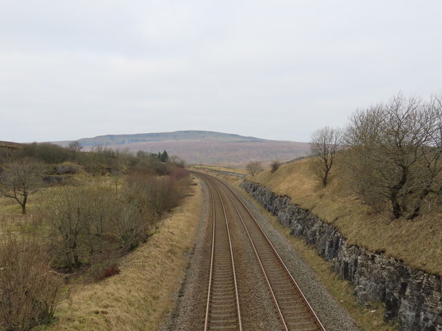
Ribblehead Quarry

Ribblehead Quarry is a former limestone quarry next to Ribblehead railway station in the Yorkshire Dales National Park, North Yorkshire, England. It had...

Selside, North Yorkshire

Selside is a small village in Ribblesdale in North Yorkshire, England. It lies 2 miles (3 km) north west of Horton in Ribblesdale. Selside was mentioned...

Ribblehead railway station

Ribblehead is a railway station on the Settle and Carlisle Line, which runs between Carlisle and Leeds via Settle. The station, situated 52 miles 17 chains...

Nearby Amenities

Located within 500m of 54.188124,-2.353315
Natural: spring
Source: NLS-OS-1st_Series
Lat/Long: 54.1847204/-2.3506398
Pint Pot
Natural: cave_entrance
Lat/Long: 54.188091/-2.3481903
Natural: spring
Source: NLS-OS-1st_Series
Lat/Long: 54.1862202/-2.3600286
Natural: spring
Source: NLS-OS-1st_Series
Lat/Long: 54.1891147/-2.3562359
Natural: spring
Source: NLS-OS-1st_Series
Lat/Long: 54.192472/-2.3546631
Natural: spring
Source: NLS-OS-1st_Series
Lat/Long: 54.1848635/-2.3495347
Natural: spring
Source: NLS-OS-1st_Series
Lat/Long: 54.1915129/-2.3507131
Bent Hill Rigg
Natural: peak
Lat/Long: 54.1869896/-2.3473876
The data included in this document is from www.openstreetmap.org. The data is made available under ODbL.

Have you been to Park Fell?

Leave your review of Park Fell below (or comments, questions and feedback).