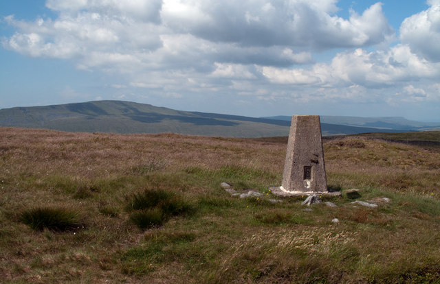
Top Cow Pasture

Downs, Moorland in Yorkshire Craven

England

Top Cow Pasture

Low Birkwith Ribblesdale Farm
Low Birkwith Credit: Stephen Shaw

Top Cow Pasture is a picturesque and sprawling expanse of land located in the heart of Yorkshire, England. Nestled amidst the stunning natural landscapes of the region, this pasture is renowned for its idyllic beauty and rich agricultural heritage.

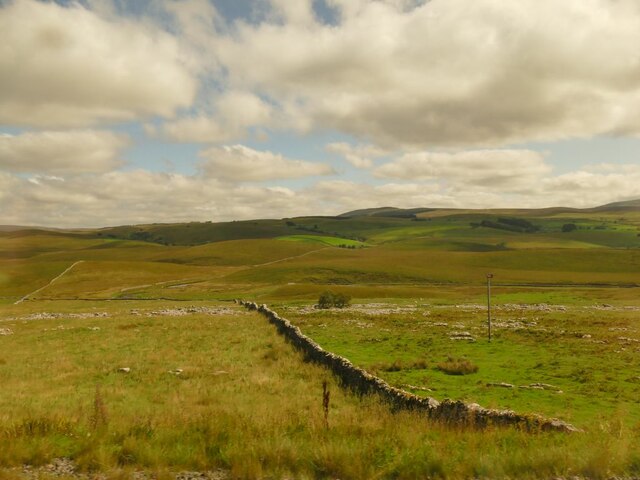
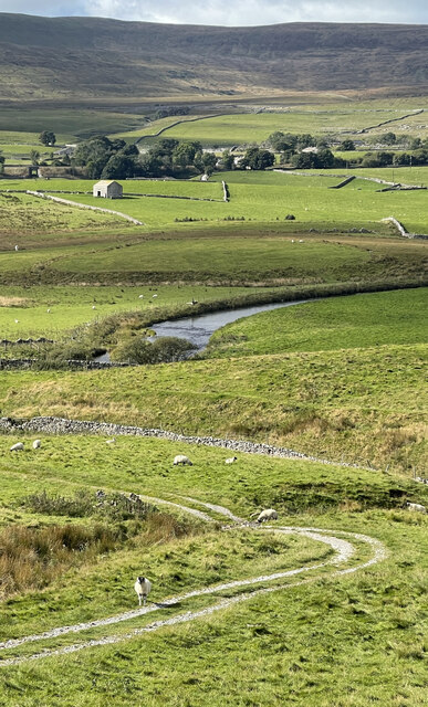
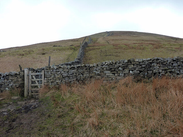
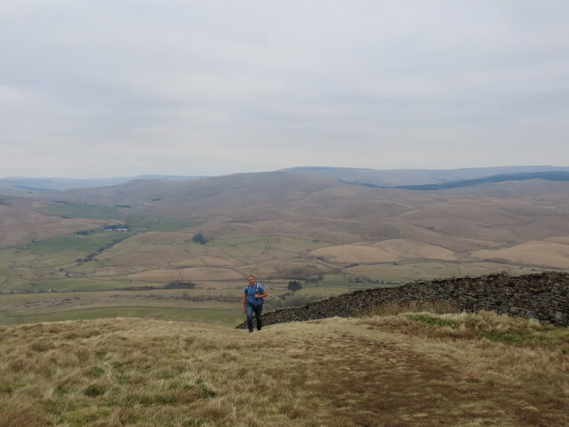
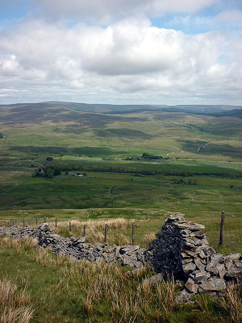
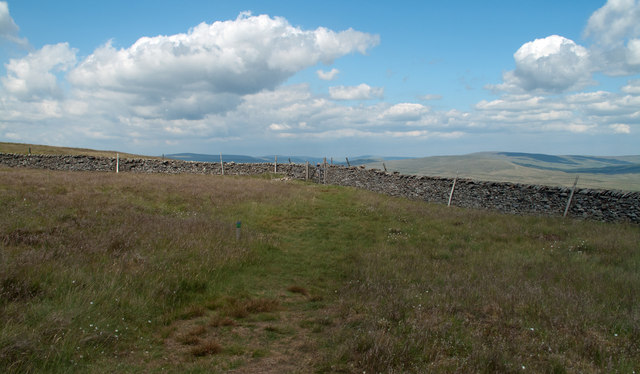
Covering an extensive area, the pasture encompasses diverse terrains such as downs, moorland, and rolling hills. Its diverse ecosystem supports a wide array of flora and fauna, making it a haven for nature enthusiasts and wildlife enthusiasts alike. Visitors to Top Cow Pasture are treated to breathtaking panoramic views of the surrounding countryside, with the undulating meadows stretching as far as the eye can see.

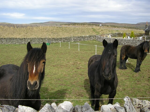
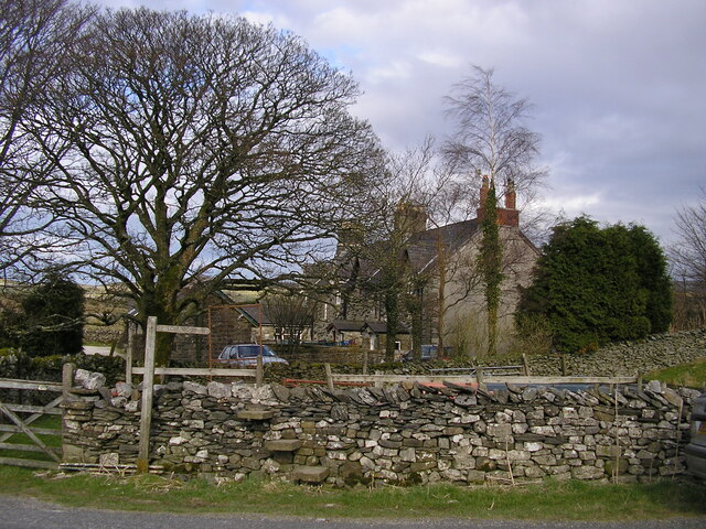
The lush grasslands of the pasture provide ample grazing opportunities for livestock, particularly cows, which has earned it its distinctive name. The area is dotted with traditional farmhouses and barns that add to its rustic charm and offer a glimpse into the region's agricultural heritage.

Walking trails crisscross the pasture, allowing visitors to explore its various nooks and crannies at their own pace. The trails wind through fields of vibrant wildflowers, ancient woodlands, and babbling streams, offering a serene and peaceful escape from the hustle and bustle of everyday life.

Top Cow Pasture is not only a haven for nature lovers but also a popular destination for outdoor activities such as hiking, birdwatching, and photography. Its raw and unspoiled beauty has made it a favorite spot for artists and photographers seeking inspiration from its tranquil surroundings.

In summary, Top Cow Pasture in Yorkshire is a captivating landscape that showcases the natural beauty of the region. With its diverse terrains, abundant wildlife, and peaceful ambiance, it is a destination that offers a truly immersive experience in the heart of nature.

If you have any feedback on the listing, please let us know in the comments section below.

Top Cow Pasture Images

Images are sourced within 2km of 54.17875/-2.3409016 or Grid Reference SD7775. Thanks to Geograph Open Source API. All images are credited.

Low Birkwith Ribblesdale Farm
Low Birkwith
Ribblesdale Farm
Sink holes on Far Moor A common feature of Ribblesdale with its limestone geology.
Sink holes on Far Moor
A common feature of Ribblesdale with its limestone geology.
Wrays Barn The name is that of the stone laithe (left).
Wrays Barn
The name is that of the stone laithe (left).
Shaw House A now ruined farmhouse.
Shaw House
A now ruined farmhouse.
Dry stone wall at Selside Along with the limestone pavement from which the stone was presumably taken, this is typical Ribblesdale scenery.
Dry stone wall at Selside
Along with the limestone pavement from which the stone was presumably taken, this is typical Ribblesdale scenery.
Horses and Railway Embankment at Selside The horses were in a field between the B6479 and the Settle & Carlisle Railway, near the Railway Cottages at Selside. The embankment can be seen beyond the field.
Horses and Railway Embankment at Selside
The horses were in a field between the B6479 and the Settle & Carlisle Railway, near the Railway Cottages at Selside. The embankment can be seen beyond the field.
Stone Step Stile & Footpath Finger Post at Selside Located on the B6479, by the Railway Cottages at Selside. The finger post points to Low Moor.
Stone Step Stile & Footpath Finger Post at Selside
Located on the B6479, by the Railway Cottages at Selside. The finger post points to Low Moor.
Borrins Ford This ford on the Pennine Bridleway is found near Borrins. A photograph taken in the opposite direction can be viewed at:
<a title="https://www.geograph.org.uk/photo/3034299" href="https://www.geograph.org.uk/photo/3034299">Link</a>
Borrins Ford
This ford on the Pennine Bridleway is found near Borrins. A photograph taken in the opposite direction can be viewed at: Link
Ford at Dale Mire Barn This ford is found on the track to Dale Mire Barn.
Ford at Dale Mire Barn
This ford is found on the track to Dale Mire Barn.
Path climbing Park Fell Up from Gauber and Ribblehead.
Path climbing Park Fell
Up from Gauber and Ribblehead.
Summiting Park Fell
Summiting Park Fell
Old dry stone wall, north flank of Park Fell Looking towards the drumlins of north Ribblesdale and the moors beyond.
Old dry stone wall, north flank of Park Fell
Looking towards the drumlins of north Ribblesdale and the moors beyond.
Wall corner on Park Fell Just north of the trig point of Park Fell, (itself north-east of Ingleborough), the grassy slope drops away gently to the wall corner in the image where there's a gate and from where a path approaches.
Wall corner on Park Fell
Just north of the trig point of Park Fell, (itself north-east of Ingleborough), the grassy slope drops away gently to the wall corner in the image where there's a gate and from where a path approaches.
Trig point of Park Fell Park Fell lies north-east from Ingleborough and is essentially part of it. The hill seen distantly is Whernside.
Trig point of Park Fell
Park Fell lies north-east from Ingleborough and is essentially part of it. The hill seen distantly is Whernside.
New Pennine Bridleway Bridge Bridge over River Ribble near Selside part of a newly constructed bridleway forming part of the Pennine Bridleway National Trail
New Pennine Bridleway Bridge
Bridge over River Ribble near Selside part of a newly constructed bridleway forming part of the Pennine Bridleway National Trail
New Pennine Bridleway Newly created bridleway part of the Pennine Bridleway National Trail near Selside
New Pennine Bridleway
Newly created bridleway part of the Pennine Bridleway National Trail near Selside
Low Birkwith
Low Birkwith
Low Birkwith
Low Birkwith
Show me another place!

Top Cow Pasture is located at Grid Ref: SD7775 (Lat: 54.17875, Lng: -2.3409016)

Division: West Riding

Administrative County: North Yorkshire

District: Craven

Police Authority: North Yorkshire

What 3 Words

///another.ambitions.guessing. Near Ingleton, North Yorkshire

Related Wikis

Alum Pot

Alum Pot is a pothole with a large open shaft at a surface elevation of 343 metres (1,125 ft) on the eastern flanks of Simon Fell, North Yorkshire, England...

Selside, North Yorkshire

Selside is a small village in Ribblesdale in North Yorkshire, England. It lies 2 miles (3 km) north west of Horton in Ribblesdale. Selside was mentioned...

High Birkwith

High Birkwith is a hamlet in the Craven district of North Yorkshire, England. It is located north of the village of Horton in Ribblesdale and in the same...

Simon Fell (Yorkshire Dales)

Simon Fell is a subsidiary summit on the north east ridge of Ingleborough, a mountain in the Yorkshire Dales in Northern England. With a height of 650...
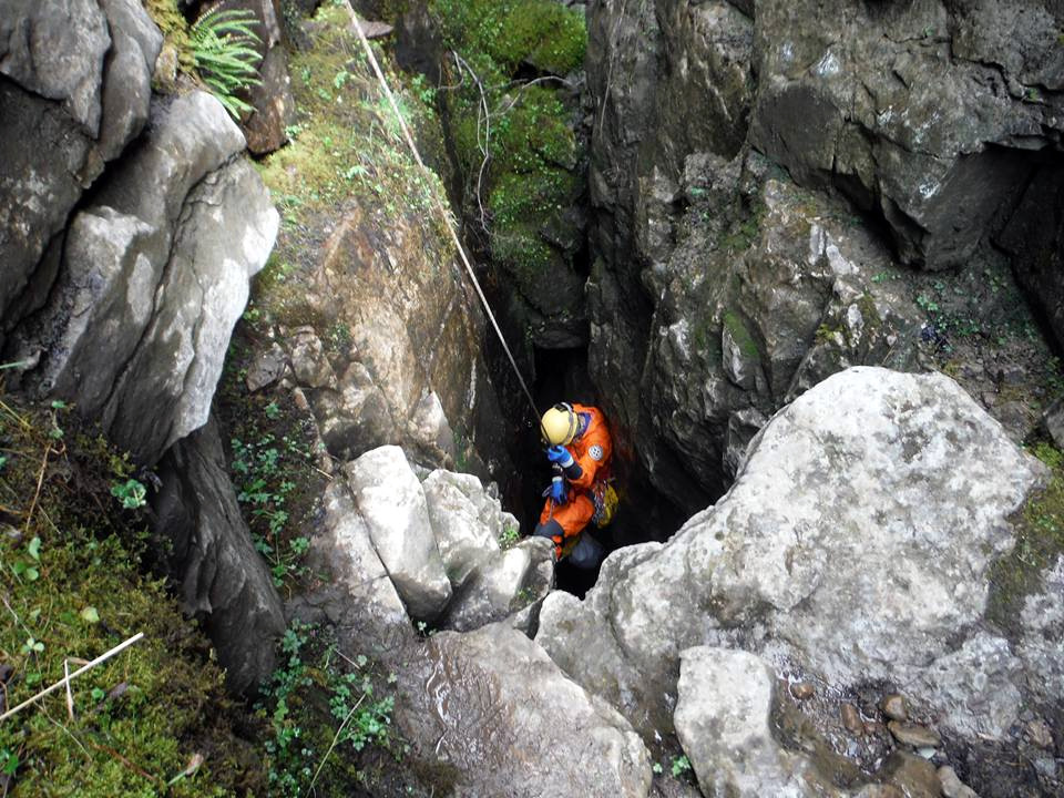
Juniper Gulf

Juniper Gulf is a pit cave in on the side of Ingleborough in Yorkshire, England. It is a popular single rope technique (SRT) trip for cavers, especially...

Ribblehead Quarry

Ribblehead Quarry is a former limestone quarry next to Ribblehead railway station in the Yorkshire Dales National Park, North Yorkshire, England. It had...

Ribblehead railway station

Ribblehead is a railway station on the Settle and Carlisle Line, which runs between Carlisle and Leeds via Settle. The station, situated 52 miles 17 chains...

Long Kin East Cave - Rift Pot System

The Long Kin East Cave - Rift Pot system is a limestone cave system on the southern flanks of Ingleborough, North Yorkshire in England lying within the...

Nearby Amenities

Located within 500m of 54.17875,-2.3409016
Barrier: cattle_grid
Source: survey
Lat/Long: 54.1769172/-2.3346808
Turning Circle
Lat/Long: 54.1773957/-2.3362913
Natural: cave_entrance
Source: OS sheet 96, publ. 1851
Lat/Long: 54.1791177/-2.3454145
Natural: cave_entrance
Source: OS sheet 96, publ. 1851
Lat/Long: 54.1776265/-2.3417238
Selside Shaw Laids
Place: locality
Source: OS OD Historic
Lat/Long: 54.1826758/-2.3417809
Diccan Pot
Natural: cave_entrance
Note: called "Long Churn" in OS sheet 96, publ. 1851
Source: OS 1:25k
Lat/Long: 54.1763733/-2.34743
Natural: cave_entrance
Source: OS 1:25k
Lat/Long: 54.1775321/-2.3470647
Barrier: entrance
Source: EsriWorldImageryClarity
Lat/Long: 54.1811393/-2.3383985
Barrier: entrance
Lat/Long: 54.1801898/-2.3388459
Abandoned Man Made: kiln
Building Condition: ruinous
Historic: yes
Mineral: limestone
Product: lime
Source: OS sheet 96, publ. 1851;EsriWorldImageryClarity
Lat/Long: 54.1777616/-2.3338924
Natural: cave_entrance
Source: OS sheet 96, publ. 1851
Lat/Long: 54.1774615/-2.3392259
Barrier: entrance
Source: EsriWorldImageryClarity
Lat/Long: 54.1814039/-2.3400281
Abandoned Barrier: stile
Material: wood
Stile: stepover
Lat/Long: 54.1757157/-2.3465073
Historic: kiln
Product: lime
Source: OS sheet 96, publ. 1851;EsriWorldImageryClarity
Lat/Long: 54.1749076/-2.3427922
Font Green Spring
Natural: spring
Source: NLS-OS-1st_Series
Lat/Long: 54.1751588/-2.337321
Alum Pot
Information: board
Tourism: information
Lat/Long: 54.1750455/-2.3390087
Barrier: stile
Count: 2
Material: stone
Stile: stepover
Lat/Long: 54.1750196/-2.3390844
Power: pole
Lat/Long: 54.1775374/-2.3335173
Power: pole
Lat/Long: 54.1775911/-2.3343076
Power: pole
Lat/Long: 54.1776373/-2.3350596
Power: pole
Lat/Long: 54.1776642/-2.3354981
Power: pole
Lat/Long: 54.1776911/-2.3358703
Board Type: nature
Information: board
Operator: Ingleborough nature reserve
Tourism: information
Lat/Long: 54.1775022/-2.3364417
Ford: yes
Lat/Long: 54.174429/-2.3416546
Ford: yes
Lat/Long: 54.1747626/-2.3410835
The data included in this document is from www.openstreetmap.org. The data is made available under ODbL.

Have you been to Top Cow Pasture?

Leave your review of Top Cow Pasture below (or comments, questions and feedback).