Holden Moor

Downs, Moorland in Yorkshire Ribble Valley

England

Holden Moor

Hesbert Hall The forest track runs alongside a seriously thistle-infested field at Hesbert Hall with the extensive Gisburn Forest surrounding it - a few colouring larches, but mostly evergreen non-native conifers (Sitka spruce, Picea sitchensis, being the majority).
Hesbert Hall Credit: Andy Waddington

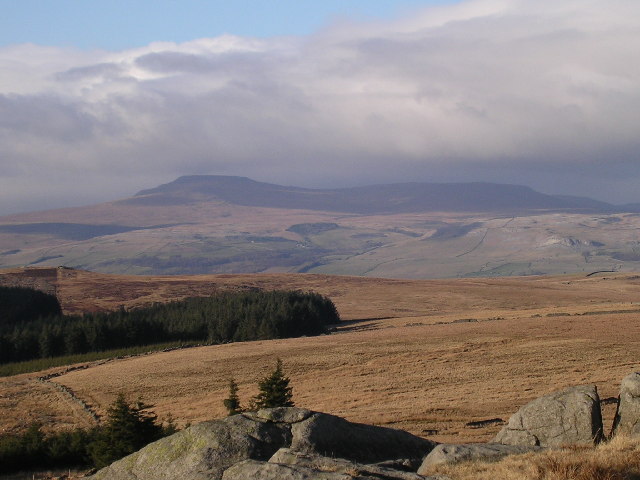
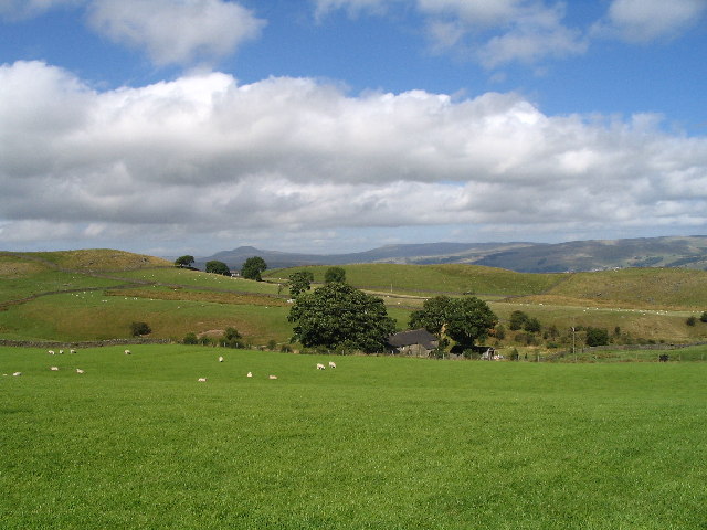
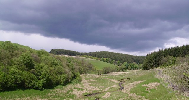
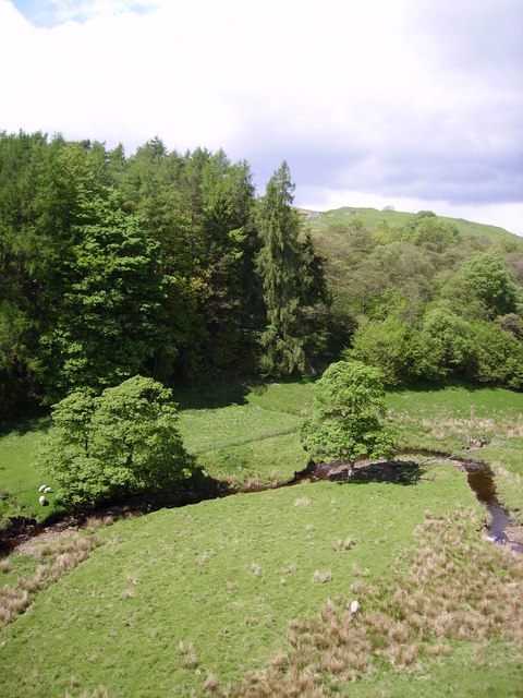
Holden Moor, located in the scenic countryside of Yorkshire, England, is a remarkable area known for its enchanting beauty and diverse landscapes. Covering an expansive area, it encompasses both picturesque downs and vast stretches of moorland, offering visitors a unique and captivating experience.

The downs of Holden Moor are characterized by rolling hills and stunning panoramic views. Lush green meadows, dotted with colorful wildflowers, create a picturesque backdrop against the clear blue sky. These downlands provide ample opportunities for leisurely walks, picnics, and birdwatching, attracting nature enthusiasts and families alike.

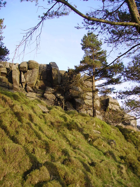
The moorland of Holden Moor presents a contrasting landscape, with its rugged terrain and expansive stretches of heather-covered hills. This untamed wilderness offers a sense of tranquility and solitude, making it a haven for hikers and outdoor adventurers. The moorland is home to various wildlife species, including grouse, curlews, and hares, providing a wonderful opportunity for wildlife spotting.

The diverse range of flora and fauna found in Holden Moor contributes to its ecological significance. It is not uncommon to come across rare and protected species, such as bilberries and orchids, in this unique habitat.

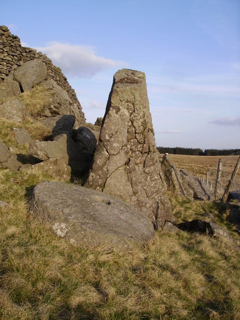
Holden Moor also holds historical importance, with archaeological remains dating back to the Bronze Age. These ancient relics, including burial mounds and stone circles, offer a glimpse into the area's rich cultural heritage.

In summary, Holden Moor in Yorkshire is a captivating destination, offering a harmonious blend of downs and moorland. Its breathtaking landscapes, diverse wildlife, and historical significance make it a must-visit location for nature lovers, hikers, and those seeking a peaceful retreat in the heart of the British countryside.

If you have any feedback on the listing, please let us know in the comments section below.

Holden Moor Images

Images are sourced within 2km of 54.025228/-2.364525 or Grid Reference SD7658. Thanks to Geograph Open Source API. All images are credited.

Hesbert Hall The forest track runs alongside a seriously thistle-infested field at Hesbert Hall with the extensive Gisburn Forest surrounding it - a few colouring larches, but mostly evergreen non-native conifers (Sitka spruce, Picea sitchensis, being the majority).
Hesbert Hall
The forest track runs alongside a seriously thistle-infested field at Hesbert Hall with the extensive Gisburn Forest surrounding it - a few colouring larches, but mostly evergreen non-native conifers (Sitka spruce, Picea sitchensis, being the majority).
Track past Heath Farm's barn The track leads from Gisburn Forest to Heath Farm, where the footpath splits, one way heading east to Longtons Lane, whilst the other heads much further to the north to Gigglewick Common.
Track past Heath Farm's barn
The track leads from Gisburn Forest to Heath Farm, where the footpath splits, one way heading east to Longtons Lane, whilst the other heads much further to the north to Gigglewick Common.
View of Ingleborough from Whelp Stone Crag From the Millstone Grit south of the Craven fault to the  Carboniferous Limestone to the north. Fell Beck can just be made out terminating in Gaping Gill.
View of Ingleborough from Whelp Stone Crag
From the Millstone Grit south of the Craven fault to the Carboniferous Limestone to the north. Fell Beck can just be made out terminating in Gaping Gill.
Ragged Hall, near Rathmell Long distance views up Ribblesdale can be had from here.
Ragged Hall, near Rathmell
Long distance views up Ribblesdale can be had from here.
Footpath to Heath Farm The way was barred by sheep aplenty.
Footpath to Heath Farm
The way was barred by sheep aplenty.
Street Heights
Street Heights
Higher Brayshaw Farm
Entrance and road to Street House Farm
Gisburn Forest Claimed to be the biggest in Lancashire. The Barn at Geldard Laithe in view in the centre of the picture is engulfed by trees.
Gisburn Forest
Claimed to be the biggest in Lancashire. The Barn at Geldard Laithe in view in the centre of the picture is engulfed by trees.
Whelp Stone Crag The Crags are a welcome surprise after you have struggled through thick plantations of Gisburn Forest
Whelp Stone Crag
The Crags are a welcome surprise after you have struggled through thick plantations of Gisburn Forest
Millstone Whelp Stone Crag Not the first abandoned millstone I have encountered in Bowland. Looks like it fell off the natural Trig Point shaped rock behind it. Perhaps it's a message saying 'Finding vacant squares to photo is becoming a bit of a millstone....'
Millstone Whelp Stone Crag
Not the first abandoned millstone I have encountered in Bowland. Looks like it fell off the natural Trig Point shaped rock behind it. Perhaps it's a message saying 'Finding vacant squares to photo is becoming a bit of a millstone....'
Holden Moor Flat unplanted patch just south of Whelp Stone Crag. An eastern spur of Gisburn Forest on't skyline.
Holden Moor
Flat unplanted patch just south of Whelp Stone Crag. An eastern spur of Gisburn Forest on't skyline.
Descent to Bottoms Down through Gisburn Forest to a little strath called Bottoms. Stooping very low now to add that Cocklick End is in the next square and Tosside is the nearest village.
Descent to Bottoms
Down through Gisburn Forest to a little strath called Bottoms. Stooping very low now to add that Cocklick End is in the next square and Tosside is the nearest village.
Dob Beck Dob Dale runs along Gisburn Forest Edge at this point before cutting into the Forest on the right. Typical Bank Holiday cloud overhead.
Dob Beck
Dob Dale runs along Gisburn Forest Edge at this point before cutting into the Forest on the right. Typical Bank Holiday cloud overhead.
Sheep and Lambs at Bottoms The sheep in the middle of the picture was a few minutes earlier bungee jumping around on the end of two pine branches which it had become entangled on with its lamb bleating mournfully. I spent 10 minutes disentangling it then watched the joyful reunion. Ahh... another successful Geograph rescue.
Sheep and Lambs at Bottoms
The sheep in the middle of the picture was a few minutes earlier bungee jumping around on the end of two pine branches which it had become entangled on with its lamb bleating mournfully. I spent 10 minutes disentangling it then watched the joyful reunion. Ahh... another successful Geograph rescue.
Dob Dale Beck Soon to become Bottoms Beck Gisburn Forest
Dob Dale Beck
Soon to become Bottoms Beck Gisburn Forest
Old Hedge Line On the edge of Gisburn Forest. It appears to be on the line of a public footpath which looks like it's never used except by Geographers looking for elusive squares like the one with Halstead Farm in view ahead.
Old Hedge Line
On the edge of Gisburn Forest. It appears to be on the line of a public footpath which looks like it's never used except by Geographers looking for elusive squares like the one with Halstead Farm in view ahead.
Gnarled oak, Dob Dale Beck On the forest edge. Halstead farm in view.
Gnarled oak, Dob Dale Beck
On the forest edge. Halstead farm in view.
Show me another place!

Holden Moor is located at Grid Ref: SD7658 (Lat: 54.025228, Lng: -2.364525)

Division: West Riding

Administrative County: Lancashire

District: Ribble Valley

Police Authority: Lancashire

What 3 Words

///muffin.shows.swarm. Near Settle, North Yorkshire

Nearby Locations

Holden Moor

Related Wikis

Tosside

Tosside is a small village on the modern border of North Yorkshire and Lancashire in Northern England. It lies within the Forest of Bowland, and is between...

Gisburn Forest

Gisburn Forest is a civil parish in the Ribble Valley, in Lancashire, England. Mainly lying within the Forest of Bowland Area of Outstanding Natural Beauty...

Easington, Lancashire

Easington () is a civil parish within the Ribble Valley district of Lancashire, England, with a population in 2001 of 52. The Census 2011 population details...

Rathmell

Rathmell is a village and civil parish in the Craven district of North Yorkshire, England. The population of the civil parish in the 2011 census was 305...

Stocks Reservoir

Stocks Reservoir is a reservoir situated at the head of the Hodder valley in the Forest of Bowland, Lancashire, England (historically in the West Riding...

Manor House, Gisburn Forest

Manor House is an historic building in Gisburn Forest, Lancashire, England. It was built in the early 18th century, but contains a section that is believed...

Wigglesworth

Wigglesworth is a village and civil parish in the Craven district of North Yorkshire, England. The population of the civil parish taken at the 2011 Census...

Settle Junction railway station

Settle Junction railway station was located near the town of Settle, North Yorkshire, England, immediately to south of the junction between the Midland...

Nearby Amenities

Located within 500m of 54.025228,-2.364525
Barrier: stile
Lat/Long: 54.0256494/-2.3692506
Whelpstone Crag
Natural: peak
Source: GPS
Lat/Long: 54.0277307/-2.3686545
The data included in this document is from www.openstreetmap.org. The data is made available under ODbL.

Have you been to Holden Moor?

Leave your review of Holden Moor below (or comments, questions and feedback).