Comb Pasture

Downs, Moorland in Yorkshire South Lakeland

England

Comb Pasture

Swarthgill Service Station
Swarthgill Service Station Credit: Anthony Parkes

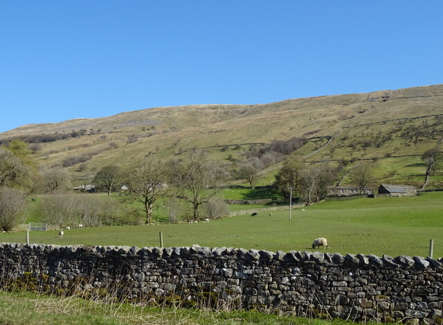
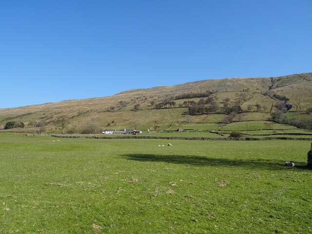
Comb Pasture is a scenic and expansive area located in the county of Yorkshire in England. Situated within the larger region known as the Yorkshire Dales, Comb Pasture specifically lies within the boundaries of the Yorkshire Downs and Moorland. This picturesque landscape stretches across approximately 5 square kilometers, offering visitors a blend of captivating natural beauty and cultural heritage.

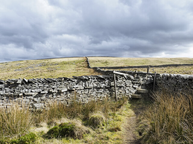
The terrain of Comb Pasture is characterized by rolling hills, lush grasslands, and scattered patches of woodland. The area is known for its open vistas and panoramic views, with gentle slopes providing ample opportunities for walking, hiking, and other outdoor recreational activities. The Yorkshire Downs and Moorland present a diverse range of flora and fauna, with heather, bracken, and wildflowers dotting the landscape, and various bird species soaring above.

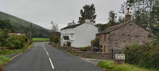
Historically, Comb Pasture has played a vital role in local agriculture, primarily serving as grazing land for sheep and cattle. The area is still home to several working farms, contributing to the rural charm and traditional way of life that Yorkshire is renowned for. Alongside its natural splendor, Comb Pasture boasts a rich cultural heritage, with ancient stone walls and remnants of old settlements adding a sense of history to the landscape.

Visitors to Comb Pasture can immerse themselves in the tranquility of the countryside, taking in the sweeping views, exploring the network of footpaths and bridleways, or simply enjoying a picnic amidst the picturesque surroundings. The area's accessibility, coupled with its natural beauty, makes Comb Pasture an appealing destination for nature enthusiasts, hikers, and those seeking a peaceful retreat in the heart of Yorkshire.

If you have any feedback on the listing, please let us know in the comments section below.
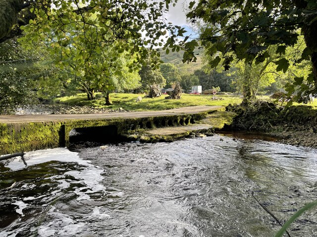
Comb Pasture Images

Images are sourced within 2km of 54.294866/-2.4103537 or Grid Reference SD7388. Thanks to Geograph Open Source API. All images are credited.

Swarthgill Service Station
Little Winterscales Ford This irish bridge ford on the River Clough is found at Little Winterscales.
Little Winterscales Ford
This irish bridge ford on the River Clough is found at Little Winterscales.
St John the Baptist Garsdale St John the Baptist Garsdale.
St John the Baptist Garsdale
St John the Baptist Garsdale.
Stile with walls beyond The stile and other similar ones allow easy access along the ridge rising to Aye Gill Pike, the highest point along a ridge between Garsdale and Dentdale.
Stile with walls beyond
The stile and other similar ones allow easy access along the ridge rising to Aye Gill Pike, the highest point along a ridge between Garsdale and Dentdale.
Trig point at Aye Gill Pike Aye Gill Pike is the highest point along the hill ridge separating Garsdale and Dentdale. The view is along the ridge, east-south-east. Great Knoutberry Hill is probably the hill cone right of centre on the horizon.
Trig point at Aye Gill Pike
Aye Gill Pike is the highest point along the hill ridge separating Garsdale and Dentdale. The view is along the ridge, east-south-east. Great Knoutberry Hill is probably the hill cone right of centre on the horizon.
Swarthgill House
Swarthgill House
Grazing, Garsdale Looking towards East Rackenthwaite.
Grazing, Garsdale
Looking towards East Rackenthwaite.
A twisty A684, Rackenthwaite Towards Sedbergh.
A twisty A684, Rackenthwaite
Towards Sedbergh.
Grazing near Swarthgill House
Swarthgill Service Station On the A684.
Probably not in use for a while.
Swarthgill Service Station
On the A684. Probably not in use for a while.
A684, Swarthgill Towards Sedbergh.
A684, Swarthgill
Towards Sedbergh.
Looking south towards Garsdale along dry stone wall at Green Side
Swarthgill Filling Station on the A684
East Rackenthwaite in Garsdale Below the steep slopes of Baugh Fell.
East Rackenthwaite in Garsdale
Below the steep slopes of Baugh Fell.
Swarth Gill House, Garsdale This prominent house on the A684 is a late 17th century dwelling and Grade II listed <span class="nowrap"><a title="http://www.britishlistedbuildings.co.uk/en-484483-swarth-gill-garsdale" rel="nofollow ugc noopener" href="http://www.britishlistedbuildings.co.uk/en-484483-swarth-gill-garsdale">Link</a><img style="margin-left:2px;" alt="External link" title="External link - shift click to open in new window" src="https://s1.geograph.org.uk/img/external.png" width="10" height="10"/></span>
Swarth Gill House, Garsdale
This prominent house on the A684 is a late 17th century dwelling and Grade II listed LinkExternal link
Swarthgill Service Station, Garsdale Not a lot happening here (or for many years). I have a vague recollection of stopping here as a teenaged boy when walking en route to/from the old Garsdale Head Youth Hostel. I may have bought a chocolate bar - fascinating stuff I know.
Swarthgill Service Station, Garsdale
Not a lot happening here (or for many years). I have a vague recollection of stopping here as a teenaged boy when walking en route to/from the old Garsdale Head Youth Hostel. I may have bought a chocolate bar - fascinating stuff I know.
Swarthgill House from A684
Track down from East Brackenthwaite towards A684
Show me another place!

Comb Pasture is located at Grid Ref: SD7388 (Lat: 54.294866, Lng: -2.4103537)

Division: West Riding

Administrative County: Cumbria

District: South Lakeland

Police Authority: Cumbria

What 3 Words

///salsa.unframed.crawler. Near Sedbergh, Cumbria

Nearby Locations

Rise Hill Comb Pasture

Related Wikis

Aye Gill Pike

Aye Gill Pike is a Marilyn in the Yorkshire Dales, the highest point of the ridge of Rise Hill between Dentdale and Garsdale in Cumbria, England.

Garsdale

Garsdale is a dale or valley in the south east of Cumbria, England, historically a part of the West Riding of Yorkshire. It is now within the Westmorland...

Baugh Fell

Baugh Fell (, or locally ) is a large, flat-topped hill in the northern Pennines of England. It lies in the north-western corner of the Yorkshire Dales...

St John the Evangelist's Church, Cowgill

St John the Evangelist's Church is the Church of England parish church of the village of Cowgill, Cumbria, England. It is in the deanery of Kendal, the...

Have you been to Comb Pasture?

Leave your review of Comb Pasture below (or comments, questions and feedback).