Melkridge Common

Downs, Moorland in Northumberland

England

Melkridge Common

Steel Rig Carpark Hadrian's wall running across the middle of the frame from right to left.
Steel Rig Carpark Credit: Brian Deegan

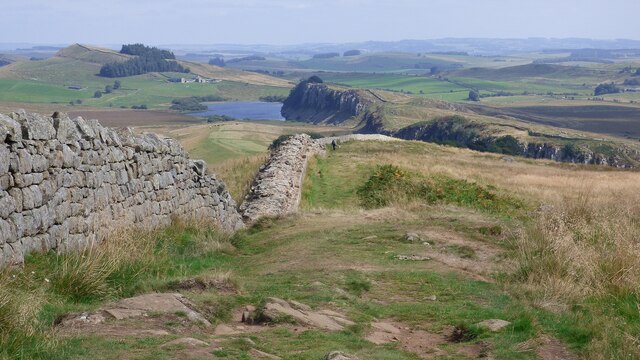
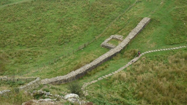
Melkridge Common is a picturesque area located in Northumberland, England. Situated amidst the stunning landscape of the North Pennines, it is a well-known destination for nature enthusiasts and hikers. The common stretches over an extensive area, incorporating downs and moorland, offering a diverse range of natural beauty.

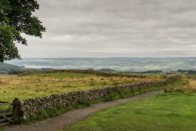
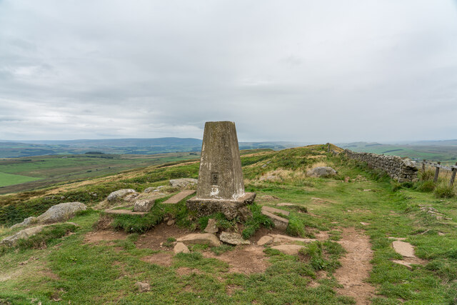
The downs of Melkridge Common are characterized by rolling hills and expansive grasslands. These open spaces are home to a variety of flora and fauna, including heather, wildflowers, and numerous bird species. The downs provide a perfect backdrop for leisurely walks or picnics, with breathtaking views of the surrounding countryside.

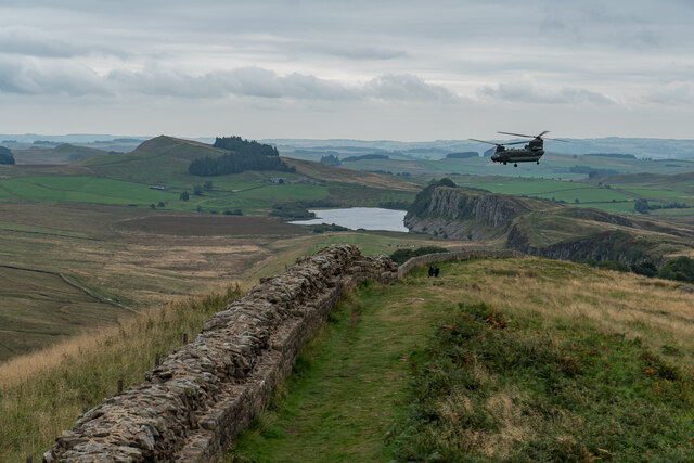
In contrast, the moorland section of Melkridge Common showcases a rugged and untamed landscape, with undulating terrain and heath-covered expanses. The moors are dotted with scattered boulders and crisscrossed by narrow footpaths, making it an ideal location for adventurous hikers and nature explorers.

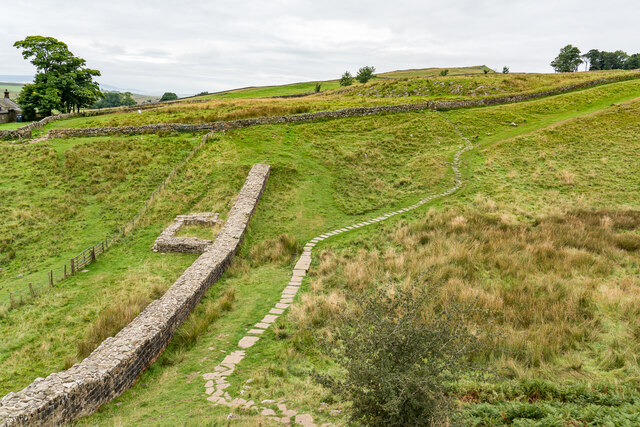
Melkridge Common is also known for its rich cultural heritage. Remnants of ancient settlements, such as Bronze Age cairns and Iron Age hillforts, can be found throughout the area. These archaeological sites serve as a testament to the long history of human habitation in the region.

Overall, Melkridge Common offers a captivating blend of natural beauty and cultural significance. Its downs and moorland provide a haven for outdoor enthusiasts seeking tranquility and adventure, while also offering a glimpse into the area's fascinating past.

If you have any feedback on the listing, please let us know in the comments section below.

Melkridge Common Images

Images are sourced within 2km of 55.001461/-2.4176479 or Grid Reference NY7367. Thanks to Geograph Open Source API. All images are credited.

Steel Rig Carpark Hadrian's wall running across the middle of the frame from right to left.
Steel Rig Carpark
Hadrian's wall running across the middle of the frame from right to left.
Hadrian's Wall Turret, Peel Crags
Chinook Helicopter over Hadrian's Wall Sure this sight would have got some attention in Roman times, It still did today.
Chinook Helicopter over Hadrian's Wall
Sure this sight would have got some attention in Roman times, It still did today.
Winshields Trigpoint, Highest point on Hadrian's Wall TP7000 - Winshields <span class="nowrap"><a title="http://trigpointing.uk/trig/7000" rel="nofollow ugc noopener" href="http://trigpointing.uk/trig/7000">Link</a><img style="margin-left:2px;" alt="External link" title="External link - shift click to open in new window" src="https://s1.geograph.org.uk/img/external.png" width="10" height="10"/></span>
Winshields Trigpoint, Highest point on Hadrian's Wall
TP7000 - Winshields LinkExternal link
Cawfields Milecastle (42) on Hadrian's Wall Hadrian's wall or 'Vallum Aelium' is the remains of a large Roman fortification. The wall extended west from Segedunum at Wallsend on the River Tyne to the shore of the Solway Firth, ending a short but unknown distance west of the village of Bowness-on-Solway. Construction probably started sometime in AD 122 and was largely completed within six years.

The remains were made a UNESCO World Heritage Site in 1987.
Cawfields Milecastle (42) on Hadrian's Wall
Hadrian's wall or 'Vallum Aelium' is the remains of a large Roman fortification. The wall extended west from Segedunum at Wallsend on the River Tyne to the shore of the Solway Firth, ending a short but unknown distance west of the village of Bowness-on-Solway. Construction probably started sometime in AD 122 and was largely completed within six years. The remains were made a UNESCO World Heritage Site in 1987.
Hadrian's Wall Vallum at Cawfields Hadrian's wall or 'Vallum Aelium' is the remains of a large Roman fortification. The wall extended west from Segedunum at Wallsend on the River Tyne to the shore of the Solway Firth, ending a short but unknown distance west of the village of Bowness-on-Solway. Construction probably started sometime in AD 122 and was largely completed within six years.

The remains were made a UNESCO World Heritage Site in 1987.
Hadrian's Wall Vallum at Cawfields
Hadrian's wall or 'Vallum Aelium' is the remains of a large Roman fortification. The wall extended west from Segedunum at Wallsend on the River Tyne to the shore of the Solway Firth, ending a short but unknown distance west of the village of Bowness-on-Solway. Construction probably started sometime in AD 122 and was largely completed within six years. The remains were made a UNESCO World Heritage Site in 1987.
Turret 41a on Hadrian's Wall at Caw Gap Hadrian's wall or 'Vallum Aelium' is the remains of a large Roman fortification. The wall extended west from Segedunum at Wallsend on the River Tyne to the shore of the Solway Firth, ending a short but unknown distance west of the village of Bowness-on-Solway. Construction probably started sometime in AD 122 and was largely completed within six years.

The remains were made a UNESCO World Heritage Site in 1987.
Turret 41a on Hadrian's Wall at Caw Gap
Hadrian's wall or 'Vallum Aelium' is the remains of a large Roman fortification. The wall extended west from Segedunum at Wallsend on the River Tyne to the shore of the Solway Firth, ending a short but unknown distance west of the village of Bowness-on-Solway. Construction probably started sometime in AD 122 and was largely completed within six years. The remains were made a UNESCO World Heritage Site in 1987.
Hadrian's Wall at Thorny Doors Hadrian's wall or 'Vallum Aelium' is the remains of a large Roman fortification. The wall extended west from Segedunum at Wallsend on the River Tyne to the shore of the Solway Firth, ending a short but unknown distance west of the village of Bowness-on-Solway. Construction probably started sometime in AD 122 and was largely completed within six years.

The remains were made a UNESCO World Heritage Site in 1987.
Hadrian's Wall at Thorny Doors
Hadrian's wall or 'Vallum Aelium' is the remains of a large Roman fortification. The wall extended west from Segedunum at Wallsend on the River Tyne to the shore of the Solway Firth, ending a short but unknown distance west of the village of Bowness-on-Solway. Construction probably started sometime in AD 122 and was largely completed within six years. The remains were made a UNESCO World Heritage Site in 1987.
Hadrian's Wall The Roman wall itself is under the bank to the left of the field wall.
Hadrian's Wall
The Roman wall itself is under the bank to the left of the field wall.
Milecastle 41 on Hadrian's Wall View from east.
Milecastle 41 on Hadrian's Wall
View from east.
Hadrian's Wall at Winshield Crags Hadrian's wall or 'Vallum Aelium' is the remains of a large Roman fortification. The wall extended west from Segedunum at Wallsend on the River Tyne to the shore of the Solway Firth, ending a short but unknown distance west of the village of Bowness-on-Solway. Construction probably started sometime in AD 122 and was largely completed within six years.

The remains were made a UNESCO World Heritage Site in 1987.
Hadrian's Wall at Winshield Crags
Hadrian's wall or 'Vallum Aelium' is the remains of a large Roman fortification. The wall extended west from Segedunum at Wallsend on the River Tyne to the shore of the Solway Firth, ending a short but unknown distance west of the village of Bowness-on-Solway. Construction probably started sometime in AD 122 and was largely completed within six years. The remains were made a UNESCO World Heritage Site in 1987.
Hadrian's Wall and turret at Peel Hadrian's wall or 'Vallum Aelium' is the remains of a large Roman fortification. The wall extended west from Segedunum at Wallsend on the River Tyne to the shore of the Solway Firth, ending a short but unknown distance west of the village of Bowness-on-Solway. Construction probably started sometime in AD 122 and was largely completed within six years.

The remains were made a UNESCO World Heritage Site in 1987.
Hadrian's Wall and turret at Peel
Hadrian's wall or 'Vallum Aelium' is the remains of a large Roman fortification. The wall extended west from Segedunum at Wallsend on the River Tyne to the shore of the Solway Firth, ending a short but unknown distance west of the village of Bowness-on-Solway. Construction probably started sometime in AD 122 and was largely completed within six years. The remains were made a UNESCO World Heritage Site in 1987.
Caw Burn west of Gibbs Hill
Hadrian’s Wall at Steel Rigg
Hadrian’s Wall at Winshield Crags
Windshields Trig Point At 345m this is the highest point on Hadrian’s Wall.
Windshields Trig Point
At 345m this is the highest point on Hadrian’s Wall.
Flush bracket on Winshields Trig Point
Hadrian’s Wall Path at Boogle Hole
Show me another place!

Melkridge Common is located at Grid Ref: NY7367 (Lat: 55.001461, Lng: -2.4176479)

Unitary Authority: Northumberland

Police Authority: Northumbria

What 3 Words

///scornful.capacity.chainsaw. Near Haltwhistle, Northumberland

Related Wikis

Milecastle 41

Milecastle 41 (Melkridge) was a milecastle on Hadrian's Wall (grid reference NY73026705). == Description == Milecastle 41 is located to the east of Caw...

Milecastle 40

Milecastle 40 (Winshields) was a milecastle on Hadrian's Wall (grid reference NY74566758). == Description == Milecastle 40 is located northwest of Twice...

Milecastle 42

Milecastle 42 (Cawfields) is a milecastle on Hadrian's Wall (grid reference NY7157466692). == Description == Milecastle 42 is on a steep south-facing slope...

Once Brewed

Once Brewed (also known as Twice Brewed or Once Brewed/Twice Brewed) is a village in Northumberland, England. It lies on the Military Road (Northumberland...

Nearby Amenities

Located within 500m of 55.001461,-2.4176479
Melkridge Common
Natural: heath
Lat/Long: 55.0026676/-2.4183624
Ford: yes
Lat/Long: 55.0015754/-2.4167069
The data included in this document is from www.openstreetmap.org. The data is made available under ODbL.

Have you been to Melkridge Common?

Leave your review of Melkridge Common below (or comments, questions and feedback).