Dowlass Moss

Downs, Moorland in Yorkshire Craven

England

Dowlass Moss

Ingleborough across the limestone pavement
Ingleborough across the limestone pavement Credit: Leanmeanmo

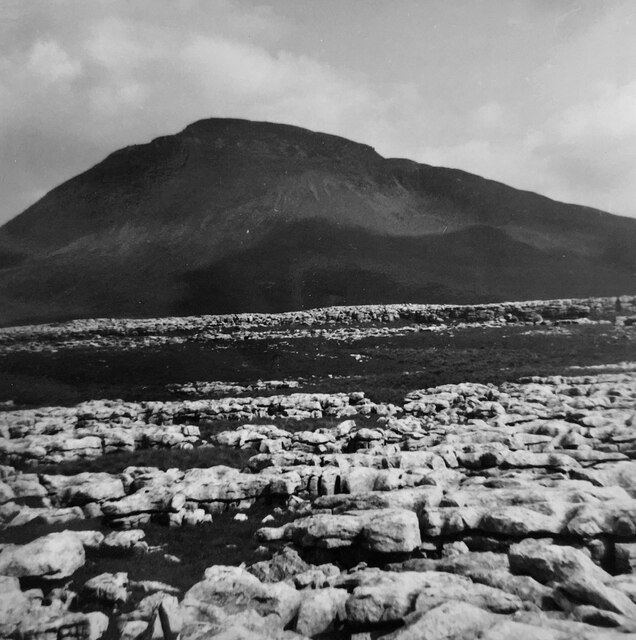
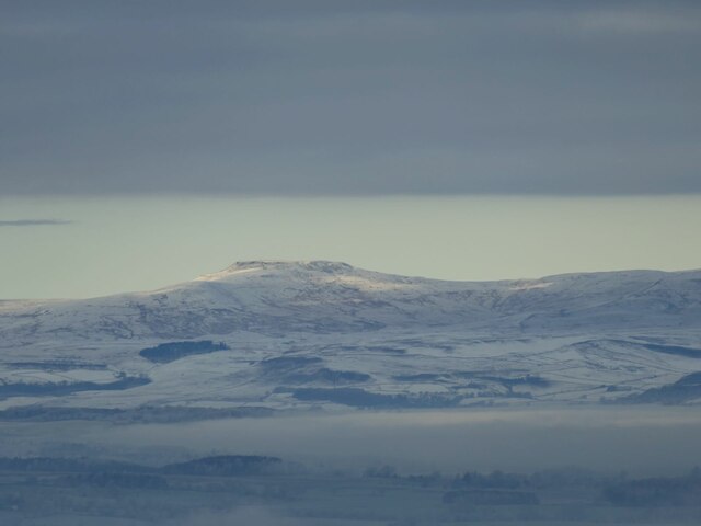
Dowlass Moss is a picturesque area situated in the county of Yorkshire, England. It is renowned for its stunning natural beauty, featuring a combination of downs and moorland landscapes that attract both locals and tourists alike.

The downs of Dowlass Moss are characterized by rolling hills and vast open spaces, providing breathtaking panoramic views of the surrounding countryside. These downs are covered in lush greenery, with grasses and wildflowers dotting the landscape, creating a vibrant and idyllic setting. The area is also home to a variety of wildlife, including hares, rabbits, and numerous species of birds, making it a haven for nature lovers and birdwatchers.

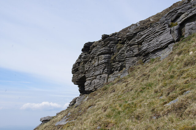
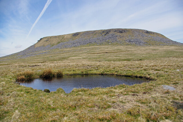
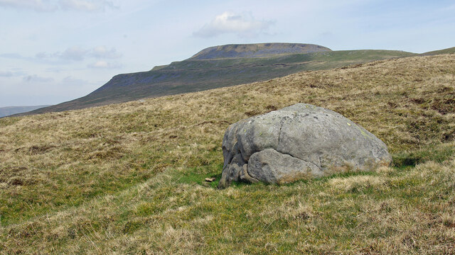
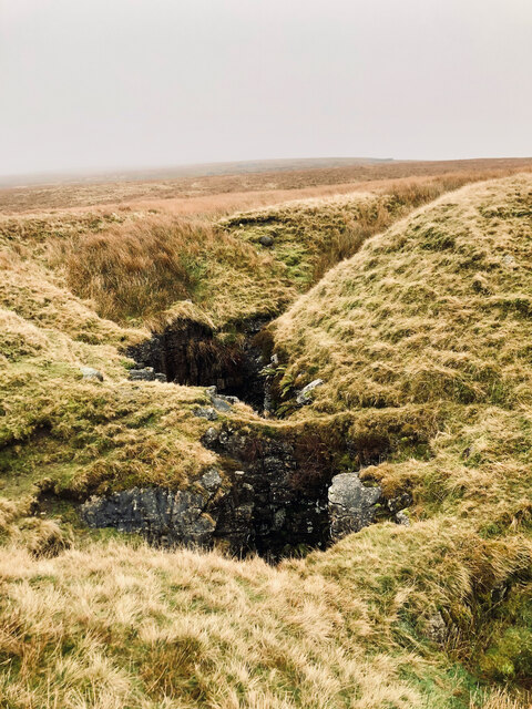
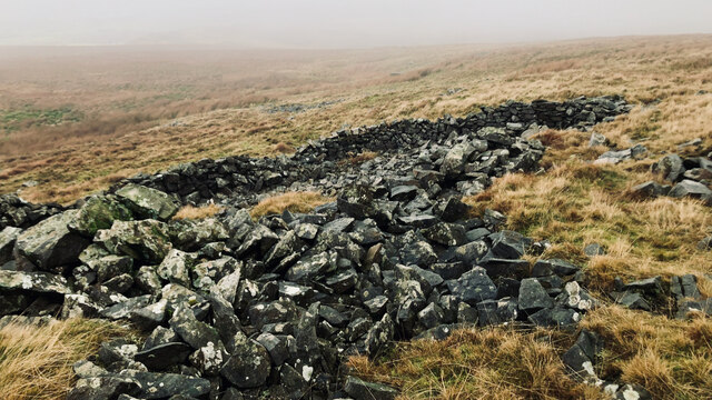
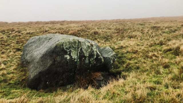
Moving towards the moorland, visitors are greeted by a more rugged and wild terrain. The moors of Dowlass Moss are characterized by expansive heather-covered hills, interspersed with rocky outcrops and scattered patches of woodland. The moorland offers a sense of solitude and tranquility, with its vast open spaces and dramatic scenery providing the perfect backdrop for long walks and hikes.

Dowlass Moss is a popular destination for outdoor enthusiasts, offering a range of activities such as hiking, cycling, and horseback riding. There are numerous well-marked trails and paths that wind through the downs and moorland, allowing visitors to explore the area at their own pace.

Overall, Dowlass Moss is a true gem of Yorkshire, offering visitors a chance to immerse themselves in the natural beauty and tranquility of the downs and moorland landscapes. Whether it's for a leisurely walk, a scenic picnic, or simply to enjoy the breathtaking views, Dowlass Moss is a must-visit destination for nature lovers and those seeking a peaceful retreat.

If you have any feedback on the listing, please let us know in the comments section below.

Dowlass Moss Images

Images are sourced within 2km of 54.15107/-2.4124662 or Grid Reference SD7372. Thanks to Geograph Open Source API. All images are credited.
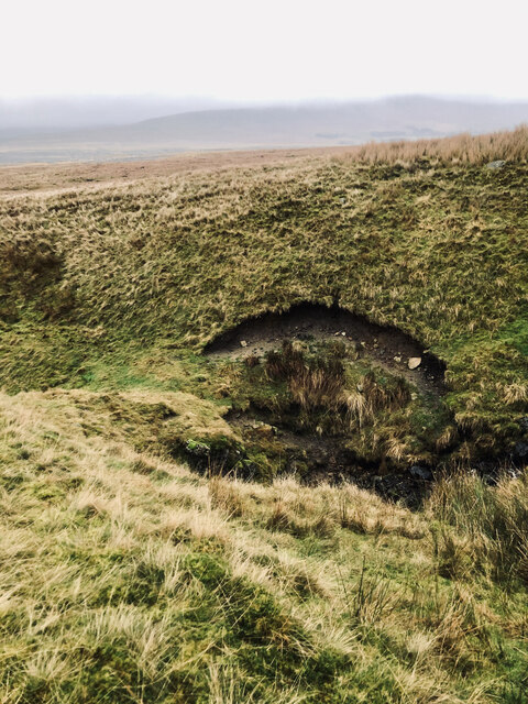
Ingleborough across the limestone pavement
Gritstone outcrop on Ingleborough On the SW side of the summit plateau, near the southern point.
Gritstone outcrop on Ingleborough
On the SW side of the summit plateau, near the southern point.
Flooded shake hole on Ingleborough South of the summit plateau, on the Little Ingleborough spur.
Flooded shake hole on Ingleborough
South of the summit plateau, on the Little Ingleborough spur.
Cloven Stone, Ingleborough Common Ingleborough is in the background. See <a href="https://www.geograph.org.uk/photo/2509839">SD7373 : Cloven Stone</a> & <a href="https://www.geograph.org.uk/photo/157297">SD7373 : Boulder on Ingleborough Common</a> for other views.
Cloven Stone, Ingleborough Common
Ingleborough is in the background. See SD7373 : Cloven Stone & SD7373 : Boulder on Ingleborough Common for other views.
Ingleborough from Weets Hill Ingleborough is 32km (20 miles) north-north-west from Weets Hill, and seen here rising above low cloud that filled Ribblesdale on this cold day.
Ingleborough from Weets Hill
Ingleborough is 32km (20 miles) north-north-west from Weets Hill, and seen here rising above low cloud that filled Ribblesdale on this cold day.
Fallen star An oddity I came across while descending Ingleborough was several masses of a whitish jelly-like substance. A sort of like wallpaper paste. There was nothing else around, no sheep, just rough open moorland at 350m asl.

There seems to be many explanations as to what this jelly was, but after consulting the oracle that is Wikipedia, I  reckon it's an alga called Nostoc, or Astromyxin, a form of cyanobacteria.

It has many common names which are most interesting: Witches’ butter, Star jelly, Troll’s butter, Spit of moon, Astral jelly and Fallen star. In Gaelic, it is called Sgeith Rionnaig, ‘Star vomit’.

Many of these names derive from the suddenness of the jelly’s appearance, resulting in a belief of it apparently falling from the sky during meteor showers.

Two 17th-century works allude to this astral origin:

“That the Starres eat …that those falling Starres, as some call them, which are found on the earth in the form of a trembling gelly, are their excrement.”

And in Dryden’s play “Œdipus”:

“The tapers the gods
The sun and moon run down like waxen globes;
The shooting stars end all in purple jellies.
And chaos is at hand.”

It’s not surprising that such a mysterious and elusive substance would have lore associated with it. In the 14th-century, the jelly was thought a cure for abscesses.

For sources see my blog <span class="nowrap"><a title="http://www.fhithich.uk/?author=1" rel="nofollow ugc noopener" href="http://www.fhithich.uk/?author=1">Link</a><img style="margin-left:2px;" alt="External link" title="External link - shift click to open in new window" src="https://s1.geograph.org.uk/img/external.png" width="10" height="10"/></span>. 2023. ‘Stepping Stone Crossing of the River Doe at Beezleys’, Fhithich <<span class="nowrap"><a title="http://www.fhithich.uk/?p=31085" rel="nofollow ugc noopener" href="http://www.fhithich.uk/?p=31085">Link</a><img style="margin-left:2px;" alt="External link" title="External link - shift click to open in new window" src="https://s1.geograph.org.uk/img/external.png" width="10" height="10"/></span> > [accessed 2 January 2023]
Fallen star
An oddity I came across while descending Ingleborough was several masses of a whitish jelly-like substance. A sort of like wallpaper paste. There was nothing else around, no sheep, just rough open moorland at 350m asl. There seems to be many explanations as to what this jelly was, but after consulting the oracle that is Wikipedia, I reckon it's an alga called Nostoc, or Astromyxin, a form of cyanobacteria. It has many common names which are most interesting: Witches’ butter, Star jelly, Troll’s butter, Spit of moon, Astral jelly and Fallen star. In Gaelic, it is called Sgeith Rionnaig, ‘Star vomit’. Many of these names derive from the suddenness of the jelly’s appearance, resulting in a belief of it apparently falling from the sky during meteor showers. Two 17th-century works allude to this astral origin: “That the Starres eat …that those falling Starres, as some call them, which are found on the earth in the form of a trembling gelly, are their excrement.” And in Dryden’s play “Œdipus”: “The tapers the gods The sun and moon run down like waxen globes; The shooting stars end all in purple jellies. And chaos is at hand.” It’s not surprising that such a mysterious and elusive substance would have lore associated with it. In the 14th-century, the jelly was thought a cure for abscesses. For sources see my blog LinkExternal link. 2023. ‘Stepping Stone Crossing of the River Doe at Beezleys’, Fhithich <LinkExternal link > [accessed 2 January 2023]
Boggarts Roaring Holes
Ruin, Crina Bottom
Ruin, Crina Bottom
Re-entrant, Nook
Re-entrant, Nook
Ruined sheepfold, Dowlass Moss
Cloven Stone
Cloven Stone
Tatham Wife Hole
Tatham Wife Hole
Old Road at Bleak Bank Looking north-westward.
Old Road at Bleak Bank
Looking north-westward.
Turbulent skies over Ingleborough Viewed from Warton by the coast about 24km away on a windy day.
Turbulent skies over Ingleborough
Viewed from Warton by the coast about 24km away on a windy day.
Rain clouds clearing off Ingleborough A zoom shot from near the coast 25km away to the west.
Rain clouds clearing off Ingleborough
A zoom shot from near the coast 25km away to the west.
Gaping Gill swallows Fell Beck Yorkshire&amp;#039;s deepest shaft (110m) first descended in 1895 by Edouard Albert Martel (a Frenchman much to the chagrin of Yorkshire pride!). He was preceded by local man John Birkbeck some time in the 1840s but he &amp;#039;only&amp;#039; succeeded in reaching a large ledge 58m down. Martel (the world&amp;#039;s first professional cave explorer) only had time to make a brief exploration of the Main Chamber before cold forced him to return up his ladders. Water had penetrated his telephone and it was only by shouts and pulling on his lifeline that he managed to get his surface team to start taking in the slack - then his feet hardly touched the rungs! He was just in time as a thunderstorm broke over Ingleborough shortly afterwards which would have been bad news indeed for the brave Frenchman.
Gaping Gill swallows Fell Beck
Yorkshire's deepest shaft (110m) first descended in 1895 by Edouard Albert Martel (a Frenchman much to the chagrin of Yorkshire pride!). He was preceded by local man John Birkbeck some time in the 1840s but he 'only' succeeded in reaching a large ledge 58m down. Martel (the world's first professional cave explorer) only had time to make a brief exploration of the Main Chamber before cold forced him to return up his ladders. Water had penetrated his telephone and it was only by shouts and pulling on his lifeline that he managed to get his surface team to start taking in the slack - then his feet hardly touched the rungs! He was just in time as a thunderstorm broke over Ingleborough shortly afterwards which would have been bad news indeed for the brave Frenchman.
Ingleborough seen through a passing shower From Gragareth about 7km away near the Lancashire boundary.
Ingleborough seen through a passing shower
From Gragareth about 7km away near the Lancashire boundary.
Ingleborough Seen from the Cheese Press Stone above lower Kingsdale.
Ingleborough
Seen from the Cheese Press Stone above lower Kingsdale.
Show me another place!

Dowlass Moss is located at Grid Ref: SD7372 (Lat: 54.15107, Lng: -2.4124662)

Division: West Riding

Administrative County: North Yorkshire

District: Craven

Police Authority: North Yorkshire

What 3 Words

///dubbing.fresh.overture. Near Ingleton, North Yorkshire

Related Wikis

Stream Passage Pot

Stream Passage Pot is one of the entrances to the Gaping Gill system being located about 320 metres (350 yd) ESE of Gaping Gill Main Shaft. It is a popular...

Disappointment Pot

Disappointment Pot is one of the entrances to the Gaping Gill cave system, located in a steep grassy shakehole some 120 metres (130 yd) south-east of Gaping...

Yorkshire Three Peaks

The mountains of Whernside (736 m or 2,415 ft), Ingleborough (723 m or 2,372 ft) and Pen-y-ghent (694 m or 2,277 ft) are collectively known as the Three...

Rat Hole, Gaping Gill

Rat Hole is one of the entrances to the Gaping Gill cave system, located in the north bank of Fell Beck 30 metres (33 yd) upstream of Gaping Gill Main...

Nearby Amenities

Located within 500m of 54.15107,-2.4124662
Dowlass Moss
Natural: wetland
Wetland: marsh
Lat/Long: 54.1527283/-2.4153307
Natural: sinkhole
Lat/Long: 54.1477038/-2.4165759
Natural: sinkhole
Lat/Long: 54.1468733/-2.4127955
Natural: sinkhole
Lat/Long: 54.1468194/-2.4131308
Natural: sinkhole
Lat/Long: 54.1469769/-2.4134698
Natural: sinkhole
Lat/Long: 54.1467654/-2.4132598
Natural: sinkhole
Lat/Long: 54.1471733/-2.4139819
Natural: sinkhole
Lat/Long: 54.1472984/-2.4141366
Natural: sinkhole
Lat/Long: 54.1474517/-2.4146414
Natural: sinkhole
Lat/Long: 54.1478108/-2.4150871
Natural: sinkhole
Lat/Long: 54.1479238/-2.415257
Natural: sinkhole
Lat/Long: 54.1477328/-2.4146921
Natural: sinkhole
Lat/Long: 54.1470711/-2.4147885
Natural: sinkhole
Lat/Long: 54.1466743/-2.4122589
Natural: sinkhole
Lat/Long: 54.1523599/-2.4181633
Natural: sinkhole
Lat/Long: 54.1522067/-2.4181996
Natural: sinkhole
Lat/Long: 54.152777/-2.4186938
Natural: sinkhole
Lat/Long: 54.1530068/-2.4186792
Natural: sinkhole
Lat/Long: 54.1530749/-2.4185702
Natural: sinkhole
Lat/Long: 54.1532281/-2.4184249
Natural: sinkhole
Lat/Long: 54.1534451/-2.4179888
Natural: sinkhole
Lat/Long: 54.1535558/-2.4175819
Natural: sinkhole
Lat/Long: 54.1538111/-2.4171749
Natural: sinkhole
Lat/Long: 54.1538835/-2.4166444
Natural: sinkhole
Lat/Long: 54.1536494/-2.4160993
Natural: sinkhole
Lat/Long: 54.1542027/-2.4165862
Natural: sinkhole
Lat/Long: 54.1544027/-2.4164191
Natural: sinkhole
Lat/Long: 54.1543304/-2.4156778
Natural: sinkhole
Lat/Long: 54.1544538/-2.4173857
The data included in this document is from www.openstreetmap.org. The data is made available under ODbL.

Have you been to Dowlass Moss?

Leave your review of Dowlass Moss below (or comments, questions and feedback).