Clapham Common

Downs, Moorland in Yorkshire Craven

England

Clapham Common

Moorland road north of Bowland Knotts On the horizon are the 'Three Peaks' of Yorkshire.
Moorland road north of Bowland Knotts Credit: John H Darch

Clapham Common is a picturesque area located in the county of Yorkshire, England. Situated amidst the stunning Yorkshire Downs and Moorland, this charming countryside destination offers a blend of natural beauty and historical significance.

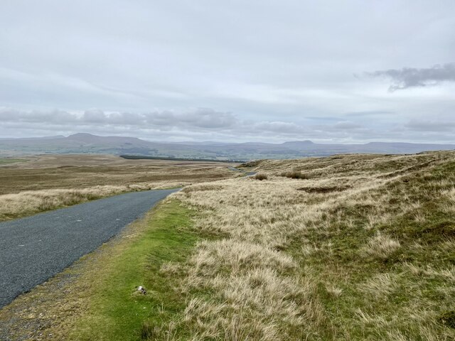
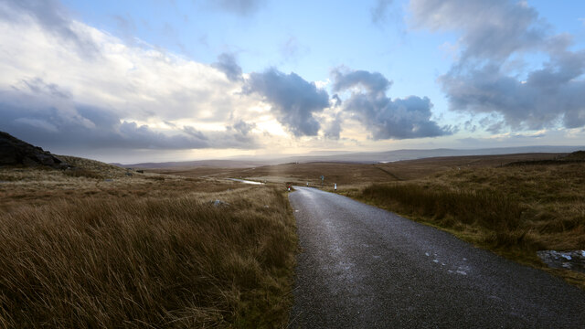
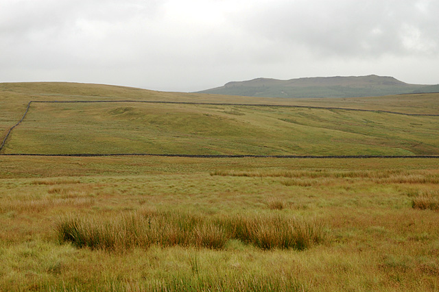
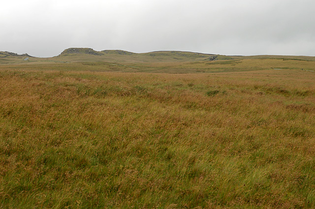
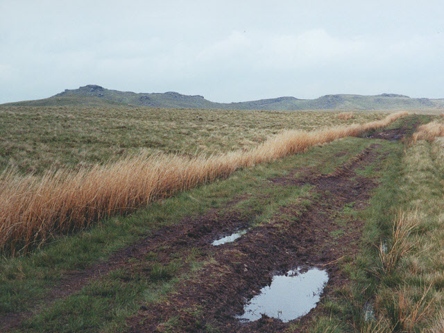
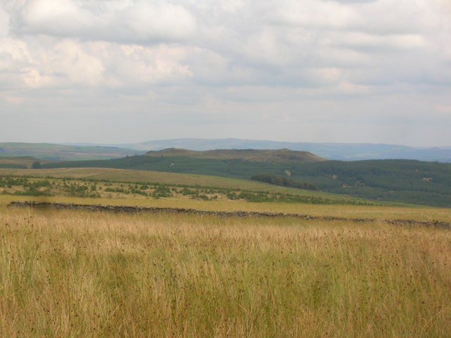
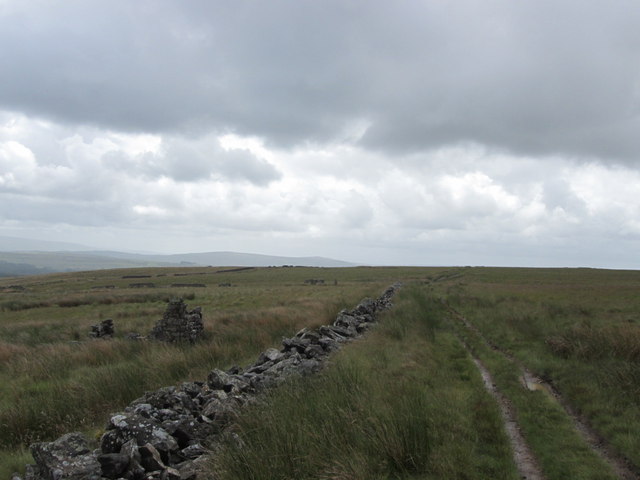
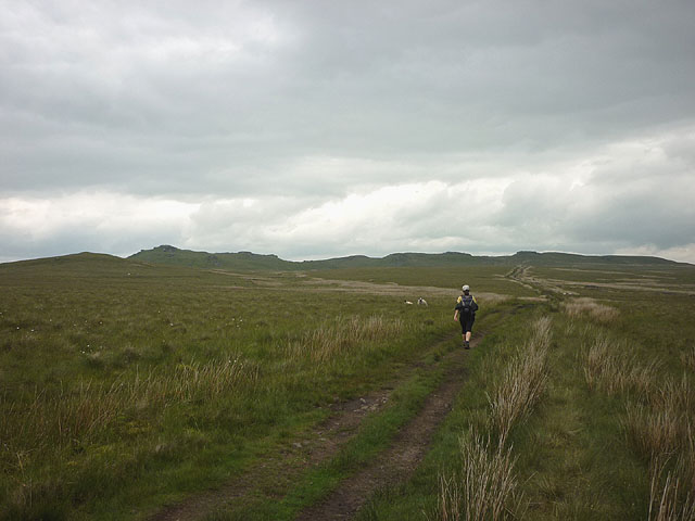
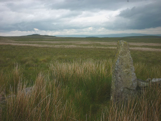
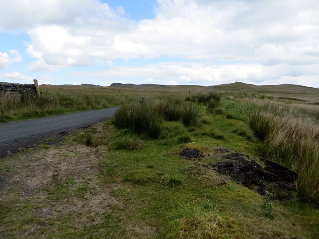
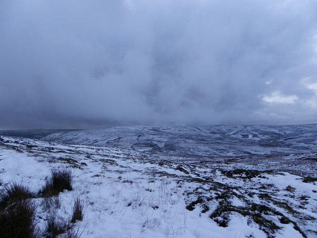
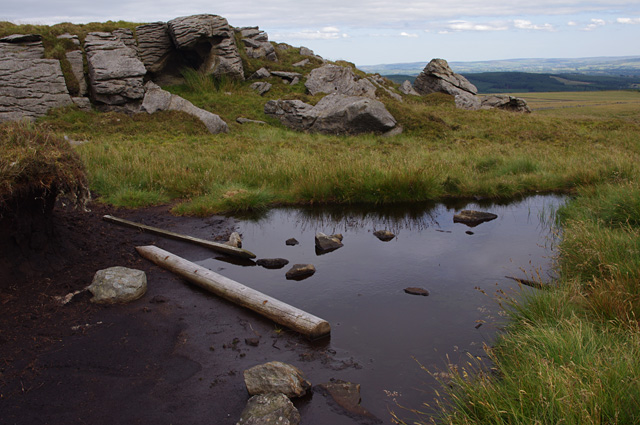
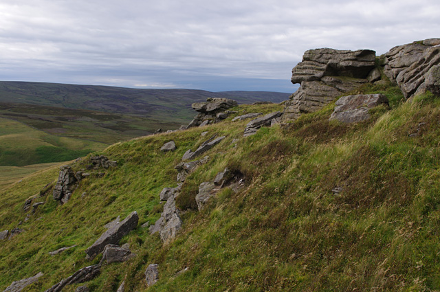
The common itself is a large expanse of open grassland, covering an area of approximately 200 acres. It is renowned for its rolling hills, scattered with vibrant wildflowers during the summer months. Visitors can enjoy leisurely walks or picnics on the well-maintained pathways that crisscross the common, while taking in breathtaking views of the surrounding countryside.

Clapham Common is also home to a diverse range of wildlife, including rabbits, squirrels, and various species of birds. Nature enthusiasts can explore the area's rich biodiversity by birdwatching or simply observing the local fauna in their natural habitats.

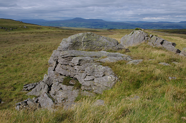
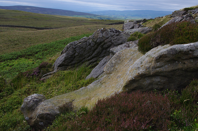
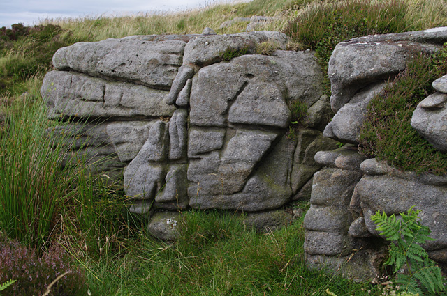
In addition to its natural splendor, Clapham Common boasts a rich history. The nearby village of Clapham is renowned for its limestone caves, which have been inhabited by humans for thousands of years. These caves were once used as shelters during the Ice Age and have since become a popular attraction for tourists interested in archaeology and geology.

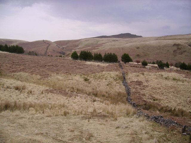
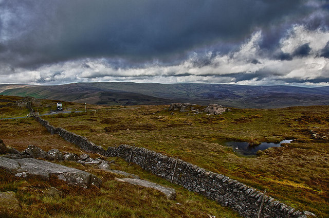
Moreover, the common offers easy access to the neighboring Yorkshire Downs and Moorland, which provide ample opportunities for hiking, biking, and horseback riding. The vast expanses of heather-covered moors and rugged hills offer a scenic backdrop for outdoor enthusiasts and nature lovers alike.

Overall, Clapham Common is a captivating destination that combines natural beauty with historical significance, making it an ideal place to experience the charm of the Yorkshire countryside.

If you have any feedback on the listing, please let us know in the comments section below.

Clapham Common Images

Images are sourced within 2km of 54.047861/-2.4241192 or Grid Reference SD7261. Thanks to Geograph Open Source API. All images are credited.

Moorland road north of Bowland Knotts On the horizon are the 'Three Peaks' of Yorkshire.
Moorland road north of Bowland Knotts
On the horizon are the 'Three Peaks' of Yorkshire.
Keasden road heads down Crutchenber Fell Despite rain overngight and an unpromising sky in the morning, the weather is clearing up enough for a good day out in Gisburn Forest. The Keasden road crosses the watershed at Bowland Knotts and heads south for the forest and Stocks reservoir en route for Slaidburn. This used to be a very quiet road when last I passed this way (probably thirty years ago) but now carries a lot of people to the extensive carparks, paths and bike trails provided by the forestry and water companies.
Keasden road heads down Crutchenber Fell
Despite rain overngight and an unpromising sky in the morning, the weather is clearing up enough for a good day out in Gisburn Forest. The Keasden road crosses the watershed at Bowland Knotts and heads south for the forest and Stocks reservoir en route for Slaidburn. This used to be a very quiet road when last I passed this way (probably thirty years ago) but now carries a lot of people to the extensive carparks, paths and bike trails provided by the forestry and water companies.
Catlow Plantation Just above the original plantation. Looking towards Knot Clough and Bowland Knotts
Catlow Plantation
Just above the original plantation. Looking towards Knot Clough and Bowland Knotts
Birch Clough Rigg With Whelp Stone Crag on the horizon
Birch Clough Rigg
With Whelp Stone Crag on the horizon
Crutchenber Fell Knotteranum on the horizon
Crutchenber Fell
Knotteranum on the horizon
Track towards Bowland Knotts A footpath across the peaty moorland.
Track towards Bowland Knotts
A footpath across the peaty moorland.
Rough pasture south of Bowland Knotts Gisburn Forest and Whelp Stone Crag form the backcloth.
Rough pasture south of Bowland Knotts
Gisburn Forest and Whelp Stone Crag form the backcloth.
Small ruined building beside the path near Old Moss
Heading towards the Bowland Knotts After the steep pull up from Catlow in humid and drizzly conditions the virtually level footpath across the moor is a joy to walk. The inspiring skyline of the Knotts draws us on.
Heading towards the Bowland Knotts
After the steep pull up from Catlow in humid and drizzly conditions the virtually level footpath across the moor is a joy to walk. The inspiring skyline of the Knotts draws us on.
Old gatepost by the track over Old Moss Its counterpart lies fallen in the rough grasses and moss. A small ruin lies close by. In the distance, beyond Bowland Knotts is Fountains Fell.
Old gatepost by the track over Old Moss
Its counterpart lies fallen in the rough grasses and moss. A small ruin lies close by. In the distance, beyond Bowland Knotts is Fountains Fell.
Moorland above Gisburn Forest On the road to Clapham.
Moorland above Gisburn Forest
On the road to Clapham.
Bowland Knotts Before the storm at Bowland Knotts.
Bowland Knotts
Before the storm at Bowland Knotts.
There be a storm brewing - Bowland Fells Aye snow had been falling in the high wild fells of Bowland. Taken from Bowland Knotts looking towards the storm clouds,in the distance we see the dark stone wall zig-zagging (left of centre) up Cold Stone Plain towards the summit of Great Harlow.
There be a storm brewing - Bowland Fells
Aye snow had been falling in the high wild fells of Bowland. Taken from Bowland Knotts looking towards the storm clouds,in the distance we see the dark stone wall zig-zagging (left of centre) up Cold Stone Plain towards the summit of Great Harlow.
Green Knots A gritstone outcrop
Ingleborough is the prominent fell in the distance.
Green Knots
A gritstone outcrop Ingleborough is the prominent fell in the distance.
Knotteranum Gritstone rocks
Knotteranum
Gritstone rocks
Knotteranum A gritstone outcrop
Knotteranum
A gritstone outcrop
Bowland Knotts A gritstone outcrop and peat bog
Bowland Knotts
A gritstone outcrop and peat bog
Bowland Knotts Gritstone outcrops
Bowland Knotts
Gritstone outcrops
Show me another place!

Clapham Common is located at Grid Ref: SD7261 (Lat: 54.047861, Lng: -2.4241192)

Division: West Riding

Administrative County: North Yorkshire

District: Craven

Police Authority: North Yorkshire

What 3 Words

///mass.mediate.unpainted. Near High Bentham, North Yorkshire

Related Wikis

Keasden

Keasden is a hamlet in the civil parish of Clapham-cum-Newby, in the Craven district of the county of North Yorkshire, in the north-western England. It...

Easington, Lancashire

Easington () is a civil parish within the Ribble Valley district of Lancashire, England, with a population in 2001 of 52. The Census 2011 population details...

Eldroth

Eldroth is a village in North Yorkshire, England. It is in the civil parish of Lawkland, part of the former Craven District, some 3.25 miles (5.23 km)...

White Hill (Forest of Bowland)

White Hill is a hill in the Forest of Bowland, north-western England. It lies between Slaidburn and High Bentham. The summit houses a tower and a trig...

Stocks Reservoir

Stocks Reservoir is a reservoir situated at the head of the Hodder valley in the Forest of Bowland, Lancashire, England (historically in the West Riding...

Clapham railway station

Clapham is a railway station on the Bentham Line, which runs between Leeds and Morecambe via Skipton. The station, situated 48 miles (77 km) north-west...

Keasden Beck

Keasden Beck is a stream in Yorkshire (formerly the West Riding) rising near Keasden Head, joining the River Wenning south west of Clapham. == References... ==

Lawkland

Lawkland is a civil parish in North Yorkshire, England, near the A65 and 4 miles (6.4 km) west of Settle. It lies within the Forest of Bowland Area of...

Nearby Amenities

Located within 500m of 54.047861,-2.4241192
Clapham Common
Created By: Potlatch 0.10f
Is In: Craven, North Yorkshire, Yorkshire, England, UK
Place: locality
Source: npe
Lat/Long: 54.0496077/-2.4245986
The data included in this document is from www.openstreetmap.org. The data is made available under ODbL.

Have you been to Clapham Common?

Leave your review of Clapham Common below (or comments, questions and feedback).