Handside

Settlement in Hertfordshire Welwyn Hatfield

England

Handside

Brocket Hall gates Looking south from TL218139 to the gates of Brocket Hall - home of convicted fraudster and annoying D-list reality TV celeb Lord Brocket. Most of the rest of the grid square South of here is private, and judging by the spikes, CCTV and "STOP" notices I don't think he'll let you in.
Brocket Hall gates Credit: Rob Hinkley

Handside is a residential area located in the county of Hertfordshire, England. Situated on the outskirts of Welwyn Garden City, it is approximately 30 miles north of London. Handside is part of the Welwyn Hatfield district and falls under the postal code AL8.

The area is predominantly residential, characterized by a mix of houses and flats. The architecture in Handside is varied, with a combination of traditional brick-built homes and more modern developments. It offers a range of housing options, catering to different budgets and preferences.

Handside benefits from its proximity to Welwyn Garden City town center, which is within walking distance. Here, residents can find an array of amenities, including shops, supermarkets, restaurants, and cafes. The area is also well-served by public transportation, with regular bus services connecting it to the town center and surrounding areas.

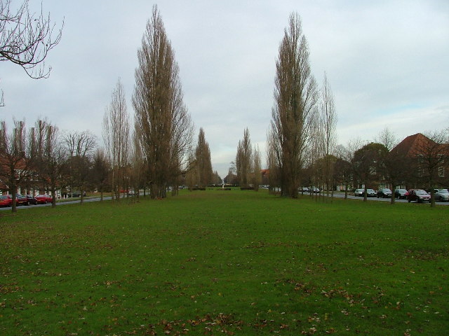
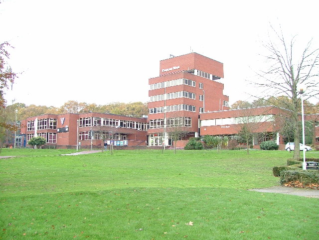
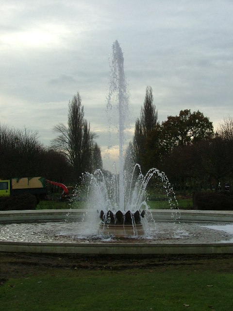
One notable feature of Handside is the presence of green spaces. The area is surrounded by parks and open fields, providing residents with opportunities for outdoor activities and leisurely walks. Furthermore, there are several schools nearby, making it a popular choice for families.

Handside offers a peaceful and suburban lifestyle while still providing easy access to the amenities of Welwyn Garden City. Its convenient location, combined with its green surroundings, makes it an attractive place to live for those seeking a balance between urban conveniences and a tranquil environment.

If you have any feedback on the listing, please let us know in the comments section below.
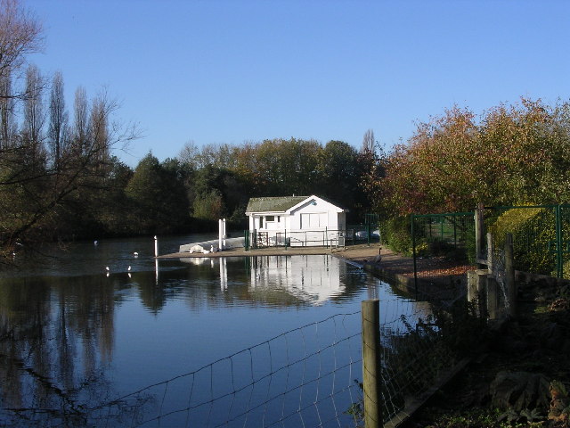
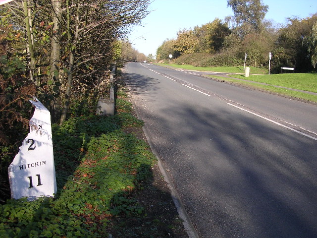
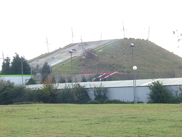
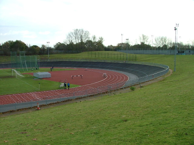
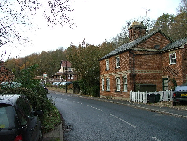
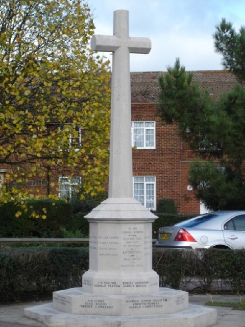
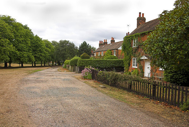
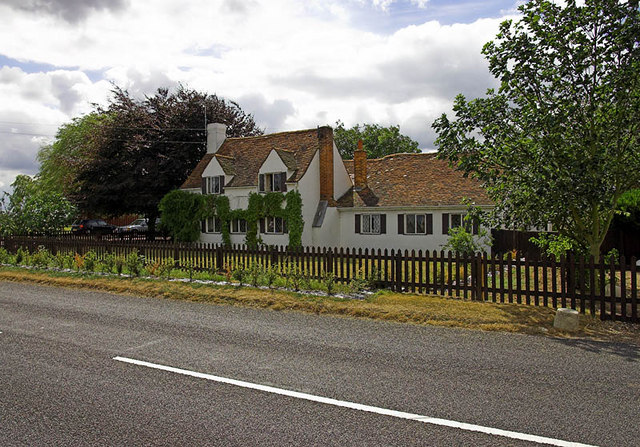
Handside Images

Images are sourced within 2km of 51.796996/-0.215202 or Grid Reference TL2312. Thanks to Geograph Open Source API. All images are credited.

Brocket Hall gates Looking south from TL218139 to the gates of Brocket Hall - home of convicted fraudster and annoying D-list reality TV celeb Lord Brocket. Most of the rest of the grid square South of here is private, and judging by the spikes, CCTV and "STOP" notices I don't think he'll let you in.
Brocket Hall gates
Looking south from TL218139 to the gates of Brocket Hall - home of convicted fraudster and annoying D-list reality TV celeb Lord Brocket. Most of the rest of the grid square South of here is private, and judging by the spikes, CCTV and "STOP" notices I don't think he'll let you in.
Brocket Hall, Lemsford This is the view one gets from the highway.
Brocket Hall, Lemsford
This is the view one gets from the highway.
Welwyn Garden City View looking across the memorial garden to Louis de Soissons the designer of the town.
Welwyn Garden City
View looking across the memorial garden to Louis de Soissons the designer of the town.
Welwyn Garden City Shops offices and rooftop restaurant
Welwyn Garden City
Shops offices and rooftop restaurant
Boathouse on Stanborough Lakes.  Welwyn Garden City. Taken on a cold November day otherwise there would probably have been people rowing on this lake.
Boathouse on Stanborough Lakes. Welwyn Garden City.
Taken on a cold November day otherwise there would probably have been people rowing on this lake.
Milepost on Great North Rd This broken milepost stands on the old Great North Rd.  This is now the B197 Stevenage to Welwyn Garden City road.  In fact most people making this journey use  the A1 which runs parallel and about 50 yards to the left.  This milepost is cast iron and has been broken at some stage.  This is the road that Dick Turpin would have ridden from York to London on.
Milepost on Great North Rd
This broken milepost stands on the old Great North Rd. This is now the B197 Stevenage to Welwyn Garden City road. In fact most people making this journey use the A1 which runs parallel and about 50 yards to the left. This milepost is cast iron and has been broken at some stage. This is the road that Dick Turpin would have ridden from York to London on.
Southern lake at Stanborough Even though it was cold today some hardy souls were out fishing and sailing today.  These lakes are very busy in the summer months.
Southern lake at Stanborough
Even though it was cold today some hardy souls were out fishing and sailing today. These lakes are very busy in the summer months.
Welwyn Garden City Ski Slope On a dull November afternoon there were two people on the slope.  You can see them if you look closely.
Welwyn Garden City Ski Slope
On a dull November afternoon there were two people on the slope. You can see them if you look closely.
Welwyn Garden City Athletics Track - Gosling Stadium. The outer black track is a banked cycle racing track.  The red inner one is for running.
Welwyn Garden City Athletics Track - Gosling Stadium.
The outer black track is a banked cycle racing track. The red inner one is for running.
Parkway - Welwyn Garden City. A broad avenue in the centre of the town.  Stretches well into the next square north.
Parkway - Welwyn Garden City.
A broad avenue in the centre of the town. Stretches well into the next square north.
Campus West - Welwyn Garden City Arts centre, Library and Theatre at the top end of Parkway.
Campus West - Welwyn Garden City
Arts centre, Library and Theatre at the top end of Parkway.
Fountain - Parkway Welwyn Garden City. Two weeks ago this fountain was "fountaining" pink water for breast cancer awareness week.  It looks better this week.
Fountain - Parkway Welwyn Garden City.
Two weeks ago this fountain was "fountaining" pink water for breast cancer awareness week. It looks better this week.
Lemsford mill and the River Lea. Taken from the very edge of the square facing the mill.
Lemsford mill and the River Lea.
Taken from the very edge of the square facing the mill.
Lemsford Village. To the left, and not possible to get a view of at this point is the River Lea.  This photograph is taken from the Welwyn Garden City - Lemsford road.  The pub in the distance is the "Long Arm and the Short Arm".  The pub sign depicts a wooden lever arm that indicated the depth of the water at the crossing point of the River Lea of the ancient Great North Road. When the arm was in the dropped or raised position it showed the depth of water to the horse drawn waggoners and other users.
Lemsford Village.
To the left, and not possible to get a view of at this point is the River Lea. This photograph is taken from the Welwyn Garden City - Lemsford road. The pub in the distance is the "Long Arm and the Short Arm". The pub sign depicts a wooden lever arm that indicated the depth of the water at the crossing point of the River Lea of the ancient Great North Road. When the arm was in the dropped or raised position it showed the depth of water to the horse drawn waggoners and other users.
Hatfield Hyde War Memorial, Hollybush Lane Taken just before 1100 on 13/11/2005
Hatfield Hyde War Memorial, Hollybush Lane
Taken just before 1100 on 13/11/2005
OSB1 This is the new Operational Support Building at Hertfordshire Police Headquarters, due to open in Autumn 2006. It will house the CCR (County Control Room) and the FCC (Force Contact Centre).
OSB1
This is the new Operational Support Building at Hertfordshire Police Headquarters, due to open in Autumn 2006. It will house the CCR (County Control Room) and the FCC (Force Contact Centre).
Ayot Green A peaceful village scene but, yards away in a cutting, is the A1(M)
Ayot Green
A peaceful village scene but, yards away in a cutting, is the A1(M)
Lemsford Kennels Shown as Gosmore on the OS Explorer, the house is the core of a business named Lemsford Kennels
Lemsford Kennels
Shown as Gosmore on the OS Explorer, the house is the core of a business named Lemsford Kennels
Show me another place!

Handside is located at Grid Ref: TL2312 (Lat: 51.796996, Lng: -0.215202)

Administrative County: Hertfordshire

District: Welwyn Hatfield

Police Authority: Hertfordshire

What 3 Words

///frozen.shiny.visit. Near Welwyn Garden City, Hertfordshire

Nearby Locations

Handside

Related Wikis

Barn Theatre, Welwyn Garden City

The Barn Theatre, located in Welwyn Garden City, England is a Grade II listed, 17th-century timber-framed barn converted to a community theatre in 1931...

Stanborough School, Welwyn Garden City

Stanborough School is a secondary academy school located in Welwyn Garden City, Hertfordshire, England. Like most secondary schools, it has a sixth form...

Howard Centre

The Howard Centre is a shopping centre in Welwyn Garden City. It is named after Sir Ebenezer Howard, founder of the garden city movement. == History... ==

Welwyn Garden City railway station

Welwyn Garden City railway station serves the town of Welwyn Garden City in Hertfordshire, England. It is 20 miles 25 chains (20.31 miles, 32.69 km) from...

Nearby Amenities

Located within 500m of 51.796996,-0.215202
Crossing
Crossing: unmarked
Crossing Island: no
Crossing Markings: no
Tactile Paving: no
Lat/Long: 51.7943685/-0.2132412
Bus Stop
Applecroft Road
Naptan AtcoCode: 210021600720
Naptan Bearing: NE
Naptan CommonName: Applecroft Road
Naptan Indicator: opp
Naptan Landmark: Unknown
Naptan NaptanCode: hrtatapj
Naptan PlusbusZoneRef: WLWYNGC
Naptan ShortCommonName: NA
Naptan Street: Valley Road
Naptan Verified: no
Source: naptan_import
Lat/Long: 51.7993637/-0.2207693
Bus Stop
Youngs Rise
Naptan AtcoCode: 210021600740
Naptan Bearing: NE
Naptan CommonName: Youngs Rise
Naptan Crossing: High Oaks Road
Naptan Indicator: opp
Naptan Landmark: High Oaks Road
Naptan NaptanCode: hrtatapm
Naptan PlusbusZoneRef: WLWYNGC
Naptan ShortCommonName: NA
Naptan Street: Valley Road
Naptan Verified: no
Source: naptan_import
Lat/Long: 51.8009425/-0.21814
Bus Stop
Church Road
Bus: yes
Local Ref: NR
Naptan AtcoCode: 210021601860
Naptan Bearing: SW
Naptan CommonName: Church Road
Naptan Crossing: opp Guessens Court
Naptan Indicator: nr
Naptan Landmark: opp Guessens Court
Naptan NaptanCode: hrtapwag
Naptan PlusbusZoneRef: WLWYNGC
Naptan ShortCommonName: NA
Naptan Street: Guessens Road
Naptan Verified: no
Public Transport: platform
Source: naptan_import
Lat/Long: 51.8003568/-0.2115494
Bus Stop
Farm Close
Local Ref: NR
Naptan AtcoCode: 210021601880
Naptan Bearing: W
Naptan CommonName: Farm Close
Naptan Crossing: Handside Lane
Naptan Indicator: nr
Naptan Landmark: Handside Lane
Naptan NaptanCode: hrtaptmg
Naptan PlusbusZoneRef: WLWYNGC
Naptan ShortCommonName: NA
Naptan Street: Guessens Road
Naptan Verified: no
Source: naptan_import
Lat/Long: 51.799774/-0.2146182
Bus Stop
Barn Close
Local Ref: NR
Naptan AtcoCode: 210021601900
Naptan Bearing: S
Naptan CommonName: Barn Close
Naptan Crossing: opp Meadow Green
Naptan Indicator: nr
Naptan Landmark: opp Meadow Green
Naptan NaptanCode: hrtaptmj
Naptan PlusbusZoneRef: WLWYNGC
Naptan ShortCommonName: NA
Naptan Street: Handside Lane
Naptan Verified: no
Source: naptan_import
Lat/Long: 51.7980611/-0.2161071
Bus Stop
Marsden Road
Local Ref: NR
Naptan AtcoCode: 210021601920
Naptan Bearing: SW
Naptan CommonName: Marsden Road
Naptan Indicator: nr
Naptan Landmark: Unknown
Naptan NaptanCode: hrtaptmp
Naptan PlusbusZoneRef: WLWYNGC
Naptan ShortCommonName: NA
Naptan Street: Handside Lane
Naptan Verified: no
Source: naptan_import
Lat/Long: 51.7939921/-0.2199657
Bus Stop
Marsden Road
Naptan AtcoCode: 210021605820
Naptan Bearing: NE
Naptan CommonName: Marsden Road
Naptan Crossing: Attimore Road
Naptan Indicator: opp
Naptan Landmark: Attimore Road
Naptan NaptanCode: hrtamwmp
Naptan PlusbusZoneRef: WLWYNGC
Naptan ShortCommonName: NA
Naptan Street: Handside Lane
Naptan Verified: no
Source: naptan_import
Lat/Long: 51.7944357/-0.2195712
Bus Stop
Barn Close
Naptan AtcoCode: 210021605840
Naptan Bearing: N
Naptan CommonName: Barn Close
Naptan Indicator: opp
Naptan Landmark: Unknown
Naptan NaptanCode: hrtamwmt
Naptan PlusbusZoneRef: WLWYNGC
Naptan ShortCommonName: NA
Naptan Street: Handside Lane
Naptan Verified: no
Source: naptan_import
Lat/Long: 51.79835/-0.2161828
Bus Stop
Farm Close
Naptan AtcoCode: 210021605860
Naptan Bearing: E
Naptan CommonName: Farm Close
Naptan Crossing: Guessens Grove
Naptan Indicator: opp
Naptan Landmark: Guessens Grove
Naptan NaptanCode: hrtamwmw
Naptan PlusbusZoneRef: WLWYNGC
Naptan ShortCommonName: NA
Naptan Street: Guessens Road
Naptan Verified: no
Source: naptan_import
Lat/Long: 51.799913/-0.2148883
Bus Stop
Youngs Rise
Local Ref: NR
Naptan AtcoCode: 210021606880
Naptan Bearing: SW
Naptan CommonName: Youngs Rise
Naptan Crossing: opp High Oaks Road
Naptan Indicator: nr
Naptan Landmark: opp High Oaks Road
Naptan NaptanCode: hrtamtda
Naptan PlusbusZoneRef: WLWYNGC
Naptan ShortCommonName: NA
Naptan Street: Valley Road
Naptan Verified: no
Source: naptan_import
Lat/Long: 51.8005034/-0.218839
Bus Stop
Applecroft Road
Naptan AtcoCode: 210021606900
Naptan Bearing: SW
Naptan CommonName: Applecroft Road
Naptan Indicator: adj
Naptan Landmark: Unknown
Naptan NaptanCode: hrtamtdj
Naptan PlusbusZoneRef: WLWYNGC
Naptan ShortCommonName: NA
Naptan Street: Valley Road
Naptan Verified: no
Source: naptan_import
Lat/Long: 51.7992642/-0.2207297
Post Box
Collection Times: Mo-Fr 16:45; Sa 11:45
Post Box Type: pillar
Ref: AL8 177
Royal Cypher: GR
Royal Cypher Wikidata: Q33102273
Lat/Long: 51.800766/-0.218557
Post Box
Collection Times: Mo-Fr 17:30; Sa 12:00
Post Box Type: pillar
Ref: AL8 242
Royal Cypher: GR
Royal Cypher Wikidata: Q33102273
Lat/Long: 51.79826/-0.219552
Post Box
Collection Times: Mo-Fr 17:30; Sa 12:00
Post Box Type: pillar
Ref: AL8 234
Royal Cypher: GVIR
Royal Cypher Wikidata: Q33102169
Lat/Long: 51.794603/-0.209306
Post Box
Collection Times: Mo-Fr 09:00; Sa 07:00
Post Box Design: romec_pillar
Post Box Type: pillar
Ref: AL8 159D
Royal Cypher: EIIR
Royal Cypher Wikidata: Q33102113
Lat/Long: 51.7987729/-0.2159822
Barrier: bollard
Bollard: fixed
Lat/Long: 51.7963663/-0.2082921
Barrier: bollard
Bollard: fixed
Lat/Long: 51.7962964/-0.2083238
Post Box
Collection Times: Mo-Fr 17:30; Sa 11:30
Post Box Type: pillar
Ref: AL8 183
Royal Cypher: GR
Royal Cypher Wikidata: Q33102273
Lat/Long: 51.7978033/-0.2114099
Huttons
Shop: newsagent
Lat/Long: 51.7939573/-0.2193101
Nisa Local
Addr City: Welwyn Garden City
Addr Postcode: AL8 6TA
Addr Street: Handside Lane
Brand: Nisa Local
Brand Wikidata: Q16999069
Brand Wikipedia: en:Nisa (retailer)
Shop: convenience
Lat/Long: 51.7940457/-0.2195783
Post Box
Post Box Type: pillar
Ref: AL8 241
Royal Cypher: EIIR
Royal Cypher Wikidata: Q33102113
Lat/Long: 51.7940421/-0.2194585
Place Of Worship
Quaker Meeting House
Denomination: quaker
Religion: christian
Lat/Long: 51.7986734/-0.2155989
Handside
Is In: Welwyn Garden City
Place: suburb
Lat/Long: 51.7993607/-0.2152908
Place Of Worship
St Bonaventure's Church
Contact Website: http://www.wgc-catholics.org.uk/
Denomination: roman_catholic
Religion: christian
Lat/Long: 51.7978717/-0.2101794
Doctors
Garden City Practice
Healthcare: doctor
Lat/Long: 51.7972625/-0.2104574
Crossing
Crossing: unmarked
Crossing Island: no
Crossing Markings: no
Tactile Paving: no
Lat/Long: 51.7952284/-0.2124057
Crossing
Crossing: unmarked
Crossing Island: no
Crossing Markings: no
Tactile Paving: no
Lat/Long: 51.7962529/-0.2118873
Crossing
Crossing: unmarked
Crossing Island: no
Crossing Markings: no
Tactile Paving: no
Lat/Long: 51.7977447/-0.2114118
Crossing
Crossing: unmarked
Crossing Island: no
Crossing Markings: no
Tactile Paving: yes
Lat/Long: 51.7989834/-0.2107584
Crossing
Crossing: unmarked
Crossing Island: yes
Crossing Markings: no
Tactile Paving: yes
Lat/Long: 51.7945221/-0.2126163
Crossing
Crossing: unmarked
Crossing Island: no
Crossing Markings: no
Tactile Paving: no
Lat/Long: 51.7939677/-0.2129061
Crossing
Crossing: unmarked
Crossing Island: no
Crossing Markings: no
Tactile Paving: no
Lat/Long: 51.7941413/-0.2122379
The data included in this document is from www.openstreetmap.org. The data is made available under ODbL.

Have you been to Handside?

Leave your review of Handside below (or comments, questions and feedback).