North Lord's Land

Downs, Moorland in Yorkshire South Lakeland

England

North Lord's Land

Walking path beside coniferous plantation The walkers are descending on a track over moorland into Garsdale following an ascent to Aye Gill Pike.
Walking path beside coniferous plantation Credit: Trevor Littlewood

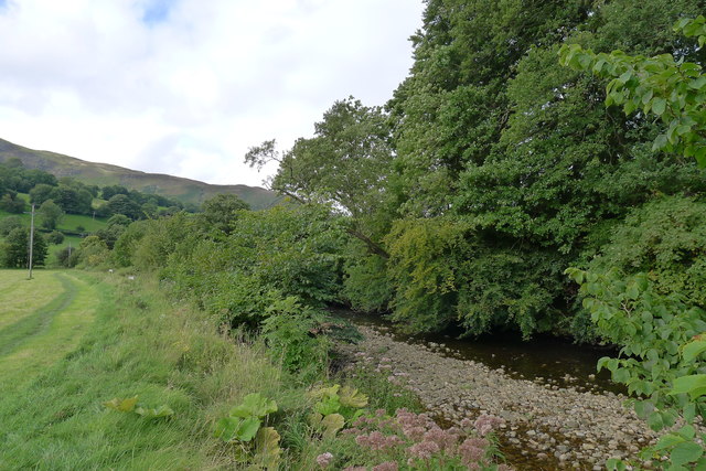
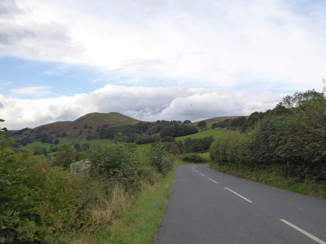
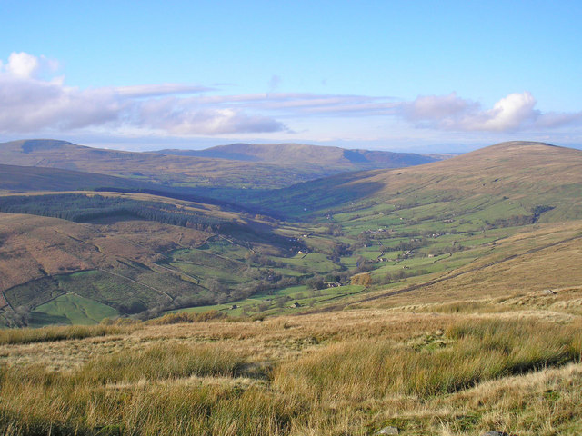
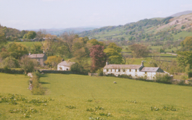
North Lord's Land is a picturesque region located in Yorkshire, England. Nestled between the magnificent Yorkshire Downs and Moorland, this area is known for its breathtaking natural beauty and diverse landscapes. Spanning across a sprawling area, North Lord's Land is a haven for nature enthusiasts and outdoor adventurers.

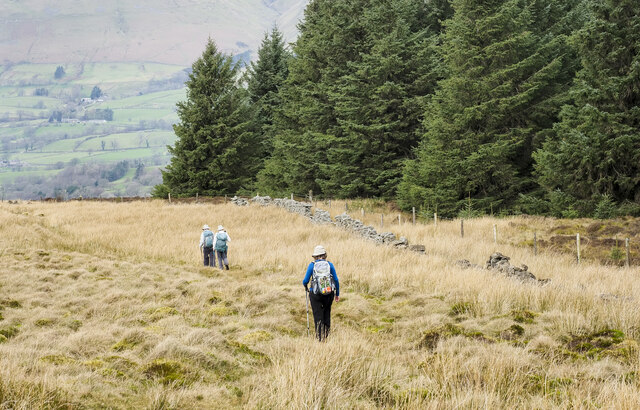
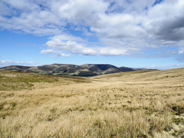
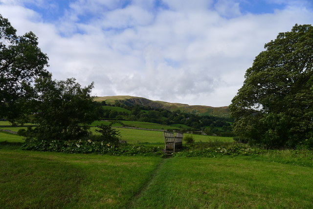
The Yorkshire Downs, with their rolling hills and expansive meadows, offer stunning vistas that stretch as far as the eye can see. Visitors can explore the numerous walking trails and enjoy the tranquility of the countryside. The Downs are also home to an abundance of wildlife, including rare bird species, making it a popular spot for birdwatching.

To the north, the Moorland adds a rugged and wild element to the landscape. Here, visitors can witness the dramatic beauty of heather-covered hills, rocky outcrops, and vast expanses of open land. The Moorland is a haven for hikers and climbers, offering challenging terrains and breathtaking views.

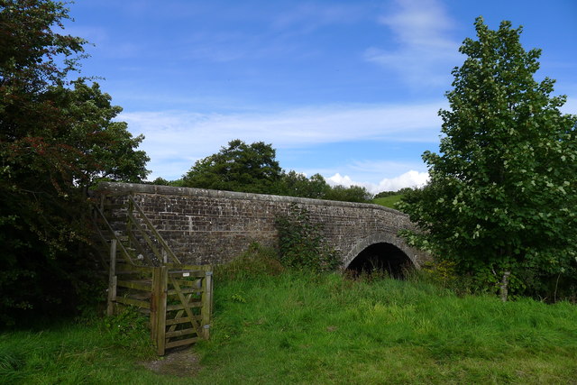
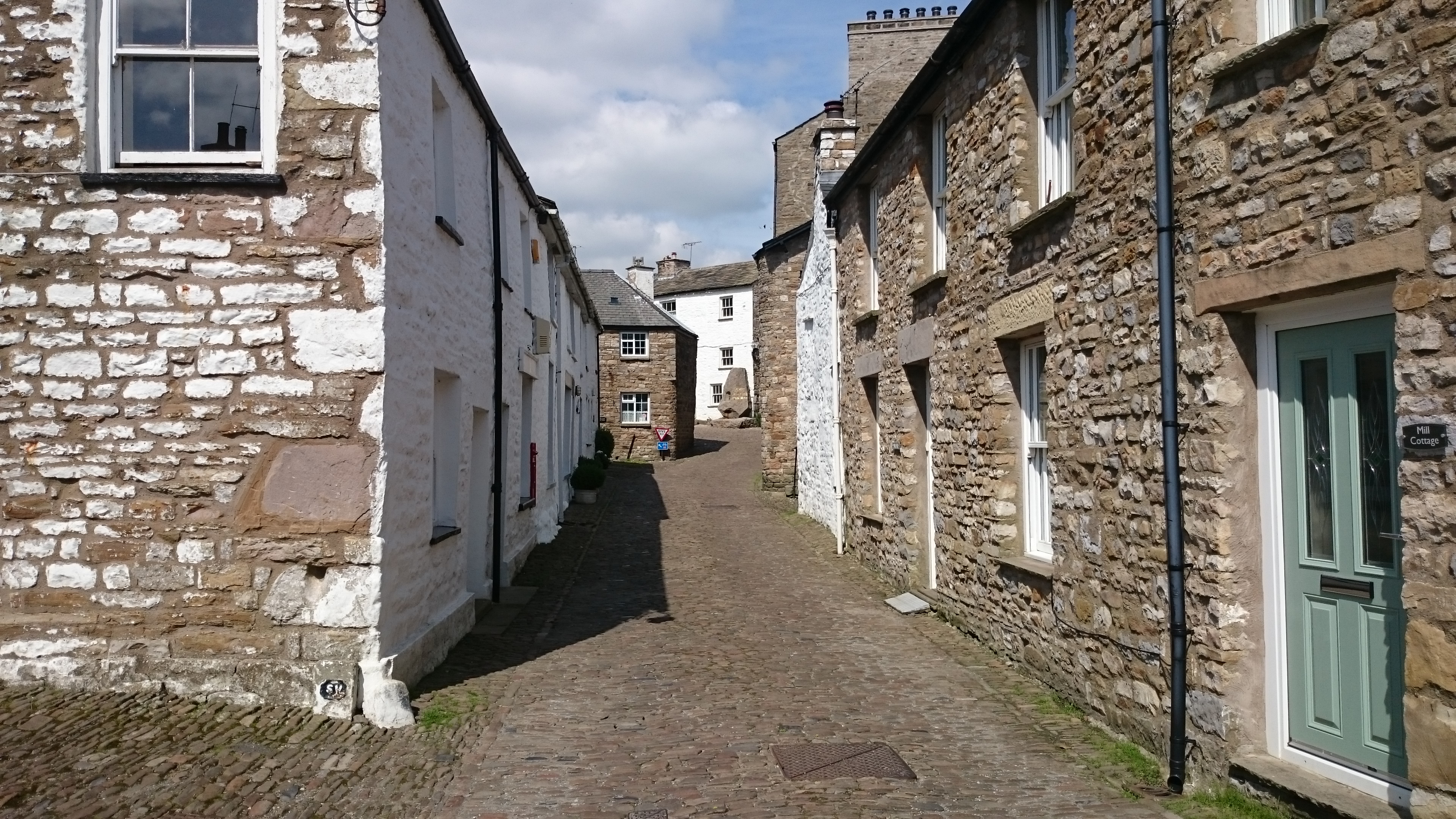
North Lord's Land is also rich in history and cultural heritage. The region boasts ancient ruins, such as stone circles and burial mounds, which shed light on its ancient inhabitants. There are also charming villages and historic sites that provide insight into the area's past.

With its combination of stunning natural landscapes, rich biodiversity, and cultural significance, North Lord's Land is a destination that offers something for everyone. Whether exploring the peaceful beauty of the Yorkshire Downs or embarking on an adventure in the rugged Moorland, visitors are sure to be captivated by the charm and allure of this remarkable region in Yorkshire.

If you have any feedback on the listing, please let us know in the comments section below.

North Lord's Land Images

Images are sourced within 2km of 54.289693/-2.4544532 or Grid Reference SD7088. Thanks to Geograph Open Source API. All images are credited.

Walking path beside coniferous plantation The walkers are descending on a track over moorland into Garsdale following an ascent to Aye Gill Pike.
Walking path beside coniferous plantation
The walkers are descending on a track over moorland into Garsdale following an ascent to Aye Gill Pike.
Milestone by Holme Cottage The milestone is of a design distinctive to this area, a circular column just marked  "S 5" (S standing for Sedbergh).  Listed grade II (list entry 1383912).
Milestone by Holme Cottage
The milestone is of a design distinctive to this area, a circular column just marked "S 5" (S standing for Sedbergh). Listed grade II (list entry 1383912).
Gawthrop A small hamlet around a bridge over Oliver Gill.
Gawthrop
A small hamlet around a bridge over Oliver Gill.
Valley of Holebeck Gill The shallow, upper valley of Holebeck Gill heading north to where it will meet the Clough River which drains Garsdale.
The Howgill Fells are in the distance beyond both the Clough River and the River Rawthey.
Valley of Holebeck Gill
The shallow, upper valley of Holebeck Gill heading north to where it will meet the Clough River which drains Garsdale. The Howgill Fells are in the distance beyond both the Clough River and the River Rawthey.
Old Bridge Marker on Oliver Bridge at Gawthrop Bridge Marker at the southeast end of the parapet of Oliver Bridge, Oliver Beck, in Gawthrop. Dent parish. W R in raised lettering on adjacent faces to mark the extent of roadway adjoining the bridge that the County was obliged to maintain. See also <span class="nowrap"><a title="http://www.geog.port.ac.uk/webmap/thelakes/photos/bnh63.jpg" rel="nofollow ugc noopener" href="http://www.geog.port.ac.uk/webmap/thelakes/photos/bnh63.jpg">Link</a><img style="margin-left:2px;" alt="External link" title="External link - shift click to open in new window" src="https://s1.geograph.org.uk/img/external.png" width="10" height="10"/></span>.

Milestone Society National ID: YW_DENT07br
Old Bridge Marker on Oliver Bridge at Gawthrop
Bridge Marker at the southeast end of the parapet of Oliver Bridge, Oliver Beck, in Gawthrop. Dent parish. W R in raised lettering on adjacent faces to mark the extent of roadway adjoining the bridge that the County was obliged to maintain. See also LinkExternal link. Milestone Society National ID: YW_DENT07br
Old Bridge Marker on Oliver Bridge at Gawthrop Bridge Marker against the wall of a garage at the east end of the parapet of Oliver Bridge, Oliver Beck, Gawthrop. Dent parish. W R in raised lettering on adjacent faces to mark the extent of roadway adjoining the bridge that the County was obliged to maintain. See also <span class="nowrap"><a title="http://www.geog.port.ac.uk/webmap/thelakes/photos/bnh64.jpg" rel="nofollow ugc noopener" href="http://www.geog.port.ac.uk/webmap/thelakes/photos/bnh64.jpg">Link</a><img style="margin-left:2px;" alt="External link" title="External link - shift click to open in new window" src="https://s1.geograph.org.uk/img/external.png" width="10" height="10"/></span> and <a title="https://www.geograph.org.uk/photo/2993136" href="https://www.geograph.org.uk/photo/2993136">Link</a>

Milestone Society National ID: YW_DENT04br
Old Bridge Marker on Oliver Bridge at Gawthrop
Bridge Marker against the wall of a garage at the east end of the parapet of Oliver Bridge, Oliver Beck, Gawthrop. Dent parish. W R in raised lettering on adjacent faces to mark the extent of roadway adjoining the bridge that the County was obliged to maintain. See also LinkExternal link and Link Milestone Society National ID: YW_DENT04br
A barn and Holme Cottage
Barth Bridge Carrying the Dent to Sedbergh road over the River Dee
Barth Bridge
Carrying the Dent to Sedbergh road over the River Dee
The Dales Way in Dentdale The slopes of Combe Scar in the distance
The Dales Way in Dentdale
The slopes of Combe Scar in the distance
The Dales Way alongside the River Dee
Cottage between Dent and Gowlands Cross On the left is a pull-off for a farm building and access to the field through the gate
Cottage between Dent and Gowlands Cross
On the left is a pull-off for a farm building and access to the field through the gate
Brackensgill Lane at Gowlands Cross Contrasting walls on the two sides of the road
Brackensgill Lane at Gowlands Cross
Contrasting walls on the two sides of the road
Barth Bridge over River Dee On the left is a sign and a gap in the wall for the Dales Way which follows the riverbank
Barth Bridge over River Dee
On the left is a sign and a gap in the wall for the Dales Way which follows the riverbank
The road to Helmside The road from Dent to Helmside follows the riverbank until this point, where it turns to the north to run along the bank of Helmside Holme stream, on the edge of the flood plain of the River Dee.  In the distance is the distinctive summit of Helms Knott
The road to Helmside
The road from Dent to Helmside follows the riverbank until this point, where it turns to the north to run along the bank of Helmside Holme stream, on the edge of the flood plain of the River Dee. In the distance is the distinctive summit of Helms Knott
Sheep above Gawthrop Ewes and their lambs enjoying the Spring sunshine. Beyond the cottages of the village are the rounded tops of the Howgill Fells.
Sheep above Gawthrop
Ewes and their lambs enjoying the Spring sunshine. Beyond the cottages of the village are the rounded tops of the Howgill Fells.
High House above Gawthrop A late 17th Century farmhouse which is still a working farm. It is Grade II* listed <span class="nowrap"><a title="http://www.britishlistedbuildings.co.uk/101383968-high-house-dent#.WQIIzrgwJI4" rel="nofollow ugc noopener" href="http://www.britishlistedbuildings.co.uk/101383968-high-house-dent#.WQIIzrgwJI4">Link</a><img style="margin-left:2px;" alt="External link" title="External link - shift click to open in new window" src="https://s1.geograph.org.uk/img/external.png" width="10" height="10"/></span> and was once a Quaker meeting house.
High House above Gawthrop
A late 17th Century farmhouse which is still a working farm. It is Grade II* listed LinkExternal link and was once a Quaker meeting house.
Barn above Gawthrop Beyond, across lower Dentdale, is the dark outline of Helms Knott with the Howgill Fells rising above. A zoom shot from above High House.
Barn above Gawthrop
Beyond, across lower Dentdale, is the dark outline of Helms Knott with the Howgill Fells rising above. A zoom shot from above High House.
Sheep and lamb at Millbeck A Swaledale ewe and her lamb enjoying some Spring sunshine. The lamb looks like a mule cross-breed.
Sheep and lamb at Millbeck
A Swaledale ewe and her lamb enjoying some Spring sunshine. The lamb looks like a mule cross-breed.
Show me another place!

North Lord's Land is located at Grid Ref: SD7088 (Lat: 54.289693, Lng: -2.4544532)

Division: West Riding

Administrative County: Cumbria

District: South Lakeland

Police Authority: Cumbria

What 3 Words

///denoting.chained.sprinter. Near Sedbergh, Cumbria

Related Wikis

St Andrew's Church, Dent

St Andrew's Church is in the village of Dent, Cumbria, England. It is an active Anglican parish church in the Western Dales Mission Community in the deanery...

Dentdale

Dentdale is a dale or valley in the north-west of the Yorkshire Dales National Park in Cumbria, England. It is the valley of the River Dee, but takes...

Dent, Cumbria

Dent is a village and civil parish in Cumbria, England, within the historic boundaries of the West Riding of Yorkshire. It lies in Dentdale, a narrow valley...

Gawthrop

Gawthrop is a hamlet in the South Lakeland district, in the county of Cumbria, England. Historically part of the West Riding of Yorkshire, it lies within...

Nearby Amenities

Located within 500m of 54.289693,-2.4544532
Lord's Land
Natural: fell
Source: npe
Lat/Long: 54.2924284/-2.4492676
The data included in this document is from www.openstreetmap.org. The data is made available under ODbL.

Have you been to North Lord's Land?

Leave your review of North Lord's Land below (or comments, questions and feedback).