Barker Faws Wood

Wood, Forest in Yorkshire South Lakeland

England

Barker Faws Wood

Walking path beside coniferous plantation The walkers are descending on a track over moorland into Garsdale following an ascent to Aye Gill Pike.
Walking path beside coniferous plantation Credit: Trevor Littlewood

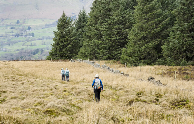
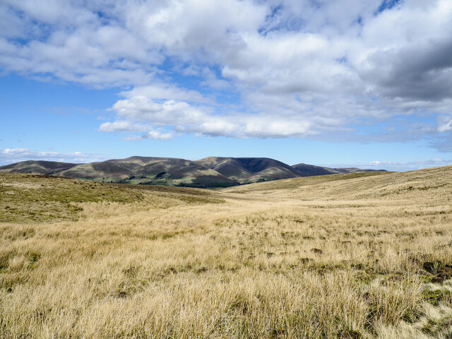
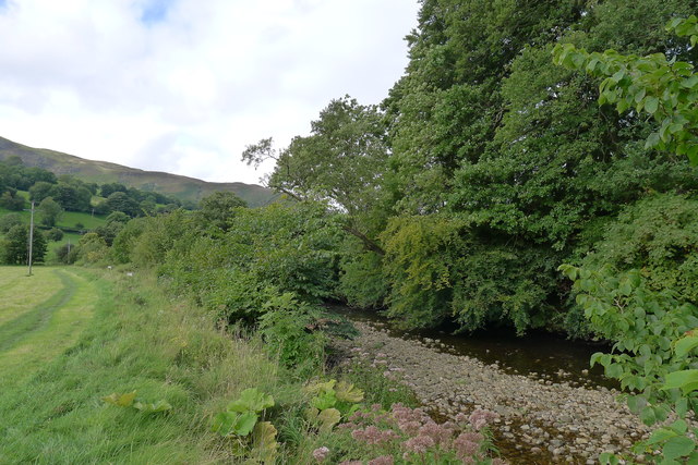
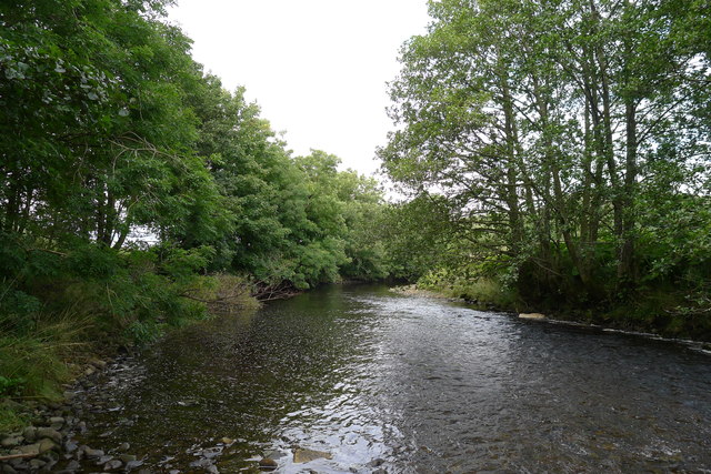
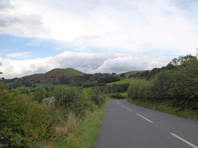
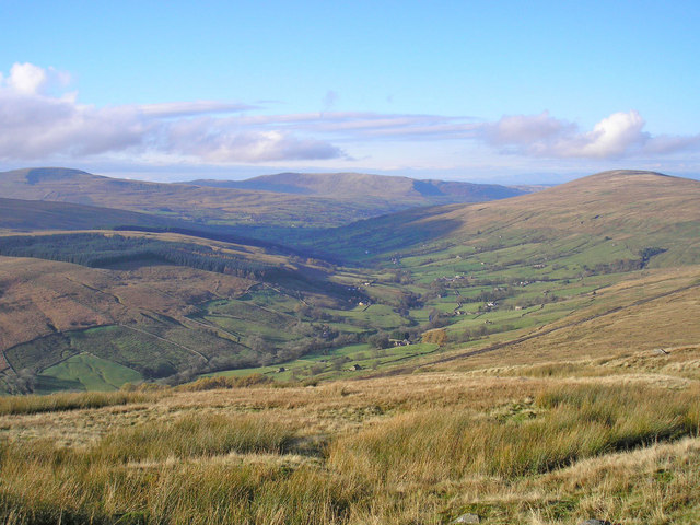
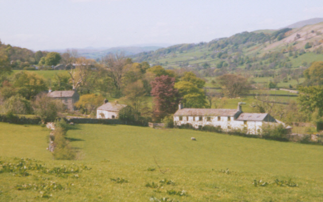
Barker Faws Wood is a picturesque woodland located in the county of Yorkshire, England. Situated near the village of Barker Faws, this woodland is renowned for its natural beauty and diverse ecosystem. Covering an area of approximately 100 acres, it serves as a vital habitat for various plant and animal species.

The wood is characterized by its dense canopy of oak, birch, and beech trees, which provide shelter and nesting sites for a range of bird species including woodpeckers, owls, and thrushes. The forest floor is carpeted with an array of wildflowers, such as bluebells and primroses, adding to the enchanting atmosphere of the wood.

Several walking trails wind their way through Barker Faws Wood, allowing visitors to explore its hidden treasures. These paths offer a chance to observe wildlife, listen to the soothing sounds of birdsong, and admire the changing colors of the leaves throughout the seasons. Additionally, the wood is home to a number of ancient trees, some of which are centuries old, adding a sense of history and grandeur to the landscape.

Barker Faws Wood is not only a haven for wildlife enthusiasts and nature lovers but also a popular destination for outdoor activities such as hiking, picnicking, and photography. The tranquil and serene environment of the wood provides a perfect escape from the hustle and bustle of everyday life.

Overall, Barker Faws Wood is a captivating natural gem that showcases the beauty of Yorkshire's countryside. Its rich biodiversity and stunning scenery make it a must-visit destination for anyone seeking a peaceful and immersive woodland experience.

If you have any feedback on the listing, please let us know in the comments section below.

Barker Faws Wood Images

Images are sourced within 2km of 54.290523/-2.4583644 or Grid Reference SD7088. Thanks to Geograph Open Source API. All images are credited.

Walking path beside coniferous plantation The walkers are descending on a track over moorland into Garsdale following an ascent to Aye Gill Pike.
Walking path beside coniferous plantation
The walkers are descending on a track over moorland into Garsdale following an ascent to Aye Gill Pike.
Milestone by Holme Cottage The milestone is of a design distinctive to this area, a circular column just marked  "S 5" (S standing for Sedbergh).  Listed grade II (list entry 1383912).
Milestone by Holme Cottage
The milestone is of a design distinctive to this area, a circular column just marked "S 5" (S standing for Sedbergh). Listed grade II (list entry 1383912).
Gawthrop A small hamlet around a bridge over Oliver Gill.
Gawthrop
A small hamlet around a bridge over Oliver Gill.
Valley of Holebeck Gill The shallow, upper valley of Holebeck Gill heading north to where it will meet the Clough River which drains Garsdale.
The Howgill Fells are in the distance beyond both the Clough River and the River Rawthey.
Valley of Holebeck Gill
The shallow, upper valley of Holebeck Gill heading north to where it will meet the Clough River which drains Garsdale. The Howgill Fells are in the distance beyond both the Clough River and the River Rawthey.
Old Bridge Marker on Oliver Bridge at Gawthrop Bridge Marker at the southeast end of the parapet of Oliver Bridge, Oliver Beck, in Gawthrop. Dent parish. W R in raised lettering on adjacent faces to mark the extent of roadway adjoining the bridge that the County was obliged to maintain. See also <span class="nowrap"><a title="http://www.geog.port.ac.uk/webmap/thelakes/photos/bnh63.jpg" rel="nofollow ugc noopener" href="http://www.geog.port.ac.uk/webmap/thelakes/photos/bnh63.jpg">Link</a><img style="margin-left:2px;" alt="External link" title="External link - shift click to open in new window" src="https://s1.geograph.org.uk/img/external.png" width="10" height="10"/></span>.

Milestone Society National ID: YW_DENT07br
Old Bridge Marker on Oliver Bridge at Gawthrop
Bridge Marker at the southeast end of the parapet of Oliver Bridge, Oliver Beck, in Gawthrop. Dent parish. W R in raised lettering on adjacent faces to mark the extent of roadway adjoining the bridge that the County was obliged to maintain. See also LinkExternal link. Milestone Society National ID: YW_DENT07br
Old Bridge Marker on Oliver Bridge at Gawthrop Bridge Marker against the wall of a garage at the east end of the parapet of Oliver Bridge, Oliver Beck, Gawthrop. Dent parish. W R in raised lettering on adjacent faces to mark the extent of roadway adjoining the bridge that the County was obliged to maintain. See also <span class="nowrap"><a title="http://www.geog.port.ac.uk/webmap/thelakes/photos/bnh64.jpg" rel="nofollow ugc noopener" href="http://www.geog.port.ac.uk/webmap/thelakes/photos/bnh64.jpg">Link</a><img style="margin-left:2px;" alt="External link" title="External link - shift click to open in new window" src="https://s1.geograph.org.uk/img/external.png" width="10" height="10"/></span> and <a title="https://www.geograph.org.uk/photo/2993136" href="https://www.geograph.org.uk/photo/2993136">Link</a>

Milestone Society National ID: YW_DENT04br
Old Bridge Marker on Oliver Bridge at Gawthrop
Bridge Marker against the wall of a garage at the east end of the parapet of Oliver Bridge, Oliver Beck, Gawthrop. Dent parish. W R in raised lettering on adjacent faces to mark the extent of roadway adjoining the bridge that the County was obliged to maintain. See also LinkExternal link and Link Milestone Society National ID: YW_DENT04br
A barn and Holme Cottage
Barth Bridge Carrying the Dent to Sedbergh road over the River Dee
Barth Bridge
Carrying the Dent to Sedbergh road over the River Dee
The Dales Way in Dentdale The slopes of Combe Scar in the distance
The Dales Way in Dentdale
The slopes of Combe Scar in the distance
The Dales Way alongside the River Dee
The River Dee, Dentdale
Cottage between Dent and Gowlands Cross On the left is a pull-off for a farm building and access to the field through the gate
Cottage between Dent and Gowlands Cross
On the left is a pull-off for a farm building and access to the field through the gate
Brackensgill Lane at Gowlands Cross Contrasting walls on the two sides of the road
Brackensgill Lane at Gowlands Cross
Contrasting walls on the two sides of the road
Barth Bridge over River Dee On the left is a sign and a gap in the wall for the Dales Way which follows the riverbank
Barth Bridge over River Dee
On the left is a sign and a gap in the wall for the Dales Way which follows the riverbank
The road to Helmside The road from Dent to Helmside follows the riverbank until this point, where it turns to the north to run along the bank of Helmside Holme stream, on the edge of the flood plain of the River Dee.  In the distance is the distinctive summit of Helms Knott
The road to Helmside
The road from Dent to Helmside follows the riverbank until this point, where it turns to the north to run along the bank of Helmside Holme stream, on the edge of the flood plain of the River Dee. In the distance is the distinctive summit of Helms Knott
Sheep above Gawthrop Ewes and their lambs enjoying the Spring sunshine. Beyond the cottages of the village are the rounded tops of the Howgill Fells.
Sheep above Gawthrop
Ewes and their lambs enjoying the Spring sunshine. Beyond the cottages of the village are the rounded tops of the Howgill Fells.
High House above Gawthrop A late 17th Century farmhouse which is still a working farm. It is Grade II* listed <span class="nowrap"><a title="http://www.britishlistedbuildings.co.uk/101383968-high-house-dent#.WQIIzrgwJI4" rel="nofollow ugc noopener" href="http://www.britishlistedbuildings.co.uk/101383968-high-house-dent#.WQIIzrgwJI4">Link</a><img style="margin-left:2px;" alt="External link" title="External link - shift click to open in new window" src="https://s1.geograph.org.uk/img/external.png" width="10" height="10"/></span> and was once a Quaker meeting house.
High House above Gawthrop
A late 17th Century farmhouse which is still a working farm. It is Grade II* listed LinkExternal link and was once a Quaker meeting house.
Barn above Gawthrop Beyond, across lower Dentdale, is the dark outline of Helms Knott with the Howgill Fells rising above. A zoom shot from above High House.
Barn above Gawthrop
Beyond, across lower Dentdale, is the dark outline of Helms Knott with the Howgill Fells rising above. A zoom shot from above High House.
Show me another place!

Barker Faws Wood is located at Grid Ref: SD7088 (Lat: 54.290523, Lng: -2.4583644)

Division: West Riding

Administrative County: Cumbria

District: South Lakeland

Police Authority: Cumbria

What 3 Words

///resists.shortage.pacifist. Near Sedbergh, Cumbria

Related Wikis

St Andrew's Church, Dent

St Andrew's Church is in the village of Dent, Cumbria, England. It is an active Anglican parish church in the Western Dales Mission Community in the deanery...

Dentdale

Dentdale is a dale or valley in the north-west of the Yorkshire Dales National Park in Cumbria, England. It is the valley of the River Dee, but takes...

Gawthrop

Gawthrop is a hamlet in the South Lakeland district, in the county of Cumbria, England. Historically part of the West Riding of Yorkshire, it lies within...
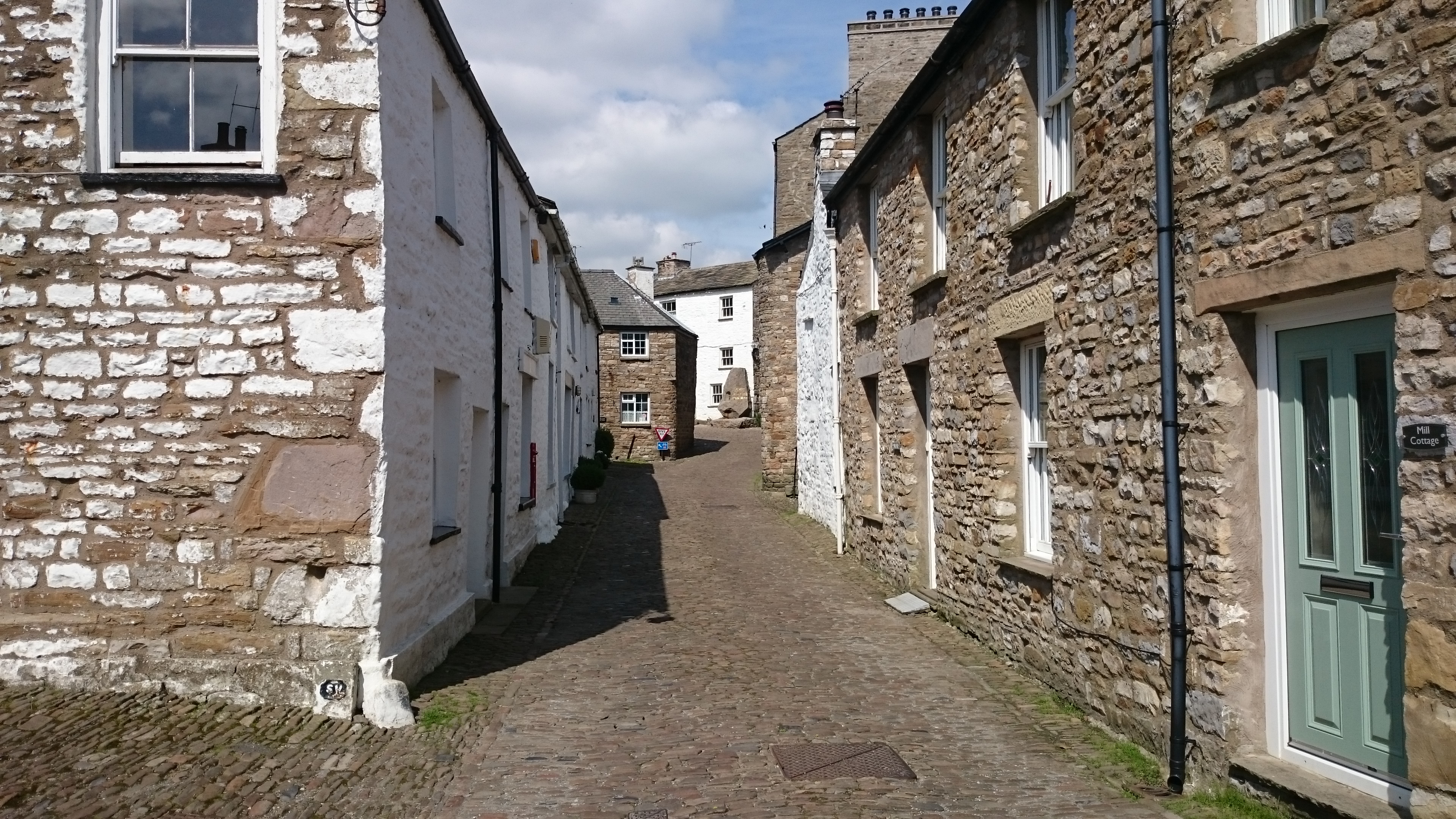
Dent, Cumbria

Dent is a village and civil parish in Cumbria, England, within the historic boundaries of the West Riding of Yorkshire. It lies in Dentdale, a narrow valley...

Nearby Amenities

Located within 500m of 54.290523,-2.4583644
Barrier: stile
Material: stone
Source: survey;gps
Stile: squeezer
Lat/Long: 54.2867177/-2.4621268
Barrier: stile
Material: stone
Source: survey;gps
Stile: squeezer
Lat/Long: 54.2875364/-2.463161
Barrier: stile
Material: stone
Source: survey;gps
Stile: stepover
Lat/Long: 54.2892046/-2.4646803
Barrier: stile
Material: stone
Source: survey;gps
Stile: stepover
Lat/Long: 54.2903566/-2.4659596
Hiking: yes
Information: guidepost
Source: GPS survey
Tourism: information
Lat/Long: 54.2868894/-2.4621599
Hiking: yes
Information: guidepost
Source: GPS survey
Tourism: information
Lat/Long: 54.2874632/-2.4631362
Hiking: yes
Information: guidepost
Source: GPS survey
Tourism: information
Lat/Long: 54.2876487/-2.4632469
Hiking: yes
Information: guidepost
Source: GPS survey
Tourism: information
Lat/Long: 54.2880808/-2.4635634
The data included in this document is from www.openstreetmap.org. The data is made available under ODbL.

Have you been to Barker Faws Wood?

Leave your review of Barker Faws Wood below (or comments, questions and feedback).