Stopes Moss

Downs, Moorland in Yorkshire South Lakeland

England

Stopes Moss

Ellers barn A grade II listed barn (list entry 1383860).  The farmhouse beyond <a href="https://www.geograph.org.uk/photo/3629842">SD6788 : The farm at Ellers</a>, not clearly visible in this photo, is also listed (1383859).
Ellers barn Credit: Stephen Craven

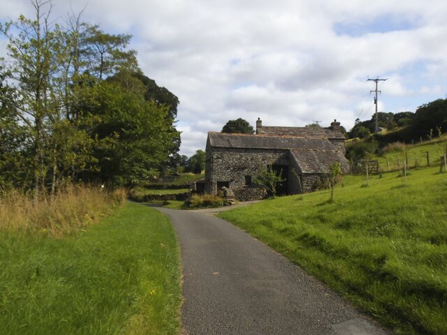
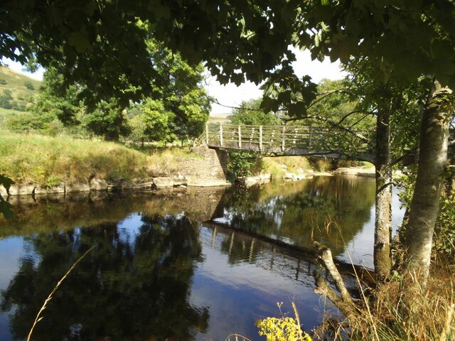
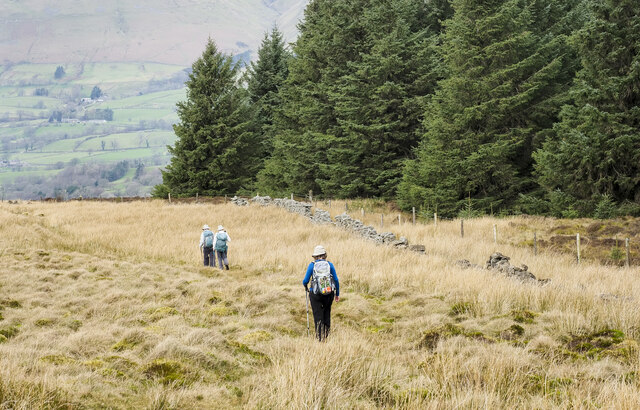
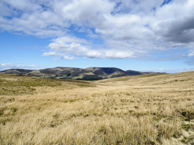
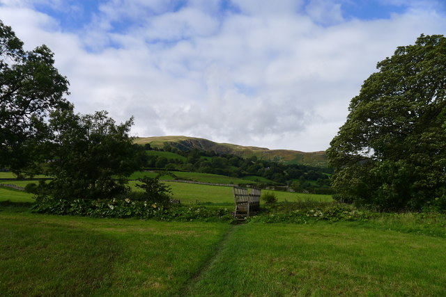
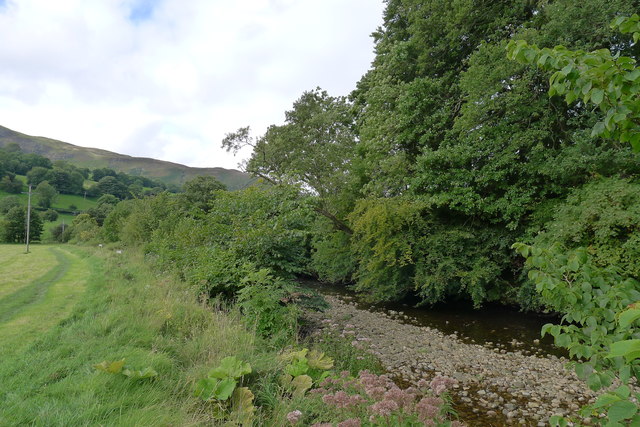
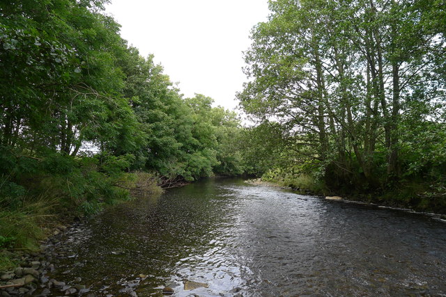
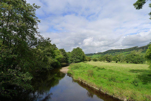
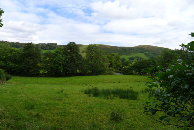
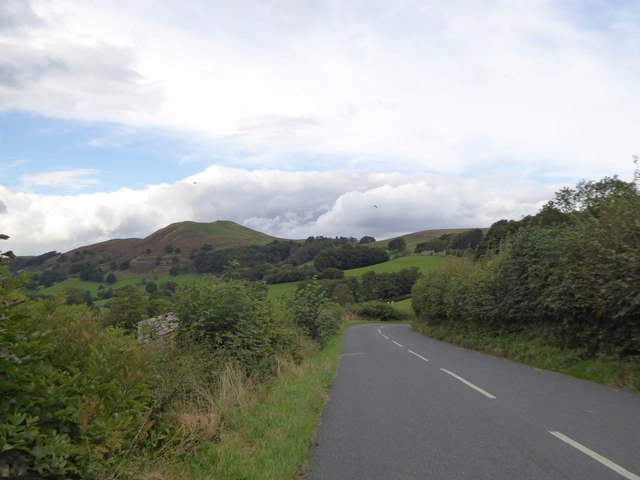
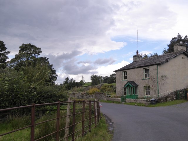
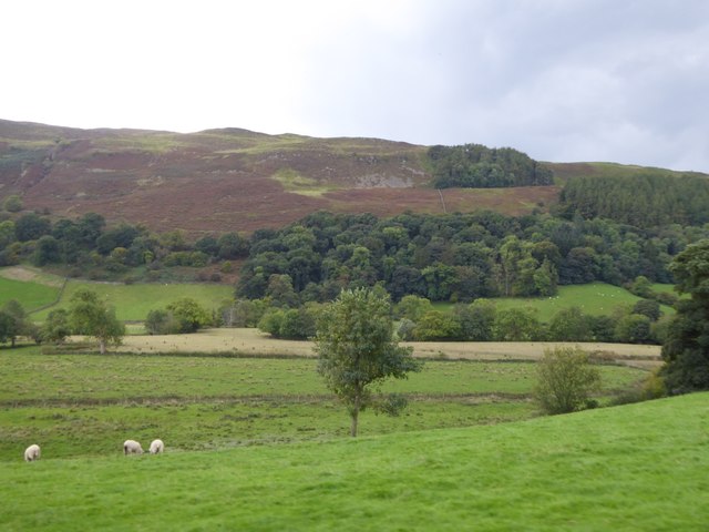
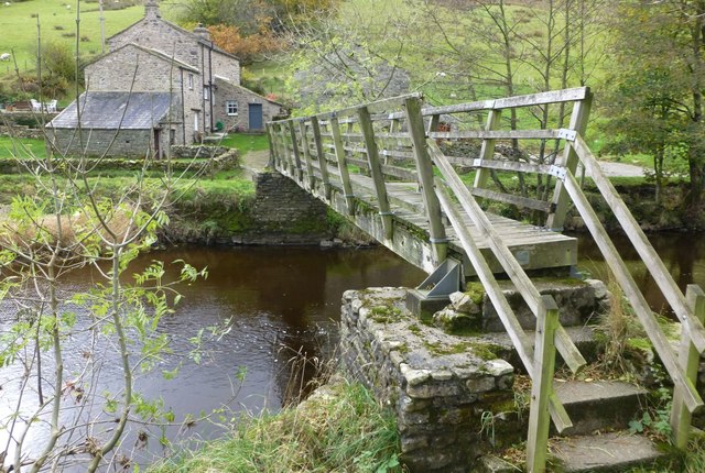
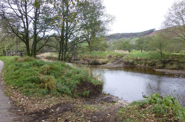
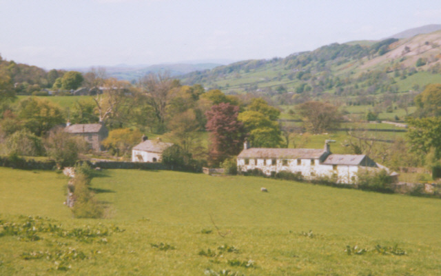
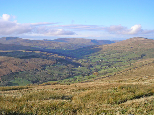
Stopes Moss is a vast expanse of moorland located in Yorkshire, England. Situated within the Yorkshire Downs, this area is characterized by its rolling hills, heather-covered landscapes, and stunning views of the surrounding countryside. The moss is home to a diverse range of plant and animal species, including rare birds such as curlews and lapwings.

The terrain of Stopes Moss is relatively flat, making it an ideal location for leisurely walks and hikes. Visitors can enjoy the peaceful atmosphere and immerse themselves in the natural beauty of the moorland. The heather blooms in late summer, painting the landscape in vibrant hues of purple and pink.

Stopes Moss is also a popular spot for birdwatching, with many bird enthusiasts flocking to the area to catch a glimpse of the various species that call the moorland home. The vast open spaces provide ample opportunities for spotting birds in their natural habitat.

Overall, Stopes Moss is a picturesque and tranquil destination for nature lovers and outdoor enthusiasts looking to explore the beauty of Yorkshire's countryside.

If you have any feedback on the listing, please let us know in the comments section below.
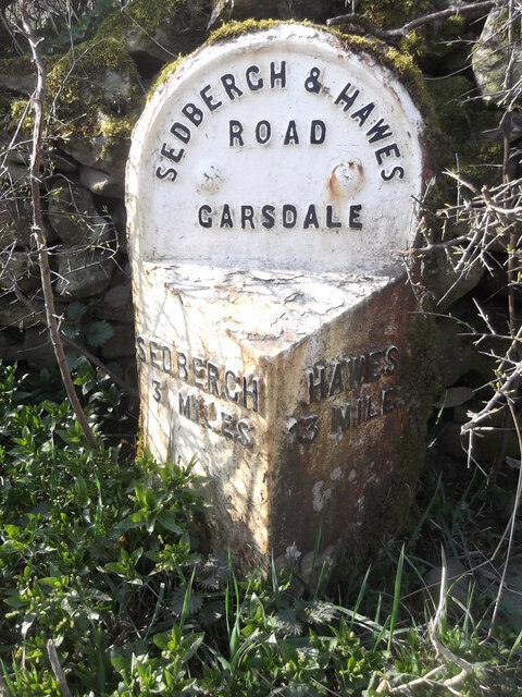
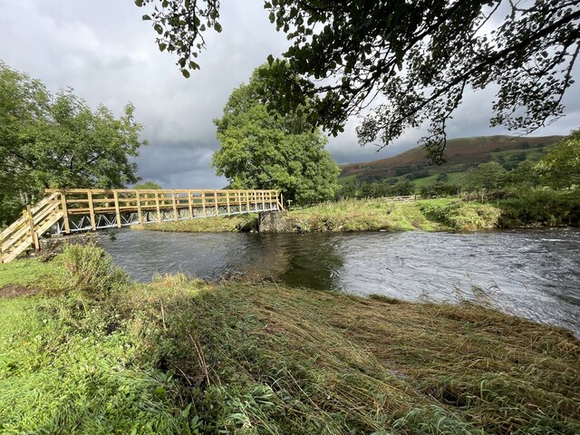
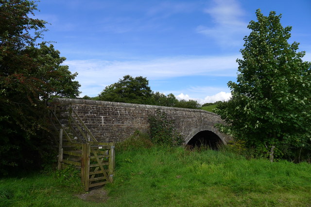
Stopes Moss Images

Images are sourced within 2km of 54.301291/-2.4766319 or Grid Reference SD6989. Thanks to Geograph Open Source API. All images are credited.

Ellers barn A grade II listed barn (list entry 1383860).  The farmhouse beyond <a href="https://www.geograph.org.uk/photo/3629842">SD6788 : The farm at Ellers</a>, not clearly visible in this photo, is also listed (1383859).
Ellers barn
A grade II listed barn (list entry 1383860). The farmhouse beyond SD6788 : The farm at Ellers, not clearly visible in this photo, is also listed (1383859).
Footbridge over the river Dee at Ellers This is the small river Dee in Cumbria, not the better known larger rivers of that name in Cheshire or Aberdeen. The bridge is close to Ellers Farm <a href="https://www.geograph.org.uk/photo/2674190">SD6788 : Ellers, lower Dentdale</a>, so I presume it was intended primarily for their use, but it is on a public footpath.   Quite a long single span (c.15m) for a straight (not arched) wooden footbridge.
Footbridge over the river Dee at Ellers
This is the small river Dee in Cumbria, not the better known larger rivers of that name in Cheshire or Aberdeen. The bridge is close to Ellers Farm SD6788 : Ellers, lower Dentdale, so I presume it was intended primarily for their use, but it is on a public footpath. Quite a long single span (c.15m) for a straight (not arched) wooden footbridge.
Walking path beside coniferous plantation The walkers are descending on a track over moorland into Garsdale following an ascent to Aye Gill Pike.
Walking path beside coniferous plantation
The walkers are descending on a track over moorland into Garsdale following an ascent to Aye Gill Pike.
Valley of Holebeck Gill The shallow, upper valley of Holebeck Gill heading north to where it will meet the Clough River which drains Garsdale.
The Howgill Fells are in the distance beyond both the Clough River and the River Rawthey.
Valley of Holebeck Gill
The shallow, upper valley of Holebeck Gill heading north to where it will meet the Clough River which drains Garsdale. The Howgill Fells are in the distance beyond both the Clough River and the River Rawthey.
Old milestone The Hawes 13 milestone on the A684 has its back to a drystone wall near Nether House on the south side of the road.   615 of these milestones were set up for the West Riding County Council in 1893/94 not long after the formation of County Councils.   Gill and Frank Stead, stonemasons, of Mirfield won the contract which stated that the work had to be done in 12 months or they would incur a penalty.   Considering the size of the West Riding that was a tremendous feat but they succeeded.   The WRCC didn't always have stones erected on old tollroads.   They wanted to promote new trade routes.   It is Grade II listed 1384039.
Old milestone
The Hawes 13 milestone on the A684 has its back to a drystone wall near Nether House on the south side of the road. 615 of these milestones were set up for the West Riding County Council in 1893/94 not long after the formation of County Councils. Gill and Frank Stead, stonemasons, of Mirfield won the contract which stated that the work had to be done in 12 months or they would incur a penalty. Considering the size of the West Riding that was a tremendous feat but they succeeded. The WRCC didn't always have stones erected on old tollroads. They wanted to promote new trade routes. It is Grade II listed 1384039.
Ford at Ellers The previous day the road here was flooded for 150 metres but today this ford on the River Dee is visible but not passable.
Ford at Ellers
The previous day the road here was flooded for 150 metres but today this ford on the River Dee is visible but not passable.
Barth Bridge Carrying the Dent to Sedbergh road over the River Dee
Barth Bridge
Carrying the Dent to Sedbergh road over the River Dee
The Dales Way in Dentdale The slopes of Combe Scar in the distance
The Dales Way in Dentdale
The slopes of Combe Scar in the distance
The Dales Way alongside the River Dee
The River Dee, Dentdale
The River Dee below the footbridge at Ellers, Dentdale
Looking across Dentdale to Helms Knott
Barth Bridge over River Dee On the left is a sign and a gap in the wall for the Dales Way which follows the riverbank
Barth Bridge over River Dee
On the left is a sign and a gap in the wall for the Dales Way which follows the riverbank
The road to Helmside The road from Dent to Helmside follows the riverbank until this point, where it turns to the north to run along the bank of Helmside Holme stream, on the edge of the flood plain of the River Dee.  In the distance is the distinctive summit of Helms Knott
The road to Helmside
The road from Dent to Helmside follows the riverbank until this point, where it turns to the north to run along the bank of Helmside Holme stream, on the edge of the flood plain of the River Dee. In the distance is the distinctive summit of Helms Knott
Cottage near Mire House
Valley of River Dee near Craggs Farm Here there is marsh in the valley and a stream that runs close to the edge of the sloping field
Valley of River Dee near Craggs Farm
Here there is marsh in the valley and a stream that runs close to the edge of the sloping field
Footbridge over the River Dee At Ellers.
Footbridge over the River Dee
At Ellers.
Ford across the River Dee At Ellers, just above the footbridge.
A convenient start for a walk up the Dales Way to Dent
returning on the opposite bank to the footbridge.
Ford across the River Dee
At Ellers, just above the footbridge. A convenient start for a walk up the Dales Way to Dent returning on the opposite bank to the footbridge.
Show me another place!

Stopes Moss is located at Grid Ref: SD6989 (Lat: 54.301291, Lng: -2.4766319)

Division: West Riding

Administrative County: Cumbria

District: South Lakeland

Police Authority: Cumbria

What 3 Words

///cookbooks.fells.agency. Near Sedbergh, Cumbria

Nearby Locations

Long Moor Stopes Moss

Related Wikis

Gawthrop

Gawthrop is a hamlet in the South Lakeland district, in the county of Cumbria, England. Historically part of the West Riding of Yorkshire, it lies within...

Clough River

The Clough River is a river in Cumbria, England. A tributary of the River Rawthey, it flows for 21.8 kilometres (13.5 mi) primarily through the Garsdale...

St Andrew's Church, Dent

St Andrew's Church is in the village of Dent, Cumbria, England. It is an active Anglican parish church in the Western Dales Mission Community in the deanery...

Dentdale

Dentdale is a dale or valley in the north-west of the Yorkshire Dales National Park in Cumbria, England. It is the valley of the River Dee, but takes...

Nearby Amenities

Located within 500m of 54.301291,-2.4766319
Long Moor
Natural: moor
Source: npe
Lat/Long: 54.3042491/-2.4711115
Barrier: stile
Material: stone
Source: survey;gps
Stile: stepover
Lat/Long: 54.3003226/-2.4734906
Barrier: stile
Material: stone
Source: survey;gps
Stile: stepover
Lat/Long: 54.3004301/-2.4745227
Hiking: yes
Information: guidepost
Source: GPS survey
Tourism: information
Lat/Long: 54.3002996/-2.4734446
Hiking: yes
Information: guidepost
Source: GPS survey
Tourism: information
Lat/Long: 54.3033194/-2.4707457
The data included in this document is from www.openstreetmap.org. The data is made available under ODbL.

Have you been to Stopes Moss?

Leave your review of Stopes Moss below (or comments, questions and feedback).