North Plantation

Downs, Moorland in Northumberland

England

North Plantation

Walltown Crags Turret 45a Hadrian's wall or 'Vallum Aelium' is the remains of a large Roman fortification. The wall extended west from Segedunum at Wallsend on the River Tyne to the shore of the Solway Firth, ending a short but unknown distance west of the village of Bowness-on-Solway. Construction probably started sometime in AD 122 and was largely completed within six years.

The remains were made a UNESCO World Heritage Site in 1987.
Walltown Crags Turret 45a Credit: Sandy Gerrard

North Plantation is a picturesque area located in the county of Northumberland, situated in the northeast region of England. It encompasses the Downs and Moorland, offering a diverse and captivating landscape to its residents and visitors.

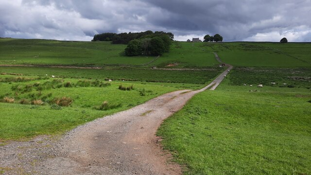
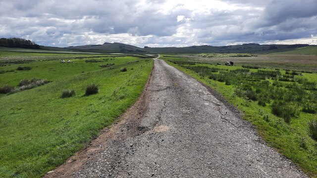
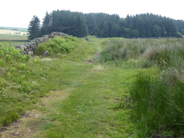
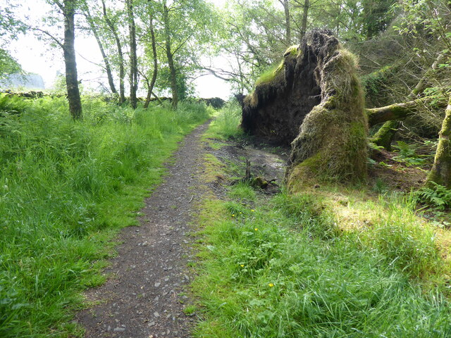
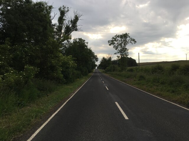
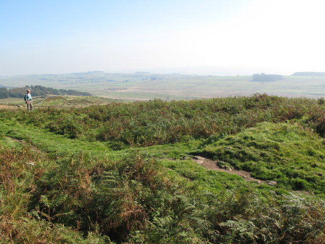
The Downs of North Plantation are characterized by rolling hills and expansive grasslands, providing scenic views of the surrounding countryside. The gently sloping terrain is ideal for outdoor activities such as hiking, picnicking, and horseback riding. Visitors can enjoy the tranquility and beauty of the Downs, immersing themselves in nature and taking in the fresh air.

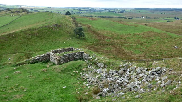
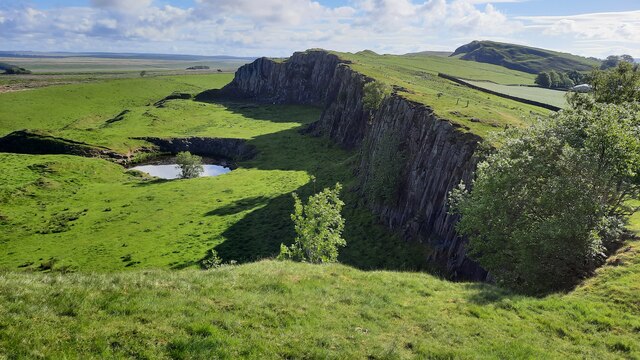
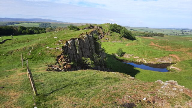
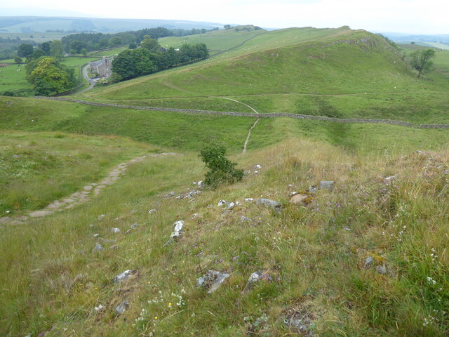
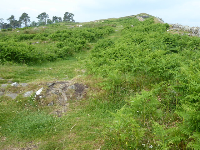
On the other hand, the Moorland in North Plantation offers a distinct ruggedness. It is characterized by vast open spaces, heather-covered hills, and marshy areas. This unique habitat supports a variety of wildlife, including birds such as curlews, lapwings, and skylarks. The Moorland is a haven for nature enthusiasts and birdwatchers, providing opportunities to observe and appreciate the region's biodiversity.

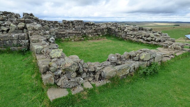
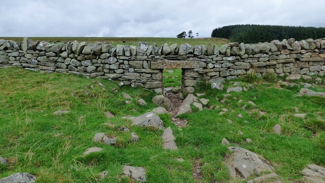
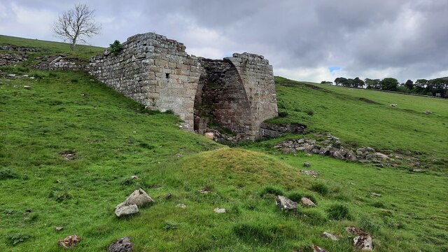
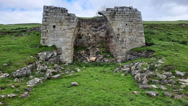
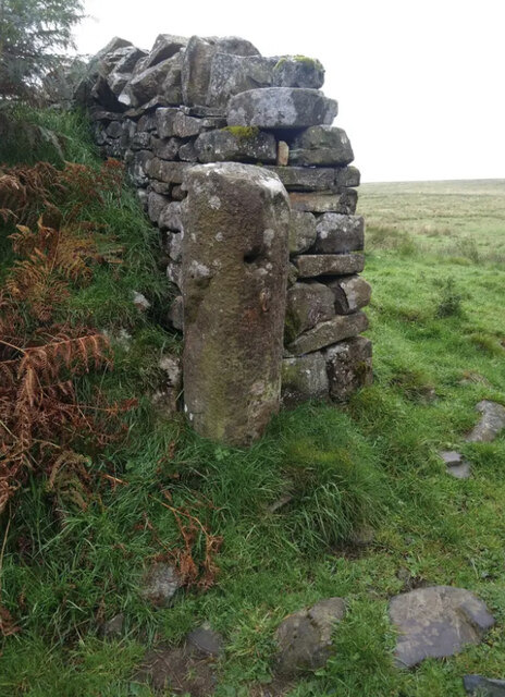
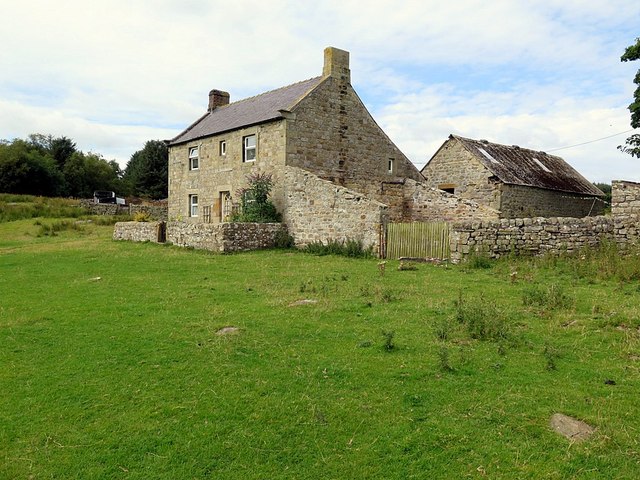
North Plantation is not only rich in natural beauty but also steeped in history. The area is dotted with remnants of ancient settlements, including stone circles and burial mounds, which serve as a reminder of its past. Visitors can explore these historical sites, gaining insights into the region's heritage and cultural significance.

Overall, North Plantation in Northumberland offers a captivating blend of natural beauty, outdoor activities, and historical significance. Whether it's admiring the stunning views of the Downs, exploring the rugged Moorland, or delving into the area's rich history, this region is sure to leave a lasting impression on all who visit.

If you have any feedback on the listing, please let us know in the comments section below.

North Plantation Images

Images are sourced within 2km of 54.999019/-2.4849183 or Grid Reference NY6967. Thanks to Geograph Open Source API. All images are credited.

Walltown Crags Turret 45a Hadrian's wall or 'Vallum Aelium' is the remains of a large Roman fortification. The wall extended west from Segedunum at Wallsend on the River Tyne to the shore of the Solway Firth, ending a short but unknown distance west of the village of Bowness-on-Solway. Construction probably started sometime in AD 122 and was largely completed within six years.

The remains were made a UNESCO World Heritage Site in 1987.
Walltown Crags Turret 45a
Hadrian's wall or 'Vallum Aelium' is the remains of a large Roman fortification. The wall extended west from Segedunum at Wallsend on the River Tyne to the shore of the Solway Firth, ending a short but unknown distance west of the village of Bowness-on-Solway. Construction probably started sometime in AD 122 and was largely completed within six years. The remains were made a UNESCO World Heritage Site in 1987.
Turret 44b on Hadrian's Wall Hadrian's wall or 'Vallum Aelium' is the remains of a large Roman fortification. The wall extended west from Segedunum at Wallsend on the River Tyne to the shore of the Solway Firth, ending a short but unknown distance west of the village of Bowness-on-Solway. Construction probably started sometime in AD 122 and was largely completed within six years.

The remains were made a UNESCO World Heritage Site in 1987.
Turret 44b on Hadrian's Wall
Hadrian's wall or 'Vallum Aelium' is the remains of a large Roman fortification. The wall extended west from Segedunum at Wallsend on the River Tyne to the shore of the Solway Firth, ending a short but unknown distance west of the village of Bowness-on-Solway. Construction probably started sometime in AD 122 and was largely completed within six years. The remains were made a UNESCO World Heritage Site in 1987.
Lime kiln at  Walltown
Lime kiln at Walltown
Sheep creep near the site of Turret 43b on Hadrian's Wall
Lime kiln at Walltown
Old Quarry between Turret 45A and Walltown Crags The Hadrian's Wall Path passes along the edge of the disused quarry.
Old Quarry between Turret 45A and Walltown Crags
The Hadrian's Wall Path passes along the edge of the disused quarry.
Old Quarry between Turret 45A and Walltown Crags
Farm track to Cockmount Hill
Unfenced minor road near Cockmount Hill This lane sits in a dip in the terrain between Hadrian's Wall and the B6318 (Military Road) roughly 2 miles north of Haltwhistle.
Unfenced minor road near Cockmount Hill
This lane sits in a dip in the terrain between Hadrian's Wall and the B6318 (Military Road) roughly 2 miles north of Haltwhistle.
The Pennine Way & Hadrian's Wall Path near Turret 44B
The Pennine Way & Hadrian's Wall Path near Milecastle 44
The Pennine Way & Hadrian's Wall Path near Turret 43B
The Pennine Way & Hadrian's Wall Path near Turret 43A
B6318 near Haltwhistle
Looking across to Walltown Crags With Hadrian's Wall marching along them.  Great vantage position but hard work for the labourers.  Looking at the shape and size of the stones in the  wall in the foreground I suspect it has benefited from 'relocated' pieces of the Roman project!
Looking across to Walltown Crags
With Hadrian's Wall marching along them. Great vantage position but hard work for the labourers. Looking at the shape and size of the stones in the wall in the foreground I suspect it has benefited from 'relocated' pieces of the Roman project!
Old Roman Milestone on Cockmount Hill, Haltwhistle Parish Carved stone post was on Military Way, in parish of HALTWHISTLE (TYNEDALE District). Found Cockmount Hill Wood, now part of gatepost at West end of wood. Roman milestone erected by the Government in the 3rd century. 

Inscription illegible.

Within Hadrian's Wall Scheduled monument. List Entry Number: 1017535
<span class="nowrap"><a title="https://web.archive.org/web/20210107221507/https://historicengland.org.uk/listing/the-list/list-entry/1017535" rel="nofollow ugc noopener" href="https://web.archive.org/web/20210107221507/https://historicengland.org.uk/listing/the-list/list-entry/1017535">Archive Link</a><img style="margin-left:2px;" alt="External link" title="External link - shift click to open in new window" src="https://s1.geograph.org.uk/img/external.png" width="10" height="10"/></span>

Milestone Society National ID: NB_ROM10.
Old Roman Milestone on Cockmount Hill, Haltwhistle Parish
Carved stone post was on Military Way, in parish of HALTWHISTLE (TYNEDALE District). Found Cockmount Hill Wood, now part of gatepost at West end of wood. Roman milestone erected by the Government in the 3rd century. Inscription illegible. Within Hadrian's Wall Scheduled monument. List Entry Number: 1017535 Archive LinkExternal link Milestone Society National ID: NB_ROM10.
Cockmount Hill
Cockmount Hill
Show me another place!

North Plantation is located at Grid Ref: NY6967 (Lat: 54.999019, Lng: -2.4849183)

Unitary Authority: Northumberland

Police Authority: Northumbria

What 3 Words

///dote.quail.instance. Near Haltwhistle, Northumberland

Nearby Locations

North Plantation

Related Wikis

Milecastle 44

Milecastle 44 (Allolee) was a milecastle on Hadrian's Wall (grid reference NY68886694). == Description == Milecastle 44 is located about 1.5 kilometres...

Allolee to Walltown

Allolee to Walltown is the name given to a Site of Special Scientific Interest (SSSI) in Northumberland, England. The site, which follows the path of a...

Northumbria

Northumbria (; Old English: Norþanhymbra rīċe [ˈnorˠðɑnˌhymbrɑ ˈriːt͡ʃe]; Latin: Regnum Northanhymbrorum) was an early medieval Anglo-Saxon kingdom in...

Alloa Lea Quarry Cave

Alloa Lea Quarry Cave is a short cave in the Five Yard Limestone of the Alston Block in Northumberland, England. It is situated in an old quarry on the...

Have you been to North Plantation?

Leave your review of North Plantation below (or comments, questions and feedback).