Green Fell

Downs, Moorland in Cumberland Eden

England

Green Fell

Old Milestone by the A686, north east of Melmerby Carved stone post by the A686, in parish of OUSBY (EDEN District), Melmerby, Long Craggs, on bend, in banking, opposite Snow pole, on East side of road. Alston stone, erected by the Alston turnpike trust in the 19th century. 

Inscription reads:-
ALSTON
8
PENRITH
11 
Carved benchmark on front top.

Milestone Society National ID: CU_ALPR08.
Old Milestone by the A686, north east of Melmerby Credit: Barbara Todd

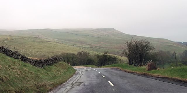
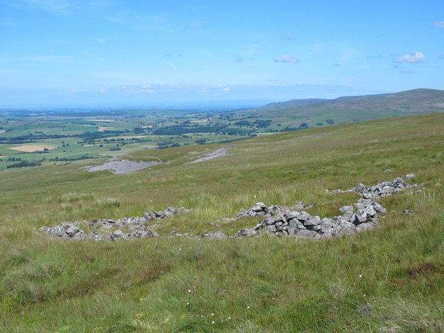
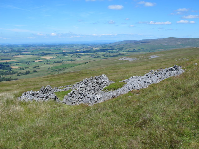
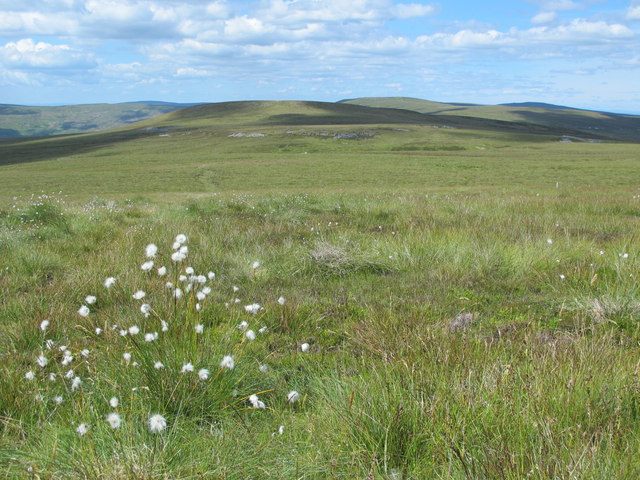
Green Fell is a picturesque and expansive area located in the county of Cumberland, England. Situated amidst the stunning landscapes of the Downs and Moorland, it offers visitors a serene and captivating experience. Covering a vast expanse of rolling hills, lush green valleys, and rugged terrain, Green Fell is a popular destination for nature enthusiasts and hikers alike.

The area boasts an abundance of natural beauty and diverse wildlife, making it an ideal spot for wildlife observation and photography. Visitors can expect to encounter a range of indigenous species, including red deer, wild ponies, and various bird species, which add to the charm of this tranquil location.

Green Fell is also home to numerous walking trails and footpaths, allowing visitors to explore the area and immerse themselves in the stunning surroundings. These trails cater to all levels of fitness and offer breathtaking views of the surrounding countryside.

In addition to its natural allure, Green Fell is steeped in history and folklore. Ancient ruins and stone circles can be found scattered throughout the area, providing a glimpse into its rich past. The locals are proud of their heritage and are often more than willing to share stories and legends associated with the land.

Whether you are seeking a peaceful retreat in nature, an opportunity to discover the region's history, or simply a place to unwind and recharge, Green Fell in Cumberland is a destination that promises to exceed expectations.

If you have any feedback on the listing, please let us know in the comments section below.
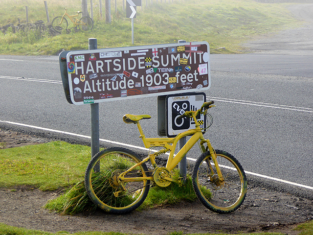
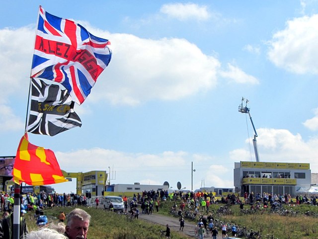
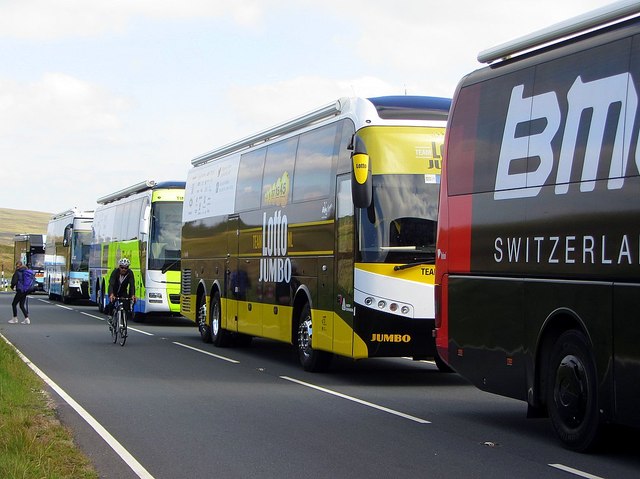
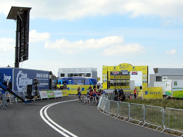
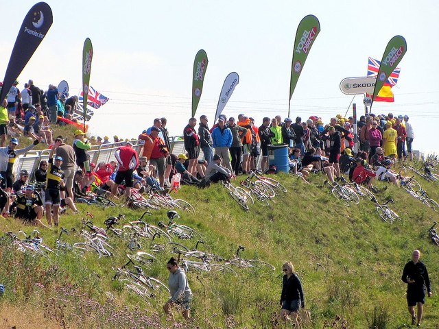
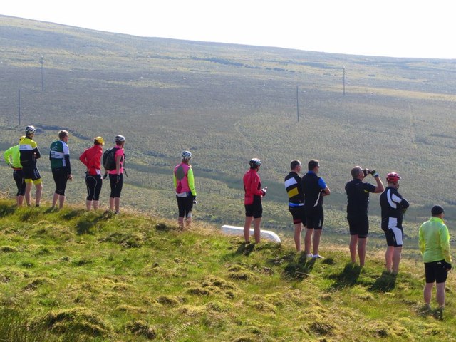
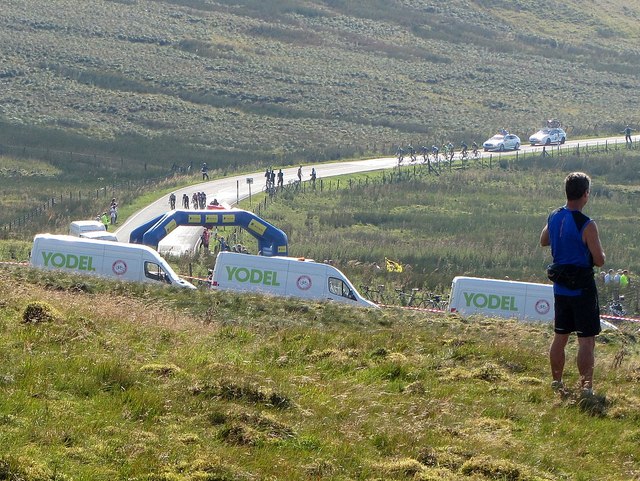
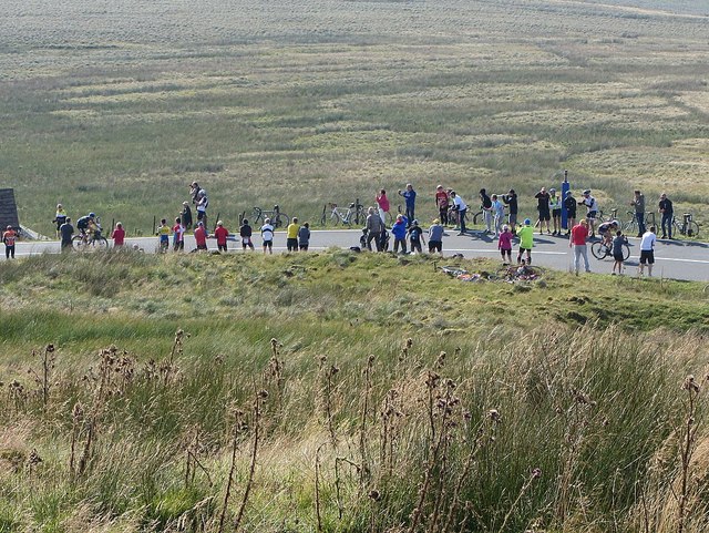
Green Fell Images

Images are sourced within 2km of 54.768636/-2.5690908 or Grid Reference NY6341. Thanks to Geograph Open Source API. All images are credited.

Old Milestone by the A686, north east of Melmerby Carved stone post by the A686, in parish of OUSBY (EDEN District), Melmerby, Long Craggs, on bend, in banking, opposite Snow pole, on East side of road. Alston stone, erected by the Alston turnpike trust in the 19th century. 

Inscription reads:-
ALSTON
8
PENRITH
11 
Carved benchmark on front top.

Milestone Society National ID: CU_ALPR08.
Old Milestone by the A686, north east of Melmerby
Carved stone post by the A686, in parish of OUSBY (EDEN District), Melmerby, Long Craggs, on bend, in banking, opposite Snow pole, on East side of road. Alston stone, erected by the Alston turnpike trust in the 19th century. Inscription reads:- ALSTON 8 PENRITH 11 Carved benchmark on front top. Milestone Society National ID: CU_ALPR08.
Direction Sign - Signpost opposite the Renwick turn off Located on the east side of the junction of the A686 and the minor road to Renwick in Kirkoswald parish. 3 arms and pawn finial

Milestone Society National ID: CU_NY6341
Direction Sign - Signpost opposite the Renwick turn off
Located on the east side of the junction of the A686 and the minor road to Renwick in Kirkoswald parish. 3 arms and pawn finial Milestone Society National ID: CU_NY6341
Approaching sharp bends north of Gamblesby junction
Ruin below Little Knapside Hill I think that this structure was a bield (rather than a sheepfold).
Ruin below Little Knapside Hill
I think that this structure was a bield (rather than a sheepfold).
Ruins above Hause in the Scar
Moorland between Little Knapside Hill and Fiends Fell
The yellow bikes of Hartside (1) Stage 5 of the Aviva Tour of Britain on September 10th runs from Prudhoe in the Tyne valley to the finish on Hartside Pass, the second highest A road in England. The sting in the tail is the gruelling climb on the A686 from Melmerby up to the summit, which gains 414 metres in elevation over a distance of 7.9 km - a climb which is scheduled to take the riders only 10 to 13 minutes!

In anticipation of the arrival of the Tour, large numbers of yellow bikes have been installed  in and around the villages of Langwathby and Melmerby and a handful have now appeared on Hartside summit.
The yellow bikes of Hartside (1)
Stage 5 of the Aviva Tour of Britain on September 10th runs from Prudhoe in the Tyne valley to the finish on Hartside Pass, the second highest A road in England. The sting in the tail is the gruelling climb on the A686 from Melmerby up to the summit, which gains 414 metres in elevation over a distance of 7.9 km - a climb which is scheduled to take the riders only 10 to 13 minutes! In anticipation of the arrival of the Tour, large numbers of yellow bikes have been installed in and around the villages of Langwathby and Melmerby and a handful have now appeared on Hartside summit.
The yellow bikes of Hartside (2) Stage 5 of the Aviva Tour of Britain on September 10th runs from Prudhoe in the Tyne valley to the finish on Hartside Pass, the second highest A road in England. The sting in the tail is the gruelling climb on the A686 from Melmerby up to the summit, which gains 414 metres in elevation over a distance of 7.9 km - a climb which is scheduled to take the riders only 10 to 13 minutes!

In anticipation of the arrival of the Tour, large numbers of yellow bikes have been installed  in and around the villages of Langwathby and Melmerby and a handful have now appeared on Hartside summit.
The yellow bikes of Hartside (2)
Stage 5 of the Aviva Tour of Britain on September 10th runs from Prudhoe in the Tyne valley to the finish on Hartside Pass, the second highest A road in England. The sting in the tail is the gruelling climb on the A686 from Melmerby up to the summit, which gains 414 metres in elevation over a distance of 7.9 km - a climb which is scheduled to take the riders only 10 to 13 minutes! In anticipation of the arrival of the Tour, large numbers of yellow bikes have been installed in and around the villages of Langwathby and Melmerby and a handful have now appeared on Hartside summit.
The yellow bikes of Hartside (3) Stage 5 of the Aviva Tour of Britain on September 10th runs from Prudhoe in the Tyne valley to the finish on Hartside Pass, the second highest A road in England. The sting in the tail is the gruelling climb on the A686 from Melmerby up to the summit, which gains 414 metres in elevation over a distance of 7.9 km - a climb which is scheduled to take the riders only 10 to 13 minutes!

In anticipation of the arrival of the Tour, large numbers of yellow bikes have been installed  in and around the villages of Langwathby and Melmerby and a handful have now appeared on Hartside summit.
The yellow bikes of Hartside (3)
Stage 5 of the Aviva Tour of Britain on September 10th runs from Prudhoe in the Tyne valley to the finish on Hartside Pass, the second highest A road in England. The sting in the tail is the gruelling climb on the A686 from Melmerby up to the summit, which gains 414 metres in elevation over a distance of 7.9 km - a climb which is scheduled to take the riders only 10 to 13 minutes! In anticipation of the arrival of the Tour, large numbers of yellow bikes have been installed in and around the villages of Langwathby and Melmerby and a handful have now appeared on Hartside summit.
Tour of Britain at Hartside finish The fifth and hardest stage of the Tour of Britain cycle race on 10th September 2015 was 166km from Prudhoe in Northumberland to Hartside in Cumbria where there was a summit finish on the road close to the cafe after a  gruelling 8.9km climb from Melmerby <a href="https://www.geograph.org.uk/photo/1745492">NY6441 : Hartside summit</a>

Wout Poels (Team Sky) won the stage, overtaking Edvald Boasson Hagen (MTN-Qhubeka) in the final straight, with Benat Intxausti finishing third, some way behind. Boasson Hagen, did enough to take the overall race lead by a single second.

It is thought that over 5,000 people made the climb to Hartside Fell, by bicycle and on foot, to watch the finish.
Tour of Britain at Hartside finish
The fifth and hardest stage of the Tour of Britain cycle race on 10th September 2015 was 166km from Prudhoe in Northumberland to Hartside in Cumbria where there was a summit finish on the road close to the cafe after a gruelling 8.9km climb from Melmerby NY6441 : Hartside summit Wout Poels (Team Sky) won the stage, overtaking Edvald Boasson Hagen (MTN-Qhubeka) in the final straight, with Benat Intxausti finishing third, some way behind. Boasson Hagen, did enough to take the overall race lead by a single second. It is thought that over 5,000 people made the climb to Hartside Fell, by bicycle and on foot, to watch the finish.
Team buses on closed A686 east of Hartside summit The fifth and hardest stage of the Tour of Britain cycle race on 10th September 2015 was 166km from Prudhoe in Northumberland to Hartside in Cumbria where there was a summit finish on the road close to the cafe after a  gruelling 8.9km climb from Melmerby <a href="https://www.geograph.org.uk/photo/1745492">NY6441 : Hartside summit</a>

Wout Poels (Team Sky) won the stage, overtaking Edvald Boasson Hagen (MTN-Qhubeka) in the final straight, with Benat Intxausti finishing third, some way behind. Boasson Hagen, did enough to take the overall race lead by a single second.

It is thought that over 5,000 people made the climb to Hartside Fell, by bicycle and on foot, to watch the finish.
Team buses on closed A686 east of Hartside summit
The fifth and hardest stage of the Tour of Britain cycle race on 10th September 2015 was 166km from Prudhoe in Northumberland to Hartside in Cumbria where there was a summit finish on the road close to the cafe after a gruelling 8.9km climb from Melmerby NY6441 : Hartside summit Wout Poels (Team Sky) won the stage, overtaking Edvald Boasson Hagen (MTN-Qhubeka) in the final straight, with Benat Intxausti finishing third, some way behind. Boasson Hagen, did enough to take the overall race lead by a single second. It is thought that over 5,000 people made the climb to Hartside Fell, by bicycle and on foot, to watch the finish.
Tour of Britain at Hartside finish The fifth and hardest stage of the Tour of Britain cycle race on 10th September 2015 was 166km from Prudhoe in Northumberland to Hartside in Cumbria where there was a summit finish on the road close to the cafe after a  gruelling 8.9km climb from Melmerby <a href="https://www.geograph.org.uk/photo/1745492">NY6441 : Hartside summit</a>

Wout Poels (Team Sky) won the stage, overtaking Edvald Boasson Hagen (MTN-Qhubeka) in the final straight, with Benat Intxausti finishing third, some way behind. Boasson Hagen, did enough to take the overall race lead by a single second.

It is thought that over 5,000 people made the climb to Hartside Fell, by bicycle and on foot, to watch the finish.
Tour of Britain at Hartside finish
The fifth and hardest stage of the Tour of Britain cycle race on 10th September 2015 was 166km from Prudhoe in Northumberland to Hartside in Cumbria where there was a summit finish on the road close to the cafe after a gruelling 8.9km climb from Melmerby NY6441 : Hartside summit Wout Poels (Team Sky) won the stage, overtaking Edvald Boasson Hagen (MTN-Qhubeka) in the final straight, with Benat Intxausti finishing third, some way behind. Boasson Hagen, did enough to take the overall race lead by a single second. It is thought that over 5,000 people made the climb to Hartside Fell, by bicycle and on foot, to watch the finish.
Tour of Britain at Hartside finish First view of the race.
Tour of Britain at Hartside finish
First view of the race.
Tour of Britain at Hartside finish Race leaders approaching '1km to go' banner.
Tour of Britain at Hartside finish
Race leaders approaching '1km to go' banner.
Tour of Britain at Hartside finish Leading pair of riders within last kilometre.
Tour of Britain at Hartside finish
Leading pair of riders within last kilometre.
Tour of Britain at Hartside finish Leading three riders approaching the finish line at Hartside summit. Wout Poels (Team Sky), here in second place, was to overtake Edvald Boasson Hagen (MTN-Qhubeka) in the final few hundred metres of uphill sprint to win the stage with a 2 seconds advantage.
Tour of Britain at Hartside finish
Leading three riders approaching the finish line at Hartside summit. Wout Poels (Team Sky), here in second place, was to overtake Edvald Boasson Hagen (MTN-Qhubeka) in the final few hundred metres of uphill sprint to win the stage with a 2 seconds advantage.
Show me another place!

Green Fell is located at Grid Ref: NY6341 (Lat: 54.768636, Lng: -2.5690908)

Administrative County: Cumbria

District: Eden

Police Authority: Cumbria

What 3 Words

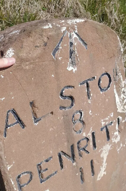
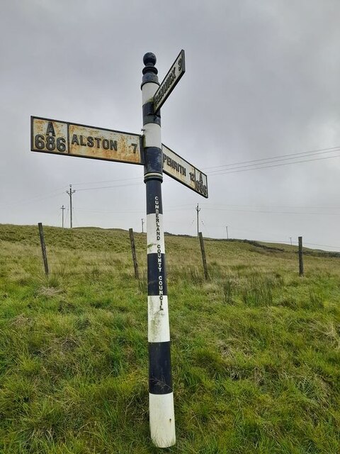
///newlywed.crumb.dragons. Near Alston, Cumbria

Nearby Locations

Twotop Hill Green Fell

Related Wikis

Busk, Cumbria

Busk is a hamlet in Cumbria, England. It is located 3.7 miles (6.0 km) by road to the east of Kirkoswald. == See also == List of places in Cumbria ��2...

Black Fell (Pennines)

Black Fell is a hill in the North Pennines, England. It is located just north of the A686 road, west of Alston and is one of the most northerly parts of...

Unthank, Glassonby

Unthank is a village near Gamblesby in the civil parish of Glassonby in Cumbria, England. It is first mentioned in writing as Unthanke in 1332. == See... ==

Gamblesby

Gamblesby is a village near Melmerby, and former civil parish, now in the parish of Glassonby, in the Westmorland and Furness district, in the ceremonial...

St John's Church, Gamblesby

St. John's Church was a Victorian parish Church of England church in the village of Gamblesby, Cumbria, England.The Gothic Revival-style church, with tall...

Renwick, Cumbria

Renwick, formerly known as Ravenwick, is a small village and former civil parish, now in the parish of Kirkoswald, in the Eden district, in the county...

Melmerby, Cumbria

Melmerby is a village and civil parish in the Eden district, in the county of Cumbria, England. It is a small village with a population of around 200....

Glassonby

Glassonby is a small village and civil parish in the Eden Valley of Cumbria, England, about 3 miles (4.8 km) south south east of Kirkoswald. At the 2001...

Nearby Amenities

Located within 500m of 54.768636,-2.5690908
Twotop Hill
Ele: 549
Natural: peak
Lat/Long: 54.7647845/-2.565136
Green Fell
Place: locality
Lat/Long: 54.7683917/-2.5694088
Greenfell Raise
Place: locality
Lat/Long: 54.767232/-2.5651334
Natural: sinkhole
Lat/Long: 54.7654227/-2.5725672
Natural: sinkhole
Lat/Long: 54.7658161/-2.572601
Natural: sinkhole
Lat/Long: 54.765785/-2.5727968
Natural: sinkhole
Lat/Long: 54.765446/-2.5739447
Natural: sinkhole
Lat/Long: 54.7655785/-2.574073
Natural: sinkhole
Lat/Long: 54.7651539/-2.5737827
Natural: sinkhole
Lat/Long: 54.7654514/-2.5670615
Natural: sinkhole
Lat/Long: 54.7654458/-2.5672759
Power: pole
Lat/Long: 54.767553/-2.5756371
Power: pole
Lat/Long: 54.7676928/-2.5743472
Power: pole
Lat/Long: 54.7678516/-2.5730121
Power: pole
Lat/Long: 54.7679938/-2.571718
Power: pole
Lat/Long: 54.7680317/-2.5706684
Power: pole
Lat/Long: 54.7681016/-2.5689441
Power: pole
Lat/Long: 54.7681348/-2.5679376
Power: pole
Lat/Long: 54.7682059/-2.5661465
Power: pole
Lat/Long: 54.7682557/-2.5645156
Power: pole
Lat/Long: 54.7683149/-2.5628848
Power: pole
Lat/Long: 54.768828/-2.5626855
Power: pole
Lat/Long: 54.768738/-2.5642979
Power: pole
Lat/Long: 54.7686372/-2.565822
Power: pole
Lat/Long: 54.7685495/-2.5672269
Power: pole
Lat/Long: 54.7684619/-2.5686791
Power: pole
Lat/Long: 54.7683671/-2.5702135
Power: pole
Lat/Long: 54.7682664/-2.5718218
Power: pole
Lat/Long: 54.7681396/-2.573046
Power: pole
Lat/Long: 54.7679986/-2.5742517
Power: pole
Lat/Long: 54.7678848/-2.5752273
Power: pole
Lat/Long: 54.7677639/-2.5762728
Abandoned: yes
Historic: lime_kiln
Lat/Long: 54.7681775/-2.5757825
Rae Gill
Place: locality
Lat/Long: 54.7665745/-2.5748314
Natural: sinkhole
Lat/Long: 54.7694392/-2.5757217
The data included in this document is from www.openstreetmap.org. The data is made available under ODbL.

Have you been to Green Fell?

Leave your review of Green Fell below (or comments, questions and feedback).