Twotop Hill

Hill, Mountain in Cumberland Eden

England

Twotop Hill

Old Milestone by the A686, north east of Melmerby Carved stone post by the A686, in parish of OUSBY (EDEN District), Melmerby, Long Craggs, on bend, in banking, opposite Snow pole, on East side of road. Alston stone, erected by the Alston turnpike trust in the 19th century. 

Inscription reads:-
ALSTON
8
PENRITH
11 
Carved benchmark on front top.

Milestone Society National ID: CU_ALPR08.
Old Milestone by the A686, north east of Melmerby Credit: Barbara Todd

Twotop Hill, located in Cumberland County, Pennsylvania, is a prominent hill and mountain formation in the central part of the state. Standing at an elevation of approximately 1,952 feet (595 meters), it is one of the highest points in the region. The hill is situated near the border of Cumberland and Perry counties, about 11 miles southwest of Carlisle.

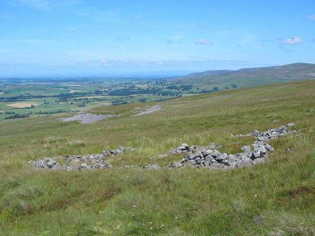
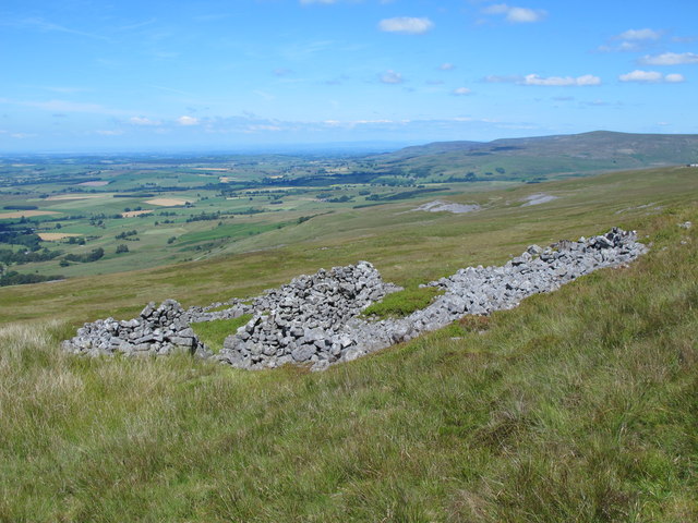
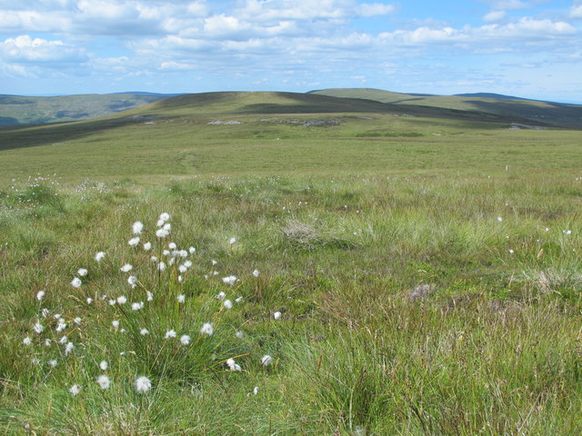
Twotop Hill offers breathtaking panoramic views of the surrounding landscape, showcasing the picturesque Cumberland Valley to the east and the rugged beauty of the Appalachian Mountains to the west. The hill is characterized by its gently sloping sides and a well-defined peak that provides an ideal vantage point for hikers, nature enthusiasts, and photographers.

The hill is predominantly covered in dense forests, primarily consisting of hardwood trees such as oak, hickory, and maple. It serves as a habitat for various wildlife species, including deer, foxes, squirrels, and numerous bird species. The area is also home to several hiking trails, which allow visitors to explore the hill's natural beauty and enjoy the tranquility of the surrounding wilderness.

Twotop Hill is a popular destination for outdoor enthusiasts, providing opportunities for activities such as hiking, birdwatching, and nature photography. Its proximity to nearby towns and cities makes it easily accessible for day trips or weekend excursions. Whether it's for a peaceful walk in nature or to capture stunning vistas, Twotop Hill offers a memorable experience for visitors of all ages.

If you have any feedback on the listing, please let us know in the comments section below.
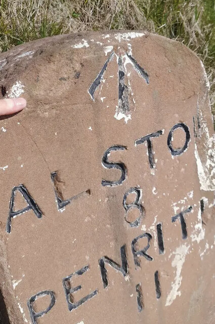
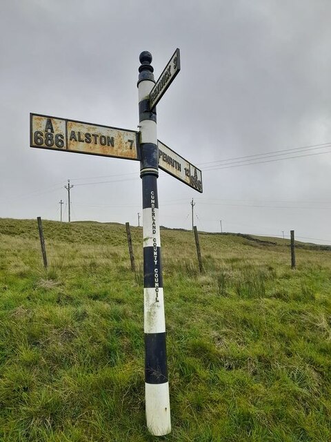
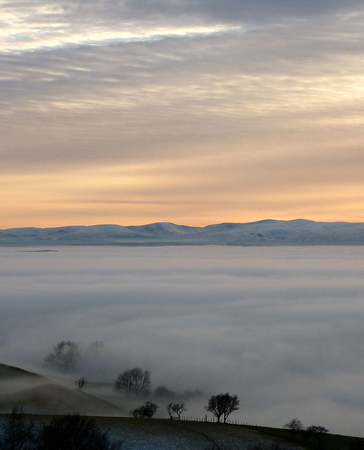
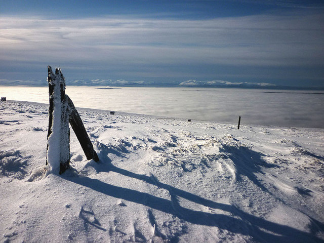
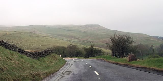
Twotop Hill Images

Images are sourced within 2km of 54.764961/-2.5651694 or Grid Reference NY6341. Thanks to Geograph Open Source API. All images are credited.

Old Milestone by the A686, north east of Melmerby Carved stone post by the A686, in parish of OUSBY (EDEN District), Melmerby, Long Craggs, on bend, in banking, opposite Snow pole, on East side of road. Alston stone, erected by the Alston turnpike trust in the 19th century. 

Inscription reads:-
ALSTON
8
PENRITH
11 
Carved benchmark on front top.

Milestone Society National ID: CU_ALPR08.
Old Milestone by the A686, north east of Melmerby
Carved stone post by the A686, in parish of OUSBY (EDEN District), Melmerby, Long Craggs, on bend, in banking, opposite Snow pole, on East side of road. Alston stone, erected by the Alston turnpike trust in the 19th century. Inscription reads:- ALSTON 8 PENRITH 11 Carved benchmark on front top. Milestone Society National ID: CU_ALPR08.
Direction Sign - Signpost opposite the Renwick turn off Located on the east side of the junction of the A686 and the minor road to Renwick in Kirkoswald parish. 3 arms and pawn finial

Milestone Society National ID: CU_NY6341
Direction Sign - Signpost opposite the Renwick turn off
Located on the east side of the junction of the A686 and the minor road to Renwick in Kirkoswald parish. 3 arms and pawn finial Milestone Society National ID: CU_NY6341
Glassonby: The A686
Glassonby: The A686
Glassonby: Lime Kiln Beck
Direction Sign - Signpost on the A686 Located on the east side of the A686 opposite the road to Glassonby in Glassonby parish. 3 arms and pawn finial. See also <a title="https://www.geograph.org.uk/photo/3479373" href="https://www.geograph.org.uk/photo/3479373">Link</a>.

Milestone Society National ID: CU_NY6239
Direction Sign - Signpost on the A686
Located on the east side of the A686 opposite the road to Glassonby in Glassonby parish. 3 arms and pawn finial. See also Link. Milestone Society National ID: CU_NY6239
Trees in the mist, Lime Kiln Beck The cloud inversion that has filled the Eden Valley all day is lapping around these trees just below the A686 Alston road. On the far side the sun has just set below the eastern fells of the Lake District.
Trees in the mist, Lime Kiln Beck
The cloud inversion that has filled the Eden Valley all day is lapping around these trees just below the A686 Alston road. On the far side the sun has just set below the eastern fells of the Lake District.
Old fenceposts, Little Knapside Hill Passed en route to Fiends Fell. Beyond, a line of wooden shooting butts head down the slope. No grouse in evidence today up here above the cloud inversion that fills the Eden Valley. Rising out of this are the snow-covered fells of the Lake District.
Old fenceposts, Little Knapside Hill
Passed en route to Fiends Fell. Beyond, a line of wooden shooting butts head down the slope. No grouse in evidence today up here above the cloud inversion that fills the Eden Valley. Rising out of this are the snow-covered fells of the Lake District.
Bend of A686 at Limekiln Beck The A686 crosses the minor stream of Limekiln Beck at this sharp bend passing under the road presumably by a culvert rather than a bridge.
Bend of A686 at Limekiln Beck
The A686 crosses the minor stream of Limekiln Beck at this sharp bend passing under the road presumably by a culvert rather than a bridge.
Approaching sharp bends north of Gamblesby junction
Gamblesby junction off A686
Sharp bend and lay by near Boorick Hill
Sheepfold above Black Tongue This sheepfold has a "tail" leading SSW - see also the satellite image <span class="nowrap"><a title="https://maps.google.co.uk/maps?q=Melmerby&hl=en&ll=54.749517,-2.569653&spn=0.001082,0.002379&sll=54.770201,-2.551275&sspn=0.017403,0.038066&oq=melmerby&hnear=Melmerby,+Cumbria,+United+Kingdom&t=h&z=19" rel="nofollow ugc noopener" href="https://maps.google.co.uk/maps?q=Melmerby&hl=en&ll=54.749517,-2.569653&spn=0.001082,0.002379&sll=54.770201,-2.551275&sspn=0.017403,0.038066&oq=melmerby&hnear=Melmerby,+Cumbria,+United+Kingdom&t=h&z=19">Link</a><img style="margin-left:2px;" alt="External link" title="External link - shift click to open in new window" src="https://s1.geograph.org.uk/img/external.png" width="10" height="10"/></span> .
Sheepfold above Black Tongue
This sheepfold has a "tail" leading SSW - see also the satellite image LinkExternal link .
Ruin below Little Knapside Hill I think that this structure was a bield (rather than a sheepfold).
Ruin below Little Knapside Hill
I think that this structure was a bield (rather than a sheepfold).
Ruins above Hause in the Scar
Moorland between Little Knapside Hill and Fiends Fell
Melting snow by Alston Road near Lime Beck The A696 from Penrith to Alston climbs the steep flanks of the Pennine chain to Hartside Summit and is often blocked by snow in winter.
Melting snow by Alston Road near Lime Beck
The A696 from Penrith to Alston climbs the steep flanks of the Pennine chain to Hartside Summit and is often blocked by snow in winter.
The yellow bikes of Hartside (1) Stage 5 of the Aviva Tour of Britain on September 10th runs from Prudhoe in the Tyne valley to the finish on Hartside Pass, the second highest A road in England. The sting in the tail is the gruelling climb on the A686 from Melmerby up to the summit, which gains 414 metres in elevation over a distance of 7.9 km - a climb which is scheduled to take the riders only 10 to 13 minutes!

In anticipation of the arrival of the Tour, large numbers of yellow bikes have been installed  in and around the villages of Langwathby and Melmerby and a handful have now appeared on Hartside summit.
The yellow bikes of Hartside (1)
Stage 5 of the Aviva Tour of Britain on September 10th runs from Prudhoe in the Tyne valley to the finish on Hartside Pass, the second highest A road in England. The sting in the tail is the gruelling climb on the A686 from Melmerby up to the summit, which gains 414 metres in elevation over a distance of 7.9 km - a climb which is scheduled to take the riders only 10 to 13 minutes! In anticipation of the arrival of the Tour, large numbers of yellow bikes have been installed in and around the villages of Langwathby and Melmerby and a handful have now appeared on Hartside summit.
The yellow bikes of Hartside (2) Stage 5 of the Aviva Tour of Britain on September 10th runs from Prudhoe in the Tyne valley to the finish on Hartside Pass, the second highest A road in England. The sting in the tail is the gruelling climb on the A686 from Melmerby up to the summit, which gains 414 metres in elevation over a distance of 7.9 km - a climb which is scheduled to take the riders only 10 to 13 minutes!

In anticipation of the arrival of the Tour, large numbers of yellow bikes have been installed  in and around the villages of Langwathby and Melmerby and a handful have now appeared on Hartside summit.
The yellow bikes of Hartside (2)
Stage 5 of the Aviva Tour of Britain on September 10th runs from Prudhoe in the Tyne valley to the finish on Hartside Pass, the second highest A road in England. The sting in the tail is the gruelling climb on the A686 from Melmerby up to the summit, which gains 414 metres in elevation over a distance of 7.9 km - a climb which is scheduled to take the riders only 10 to 13 minutes! In anticipation of the arrival of the Tour, large numbers of yellow bikes have been installed in and around the villages of Langwathby and Melmerby and a handful have now appeared on Hartside summit.
Show me another place!

Twotop Hill is located at Grid Ref: NY6341 (Lat: 54.764961, Lng: -2.5651694)

Administrative County: Cumbria

District: Eden

Police Authority: Cumbria

What 3 Words

///disprove.school.ushering. Near Alston, Cumbria

Nearby Locations

Green Fell Twotop Hill

Related Wikis

Busk, Cumbria

Busk is a hamlet in Cumbria, England. It is located 3.7 miles (6.0 km) by road to the east of Kirkoswald. == See also == List of places in Cumbria ��2...

Gamblesby

Gamblesby is a village near Melmerby, and former civil parish, now in the parish of Glassonby, in the Westmorland and Furness district, in the ceremonial...

Black Fell (Pennines)

Black Fell is a hill in the North Pennines, England. It is located just north of the A686 road, west of Alston and is one of the most northerly parts of...

Unthank, Glassonby

Unthank is a village near Gamblesby in the civil parish of Glassonby in Cumbria, England. It is first mentioned in writing as Unthanke in 1332. == See... ==

Nearby Amenities

Located within 500m of 54.764961,-2.5651694
Twotop Hill
Ele: 549
Natural: peak
Lat/Long: 54.7647845/-2.565136
Green Fell
Place: locality
Lat/Long: 54.7683917/-2.5694088
Greenfell Raise
Place: locality
Lat/Long: 54.767232/-2.5651334
Natural: sinkhole
Lat/Long: 54.7654227/-2.5725672
Natural: sinkhole
Lat/Long: 54.7658161/-2.572601
Natural: sinkhole
Lat/Long: 54.765785/-2.5727968
Natural: sinkhole
Lat/Long: 54.7654514/-2.5670615
Natural: sinkhole
Lat/Long: 54.7654458/-2.5672759
Power: pole
Lat/Long: 54.7680317/-2.5706684
Power: pole
Lat/Long: 54.7681016/-2.5689441
Power: pole
Lat/Long: 54.7681348/-2.5679376
Power: pole
Lat/Long: 54.7682059/-2.5661465
Power: pole
Lat/Long: 54.7682557/-2.5645156
Power: pole
Lat/Long: 54.7683149/-2.5628848
Power: pole
Lat/Long: 54.7683813/-2.5612498
Power: pole
Lat/Long: 54.768828/-2.5626855
Power: pole
Lat/Long: 54.768738/-2.5642979
Power: pole
Lat/Long: 54.7686372/-2.565822
Power: pole
Lat/Long: 54.7685495/-2.5672269
Power: pole
Lat/Long: 54.7684619/-2.5686791
Power: pole
Lat/Long: 54.7683671/-2.5702135
Natural: sinkhole
Lat/Long: 54.7608498/-2.5653511
Natural: sinkhole
Lat/Long: 54.7611785/-2.5647814
Natural: sinkhole
Lat/Long: 54.7613611/-2.565061
Natural: sinkhole
Lat/Long: 54.761769/-2.5657626
Information: route_marker
Tourism: information
Lat/Long: 54.7646188/-2.5575726
The data included in this document is from www.openstreetmap.org. The data is made available under ODbL.

Have you been to Twotop Hill?

Leave your review of Twotop Hill below (or comments, questions and feedback).