Airy Muir

Downs, Moorland in Kincardineshire

Scotland

Airy Muir

Moorland track on Peter Hill Looking N from position
Moorland track on Peter Hill Credit: Iain Macaulay

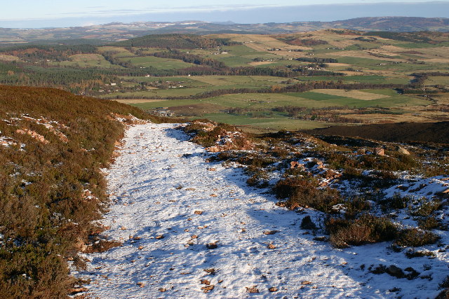
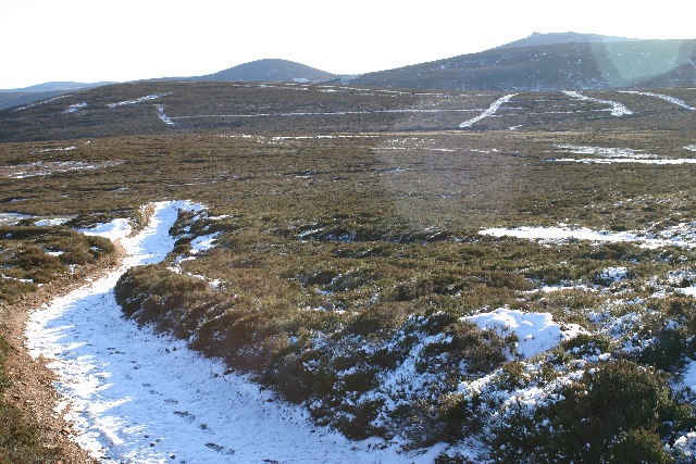
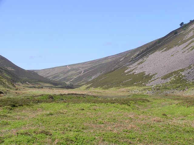
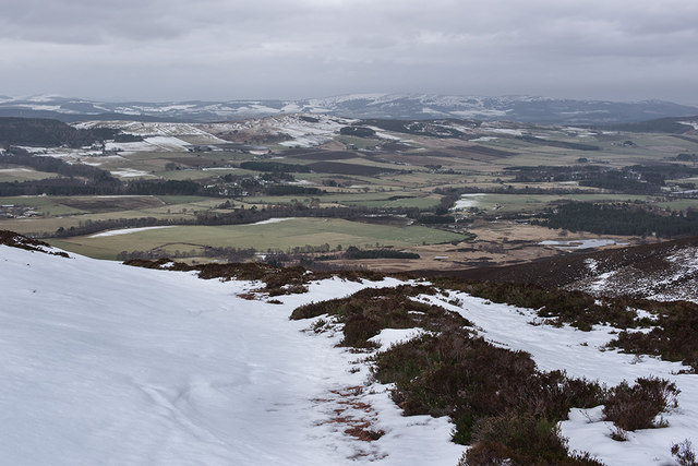
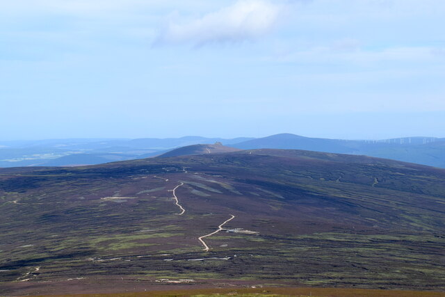
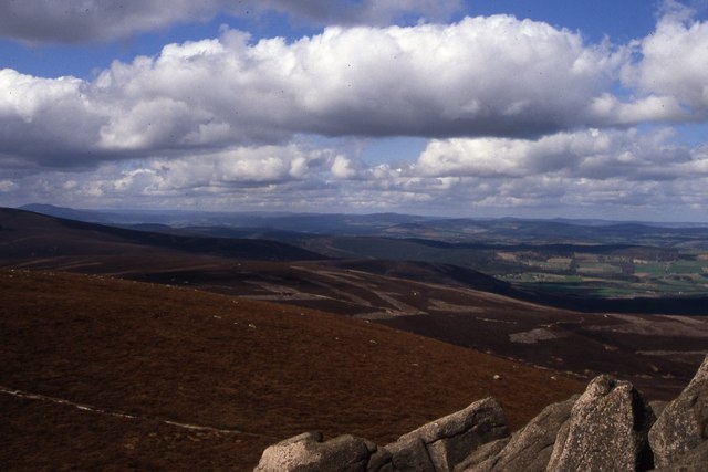
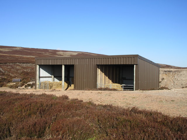
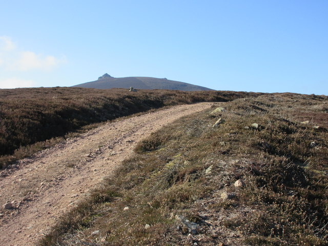
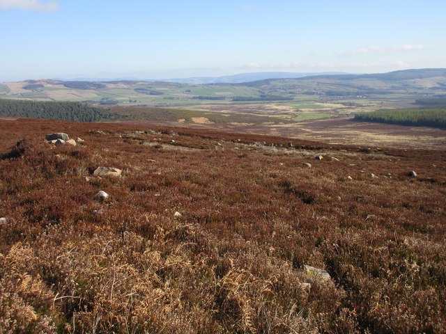
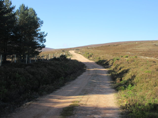
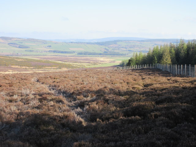
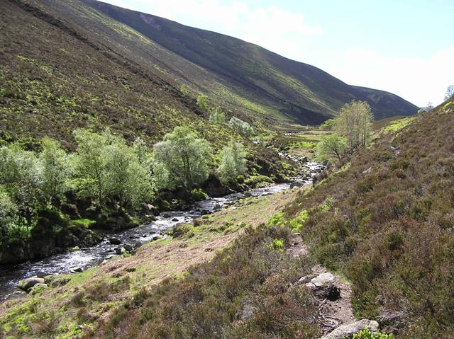
Airy Muir is a picturesque area located in Kincardineshire, Scotland. Nestled amidst rolling hills and vast moorland, this region offers breathtaking views of the surrounding landscape. It is known for its unique combination of downs and Moorland terrain, making it a popular destination for nature enthusiasts and hikers.

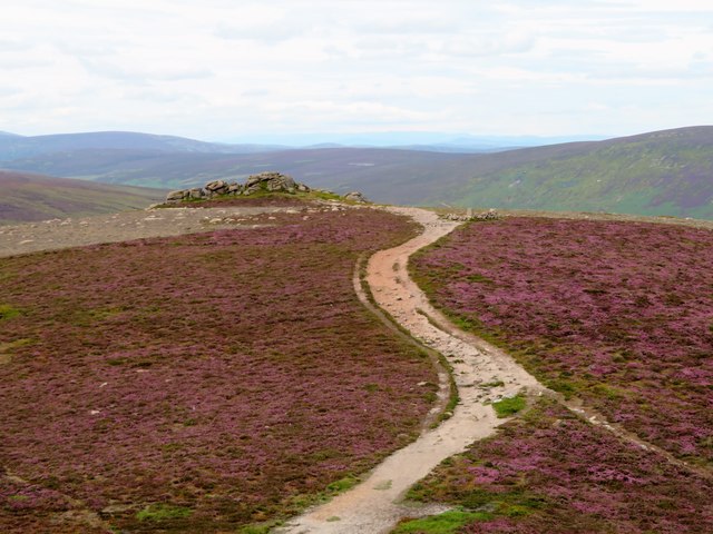
The downs in Airy Muir are characterized by their gentle slopes, covered in lush green grass and dotted with wildflowers during the summer months. These downs provide a scenic backdrop for outdoor activities such as picnicking, sunbathing, and leisurely walks. The tranquility of the downs attracts visitors seeking a peaceful retreat, away from the hustle and bustle of city life.

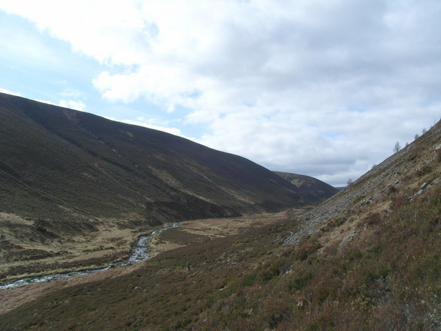
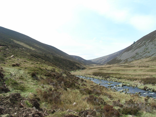
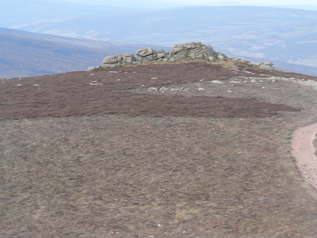
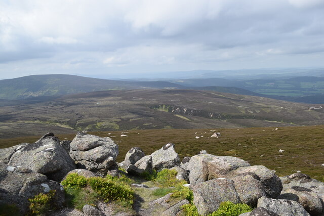
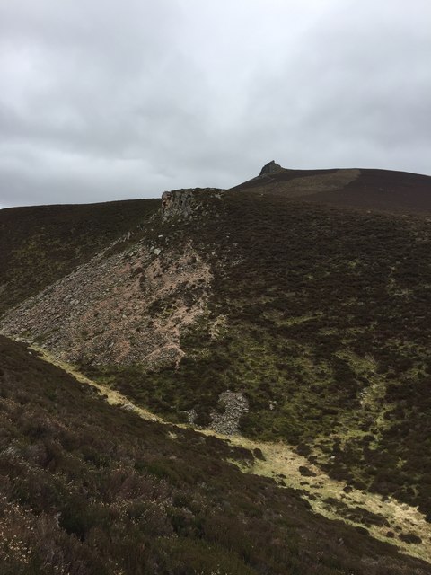
The moorland in Airy Muir offers a more rugged and untouched landscape, with vast expanses of heather and bracken covering the rolling hills. The moorland is home to a diverse range of wildlife, including birds of prey, deer, and various species of plants and flowers. It is a haven for birdwatchers and nature photographers, who can witness the beauty of nature in its purest form.

The area also features several walking trails and hiking routes, allowing visitors to explore the downs and moorland at their own pace. These trails offer stunning panoramic views and glimpses of the local wildlife. Additionally, the nearby River Dee provides opportunities for fishing and boating, adding to the recreational options available in Airy Muir.

Overall, Airy Muir in Kincardineshire is a serene and captivating destination, offering a harmonious blend of downs and moorland that appeals to nature lovers and outdoor enthusiasts alike.

If you have any feedback on the listing, please let us know in the comments section below.

Airy Muir Images

Images are sourced within 2km of 56.985367/-2.6486581 or Grid Reference NO6088. Thanks to Geograph Open Source API. All images are credited.

Moorland track on Peter Hill Looking N from position
Moorland track on Peter Hill
Looking N from position
Moorland on Peter Hill Looking SE from position
Moorland on Peter Hill
Looking SE from position
Water of Aven Looking South-West across the Water of Aven from the southern slope of Creaganducy.
Water of Aven
Looking South-West across the Water of Aven from the southern slope of Creaganducy.
Water of Aven Looking West upstream from the other bank.
Water of Aven
Looking West upstream from the other bank.
Glen Aven
Glen Aven
Clachnaben Tors The Tors on the lesser summit of 579m on the Clachnaben summit plateau.  This hill track leads to the Hill of Edendocher.
My 5th Highland 5

A Highland Five is a hill in the Scottish Highlands between 500m and 609m high with a drop of at least 30m on all sides. from The Mountains of Scotland site
Clachnaben Tors
The Tors on the lesser summit of 579m on the Clachnaben summit plateau. This hill track leads to the Hill of Edendocher. My 5th Highland 5 A Highland Five is a hill in the Scottish Highlands between 500m and 609m high with a drop of at least 30m on all sides. from The Mountains of Scotland site
Track on Peter Hill With Feughside beyond and below
Track on Peter Hill
With Feughside beyond and below
View north from Clachnaben Farmland can be seen in the far distance in the blown -up photo.
View north from Clachnaben
Farmland can be seen in the far distance in the blown -up photo.
Distant view of Clachnaben... ...from some 5.5 km to the west.     Vast swathes of eroded peat are visible in the foreground.
Distant view of Clachnaben...
...from some 5.5 km to the west. Vast swathes of eroded peat are visible in the foreground.
Clacnaben Outcrop A rocky outcrop on the top of Clachnaben near the trig point.
Clacnaben Outcrop
A rocky outcrop on the top of Clachnaben near the trig point.
Slack of Dye The narrow Slack of Dye which forms a steep sided cleft between Mount Shade and Clachnaben as pictured from the path on the slope of Mount Shade. The tor of Clachnaben is seen in the background.
Slack of Dye
The narrow Slack of Dye which forms a steep sided cleft between Mount Shade and Clachnaben as pictured from the path on the slope of Mount Shade. The tor of Clachnaben is seen in the background.
View towards airy Muir from Clachnaben
Shed on Airy Muir Storage shed on the track heading up Airy Muir.
Shed on Airy Muir
Storage shed on the track heading up Airy Muir.
Airy Muir track The bulldozed track heading through the heather up to Airy Muir, with Clachnaben in the distance.
Airy Muir track
The bulldozed track heading through the heather up to Airy Muir, with Clachnaben in the distance.
Heather hillside Looking north-eastwards down the Hill of Westerburn.
Heather hillside
Looking north-eastwards down the Hill of Westerburn.
Beginning of the track up Airy Muir The track leaving Cuttie's Wood and heading up to Airy Muir.
Beginning of the track up Airy Muir
The track leaving Cuttie's Wood and heading up to Airy Muir.
Heather moorland Looking northwards across the heather moorland near The Drummels on the western edge of Cuttie's Wood.
Heather moorland
Looking northwards across the heather moorland near The Drummels on the western edge of Cuttie's Wood.
The Water of Aven The Water of Aven runs from this remote glen to the south of Peter Hill to join the Water of Feugh at Whitestone
The Water of Aven
The Water of Aven runs from this remote glen to the south of Peter Hill to join the Water of Feugh at Whitestone
Show me another place!

Airy Muir is located at Grid Ref: NO6088 (Lat: 56.985367, Lng: -2.6486581)

Unitary Authority: Aberdeenshire

Police Authority: North East

What 3 Words

///showrooms.embellish.classmate. Near Banchory, Aberdeenshire

Nearby Locations

Airy Muir

Related Wikis

Clachnaben

Clachnaben (archaically "Cloch-na'bain"; Scottish Gaelic: "Clach na Beinne") is a 589-metre hill in Glen Dye, Aberdeenshire, Scotland. It is a distinctive...

Easter Clune Castle

Easter Clune Castle is a ruined 16th-century tower house, about 6 miles (9.7 km) south-west of Banchory, Aberdeenshire, Scotland, and south of the Water...

Finzean

Finzean (; Scottish Gaelic: Fìnnean) is a rural community, electoral polling district, community council area and former ecclesiastical parish, which forms...

Water of Aven

The Water of Aven (or A'an) (Scottish Gaelic: an t-Uisge Bàn) is a tributary of the Water of Feugh, itself the largest tributary of the River Dee, Aberdeenshire...

Have you been to Airy Muir?

Leave your review of Airy Muir below (or comments, questions and feedback).