Bruthwaite Forest

Downs, Moorland in Cumberland Carlisle

England

Bruthwaite Forest

Howgill Beck High up the beck
Howgill Beck Credit: Michael Graham

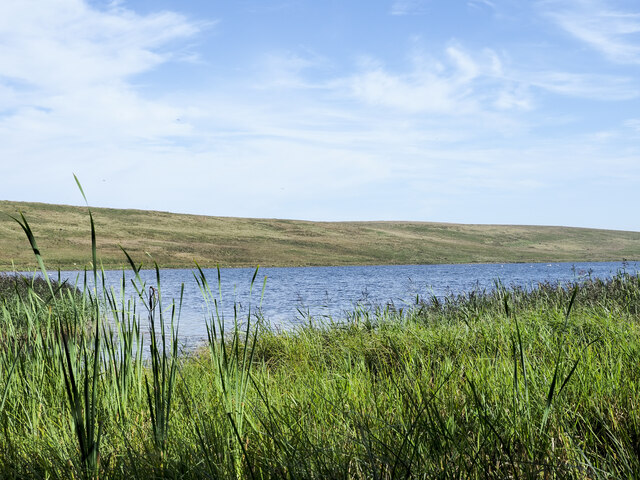
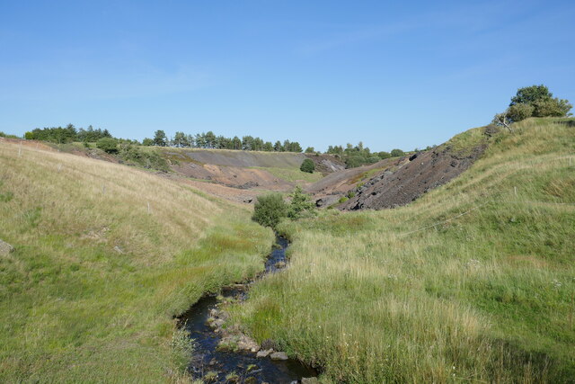
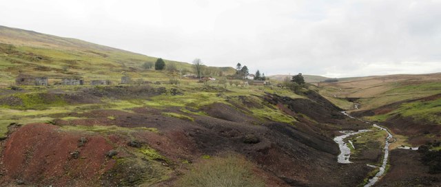
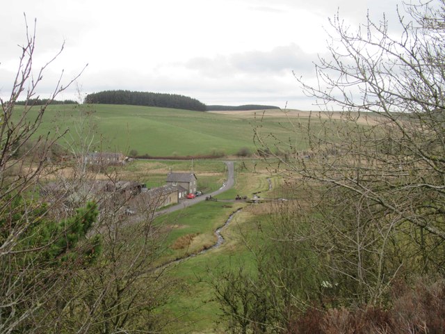
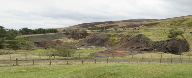
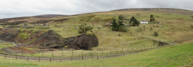
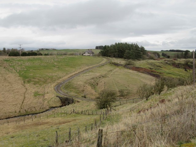
Bruthwaite Forest, located in Cumberland, is a stunning natural landscape that encompasses diverse ecosystems including downs, moorland, and forested areas. Spanning over a vast area, this enchanting forest is renowned for its breathtaking scenery and rich biodiversity.

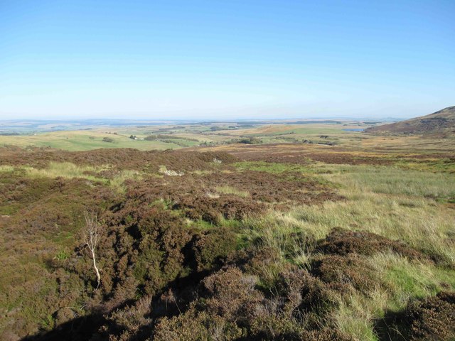
The downs section of Bruthwaite Forest is characterized by rolling hills with an abundance of vibrant wildflowers and grasses. This open landscape provides a perfect habitat for various bird species, including skylarks and meadow pipits. Visitors can enjoy leisurely walks along the downs, taking in the panoramic views of the surrounding countryside.

Moving towards the moorland, the terrain becomes more rugged and dramatic. Heather-covered hills stretch as far as the eye can see, creating a mesmerizing purple carpet during the summer months. This area is home to several species of birds of prey, such as kestrels and buzzards, which can often be spotted soaring above the moorland.

The forested areas of Bruthwaite Forest are a haven for wildlife. Towering oak and beech trees dominate the landscape, providing a perfect habitat for deer, foxes, and a variety of woodland birds. The forest is crisscrossed by numerous walking trails, allowing visitors to explore its hidden corners and immerse themselves in its tranquility.

Bruthwaite Forest is not only a haven for wildlife enthusiasts but also a popular destination for outdoor activities. Hiking, birdwatching, and nature photography are just a few of the activities that visitors can enjoy in this captivating forest.

With its diverse ecosystems and stunning natural beauty, Bruthwaite Forest in Cumberland is a must-visit destination for anyone seeking a true connection with nature.

If you have any feedback on the listing, please let us know in the comments section below.

Bruthwaite Forest Images

Images are sourced within 2km of 54.914803/-2.6148932 or Grid Reference NY6057. Thanks to Geograph Open Source API. All images are credited.

Howgill Beck High up the beck
Howgill Beck
High up the beck
View towards Tindale Tarn
Slopes of Cold Fell The north-western slope of Cold Fell. What appears to be a path rising obliquely is surely in fact a landscape feature, an elongated peat bank.
Slopes of Cold Fell
The north-western slope of Cold Fell. What appears to be a path rising obliquely is surely in fact a landscape feature, an elongated peat bank.
Rough Sike Rushes in the meandering upper reaches of Rough Sike on the north-east side of Cold Fell.
Rough Sike
Rushes in the meandering upper reaches of Rough Sike on the north-east side of Cold Fell.
Tindale Tarn The tarn as seen from a hide at its west end. It's managed as part of the RSPB's Geltsdale reserve.
Tindale Tarn
The tarn as seen from a hide at its west end. It's managed as part of the RSPB's Geltsdale reserve.
Quarry near to Black Burn A striking, disused quarry north-west of Byers Pike seen from the west across the valley of the Black Burn. There's little remaining on the site, just the ruins of a concrete building and the access road.
Les Hull names the feature as Raven Crag Quarry - <a title="https://www.geograph.org.uk/photo/1481511" href="https://www.geograph.org.uk/photo/1481511">Link</a> .
Quarry near to Black Burn
A striking, disused quarry north-west of Byers Pike seen from the west across the valley of the Black Burn. There's little remaining on the site, just the ruins of a concrete building and the access road. Les Hull names the feature as Raven Crag Quarry - Link .
Riggfoot Farm and environs near Tindale A view of this pastoral scene captured from a footpath/cycleway utilising the route of a former railway.

This photograph was taken during the Coronavirus (COVID-19) pandemic of 2020/21/22.
Riggfoot Farm and environs near Tindale
A view of this pastoral scene captured from a footpath/cycleway utilising the route of a former railway. This photograph was taken during the Coronavirus (COVID-19) pandemic of 2020/21/22.
Tarn Beck and the former site of Tindale Spelter and Fume Works An industrial wasteland produced as a result of the production of zinc in the 19 and early 20th century.  Refer to the Historic England entry at <span class="nowrap"><a title="https://historicengland.org.uk/listing/the-list/list-entry/1019761?section=official-list-entry" rel="nofollow ugc noopener" href="https://historicengland.org.uk/listing/the-list/list-entry/1019761?section=official-list-entry">Link</a><img style="margin-left:2px;" alt="External link" title="External link - shift click to open in new window" src="https://s1.geograph.org.uk/img/external.png" width="10" height="10"/></span> for further information.

This photograph was taken during the Coronavirus (COVID-19) pandemic of 2020/21/22.
Tarn Beck and the former site of Tindale Spelter and Fume Works
An industrial wasteland produced as a result of the production of zinc in the 19 and early 20th century. Refer to the Historic England entry at LinkExternal link for further information. This photograph was taken during the Coronavirus (COVID-19) pandemic of 2020/21/22.
Heading down from the summit of Cold Fell Heather moorland, tussocky grassland and peat banks together with hidden gullies do not make for the most pleasant of walking conditions.
Heading down from the summit of Cold Fell
Heather moorland, tussocky grassland and peat banks together with hidden gullies do not make for the most pleasant of walking conditions.
Former Emporium, Tindale Since my last photo of this house it has been sold and restoration to the outside has been carried out.  It much more distinctive in appearance and the restoration has enhanced the appearance of this property.
<a title="https://www.geograph.org.uk/photo/898697" href="https://www.geograph.org.uk/photo/898697">Link</a>
Former Emporium, Tindale
Since my last photo of this house it has been sold and restoration to the outside has been carried out. It much more distinctive in appearance and the restoration has enhanced the appearance of this property. Link
Spoil Heaps from Zinc Mining and Tarn Beck
Riggfoot Farm
Riggfoot Farm
Spoil Heaps from Zinc Mining and Tarn Beck
Spoil Heaps from Zinc Mining and Tarn Beck View towards Bishophill (white house) and Brithwaite Forest.
Spoil Heaps from Zinc Mining and Tarn Beck
View towards Bishophill (white house) and Brithwaite Forest.
Possible Remains of the Zinc Smelt Mill
Bishophill No doubt housed workers from the zinc mine and smelter.
Bishophill
No doubt housed workers from the zinc mine and smelter.
View towards Former Emporium, Tindale Tarn Beck valley.
View towards Former Emporium, Tindale
Tarn Beck valley.
Lime Kiln
Lime Kiln
Show me another place!

Bruthwaite Forest is located at Grid Ref: NY6057 (Lat: 54.914803, Lng: -2.6148932)

Administrative County: Cumbria

District: Carlisle

Police Authority: Cumbria

What 3 Words

///swarm.rocky.prettiest. Near Greenhead, Northumberland

Nearby Locations

Bruthwaite Forest

Related Wikis

Midgeholme

Midgeholme is a hamlet and civil parish in City of Carlisle district, Cumbria, England. At the 2001 census the parish had a population of 67.The parish...

Geltsdale RSPB reserve

Geltsdale RSPB reserve is a nature reserve in Geltsdale, Cumbria, England. The Royal Society for the Protection of Birds manages the site for upland birds...

Tindale, Cumbria

Tindale or Tindale Fell is a hamlet in the parish of Farlam in the City of Carlisle district of the English county of Cumbria. It is to the south of the...

Cold Fell (Pennines)

Cold Fell is a mountain in the northern Pennines, in Cumbria, England. Lying among the northernmost uplands of the North Pennines AONB, it is the most...

Hallbankgate

Hallbankgate is a village in Cumbria, England, 13 miles (21 km) east of Carlisle. A former coal and lead mining village, it straddles the A689 Brampton...

Midgeholme Coalfield

The Midgeholme Coalfield is a coalfield in Midgeholme, on the border of Cumbria with Northumberland in northern England. It is the largest of a series...

Geltsdale & Glendue Fells

Geltsdale & Glendue Fells is a Site of Special Scientific Interest in the North Pennines, England. The site has an area of 8059 ha, partly in Cumbria...

Halton Lea Gate

Halton Lea Gate is a small village in Northumberland, England, on the A689 road close to the boundary of the counties of Northumberland and Cumbria. The...

Nearby Amenities

Located within 500m of 54.914803,-2.6148932
Man Made: cairn
Lat/Long: 54.9112473/-2.6182067
Man Made: cairn
Lat/Long: 54.9108074/-2.6133133
The data included in this document is from www.openstreetmap.org. The data is made available under ODbL.

Have you been to Bruthwaite Forest?

Leave your review of Bruthwaite Forest below (or comments, questions and feedback).