Holdron Moss

Downs, Moorland in Lancashire Lancaster

England

Holdron Moss

Grouse Butt, Higher Dry Clough Grouse butt used as a hide / wind break for grouse shooting. This particular one is lower down the hillside than the series of grouse butts indicated on the 1:25k OS map.
Grouse Butt, Higher Dry Clough Credit: Robin

Holdron Moss is a picturesque and expansive area located in Lancashire, England. It is renowned for its stunning natural beauty, characterized by its unique combination of downs and moorland landscapes. Covering a significant area, Holdron Moss offers a diverse and captivating environment for visitors to explore.

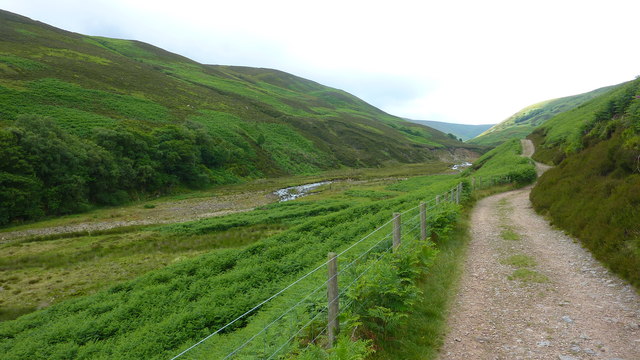
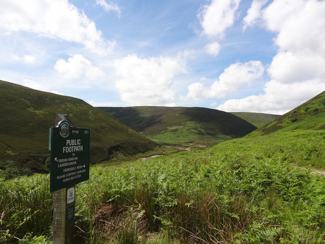
The downs of Holdron Moss are characterized by their rolling hills, lush greenery, and open vistas. These spacious grasslands provide a perfect setting for picnicking, nature walks, and leisurely strolls. The downs are home to a variety of plant species, including wildflowers, heather, and grasses, creating a vibrant and colorful tapestry throughout the seasons.

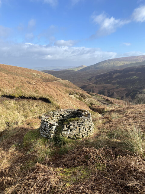
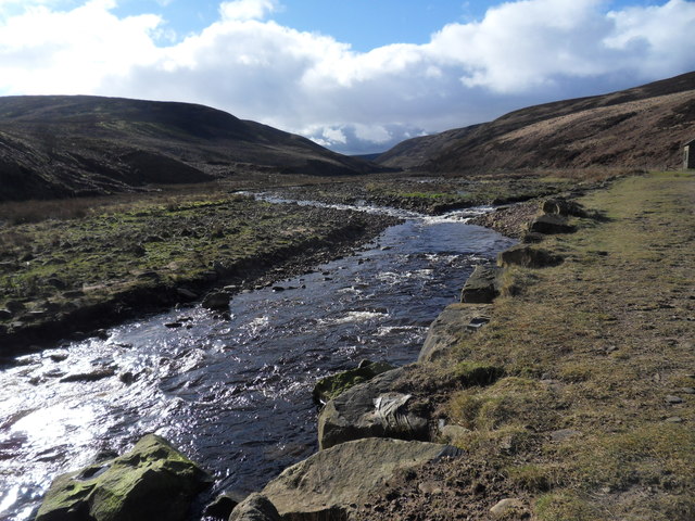
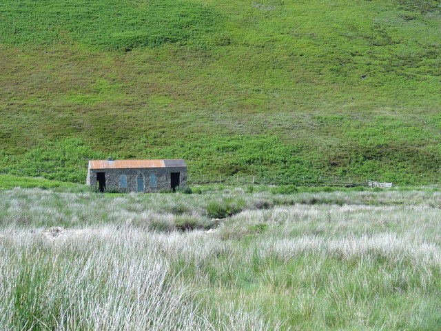
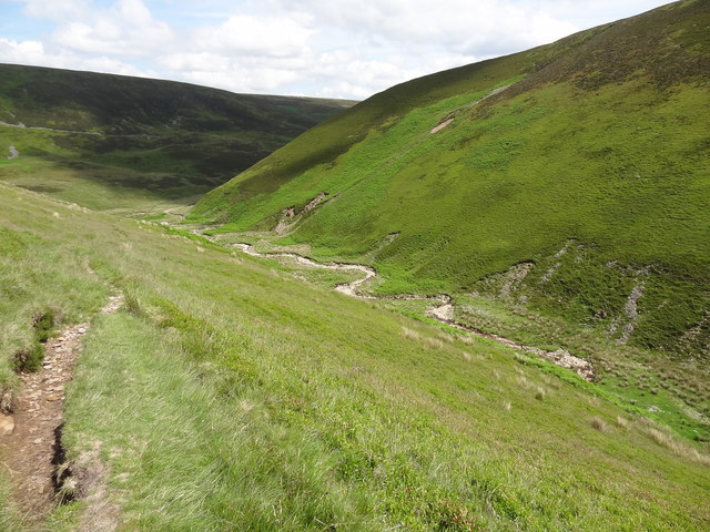
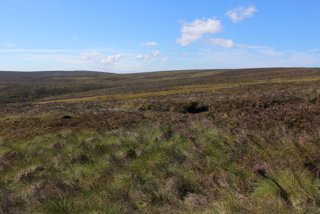
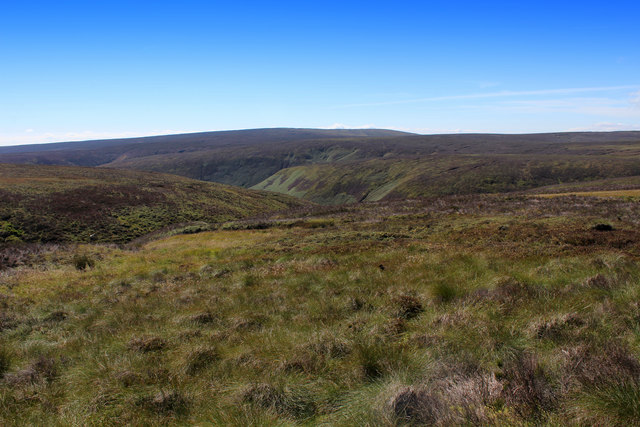
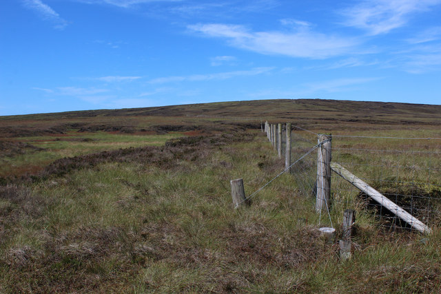
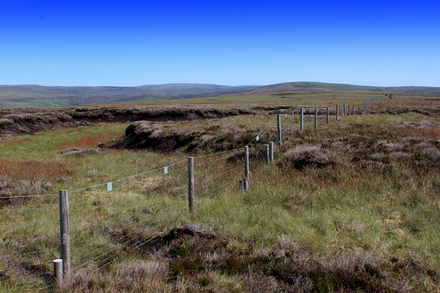
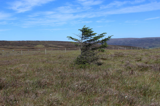
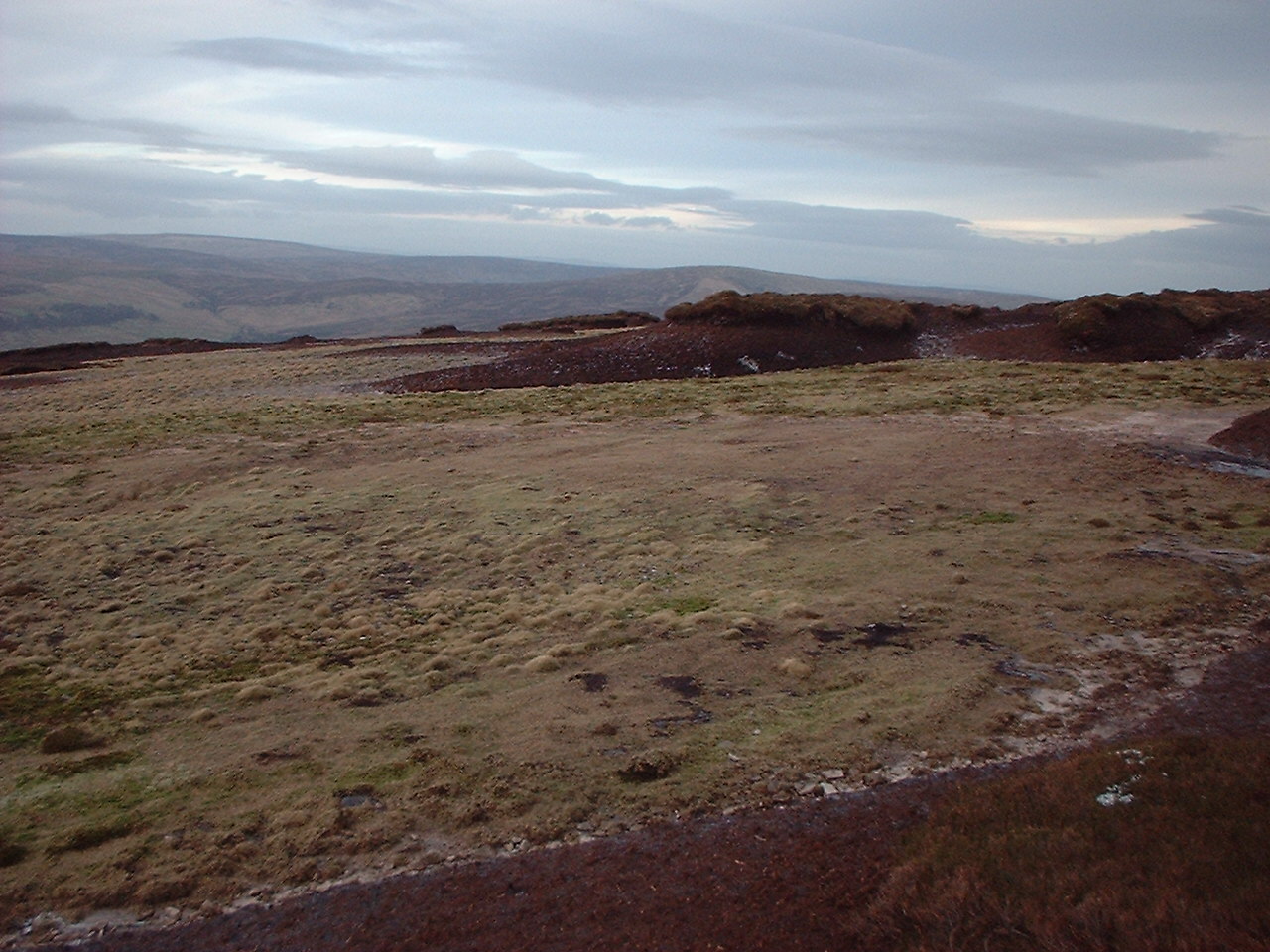
In contrast, the moorland of Holdron Moss offers a more rugged and untamed atmosphere. Here, visitors can witness the awe-inspiring beauty of vast open spaces, extensive heathlands, and peat bogs. The moorland is home to an array of wildlife, including birds of prey, sheep, and various species of insects. Adventurous hikers can traverse the moorland's challenging terrain, enjoying breathtaking panoramic views and immersing themselves in the tranquility of the surroundings.

Holdron Moss is also renowned for its rich history, with archaeological remains dating back thousands of years. Ancient burial sites, stone circles, and remnants of settlements can be found throughout the area, providing a glimpse into the region's fascinating past.

Overall, Holdron Moss in Lancashire offers visitors a unique opportunity to experience the beauty and diversity of both downs and moorland landscapes. Whether it's a leisurely stroll through the downs or an adventurous hike across the moorland, this area never fails to captivate with its natural splendor and historical significance.

If you have any feedback on the listing, please let us know in the comments section below.

Holdron Moss Images

Images are sourced within 2km of 53.95811/-2.6026744 or Grid Reference SD6051. Thanks to Geograph Open Source API. All images are credited.

Grouse Butt, Higher Dry Clough Grouse butt used as a hide / wind break for grouse shooting. This particular one is lower down the hillside than the series of grouse butts indicated on the 1:25k OS map.
Grouse Butt, Higher Dry Clough
Grouse butt used as a hide / wind break for grouse shooting. This particular one is lower down the hillside than the series of grouse butts indicated on the 1:25k OS map.
United Utilities Building Along Langden Valley
Langden Brook
Langden Brook
Langden Brook near the confluence with Little Harden Clough Little Harden Clough joins Langden Brook from the south (left). The words clough and brook both derive from Old English but the former term, which refers to a steep stream and its ravine, seems more restricted to the north of England. There was heavy snow in Lancashire the day before this photo was taken but not even a flake is visible today.
Langden Brook near the confluence with Little Harden Clough
Little Harden Clough joins Langden Brook from the south (left). The words clough and brook both derive from Old English but the former term, which refers to a steep stream and its ravine, seems more restricted to the north of England. There was heavy snow in Lancashire the day before this photo was taken but not even a flake is visible today.
Langden Castle OS map days "Langden Castle (ruin)" but it's not a castle and it's not a ruin.  Probably originally a shooting lodge.  not sure what it's used for now but it's well secured.
Langden Castle
OS map days "Langden Castle (ruin)" but it's not a castle and it's not a ruin. Probably originally a shooting lodge. not sure what it's used for now but it's well secured.
The path towards Fiendsdale Head Peaks and Northern Footpaths Society signpost no. 418
The path towards Fiendsdale Head
Peaks and Northern Footpaths Society signpost no. 418
Fiendsdale meanders Fiendsdale Water meanders before it joins Langden Beck.
Fiendsdale meanders
Fiendsdale Water meanders before it joins Langden Beck.
Relics at the memorial A few small pieces of twisted alloy at <a href="https://www.geograph.org.uk/photo/4264062">SD6150 : New air crash memorial, Langden Valley</a>. Presumably, they are aircraft wreckage collected from one or all of the crash sites.
Relics at the memorial
A few small pieces of twisted alloy at SD6150 : New air crash memorial, Langden Valley. Presumably, they are aircraft wreckage collected from one or all of the crash sites.
Blanket Bog on Top of Blaze Moss This is the summit of Blaze Moss - a desperate place of peat bog, groughs and hags.
There is a sign on the northern flank that points in an alternative direction over featureless moor to avoid these bogs - still think it is safer to keep to the fence.
Blanket Bog on Top of Blaze Moss
This is the summit of Blaze Moss - a desperate place of peat bog, groughs and hags. There is a sign on the northern flank that points in an alternative direction over featureless moor to avoid these bogs - still think it is safer to keep to the fence.
Fencing on Top of Blaze Moss In this featureless landscape, clinging to the fences helps the walker with his bearings.
Fencing on Top of Blaze Moss
In this featureless landscape, clinging to the fences helps the walker with his bearings.
On the Southern Flanks of Blaze Moss Looking south east along the line of the fence
On the Southern Flanks of Blaze Moss
Looking south east along the line of the fence
Fence on the Southern Flanks of Blaze Moss
Langden Castle Fancy shooting hut, Forest of Bowland.
Langden Castle
Fancy shooting hut, Forest of Bowland.
Moorland above Dead Man's Stake Clough Sweeping and tractless moorland
Moorland above Dead Man's Stake Clough
Sweeping and tractless moorland
Moorland above Stake Clough
Boundary Fence on Lingy Pits The fence heading across lonely peat moor towards Hawthornthwaite Fell Top
Boundary Fence on Lingy Pits
The fence heading across lonely peat moor towards Hawthornthwaite Fell Top
On Lingy Pits Lonely moorland in the form of peat groughs and haggs crossed by a boundary fence
On Lingy Pits
Lonely moorland in the form of peat groughs and haggs crossed by a boundary fence
Solitary Conifer on Lingy Pits The only tree in sight.
Closer examination reveals it is probably a Norwegian Spruce.
Solitary Conifer on Lingy Pits
The only tree in sight. Closer examination reveals it is probably a Norwegian Spruce.
Show me another place!

Holdron Moss is located at Grid Ref: SD6051 (Lat: 53.95811, Lng: -2.6026744)

Administrative County: Lancashire

District: Lancaster

Police Authority: Lancashire

What 3 Words

///objective.stockpile.rainwater. Near Bay Horse, Lancashire

Nearby Locations

Black Clough Holdron Moss

Related Wikis

Forest of Bowland

The Forest of Bowland, also known as the Bowland Fells and formerly the Chase of Bowland, is an area of gritstone fells, deep valleys and peat moorland...

National nature reserves in Lancashire

National nature reserves in Lancashire in England are established by Natural England. There are two national nature reserves in Lancashire, both of which...

Grey Stone of Trough

The Grey Stone of Trough is an historic boundary marker in Bowland Forest High, in the Trough of Bowland, Lancashire, England. A Grade II listed structure...

Trough of Bowland

The Trough of Bowland is a valley and high pass in the Forest of Bowland Area of Outstanding Natural Beauty, Lancashire, England. The pass, reaching 968...

Hawthornthwaite Fell

Hawthornthwaite Fell is one of the larger hills in the Forest of Bowland in the north west of England. Hawthornthwaite Fell marks the extreme western limit...

Sykes Smelt Mill

Sykes Smelt Mill was a mediaeval mill located between Sykes and Hareden in Bowland Forest High, Lancashire, England. It stood on the banks of Langden Brook...

Abbeystead House

Abbeystead House is a large country house to the east of the village of Abbeystead, Lancashire, England, some 12 km (7 miles) south-east of Lancaster....

William Molyneux, 4th Earl of Sefton

William Philip Molyneux, 4th Earl of Sefton, (14 October 1835 – 27 June 1897) was a British peer. == Biography == Born Viscount Molyneux, he was the eldest...

Nearby Amenities

Located within 500m of 53.95811,-2.6026744
Holdron Moss
Natural: peak
Source: npe
Lat/Long: 53.9583671/-2.5992948
The data included in this document is from www.openstreetmap.org. The data is made available under ODbL.

Have you been to Holdron Moss?

Leave your review of Holdron Moss below (or comments, questions and feedback).