White Side of Tarnbrook Fell

Downs, Moorland in Lancashire Lancaster

England

White Side of Tarnbrook Fell

Hungry Sheep On Hind Hill, they looked a bit cold. Taken from near Pennington Wood looking towards Tarnbrook Fell. Should be the last Geograph for Hectad SD55.
Hungry Sheep Credit: Michael Graham

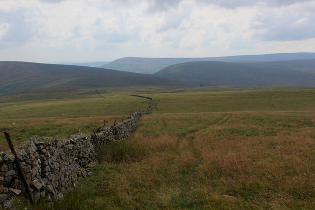
White Side of Tarnbrook Fell is a prominent hill located in the county of Lancashire, England. Situated within the Forest of Bowland Area of Outstanding Natural Beauty, this area is renowned for its picturesque landscapes and diverse natural habitats.

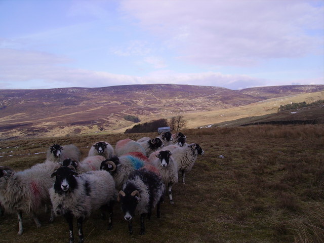
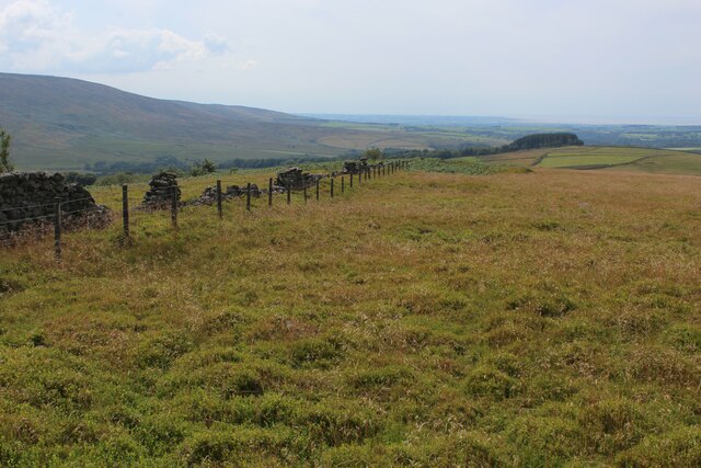
Standing at an altitude of approximately 482 meters (1,581 feet), White Side offers spectacular views of the surrounding countryside, including the Tarnbrook Valley, the Bowland Fells, and the Irish Sea on a clear day. The hill is predominantly covered in heather moorland, which creates a vibrant purple hue during the summer months.

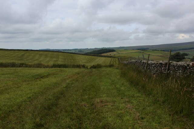
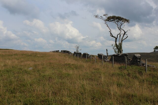
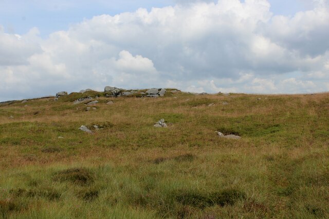
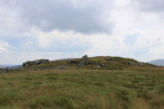
The terrain of White Side is characterized by undulating slopes, rocky outcrops, and peat bogs, making it an attractive destination for hikers, nature enthusiasts, and photographers alike. It is home to a variety of plant and animal species, including mountain hare, red grouse, and bilberry.

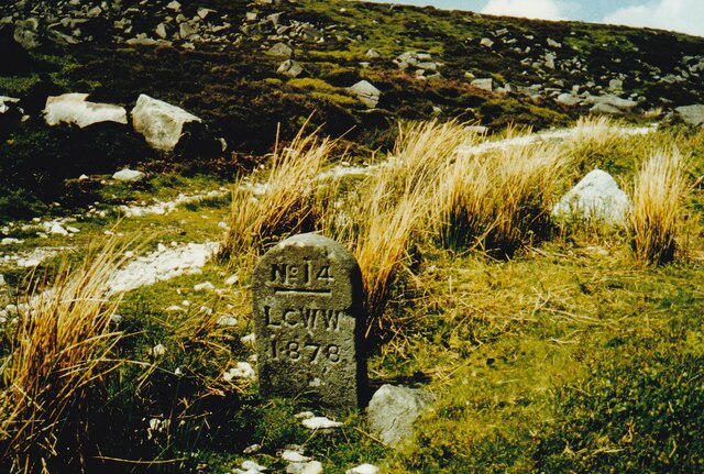
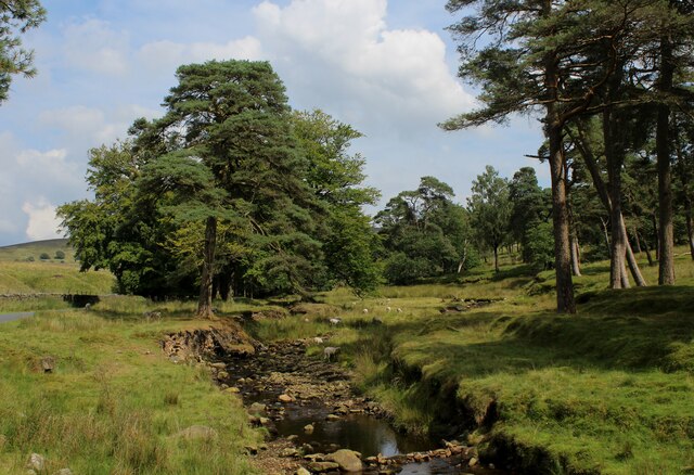
The area surrounding White Side is also rich in historical significance. The hill was once part of the Royal Hunting Forest of Bowland in medieval times, and remnants of ancient packhorse trails can still be seen. Additionally, the nearby Tarnbrook Wyre, a small river, meanders through the valley, providing a tranquil setting for visitors to enjoy.

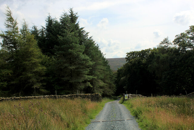
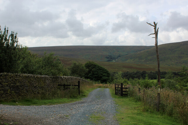
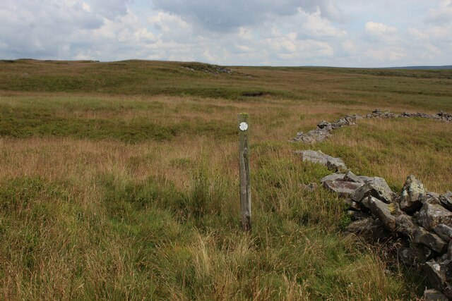
Access to White Side of Tarnbrook Fell is available via several footpaths and bridleways, allowing visitors to explore the beauty of this unspoiled landscape. It serves as a fantastic location for outdoor activities such as walking, birdwatching, and photography, offering a peaceful retreat for all who venture to this stunning corner of Lancashire.

If you have any feedback on the listing, please let us know in the comments section below.

White Side of Tarnbrook Fell Images

Images are sourced within 2km of 53.997036/-2.6044571 or Grid Reference SD6055. Thanks to Geograph Open Source API. All images are credited.

Hungry Sheep On Hind Hill, they looked a bit cold. Taken from near Pennington Wood looking towards Tarnbrook Fell. Should be the last Geograph for Hectad SD55.
Hungry Sheep
On Hind Hill, they looked a bit cold. Taken from near Pennington Wood looking towards Tarnbrook Fell. Should be the last Geograph for Hectad SD55.
Old Boundary Marker on Tarnbrook Fell, Over Wyresdale Water Company Boundary Marker beside a track on Tarnbrook Fell. Over Wyresdale parish. This marks a Lancaster Corporation Water Works pipeline to Damas Gill reservoir.

Milestone Society National ID: LA_LCWW14em
Old Boundary Marker on Tarnbrook Fell, Over Wyresdale
Water Company Boundary Marker beside a track on Tarnbrook Fell. Over Wyresdale parish. This marks a Lancaster Corporation Water Works pipeline to Damas Gill reservoir. Milestone Society National ID: LA_LCWW14em
Marshaw Wyre looking Upstream The river near Tower Lodge, enclosed by a delightful strip of woodland along side the Trough Road in Bowland
Marshaw Wyre looking Upstream
The river near Tower Lodge, enclosed by a delightful strip of woodland along side the Trough Road in Bowland
Tower Lodge Located on the Trough Road beside the Marshaw Wyre river.
Built as the lodge house for the uncompleted Wyresdale Tower Shooting House, and now a Grade II Listed Building.
The Wyre Way long distance footpath passes up the track to the left, giving access to the fells around Tarnbrook.
Tower Lodge
Located on the Trough Road beside the Marshaw Wyre river. Built as the lodge house for the uncompleted Wyresdale Tower Shooting House, and now a Grade II Listed Building. The Wyre Way long distance footpath passes up the track to the left, giving access to the fells around Tarnbrook.
Wyre Way descending into Tower Plantation Adopted a well appointed track that descends through plantation to Tower Lodge on the Trough Road
Wyre Way descending into Tower Plantation
Adopted a well appointed track that descends through plantation to Tower Lodge on the Trough Road
Descending towards Tower Plantation
Field beside White Moor
Beside High Tower Plantation There seems to be very few trees left standing in the plantation - just one or two straggly specimens.
The permissive path of this side of the wall is a trial. Uneven and narrow, when visible, smothered in bilberry bushes or head high bracken on much of its length.
Beside High Tower Plantation
There seems to be very few trees left standing in the plantation - just one or two straggly specimens. The permissive path of this side of the wall is a trial. Uneven and narrow, when visible, smothered in bilberry bushes or head high bracken on much of its length.
Permissive Footpath beside High Tower Plantation On the permissive footpath between Millers House and White Moor. A difficult and uneven path, most of which cannot be followed - at this point smothered by bilberry bushes, soft vegetation that hides a myriad of obstacles. Further on, head high bracken is encountered.
Permissive Footpath beside High Tower Plantation
On the permissive footpath between Millers House and White Moor. A difficult and uneven path, most of which cannot be followed - at this point smothered by bilberry bushes, soft vegetation that hides a myriad of obstacles. Further on, head high bracken is encountered.
Permissive Path above Harthole Plantation The path between Millers House and White Moor has the odd solitary indicator, but does not exist in physical form for much of its length.
Permissive Path above Harthole Plantation
The path between Millers House and White Moor has the odd solitary indicator, but does not exist in physical form for much of its length.
Permissive Footpath to Millers House Unseen to the naked eye, the extremely faint path is buried beneath bilberry bushes and other species of soft moorland vegetation.
Permissive Footpath to Millers House
Unseen to the naked eye, the extremely faint path is buried beneath bilberry bushes and other species of soft moorland vegetation.
Approaching Millers House from the North Basically a small rounded hillock, surmounted with gritstone outcrops. I saw no evidence of a man-made structure, hereabouts.
Approaching Millers House from the North
Basically a small rounded hillock, surmounted with gritstone outcrops. I saw no evidence of a man-made structure, hereabouts.
Fingerpost at Millers House The indicated footpaths are patchy beside the wall, and the one across to White Moor non existent along most of its length
Fingerpost at Millers House
The indicated footpaths are patchy beside the wall, and the one across to White Moor non existent along most of its length
Gritstone Outcrops at Millers House
Summit of Brennand Great Hill A faint grassy track and dry stone boundary wall cross over the summit at 1,555 ft above sea level.
Summit of Brennand Great Hill
A faint grassy track and dry stone boundary wall cross over the summit at 1,555 ft above sea level.
Elephant Rock Gritstone boulder on Brennand Great Hill - shaped like an elephant's head.
Elephant Rock
Gritstone boulder on Brennand Great Hill - shaped like an elephant's head.
Descending off Brennand Great Hill Following the boundary wall towards Millers House
Descending off Brennand Great Hill
Following the boundary wall towards Millers House
Looking North from Brennand Great Hill Looking over a stark landscape of naked peat, bog and tundra moor.
There are a huge number of seagulls of varied assortments that congregate around this location, known as "The Gullery". Apparently over 50,000 arrive around springtime to breed, making a mess that is all too obvious.
They are protected, I believe, although they discourage more native birds like curlew and lapwing from thriving through theft of eggs and chicks.
If you are thinking of stopping to have a sandwich between Brennand Great Hill and Wolfhole Crag - perhaps think again.
Looking North from Brennand Great Hill
Looking over a stark landscape of naked peat, bog and tundra moor. There are a huge number of seagulls of varied assortments that congregate around this location, known as "The Gullery". Apparently over 50,000 arrive around springtime to breed, making a mess that is all too obvious. They are protected, I believe, although they discourage more native birds like curlew and lapwing from thriving through theft of eggs and chicks. If you are thinking of stopping to have a sandwich between Brennand Great Hill and Wolfhole Crag - perhaps think again.
Show me another place!

White Side of Tarnbrook Fell is located at Grid Ref: SD6055 (Lat: 53.997036, Lng: -2.6044571)

Administrative County: Lancashire

District: Lancaster

Police Authority: Lancashire

What 3 Words

///sneezed.threading.clumped. Near Caton, Lancashire

Related Wikis

Ward's Stone

Ward's Stone is the highest hill in the Forest of Bowland, England. Its flat top hides two trig points nearly a kilometre apart. The western trig point...

Grey Stone of Trough

The Grey Stone of Trough is an historic boundary marker in Bowland Forest High, in the Trough of Bowland, Lancashire, England. A Grade II listed structure...

Wolfhole Crag

Wolfhole Crag is a lonely and seldom-visited hill in the Forest of Bowland in Lancashire, England. Its seclusion is due in part to its low profile and...

National nature reserves in Lancashire

National nature reserves in Lancashire in England are established by Natural England. There are two national nature reserves in Lancashire, both of which...

Brennand Farm

Brennand Farm is often claimed to be the true centre of Great Britain. This is about seven kilometres north-west of Dunsop Bridge - which has the nearest...

Trough of Bowland

The Trough of Bowland is a valley and high pass in the Forest of Bowland Area of Outstanding Natural Beauty, Lancashire, England. The pass, reaching 968...

Grizedale Bridge

Grizedale Bridge is a Grade II listed bridge in the English parish of Over Wyresdale, Lancashire. The structure, which dates to the 19th century, carries...

Abbeystead House

Abbeystead House is a large country house to the east of the village of Abbeystead, Lancashire, England, some 12 km (7 miles) south-east of Lancaster....

Nearby Amenities

Located within 500m of 53.997036,-2.6044571
Little Crag
Place: locality
Lat/Long: 53.9970267/-2.6113343
Swine Crag
Place: locality
Lat/Long: 53.9971623/-2.6026654
The data included in this document is from www.openstreetmap.org. The data is made available under ODbL.

Have you been to White Side of Tarnbrook Fell?

Leave your review of White Side of Tarnbrook Fell below (or comments, questions and feedback).