Muir of Turtory

Downs, Moorland in Banffshire

Scotland

Muir of Turtory

Bellman's Wood Recumbent Stone Circle (4) This Ordnance Survey bench mark has been carved, in what archaeologists have described as an act of vandalism, on the upper surface of the fallen west flanker of the stone circle. See <span class="nowrap"><a title="https://canmore.org.uk/site/18427/bellmans-wood" rel="nofollow ugc noopener" href="https://canmore.org.uk/site/18427/bellmans-wood">Link</a><img style="margin-left:2px;" alt="External link" title="External link - shift click to open in new window" src="https://s1.geograph.org.uk/img/external.png" width="10" height="10"/></span> for more information. <a href="https://www.geograph.org.uk/photo/4743217">NJ6050 : Bellman's Wood Recumbent Stone Circle (1)</a>
Bellman's Wood Recumbent Stone Circle (4) Credit: Anne Burgess

Muir of Turtory is a picturesque area located in Banffshire, Scotland, renowned for its stunning downs and moorland landscapes. Spanning approximately 10 square miles, this rural region offers visitors a tranquil escape from the hustle and bustle of city life.

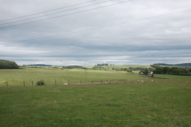
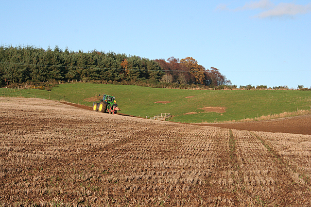
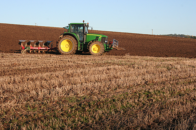
The downs of Muir of Turtory are characterized by their gently rolling hills and expansive grasslands. These open spaces provide an ideal habitat for a diverse range of plants and wildlife, making it a popular spot for nature enthusiasts and bird watchers. Visitors can expect to encounter native species such as red grouse, curlews, and golden plovers, as well as an array of wildflowers during the warmer months.

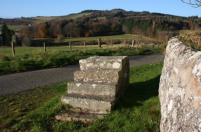
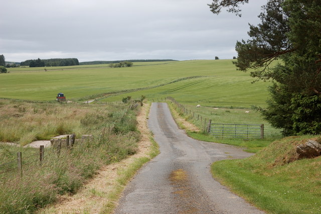
In addition to its downs, the moorland of Muir of Turtory adds to the area's natural beauty. This rugged terrain is defined by its heather-covered hills, bogs, and small lochs. Hikers and outdoor enthusiasts will find a network of trails that crisscross the moorland, offering stunning panoramic views of the surrounding countryside.

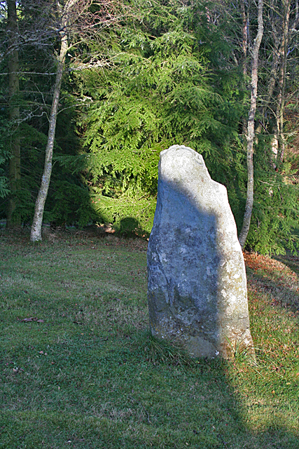
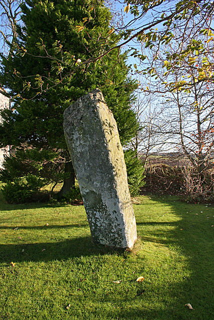
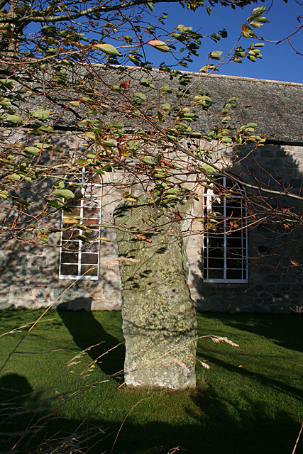
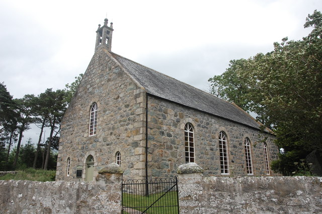
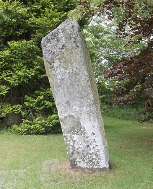
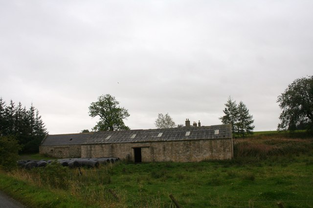
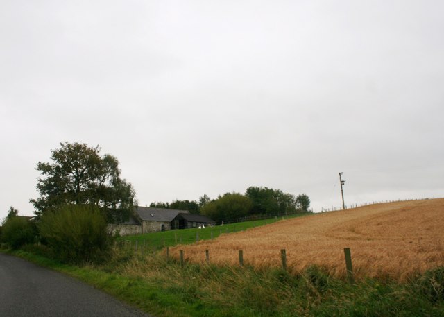
Muir of Turtory also holds historical significance, with traces of ancient settlements and archaeological sites scattered throughout the landscape. The area's rich history can be explored through visits to nearby attractions such as standing stones, cairns, and the ruins of old crofts.

With its idyllic downs, captivating moorland, and historical charm, Muir of Turtory offers visitors a unique opportunity to immerse themselves in the natural and cultural heritage of Banffshire. Whether it's a leisurely walk, birdwatching, or a deep dive into history, this tranquil haven has something to offer for everyone seeking a peaceful retreat in the heart of Scotland.

If you have any feedback on the listing, please let us know in the comments section below.

Muir of Turtory Images

Images are sourced within 2km of 57.525035/-2.6726405 or Grid Reference NJ5948. Thanks to Geograph Open Source API. All images are credited.

Bellman's Wood Recumbent Stone Circle (4) This Ordnance Survey bench mark has been carved, in what archaeologists have described as an act of vandalism, on the upper surface of the fallen west flanker of the stone circle. See <span class="nowrap"><a title="https://canmore.org.uk/site/18427/bellmans-wood" rel="nofollow ugc noopener" href="https://canmore.org.uk/site/18427/bellmans-wood">Link</a><img style="margin-left:2px;" alt="External link" title="External link - shift click to open in new window" src="https://s1.geograph.org.uk/img/external.png" width="10" height="10"/></span> for more information. <a href="https://www.geograph.org.uk/photo/4743217">NJ6050 : Bellman's Wood Recumbent Stone Circle (1)</a>
Bellman's Wood Recumbent Stone Circle (4)
This Ordnance Survey bench mark has been carved, in what archaeologists have described as an act of vandalism, on the upper surface of the fallen west flanker of the stone circle. See LinkExternal link for more information. NJ6050 : Bellman's Wood Recumbent Stone Circle (1)
Standing Stone This stone stands outside the wall surrounding the kirk. There is a suggestion that it once formed part of a stone circle where the kirk now is, but was moved and re-erected here. See <span class="nowrap"><a title="https://canmore.org.uk/site/17915/st-marnans-chair" rel="nofollow ugc noopener" href="https://canmore.org.uk/site/17915/st-marnans-chair">Link</a><img style="margin-left:2px;" alt="External link" title="External link - shift click to open in new window" src="https://s1.geograph.org.uk/img/external.png" width="10" height="10"/></span> for more information.
Standing Stone
This stone stands outside the wall surrounding the kirk. There is a suggestion that it once formed part of a stone circle where the kirk now is, but was moved and re-erected here. See LinkExternal link for more information.
St Marnan's Chair Either St Marnan was a very odd shape, or perhaps he was into pole-sitting. This un-chair-like standing stone is in the grounds of St Marnan's Kirk. It may have formed part of an ancient stone circle. See <span class="nowrap"><a title="https://canmore.org.uk/site/17915/st-marnans-chair" rel="nofollow ugc noopener" href="https://canmore.org.uk/site/17915/st-marnans-chair">Link</a><img style="margin-left:2px;" alt="External link" title="External link - shift click to open in new window" src="https://s1.geograph.org.uk/img/external.png" width="10" height="10"/></span> for more information.
St Marnan's Chair
Either St Marnan was a very odd shape, or perhaps he was into pole-sitting. This un-chair-like standing stone is in the grounds of St Marnan's Kirk. It may have formed part of an ancient stone circle. See LinkExternal link for more information.
St Marnan's Kirk This is the parish kirk of Marnoch, built in 1782. It replaced an earlier building further down near the river, where the kirkyard is. See <span class="nowrap"><a title="http://www.scottishchurches.org.uk/sites/site/id/703/name/Marnoch+Old+Parish+Church+Marnoch+Grampian" rel="nofollow ugc noopener" href="http://www.scottishchurches.org.uk/sites/site/id/703/name/Marnoch+Old+Parish+Church+Marnoch+Grampian">Link</a><img style="margin-left:2px;" alt="External link" title="External link - shift click to open in new window" src="https://s1.geograph.org.uk/img/external.png" width="10" height="10"/></span> for more information.
St Marnan's Kirk
This is the parish kirk of Marnoch, built in 1782. It replaced an earlier building further down near the river, where the kirkyard is. See LinkExternal link for more information.
Marnoch Parish Kirk Dedicated to St Marnan, built in 1782 and still in use. The trees make it difficult to photograph well, but <a href="https://www.geograph.org.uk/photo/391947">NJ5950 : Marnoch old church</a> is an older view. See <span class="nowrap"><a title="http://www.scottishchurches.org.uk/sites/site/id/703/name/Marnoch+Old+Parish+Church+Marnoch+Grampian" rel="nofollow ugc noopener" href="http://www.scottishchurches.org.uk/sites/site/id/703/name/Marnoch+Old+Parish+Church+Marnoch+Grampian">Link</a><img style="margin-left:2px;" alt="External link" title="External link - shift click to open in new window" src="https://s1.geograph.org.uk/img/external.png" width="10" height="10"/></span> for more information.
Marnoch Parish Kirk
Dedicated to St Marnan, built in 1782 and still in use. The trees make it difficult to photograph well, but NJ5950 : Marnoch old church is an older view. See LinkExternal link for more information.
St Marnan's Chair Either St Marnan was a very odd shape, or perhaps he was into pole-sitting. This un-chair-like standing stone is in the grounds of St Marnan's Kirk. It may have formed part of an ancient stone circle. See <span class="nowrap"><a title="https://canmore.org.uk/site/17915/st-marnans-chair" rel="nofollow ugc noopener" href="https://canmore.org.uk/site/17915/st-marnans-chair">Link</a><img style="margin-left:2px;" alt="External link" title="External link - shift click to open in new window" src="https://s1.geograph.org.uk/img/external.png" width="10" height="10"/></span> for more information.
St Marnan's Chair
Either St Marnan was a very odd shape, or perhaps he was into pole-sitting. This un-chair-like standing stone is in the grounds of St Marnan's Kirk. It may have formed part of an ancient stone circle. See LinkExternal link for more information.
Loupin-on Stane This mounting block stands just outside the kirkyard wall at Marnoch Parish Kirk.
Loupin-on Stane
This mounting block stands just outside the kirkyard wall at Marnoch Parish Kirk.
Marnoch Old Kirk This handsome rectangular kirk replaced St Marnoch's (old) Church, situated a few hundred metres to the southwest, in around 1790.  The bell, presumably from the old church, is dated 1747.  The congregation 'came out' in 1841 in a row over patronage and established a new church (confusingly called New Marnoch Church) at the planned village of Aberchirder, about 3km to the northeast (see: <a title="https://www.geograph.org.uk/photo/5450589" href="https://www.geograph.org.uk/photo/5450589">Link</a> ).  The two kirks were reunited in 1929 and it is now part of a joint parish with its Aberchirder neighbour.  A fine standing stone called St Marnan's Chair can be seen in the kirkyard.
Marnoch Old Kirk
This handsome rectangular kirk replaced St Marnoch's (old) Church, situated a few hundred metres to the southwest, in around 1790. The bell, presumably from the old church, is dated 1747. The congregation 'came out' in 1841 in a row over patronage and established a new church (confusingly called New Marnoch Church) at the planned village of Aberchirder, about 3km to the northeast (see: Link ). The two kirks were reunited in 1929 and it is now part of a joint parish with its Aberchirder neighbour. A fine standing stone called St Marnan's Chair can be seen in the kirkyard.
St Marnan's Chair A fine standing stone in the kirkyard of Marnoch Old Kirk, thought to possibly date from the bronze age: <span class="nowrap"><a title="https://canmore.org.uk/site/17915/st-marnans-chair" rel="nofollow ugc noopener" href="https://canmore.org.uk/site/17915/st-marnans-chair">Link</a><img style="margin-left:2px;" alt="External link" title="External link - shift click to open in new window" src="https://s1.geograph.org.uk/img/external.png" width="10" height="10"/></span> .
St Marnan's Chair
A fine standing stone in the kirkyard of Marnoch Old Kirk, thought to possibly date from the bronze age: LinkExternal link .
View over the fields Typical rolling hills in this part of Aberdeenshire.
View over the fields
Typical rolling hills in this part of Aberdeenshire.
Single-track road A typical Aberdeenshire byway which makes its windy way to Aberchirder.
Single-track road
A typical Aberdeenshire byway which makes its windy way to Aberchirder.
Crombie Burn My eye was caughte here by one of the most extensive patches of Sweet Cicely (Myrrhis odorate) that I've ever seen, but in the absence of sunshine the photograph doesn't do it justice. On the far back are the leaves of White Butterbur (Petasites albus), an invasive alien with large rhubarb-like leaves that shade out anything that tries to grow underneath them.
Crombie Burn
My eye was caughte here by one of the most extensive patches of Sweet Cicely (Myrrhis odorate) that I've ever seen, but in the absence of sunshine the photograph doesn't do it justice. On the far back are the leaves of White Butterbur (Petasites albus), an invasive alien with large rhubarb-like leaves that shade out anything that tries to grow underneath them.
Former tollhouse Surveyed by the Milestone Society.  This old toll house is on the A97 from Huntly to Aberchirder at Bridge of Marnoch. It is on the west side of the road just south of the bridge over the River Deveron.  The safety barrier at the low stone bridge can just be seen in the photograph.  The single storey house has been modernised with the addition of dormer windows but it is the classic shape of a tollhouse and is another 'guarding' a bridge.
Former tollhouse
Surveyed by the Milestone Society. This old toll house is on the A97 from Huntly to Aberchirder at Bridge of Marnoch. It is on the west side of the road just south of the bridge over the River Deveron. The safety barrier at the low stone bridge can just be seen in the photograph. The single storey house has been modernised with the addition of dormer windows but it is the classic shape of a tollhouse and is another 'guarding' a bridge.
Wood Forget-me-not (Myosotis sylvatica) Probably the most widespread and profusely flowering Forget-me-not in this area.
Wood Forget-me-not (Myosotis sylvatica)
Probably the most widespread and profusely flowering Forget-me-not in this area.
Woodhead Steading Woodhead Farm by Auchingoul.
Woodhead Steading
Woodhead Farm by Auchingoul.
Wardwell Farm A farm by Auchingoul.
Wardwell Farm
A farm by Auchingoul.
Ploughing below Bellman's Wood Bellman's Wood occupies the top of the slope above the B9117 near Marnoch.
Ploughing below Bellman's Wood
Bellman's Wood occupies the top of the slope above the B9117 near Marnoch.
Ploughing at Marnoch A tractorman ploughs meticulous furrows in a field by the B9117 at Marnoch.
Ploughing at Marnoch
A tractorman ploughs meticulous furrows in a field by the B9117 at Marnoch.
Show me another place!

Muir of Turtory is located at Grid Ref: NJ5948 (Lat: 57.525035, Lng: -2.6726405)

Unitary Authority: Moray

Police Authority: North East

What 3 Words

///songs.lizards.blueberry. Near Aberchirder, Aberdeenshire

Related Wikis

Yonder Bognie

Yonder Bognie is a stone circle in Aberdeenshire, Scotland. It is located in an agricultural field under private ownership and is a scheduled monument...

Inverkeithny

Inverkeithny is a village in the Formartine area of Aberdeenshire, Scotland. The village lies near where the Burn of Forgue flows into the River Deveron...

Bognie Castle

Bognie Castle (also called Conzie Castle) is a ruined castle near Huntly and Banff in the Aberdeenshire region of Scotland. It was built in the 17th century...

Fourman Hill

Fourman Hill is a hill located west of Bogniebrae, Aberdeenshire, Scotland. It has an elevation of 1,127 feet (344 m). A cairn near the summit marked...

Nearby Amenities

Located within 500m of 57.525035,-2.6726405
Power: pole
Lat/Long: 57.5287088/-2.6705928
Power: pole
Lat/Long: 57.5287181/-2.671659
Power: pole
Lat/Long: 57.5287356/-2.6729476
Power: pole
Lat/Long: 57.5287387/-2.6741174
Power: pole
Lat/Long: 57.5287397/-2.6750724
Power: pole
Lat/Long: 57.5288211/-2.6689053
Power: pole
Lat/Long: 57.5286285/-2.6694116
Power: pole
Lat/Long: 57.5284721/-2.6698795
Power: pole
Lat/Long: 57.5279789/-2.6699101
Power: pole
Lat/Long: 57.524694/-2.6773601
Power: pole
Lat/Long: 57.524797/-2.676639
Power: pole
Lat/Long: 57.5249782/-2.6753523
Power: pole
Lat/Long: 57.5251491/-2.674196
Power: pole
Lat/Long: 57.5254775/-2.6730148
Power: pole
Lat/Long: 57.5257339/-2.6721327
Power: pole
Lat/Long: 57.5260634/-2.6710837
Power: pole
Lat/Long: 57.5262745/-2.6708574
Power: pole
Lat/Long: 57.5266472/-2.6705027
Power: pole
Lat/Long: 57.5270353/-2.6701288
Power: pole
Lat/Long: 57.5275017/-2.6700214
Power: pole
Lat/Long: 57.5292179/-2.6699389
Power: pole
Lat/Long: 57.5272196/-2.6746908
Power: pole
Lat/Long: 57.5265555/-2.6745086
Power: pole
Lat/Long: 57.5258688/-2.6743475
Power: pole
Lat/Long: 57.5239264/-2.6738432
Power: pole
Lat/Long: 57.5233405/-2.6736476
Power: pole
Lat/Long: 57.5227299/-2.6734539
Power: pole
Lat/Long: 57.5222264/-2.6733292
Power: pole
Lat/Long: 57.5215571/-2.6731547
Power: pole
Lat/Long: 57.5208878/-2.6728997
Power: pole
Lat/Long: 57.5232736/-2.6655035
Power: pole
Lat/Long: 57.5227078/-2.6654699
Power: pole
Lat/Long: 57.5209156/-2.6705075
Power: pole
Lat/Long: 57.5209073/-2.6717654
The data included in this document is from www.openstreetmap.org. The data is made available under ODbL.

Have you been to Muir of Turtory?

Leave your review of Muir of Turtory below (or comments, questions and feedback).