Bleasdale Moor

Downs, Moorland in Lancashire Wyre

England

Bleasdale Moor

House at a road junction Previously Crag House Farmhouse at the junction of Collin's Hill Lane and Fish House Lane.
House at a road junction Credit: Phil and Juliette Platt

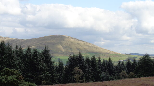
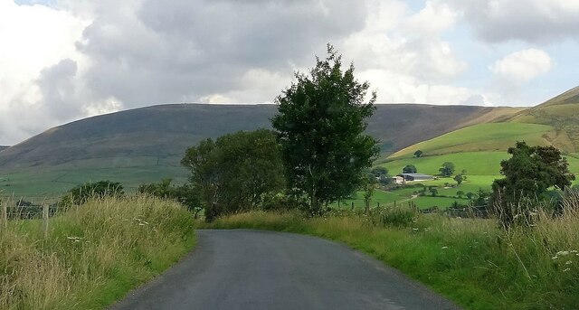
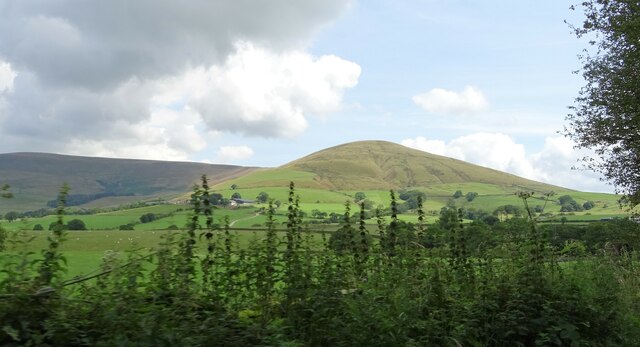
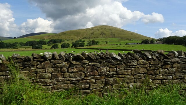
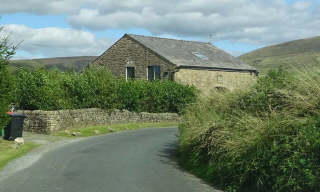
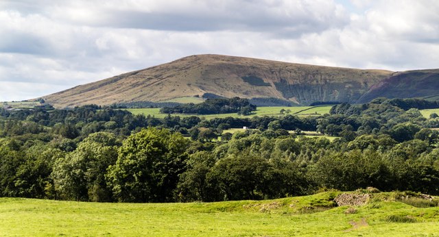
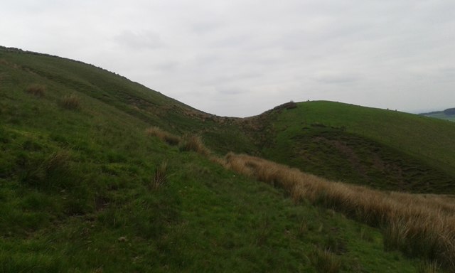
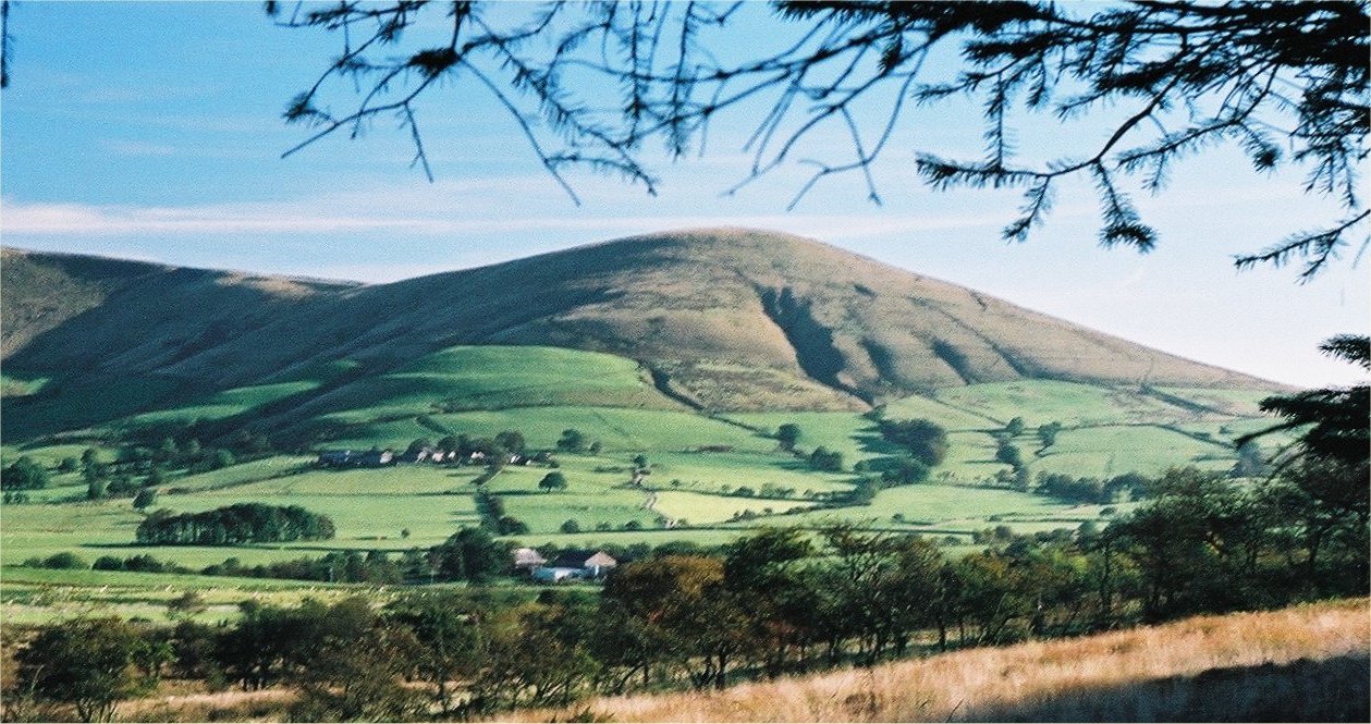
Bleasdale Moor is a picturesque area located in Lancashire, England. It is situated within the Forest of Bowland, an Area of Outstanding Natural Beauty. The moorland covers an expansive area and is characterized by its rolling hills, vast open spaces, and diverse wildlife.

Covered in heather and scattered with peat bogs, Bleasdale Moor offers a stunning landscape that changes throughout the seasons. In the summer, the moor is adorned with vibrant purple heather, creating a breathtaking sight. In contrast, during the colder months, the moorland can appear desolate and windswept, adding to its dramatic appeal.

The area is home to a variety of bird species, making it an ideal spot for birdwatchers. Visitors may catch a glimpse of the iconic red grouse, curlew, lapwing, or even the rare hen harrier. The moorland also supports other wildlife, including hares, deer, and small mammals.

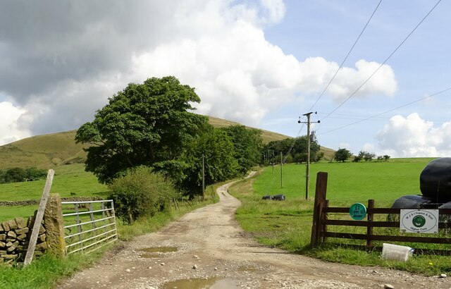
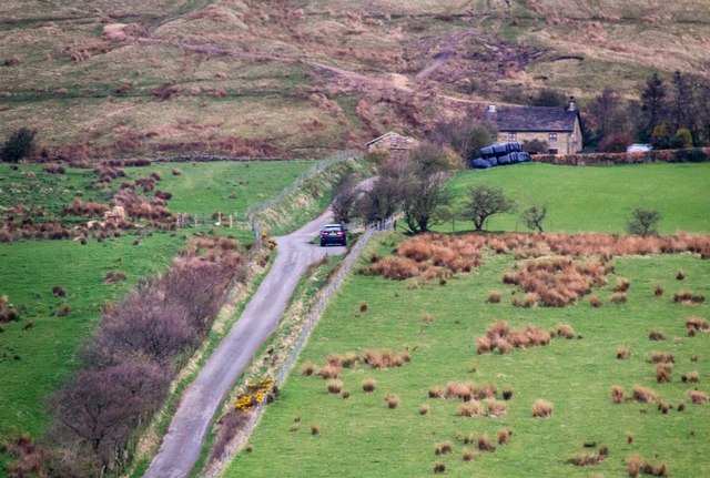
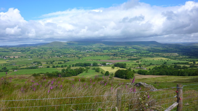
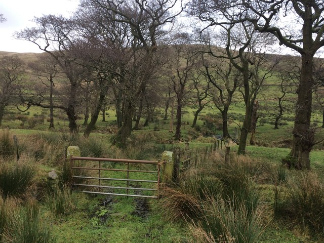
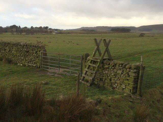
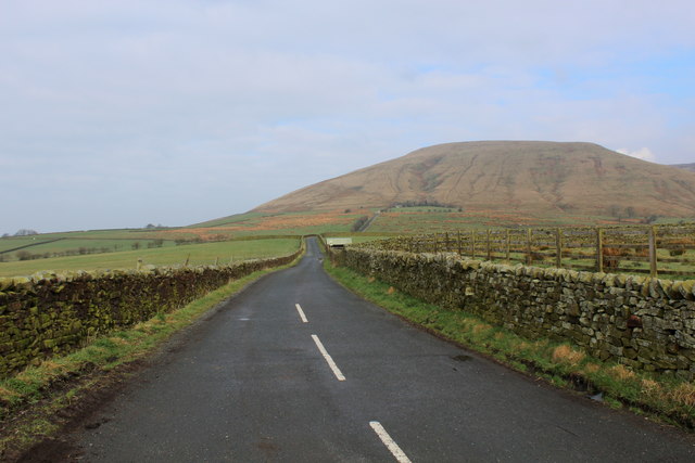
Bleasdale Moor is a popular destination for outdoor enthusiasts, offering ample opportunities for walking, hiking, and cycling. Several well-marked trails traverse the moor, allowing visitors to explore its beauty and soak in the tranquility of the area. The elevated vantage points provide breathtaking views of the surrounding countryside, including the nearby Fylde coast and the Trough of Bowland.

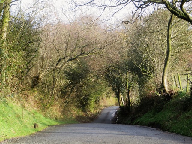
Access to Bleasdale Moor is primarily through public footpaths and bridleways, ensuring that the natural habitat remains undisturbed. Visitors are advised to take appropriate precautions when visiting, as the moorland can be remote and exposed to changing weather conditions.

In summary, Bleasdale Moor is a captivating area in Lancashire, offering a stunning combination of heather-covered moorland, diverse wildlife, and breathtaking views. It is a haven for nature lovers and outdoor enthusiasts seeking a peaceful retreat in the heart of the Forest of Bowland.

If you have any feedback on the listing, please let us know in the comments section below.

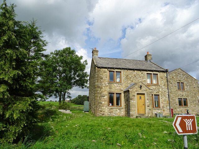
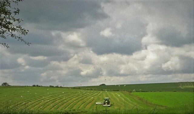
Bleasdale Moor Images

Images are sourced within 2km of 53.898159/-2.6241819 or Grid Reference SD5944. Thanks to Geograph Open Source API. All images are credited.

House at a road junction Previously Crag House Farmhouse at the junction of Collin's Hill Lane and Fish House Lane.
House at a road junction
Previously Crag House Farmhouse at the junction of Collin's Hill Lane and Fish House Lane.
Blindhurst Fell View from Beacon Fell Country Park
Blindhurst Fell
View from Beacon Fell Country Park
Making hay As the grass is turned and small creatures may be exposed seagulls follow the tractor hoping to snaffle an easy meal.
Making hay
As the grass is turned and small creatures may be exposed seagulls follow the tractor hoping to snaffle an easy meal.
Approaching Oakenclough Road Near Watery Gate.
Approaching Oakenclough Road
Near Watery Gate.
Parlick Hill At the south of the main range of the Bowland Fells.
Parlick Hill
At the south of the main range of the Bowland Fells.
Cattle grazing under Parlick At Higher Core farm.
Cattle grazing under Parlick
At Higher Core farm.
Farm track The entrance to Higher Core farm.
Farm track
The entrance to Higher Core farm.
Moss Hall At the junction of Nat Barn Lane and Fiddlers Lane.
Moss Hall
At the junction of Nat Barn Lane and Fiddlers Lane.
Wickins Barn The datestone reads G.S. 1850.
Wickins Barn
The datestone reads G.S. 1850.
Fell Foot View of Fell Foot .
Fell Foot
View of Fell Foot .
From Longridge Fell to Chipping and Fells Beyond
Lower Cock Hill Gliding Club The West end of the runway at Lower Cock Hill Gliding Club.
Lower Cock Hill Gliding Club
The West end of the runway at Lower Cock Hill Gliding Club.
Parlick View of Parlick seen from Higher Lees.
Parlick
View of Parlick seen from Higher Lees.
Possible Glacial Overflow Channel on Parlick This dip in the side of Parlick has the makings of a gouge made by an ice flow or subglacial water flow; its smoothness detracts from its being man made.
Possible Glacial Overflow Channel on Parlick
This dip in the side of Parlick has the makings of a gouge made by an ice flow or subglacial water flow; its smoothness detracts from its being man made.
Small wood by the infant River Brock
Stile and gate in Bleasdale
Fish House Lane A designated Quiet Lane near Chipping.
Fish House Lane
A designated Quiet Lane near Chipping.
The Road to Fell Foot This is Startifants Lane heading towards Fell Foot, although it executes a sharp ninety degree turn before it reaches this objective - a minor no through road picking up the baton instead.
Fell Foot nestles at the bottom of Parlick, the hill seen in the distance - a favoured destination for the paragliding fraternity and walkers aiming for the south western Bowland Fells.
The Road to Fell Foot
This is Startifants Lane heading towards Fell Foot, although it executes a sharp ninety degree turn before it reaches this objective - a minor no through road picking up the baton instead. Fell Foot nestles at the bottom of Parlick, the hill seen in the distance - a favoured destination for the paragliding fraternity and walkers aiming for the south western Bowland Fells.
Show me another place!

Bleasdale Moor is located at Grid Ref: SD5944 (Lat: 53.898159, Lng: -2.6241819)

Administrative County: Lancashire

District: Wyre

Police Authority: Lancashire

What 3 Words

///shields.conjured.mystery. Near Longridge, Lancashire

Nearby Locations

Bleasdale Moor

Related Wikis

Parlick

Parlick (also known as Parlick Pike) is an approximately cone-shaped steep-sided hill at the extreme south of the main range of Bowland fells in Lancashire...

Bowland Forest Gliding Club

Bowland Forest Gliding Club is a British gliding club near the village of Chipping, Lancashire. It was formed as the Blackpool and Fylde Gliding Club in...

Bleasdale

Bleasdale is a village and civil parish in the Wyre district of Lancashire, England, in the Forest of Bowland Area of Outstanding Natural Beauty. The two...

Beacon Fell, Lancashire

Beacon Fell is a fell in the civil parish of Goosnargh in Lancashire, England. The high ground, which rises to 266 m (873 ft), has been a country park...

Nearby Amenities

Located within 500m of 53.898159,-2.6241819
Barrier: stile
Lat/Long: 53.8992637/-2.628473
Barrier: stile
Material: wood
Stile: stepover
Lat/Long: 53.895871/-2.6231552
Ford: yes
Lat/Long: 53.8959921/-2.6253502
Fixme: Unfinished
Lat/Long: 53.8965724/-2.6217045
Ford: yes
Lat/Long: 53.895327/-2.6221629
Ford: yes
Lat/Long: 53.8958523/-2.6230814
Barrier: cattle_grid
Lat/Long: 53.895322/-2.6294446
The data included in this document is from www.openstreetmap.org. The data is made available under ODbL.

Have you been to Bleasdale Moor?

Leave your review of Bleasdale Moor below (or comments, questions and feedback).