Crew Moor

Downs, Moorland in Cumberland Carlisle

England

Crew Moor

On a track near Crossgreens This track links Crossgreens, Bewcastle with Spadeadam Forest crossing rather bleak grazing moorland for the most part.

This photograph was taken during the Coronavirus (COVID-19) pandemic of 2020/21.
On a track near Crossgreens Credit: James T M Towill

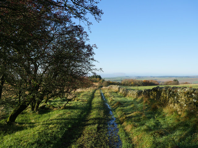
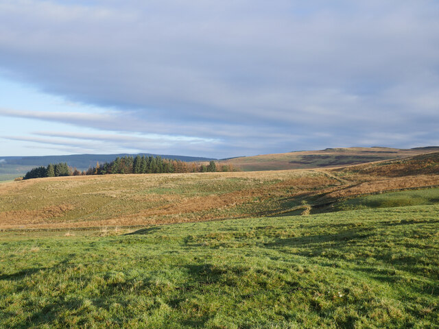
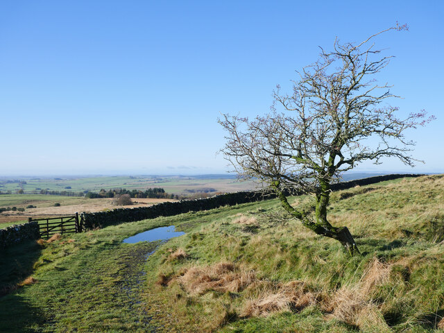
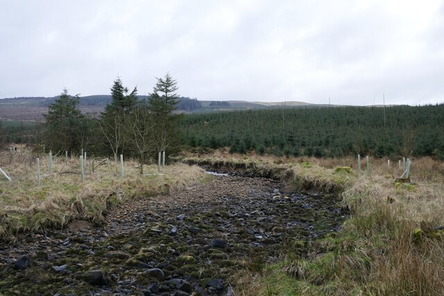
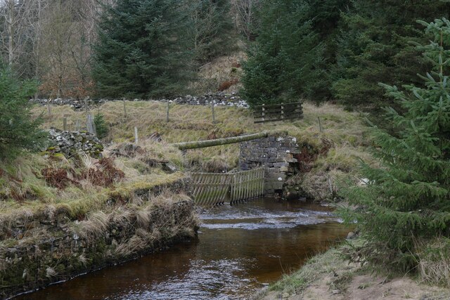
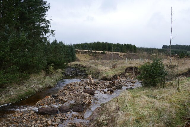
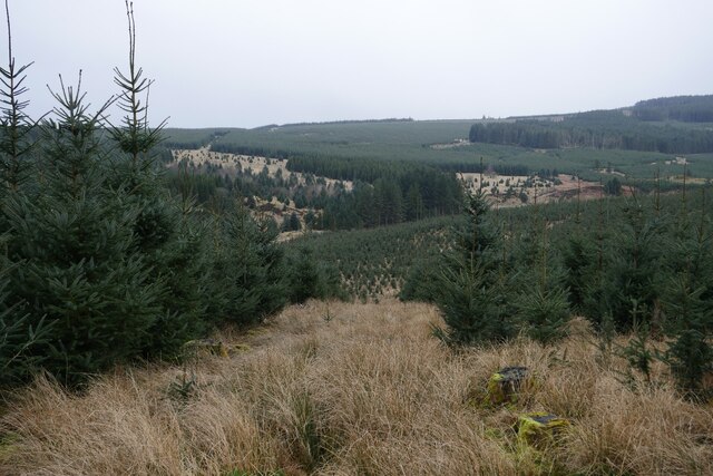
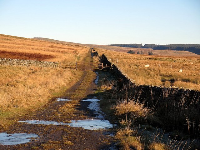
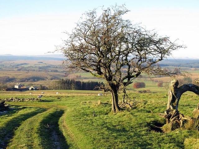
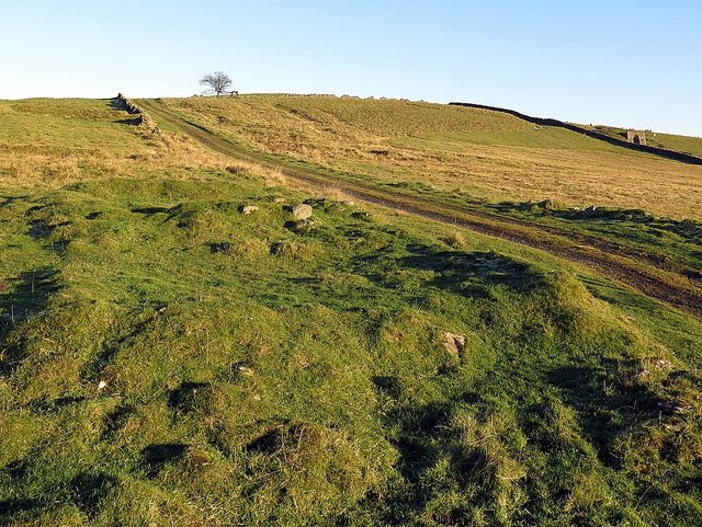
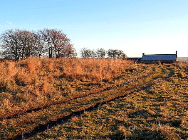
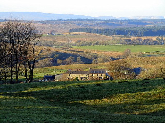
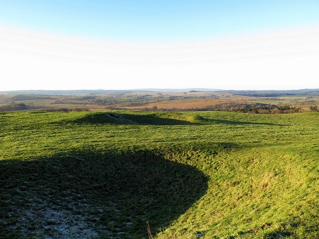
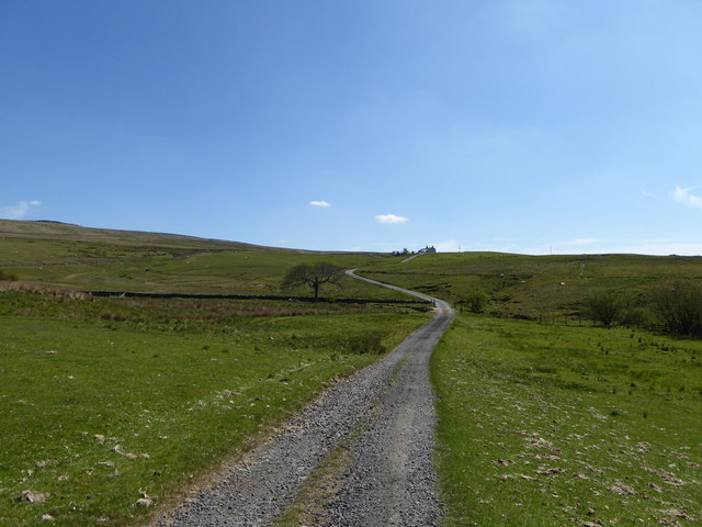
Crew Moor, located in Cumberland, England, is a vast expanse of moorland that stretches across the region. It is situated in the northern part of the county, within the Lake District National Park. The moorland is characterized by its rugged and wild terrain, featuring rolling hills, open grasslands, and scattered patches of heather and bracken.

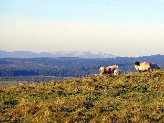
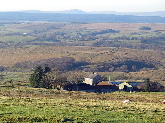
Crew Moor is known for its outstanding natural beauty, attracting countless visitors each year. The landscape offers breathtaking panoramic views, with the peaks of nearby mountains visible in the distance. The moorland is home to a diverse range of flora and fauna, including various species of birds, mammals, and insects.

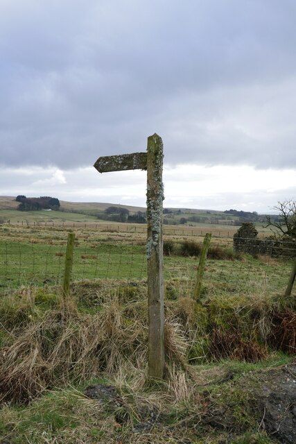
Hikers and outdoor enthusiasts flock to Crew Moor to explore its vast network of walking trails and footpaths. It provides an excellent opportunity for walking, hiking, and adventure activities. The moorland's vastness allows visitors to experience a sense of tranquility and solitude while immersing themselves in the beauty of nature.

Crew Moor also holds historical significance, with traces of ancient settlements and burial sites scattered throughout the area. These remnants offer insights into the lives of early inhabitants and their connection to the land.

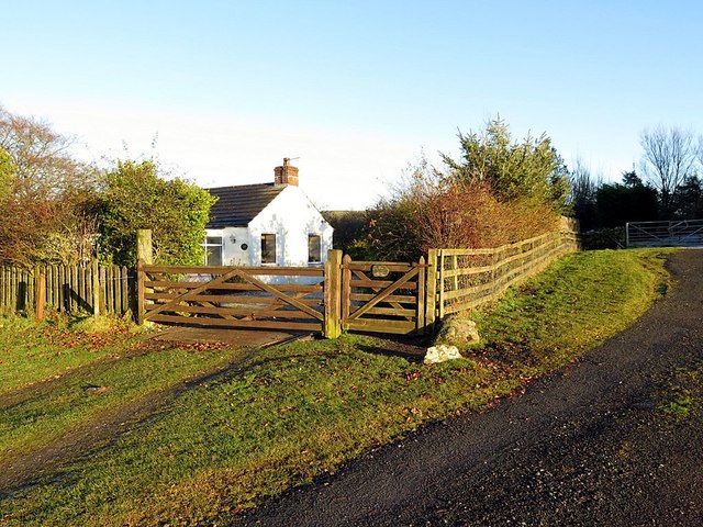
Access to Crew Moor is generally unrestricted, allowing visitors to freely explore and appreciate its natural wonders. However, it is important to note that certain areas may be subject to seasonal restrictions or conservation efforts to protect the delicate ecosystem.

In conclusion, Crew Moor is a remarkable moorland in Cumberland, offering breathtaking scenery, wildlife diversity, and opportunities for outdoor activities. Its natural beauty and historical significance make it a must-visit destination for nature lovers and history enthusiasts alike.

If you have any feedback on the listing, please let us know in the comments section below.

Crew Moor Images

Images are sourced within 2km of 55.09225/-2.6866657 or Grid Reference NY5677. Thanks to Geograph Open Source API. All images are credited.

On a track near Crossgreens This track links Crossgreens, Bewcastle with Spadeadam Forest crossing rather bleak grazing moorland for the most part.

This photograph was taken during the Coronavirus (COVID-19) pandemic of 2020/21.
On a track near Crossgreens
This track links Crossgreens, Bewcastle with Spadeadam Forest crossing rather bleak grazing moorland for the most part. This photograph was taken during the Coronavirus (COVID-19) pandemic of 2020/21.
Grazings at The Pike Uplands illuminated by November morning sun.

This photograph was taken during the Coronavirus (COVID-19) pandemic of 2020/21.
Grazings at The Pike
Uplands illuminated by November morning sun. This photograph was taken during the Coronavirus (COVID-19) pandemic of 2020/21.
Hawthorn on the bend An old weather-beaten Hawthorn tree on the track between Crossgreens and Spadeadam Forest. 

This photograph was taken during the Coronavirus (COVID-19) pandemic of 2020/21.
Hawthorn on the bend
An old weather-beaten Hawthorn tree on the track between Crossgreens and Spadeadam Forest. This photograph was taken during the Coronavirus (COVID-19) pandemic of 2020/21.
The dry(ish) bed of the White Lyne The White Lyne has broken through the bank to the right in the distance and has consequently left this section relatively dry.
The dry(ish) bed of the White Lyne
The White Lyne has broken through the bank to the right in the distance and has consequently left this section relatively dry.
Site of a footbridge over the White Lyne Whilst still marked as 'FB' on the Ordnance Survey 1:25k map, this seems to have long gone.
Site of a footbridge over the White Lyne
Whilst still marked as 'FB' on the Ordnance Survey 1:25k map, this seems to have long gone.
An old and new course of the White Lyne The former section of the White Lyne can be noted to the left.  A flood event has resulted in a new channel entering from the right.
An old and new course of the White Lyne
The former section of the White Lyne can be noted to the left. A flood event has resulted in a new channel entering from the right.
A moss-encrusted fingerpost by Townfoot The fingerpost is pointing the way to a seldom-used right of way to Christianbury Crags.
A moss-encrusted fingerpost by Townfoot
The fingerpost is pointing the way to a seldom-used right of way to Christianbury Crags.
Heading into the forest by The Flatt A seldom used right of way to Christianbury Crags with tricky conditions underfoot.
Heading into the forest by The Flatt
A seldom used right of way to Christianbury Crags with tricky conditions underfoot.
Track near The Pike
Track near The Pike
Sheep on The Pike In the distance, the Cheviot Hills above Kielder Forest.
Sheep on The Pike
In the distance, the Cheviot Hills above Kielder Forest.
Track near The Pike
Track near The Pike
Park Head from the south-east
Track below The Pike A limekiln can be seen in the neighbouring field on the right. The 1895 OS map shows that the lumps and bumps in the foreground are the remains of a farmstead named Pikefoot.
Track below The Pike
A limekiln can be seen in the neighbouring field on the right. The 1895 OS map shows that the lumps and bumps in the foreground are the remains of a farmstead named Pikefoot.
Cottage near Crossgreens
Parknook Farm from the south
Slate Cottage near Bewcastle
Old quarries near Crossgreens Probably shallow quarries used to extract limestone. There are shake- and swallow-holes nearby, as well as old limekilns.

It has been suggested that other old quarries in the area of Crossgreens could have supplied the sandstone for the Bewcastle Cross <a href="https://www.geograph.org.uk/photo/5205479">NY5674 : Bewcastle Cross</a>. The usual candidate though is at Long Bar, 5 miles north-east of Bewcastle, where a possible rough-out of a similar shaft still lies on the hillside <a href="https://www.geograph.org.uk/photo/625503">NY5980 : The Long Bar</a>
<span class="nowrap"><a title="http://www.ascorpus.ac.uk/catvol2.php?pageNum_urls=34" rel="nofollow ugc noopener" href="http://www.ascorpus.ac.uk/catvol2.php?pageNum_urls=34">Link</a><img style="margin-left:2px;" alt="External link" title="External link - shift click to open in new window" src="https://s1.geograph.org.uk/img/external.png" width="10" height="10"/></span>
Old quarries near Crossgreens
Probably shallow quarries used to extract limestone. There are shake- and swallow-holes nearby, as well as old limekilns. It has been suggested that other old quarries in the area of Crossgreens could have supplied the sandstone for the Bewcastle Cross NY5674 : Bewcastle Cross. The usual candidate though is at Long Bar, 5 miles north-east of Bewcastle, where a possible rough-out of a similar shaft still lies on the hillside NY5980 : The Long Bar LinkExternal link
Track leading to Crew
Show me another place!

Crew Moor is located at Grid Ref: NY5677 (Lat: 55.09225, Lng: -2.6866657)

Administrative County: Cumbria

District: Carlisle

Police Authority: Cumbria

What 3 Words

///blessing.topics.abolish. Near Brampton, Cumbria

Nearby Locations

Crew Moor Crew Castle

Related Wikis

Blackpool Gate

Blackpool Gate is a settlement in the civil parish of Bewcastle, which is in the district of the City of Carlisle in the county of Cumbria, England. It...

Bewcastle Castle

Bewcastle Castle is a ruined castle in the parish of Bewcastle in the English county of Cumbria, a few miles from the Scottish border. == History == The...

Bewcastle Roman Fort

Bewcastle Roman Fort was built to the north of Hadrian's Wall as an outpost fort possibly intended for scouting and intelligence. The remains of the fort...

Bewcastle Cross

The Bewcastle Cross is an Anglo-Saxon cross which is still in its original position within the churchyard of St Cuthbert's church at Bewcastle, in the...

Nearby Amenities

Located within 500m of 55.09225,-2.6866657
Power: pole
Lat/Long: 55.094939/-2.6923584
Power: pole
Lat/Long: 55.0949691/-2.6909809
Power: pole
Lat/Long: 55.0950144/-2.6893783
Power: pole
Lat/Long: 55.0950637/-2.6877685
Power: pole
Lat/Long: 55.0949705/-2.6863648
Power: pole
Lat/Long: 55.094891/-2.6849754
Power: pole
Lat/Long: 55.0948087/-2.6836123
Power: pole
Lat/Long: 55.0947128/-2.6820456
Power: pole
Lat/Long: 55.0946292/-2.6805843
Power: pole
Lat/Long: 55.0940809/-2.691254
Power: pole
Lat/Long: 55.0930692/-2.691496
Power: pole
Lat/Long: 55.0922823/-2.6917236
Power: pole
Lat/Long: 55.0912226/-2.6920182
Power: pole
Lat/Long: 55.0903151/-2.6922793
Power: pole
Lat/Long: 55.0894583/-2.6924949
Power: pole
Lat/Long: 55.0887426/-2.691393
Power: pole
Lat/Long: 55.0926977/-2.6923823
Power: pole
Lat/Long: 55.0923522/-2.6931824
Power: pole
Lat/Long: 55.0963056/-2.6844938
Power: pole
Lat/Long: 55.0955572/-2.684065
The data included in this document is from www.openstreetmap.org. The data is made available under ODbL.

Have you been to Crew Moor?

Leave your review of Crew Moor below (or comments, questions and feedback).