Marsh Common

Downs, Moorland in Gloucestershire

England

Marsh Common

Compton Greenfield (Glos) All Saints Church
Compton Greenfield (Glos) All Saints Church Credit: ChurchCrawler

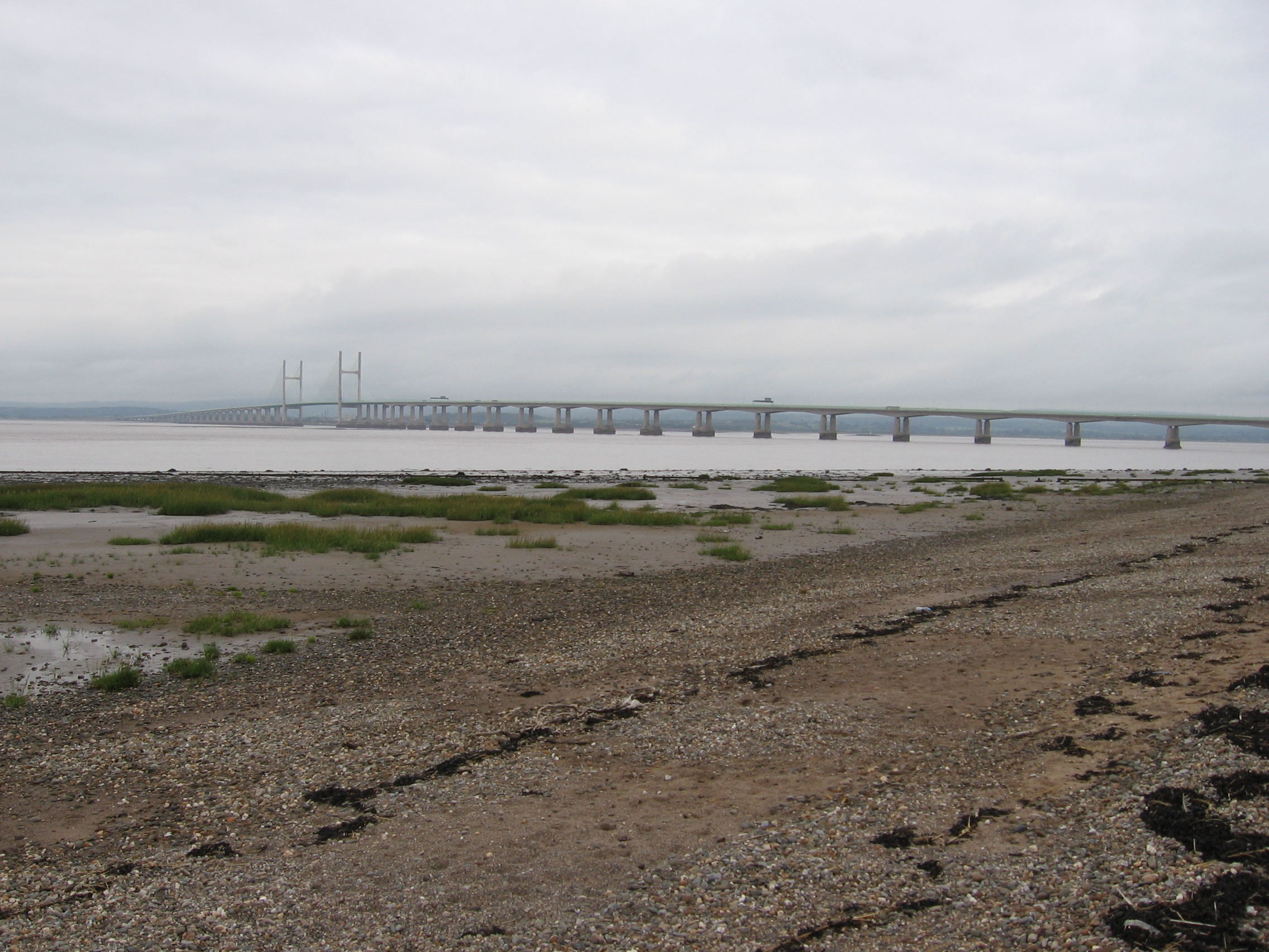
Marsh Common is a picturesque area located in Gloucestershire, England. Situated on the edge of the Cotswolds, this region is characterized by its stunning downs and moorland landscapes. Covering an area of approximately 100 hectares, Marsh Common is a haven for nature enthusiasts and those seeking tranquility away from the bustling city life.

The downs of Marsh Common are vast and open spaces, covered in lush green grass and dotted with wildflowers during the summer months. These rolling hills offer breathtaking panoramic views of the surrounding countryside, making it a popular spot for walkers, hikers, and photographers alike.

In contrast, the moorland of Marsh Common provides a completely different experience. With its heather-covered terrain and scattered patches of gorse bushes, this area is home to a diverse range of wildlife including birds, small mammals, and insects. Visitors can explore the moorland by following the designated trails and footpaths, immersing themselves in the natural beauty of the area.

Throughout the year, Marsh Common plays host to a variety of events and activities. From guided nature walks and birdwatching sessions to outdoor concerts and festivals, there is always something happening to cater to different interests. Additionally, the area has several picnic spots and benches where visitors can relax and enjoy a peaceful meal while taking in the stunning surroundings.

Overall, Marsh Common in Gloucestershire offers a unique blend of downs and moorland landscapes, making it a truly enchanting destination for nature lovers and outdoor enthusiasts.

If you have any feedback on the listing, please let us know in the comments section below.

Marsh Common Images

Images are sourced within 2km of 51.551224/-2.6316093 or Grid Reference ST5683. Thanks to Geograph Open Source API. All images are credited.

Compton Greenfield (Glos) All Saints Church
Pilning (Glos) St Peter's Church
End of the road This road used to go to Vimpenny's Common according to the 1940's OS Map, now the M49 blocks the way and Vimpenny's Common is no longer there. The M49 is on the horizon.
End of the road
This road used to go to Vimpenny's Common according to the 1940's OS Map, now the M49 blocks the way and Vimpenny's Common is no longer there. The M49 is on the horizon.
Road by Brook Farm
Road by Brook Farm
Delivering the mail The front entrance of a large Royal Mail warehouse and distribution centre near Severn Beach.  This is a good location for distribution centres (and many other companies have warehouses nearby) as there is good access to the M5 and M4, and land values are relatively low.
Delivering the mail
The front entrance of a large Royal Mail warehouse and distribution centre near Severn Beach. This is a good location for distribution centres (and many other companies have warehouses nearby) as there is good access to the M5 and M4, and land values are relatively low.
New Warehouse This warehouse is so new that it's not on the most recent OS map.  A large, temporary 'Currys' banner on the front entrance denotes ownership. It has been constructed on part of an area known as Dyer's Common, and more plots of the common are for sale.
New Warehouse
This warehouse is so new that it's not on the most recent OS map. A large, temporary 'Currys' banner on the front entrance denotes ownership. It has been constructed on part of an area known as Dyer's Common, and more plots of the common are for sale.
M49 M49 northbound taken from a footpath on a bridge over the motorway.
M49
M49 northbound taken from a footpath on a bridge over the motorway.
Dyer's Common This rough, hummocky looking land is what remains of Dyer's Common. It is dissected by rhines and reed beds, and much of it is for sale.
Dyer's Common
This rough, hummocky looking land is what remains of Dyer's Common. It is dissected by rhines and reed beds, and much of it is for sale.
Pilning railway station Only one train stops for passengers here each day: the 9.28 to Bristol Temple Meads
Pilning railway station
Only one train stops for passengers here each day: the 9.28 to Bristol Temple Meads
M49 at Dyer's Common The M49 is a short motorway linking the M4 at the second Severn Crossing to the southboard M5. Dyer's Common is now occupied by distribution warehouses.
M49 at Dyer's Common
The M49 is a short motorway linking the M4 at the second Severn Crossing to the southboard M5. Dyer's Common is now occupied by distribution warehouses.
All Saints Church, Compton Greenfield
Lych gate to Compton Greenfield church
Disused lane to Dyer's Common This lane from Compton Greenfield used to go to Dyer's Common but since the arrival of the M49 is no longer passable for vehicles and is used as cycle route No. 4
Disused lane to Dyer's Common
This lane from Compton Greenfield used to go to Dyer's Common but since the arrival of the M49 is no longer passable for vehicles and is used as cycle route No. 4
Post office, Easter Compton
Station Road, Marsh Common
Shaymoor Lane, Marsh Common
Springfields, Bell Lane, Marsh Common
Bell House
Bell House
Show me another place!

Marsh Common is located at Grid Ref: ST5683 (Lat: 51.551224, Lng: -2.6316093)

Unitary Authority: South Gloucestershire

Police Authority: Avon and Somerset

What 3 Words

///closer.fooling.prepped. Near Pilning, Gloucestershire

Nearby Locations

Marsh Common Marsh Common

Related Wikis

Pilning railway station

Pilning railway station is a minor station on the South Wales Main Line near Pilning, South Gloucestershire, England. It is 10 miles (16 km) from Bristol...

Pilning

Pilning is a village in South Gloucestershire, England, close to Redwick and Severn Beach. Pilning is close to the M4, M49 and A403 roads, and has the...

Cross Hands Halt railway station

Cross Hands Halt railway station served Pilning, South Gloucestershire, England from 1928 to 1964 on the Severn Beach Line. == History == The station opened...

Severn Beach

Severn Beach is a village on the Severn Estuary in South Gloucestershire, England. The eastern portal of the Severn Tunnel is on the outskirts of the village...

Nearby Amenities

Located within 500m of 51.551224,-2.6316093
Bus Stop
Chequers Farm
Naptan AtcoCode: 0170SGB20618
Naptan Bearing: N
Naptan CommonName: Chequers Farm
Naptan NaptanCode: sgladwm
Naptan Street: N/A
Naptan Verified: no
Source: naptan_import
Lat/Long: 51.552643/-2.6326758
Bus Stop
Chequers Farm
Naptan AtcoCode: 0170SGB20619
Naptan Bearing: S
Naptan CommonName: Chequers Farm
Naptan NaptanCode: sgladwp
Naptan Street: N/A
Naptan Verified: no
Source: naptan_import
Lat/Long: 51.552644/-2.6324883
Bus Stop
Pilning Road
Bus: yes
Naptan AtcoCode: 0170SGB20620
Naptan Bearing: N
Naptan CommonName: Pilning Road
Naptan NaptanCode: sgladwd
Naptan Street: B4055
Naptan Verified: no
Public Transport: platform
Source: naptan_import
Lat/Long: 51.5495296/-2.632926
Bus Stop
Pilning Road
Bus: yes
Naptan AtcoCode: 0170SGB20621
Naptan Bearing: S
Naptan CommonName: Pilning Road
Naptan NaptanCode: sgladwg
Naptan Street: B4055
Naptan Verified: no
Public Transport: platform
Source: naptan_import
Lat/Long: 51.5494147/-2.6327176
Bus Stop
Swanmoor Bridge
Naptan AtcoCode: 0170SGB20622
Naptan Bearing: N
Naptan CommonName: Swanmoor Bridge
Naptan NaptanCode: sglagag
Naptan Street: B4055
Naptan Verified: no
Source: naptan_import
Lat/Long: 51.5481329/-2.6302913
Bus Stop
Swanmoor Bridge
Naptan AtcoCode: 0170SGB20623
Naptan Bearing: N
Naptan CommonName: Swanmoor Bridge
Naptan NaptanCode: sglagaj
Naptan Street: Station Road
Naptan Verified: no
Source: naptan_import
Lat/Long: 51.5482962/-2.6283466
Bus Stop
Swanmoor Bridge
Naptan AtcoCode: 0170SGB20624
Naptan Bearing: S
Naptan CommonName: Swanmoor Bridge
Naptan NaptanCode: sglagam
Naptan Street: Station Road
Naptan Verified: no
Source: naptan_import
Lat/Long: 51.5477126/-2.6281943
Power: tower
Lat/Long: 51.5534225/-2.635125
Power: tower
Lat/Long: 51.5518408/-2.6385476
Give Way
Direction: backward
Lat/Long: 51.5478509/-2.6289114
Barrier: stile
Lat/Long: 51.5473425/-2.6283313
Post Box
Collection Times: Mo-Fr 17:00; Sa 10:00
Operator: Royal Mail
Post Box Type: lamp
Ref: BS35 411
Royal Cypher: EIIR
Royal Cypher Wikidata: Q33102113
Lat/Long: 51.548073/-2.629446
Power: pole
Lat/Long: 51.5554189/-2.629845
Power: pole
Lat/Long: 51.5546417/-2.6290779
Power: pole
Lat/Long: 51.5538345/-2.6283054
Power: pole
Lat/Long: 51.5530774/-2.6270877
Power: pole
Lat/Long: 51.5524201/-2.6269481
Power: pole
Lat/Long: 51.5517393/-2.6263213
Power: pole
Lat/Long: 51.5512392/-2.6258116
Power: pole
Lat/Long: 51.5504996/-2.625098
Power: pole
Lat/Long: 51.5525779/-2.6320163
Power: pole
Lat/Long: 51.5527286/-2.6316878
Power: pole
Lat/Long: 51.5532034/-2.630973
Power: pole
Lat/Long: 51.553797/-2.6299662
Give Way
Direction: forward
Lat/Long: 51.5478752/-2.6285553
Give Way
Direction: backward
Lat/Long: 51.5474728/-2.6282369
Marsh Common
Place: hamlet
Wikidata: Q105307548
Lat/Long: 51.5501496/-2.6299859
The data included in this document is from www.openstreetmap.org. The data is made available under ODbL.

Have you been to Marsh Common?

Leave your review of Marsh Common below (or comments, questions and feedback).