The Forest

Downs, Moorland in Westmorland South Lakeland

England

The Forest

Newly planted trees On the lower slopes of Ashstead Fell
Newly planted trees Credit: Eirian Evans

The Forest, located in the county of Westmorland, is a picturesque region known for its diverse landscapes and natural beauty. Stretching across vast areas of downs, moorland, and woodlands, it offers a rich and unique experience for visitors and nature enthusiasts alike.

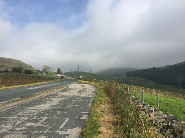
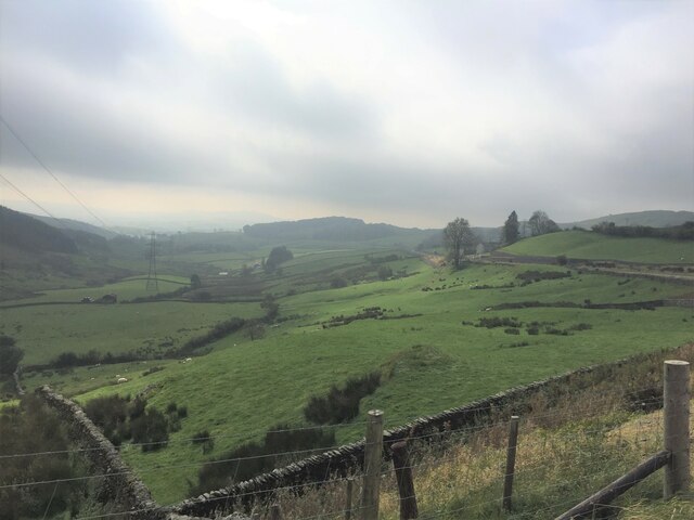
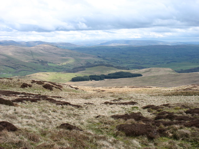
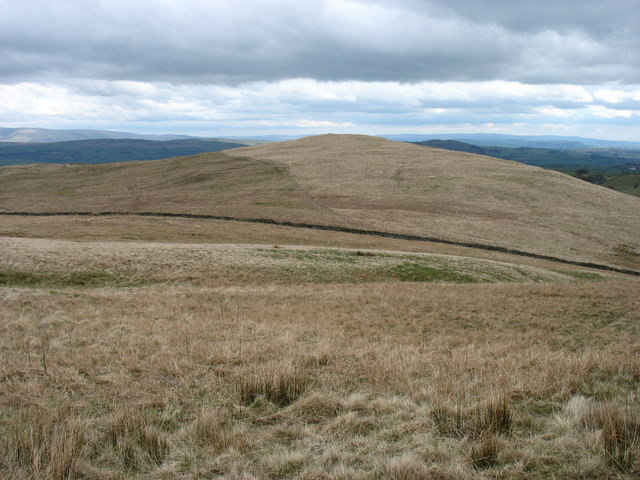
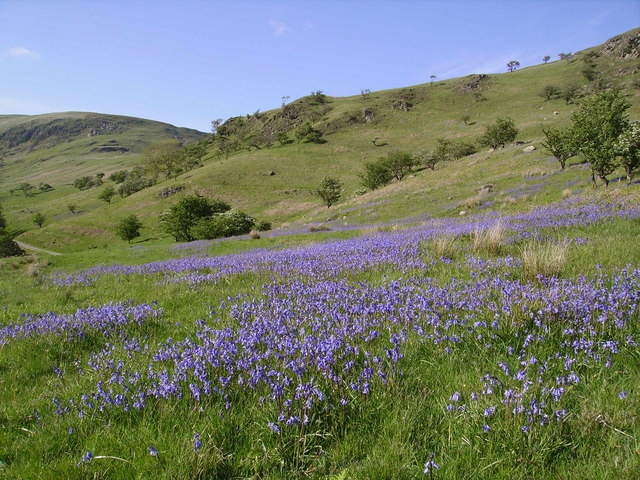
The downs of The Forest are characterized by their rolling hills and expansive grasslands. These open spaces provide a tranquil setting, where one can enjoy leisurely walks, picnics, or even horse riding. The downs also offer breathtaking panoramic views of the surrounding countryside, making it a popular spot for photographers and artists.

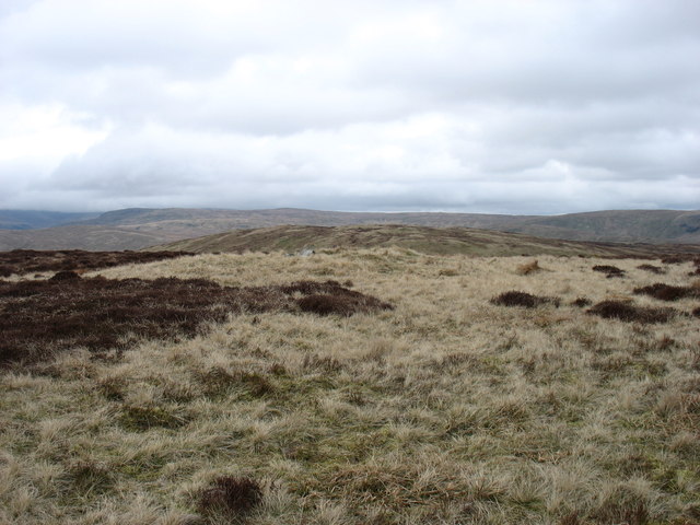
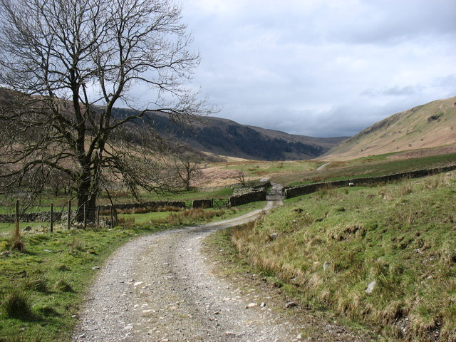
Moving towards the moorland, visitors will find themselves immersed in a rugged and untamed landscape. Covered in heather and bracken, the moors provide a habitat for a variety of wildlife, including birds of prey, deer, and rare plant species. Exploring the moorland can be an adventure in itself, with winding trails and hidden valleys waiting to be discovered.

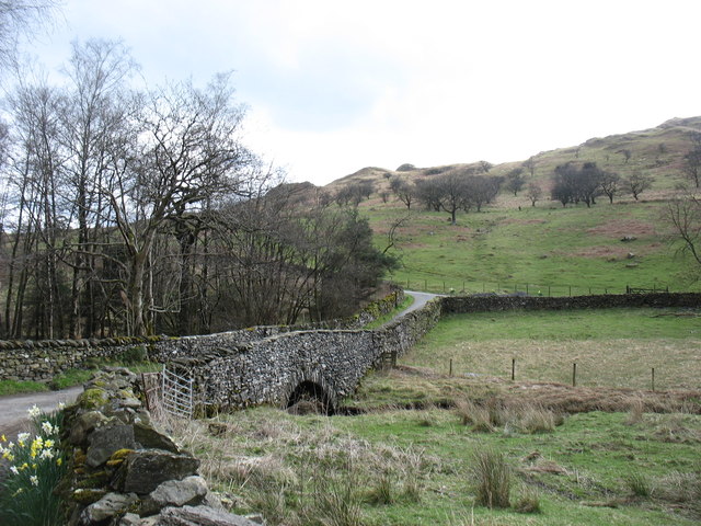
The Forest is also home to ancient woodlands, which add a touch of enchantment to the region. These woodlands are filled with towering trees, moss-covered rocks, and babbling brooks, creating a serene atmosphere that feels timeless. Walking through the woods, visitors may stumble upon hidden clearings or stumble upon ancient ruins, adding an element of mystery and intrigue to the experience.

In conclusion, The Forest in Westmorland is a diverse and captivating region that showcases the beauty of downs, moorland, and woodlands. With its stunning landscapes and abundant wildlife, it offers a truly unforgettable experience for those seeking a connection with nature.

If you have any feedback on the listing, please let us know in the comments section below.

The Forest Images

Images are sourced within 2km of 54.426751/-2.7213747 or Grid Reference NY5303. Thanks to Geograph Open Source API. All images are credited.

Newly planted trees On the lower slopes of Ashstead Fell
Newly planted trees
On the lower slopes of Ashstead Fell
Lay-by on the A6 Between Martclose Farm and Hollowgate Farm
Lay-by on the A6
Between Martclose Farm and Hollowgate Farm
Ashstead Beck valley Rough grazing up here
Ashstead Beck valley
Rough grazing up here
Old Boundary Marker on the A6 Parish Boundary Marker against a drystone wall on the northwest side of the A6 south of Hucks Bridge. Fawcett Forest parish became part of Selside and Fawcett Forest parish in 2020. See also <span class="nowrap"><a title="http://www.geog.port.ac.uk/webmap/thelakes/photos/bnk42.jpg" rel="nofollow ugc noopener" href="http://www.geog.port.ac.uk/webmap/thelakes/photos/bnk42.jpg">Link</a><img style="margin-left:2px;" alt="External link" title="External link - shift click to open in new window" src="https://s1.geograph.org.uk/img/external.png" width="10" height="10"/></span>. In 2009 the stone was reported to have been knocked over in a collision, see <span class="nowrap"><a title="https://www.lakesguides.co.uk/html/lgaz/LK13914.htm" rel="nofollow ugc noopener" href="https://www.lakesguides.co.uk/html/lgaz/LK13914.htm">Link</a><img style="margin-left:2px;" alt="External link" title="External link - shift click to open in new window" src="https://s1.geograph.org.uk/img/external.png" width="10" height="10"/></span>.

Milestone Society National ID: WE_KDSP08pb
Old Boundary Marker on the A6
Parish Boundary Marker against a drystone wall on the northwest side of the A6 south of Hucks Bridge. Fawcett Forest parish became part of Selside and Fawcett Forest parish in 2020. See also LinkExternal link. In 2009 the stone was reported to have been knocked over in a collision, see LinkExternal link. Milestone Society National ID: WE_KDSP08pb
Lonely phone box In the A6 road lay-by south of Huck's Bridge
Lonely phone box
In the A6 road lay-by south of Huck's Bridge
Sheep at High House The shepherd has gathered his flock to await the attention of the tups
Sheep at High House
The shepherd has gathered his flock to await the attention of the tups
Borrow Beck A major feeder of the River Lune
Borrow Beck
A major feeder of the River Lune
The wall across White Howe The Bannisdale Horseshoe follows this wall before veering right to the summit of White Howe.
The wall across White Howe
The Bannisdale Horseshoe follows this wall before veering right to the summit of White Howe.
View from the summit of The Forest White Howe is in the middle distance. The Bannisdale Horseshoe crosses both these hills.
View from the summit of The Forest
White Howe is in the middle distance. The Bannisdale Horseshoe crosses both these hills.
South-eastern slopes of The Forest Ahead is the only steep slope on the Bannisdale Horseshoe. In descent I found this quite awkward.
South-eastern slopes of The Forest
Ahead is the only steep slope on the Bannisdale Horseshoe. In descent I found this quite awkward.
Lamb Pasture The final hill on the Bannisdale Horseshoe.
Lamb Pasture
The final hill on the Bannisdale Horseshoe.
The Bannisdale track Taken after descending from the Bannisdale Horseshoe.
The Bannisdale track
Taken after descending from the Bannisdale Horseshoe.
Dryhowe Bridge From here, there is just 2 kilometres of country lane to complete the Bannisdale Horseshoe.
Dryhowe Bridge
From here, there is just 2 kilometres of country lane to complete the Bannisdale Horseshoe.
Hollowgate
Hollowgate
Cottages, Hollowgate
A6, Hollowgate Looking north.
A6, Hollowgate
Looking north.
Pylon near Hollowgate
Sharp bend in the A6 Heading north east  towards Shap.
Sharp bend in the A6
Heading north east towards Shap.
Show me another place!

The Forest is located at Grid Ref: NY5303 (Lat: 54.426751, Lng: -2.7213747)

Administrative County: Cumbria

District: South Lakeland

Police Authority: Cumbria

What 3 Words

///blanking.sending.constants. Near Staveley, Cumbria

Nearby Locations

The Forest

Related Wikis

Bannisdale Horseshoe

The Bannisdale Horseshoe is an upland area in Cumbria, England, near the eastern boundary of the Lake District National Park, surrounding the valley of...

Lowbridge Estate

The Lowbridge Estate is a country estate of approximately 2000 acres in the Lake District region of England that was in the continuous ownership of the...

Crookdale Horseshoe

The Crookdale Horseshoe is a group of hills on the eastern edge of the English Lake District, in Cumbria, west of the A6 road. They are the subject of...

Fawcett Forest

Fawcett Forest is a former civil parish, now in the parish of Selside and Fawcett Forest, in the South Lakeland district of the English county of Cumbria...

Nearby Amenities

Located within 500m of 54.426751,-2.7213747
The Forest
Place: locality
Source: Bing
Lat/Long: 54.4246065/-2.7173219
The data included in this document is from www.openstreetmap.org. The data is made available under ODbL.

Have you been to The Forest?

Leave your review of The Forest below (or comments, questions and feedback).