Burnt Wood

Downs, Moorland in Cumberland Eden

England

Burnt Wood

Dairy pasture south of Plumpton This is the shallow valley of the Petteril just west of the A6.
Dairy pasture south of Plumpton Credit: Jonathan Billinger

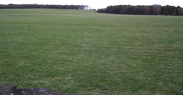
Burnt Wood, Cumberland (Downs, Moorland) is a picturesque area located in the county of Cumberland, England. Situated amidst rolling hills and vast moorlands, this region is renowned for its natural beauty and stunning landscapes.

The name "Burnt Wood" originates from the presence of charred tree stumps that can be found scattered throughout the area. These remnants serve as a reminder of past wildfires that have occurred in the region, adding an intriguing element to the landscape.

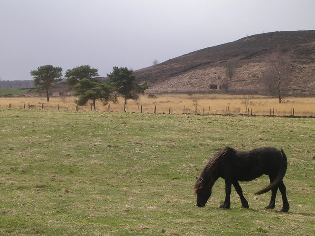
The Cumberland Downs, which encompass Burnt Wood, are characterized by their undulating terrain and sweeping vistas. The area is home to a diverse range of flora and fauna, including heather, gorse, and mosses, which create a vibrant tapestry of colors throughout the year.

Moorland, another prominent feature of this region, is characterized by its open expanses and peat bogs. These moors provide a unique habitat for a variety of bird species, such as curlews, lapwings, and golden plovers. Visitors to Burnt Wood can enjoy birdwatching and immerse themselves in the tranquility of this untouched wilderness.

The surroundings of Burnt Wood offer ample opportunities for outdoor activities such as hiking, cycling, and horseback riding. There are several well-marked trails that wind through the area, allowing visitors to explore its natural wonders at their leisure.

Overall, Burnt Wood, Cumberland (Downs, Moorland) is a captivating destination for nature enthusiasts and those seeking a peaceful retreat. Its rugged beauty, diverse wildlife, and abundance of outdoor recreational opportunities make it a must-visit location for anyone looking to connect with nature.

If you have any feedback on the listing, please let us know in the comments section below.
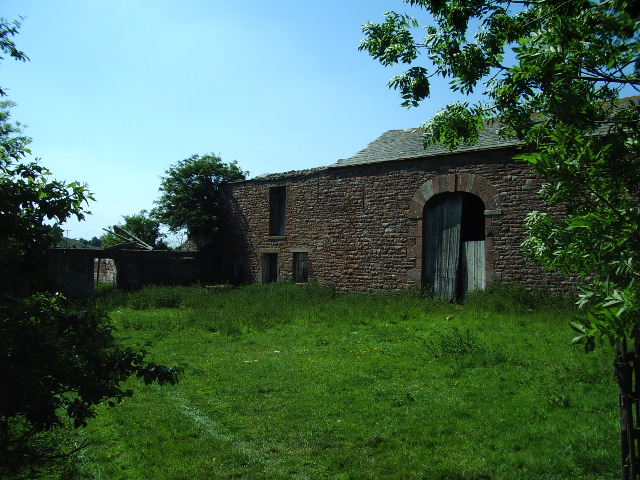
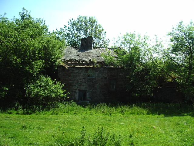
Burnt Wood Images

Images are sourced within 2km of 54.713781/-2.7521523 or Grid Reference NY5135. Thanks to Geograph Open Source API. All images are credited.

Dairy pasture south of Plumpton This is the shallow valley of the Petteril just west of the A6.
Dairy pasture south of Plumpton
This is the shallow valley of the Petteril just west of the A6.
Harvested barley crop near Plumpton Hall Looking south-west towards approaching rainclouds.
Harvested barley crop near Plumpton Hall
Looking south-west towards approaching rainclouds.
Track junction at Boggle Hall
Sheep in field NE of Plumpton Hall
Farmhouse at Plumpton Old Hall There is an Ordnance Survey benchmark <a href="https://www.geograph.org.uk/photo/7069240">NY4936 : Benchmark on Plumpton Old Hall farmhouse</a> on the right hand side of the house at its back corner
Farmhouse at Plumpton Old Hall
There is an Ordnance Survey benchmark NY4936 : Benchmark on Plumpton Old Hall farmhouse on the right hand side of the house at its back corner
Benchmark on top of Carlisle 14 milestone on east side of A6 opposite Boggle Hall Ordnance Survey rivet benchmark levelled at 146.904m above Newlyn Datum verified 1969. The mark was cut during the 1841-1844 1GL Liverpool to Port Carlisle Survey and levelled at 481.646 feet above Liverpool Datum. The surveyor's description was 'No. 410. Mark on top of the 4th milestone from Penrith ; 4.54 ft. above surface of road'.
See <span class="nowrap"><a title="www.bench-marks.org.uk/bm68650" rel="nofollow ugc noopener" href="http://www.bench-marks.org.uk/bm68650">Link</a><img style="margin-left:2px;" alt="External link" title="External link - shift click to open in new window" src="https://s1.geograph.org.uk/img/external.png" width="10" height="10"/></span>
Benchmark on top of Carlisle 14 milestone on east side of A6 opposite Boggle Hall
Ordnance Survey rivet benchmark levelled at 146.904m above Newlyn Datum verified 1969. The mark was cut during the 1841-1844 1GL Liverpool to Port Carlisle Survey and levelled at 481.646 feet above Liverpool Datum. The surveyor's description was 'No. 410. Mark on top of the 4th milestone from Penrith ; 4.54 ft. above surface of road'. See LinkExternal link
Carlisle 14 Penrith 4 milestone on east side of A6 opposite Boggle Hall There is an Ordnance Survey benchmark <a href="https://www.geograph.org.uk/photo/7070856">NY4936 : Benchmark on top of Carlisle 14 milestone on east side of A6 opposite Boggle Hall</a> on top of the stone which has Milestone Society National ID CU_PRCL04
Carlisle 14 Penrith 4 milestone on east side of A6 opposite Boggle Hall
There is an Ordnance Survey benchmark NY4936 : Benchmark on top of Carlisle 14 milestone on east side of A6 opposite Boggle Hall on top of the stone which has Milestone Society National ID CU_PRCL04
A6 heading north at Boggle Hall There is an old milestone <a href="https://www.geograph.org.uk/photo/7070860">NY4936 : Carlisle 14 Penrith 4 milestone on east side of A6 opposite Boggle Hall</a> against the dry stone wall
A6 heading north at Boggle Hall
There is an old milestone NY4936 : Carlisle 14 Penrith 4 milestone on east side of A6 opposite Boggle Hall against the dry stone wall
Field drain with culvert in field at Plumpton Hall
Entrance road to Holme View, Plumpton Hall and The Mill from west side of A6 There is an Ordnance Survey benchmark <a href="https://www.geograph.org.uk/photo/7071091">NY5035 : Benchmark on gatepost at north side of entrance road to Plumpton Hall</a> on the inside face of the gatepost at the right hand side of the road. Ordnance Survey records indicate that another benchmark was levelled at 451.484 feet above Liverpool Datum during the 1841/4 Liverpool to Port Carlisle 1GL Survey on a gatepost here. The surveyor's description was 'No. 409. Mark on top of gate pier at West side of road ; 5.05 ft. above surface'
Entrance road to Holme View, Plumpton Hall and The Mill from west side of A6
There is an Ordnance Survey benchmark NY5035 : Benchmark on gatepost at north side of entrance road to Plumpton Hall on the inside face of the gatepost at the right hand side of the road. Ordnance Survey records indicate that another benchmark was levelled at 451.484 feet above Liverpool Datum during the 1841/4 Liverpool to Port Carlisle 1GL Survey on a gatepost here. The surveyor's description was 'No. 409. Mark on top of gate pier at West side of road ; 5.05 ft. above surface'
Old Milestone by A6, opposite white house "Boggle Hall", South of Plumpton The Milestone is located on the verge in lay-by, near brow of hill on the East of the road.  Parish of Catterlen (Eden District). Stone post, Carlisle red stone numeral design, erected by the Carlisle & Eamont Bridge turnpike trust in the 19th Century, chips off top and front edge; restored in July 2023 by Terry Moore. An earlier photograph can be found here: <a title="https://www.geograph.org.uk/photo/6099220" href="https://www.geograph.org.uk/photo/6099220">Link</a> 

Inscription reads:- 
4 : : 14 

Society National ID: CU_PRCL04
Old Milestone by A6, opposite white house "Boggle Hall", South of Plumpton
The Milestone is located on the verge in lay-by, near brow of hill on the East of the road.  Parish of Catterlen (Eden District). Stone post, Carlisle red stone numeral design, erected by the Carlisle & Eamont Bridge turnpike trust in the 19th Century, chips off top and front edge; restored in July 2023 by Terry Moore. An earlier photograph can be found here: Link  Inscription reads:- 4 : : 14 Society National ID: CU_PRCL04
M6 and Solway to the north Taken from a microlight aeroplane on a beautiful clear day
M6 and Solway to the north
Taken from a microlight aeroplane on a beautiful clear day
A nice Sward up to the woods. Established grassland is called Sward and this is weed free, clean and not overgrazed.
A nice Sward up to the woods.
Established grassland is called Sward and this is weed free, clean and not overgrazed.
Grazing Horse near Greengill and Wan Fell
Deepghyll House
Deepghyll House
New and Old The new and old entrances to Open access land Wan Fell
New and Old
The new and old entrances to Open access land Wan Fell
East Brownrigg
East Brownrigg
East Brownrigg
East Brownrigg
Show me another place!

Burnt Wood is located at Grid Ref: NY5135 (Lat: 54.713781, Lng: -2.7521523)

Administrative County: Cumbria

District: Eden

Police Authority: Cumbria

What 3 Words

///leafing.crackling.outs. Near Penrith, Cumbria

Related Wikis

Plumpton, Cumbria

Plumpton or Plumpton Wall is a small village and former civil parish, in the parish of Hesket, in the Westmorland and Furness district, in the traditional...

Brockleymoor

Brockleymoor was a hamlet in Cumbria, England, but it is now part of the village of Plumpton. It is located several miles north of Penrith, not far from...

Plumpton railway station (Cumbria)

Plumpton railway station in Hesket parish in what is now Cumbria but was then Cumberland in the north west of England, was situated on the Lancaster and...

Great Salkeld

Great Salkeld is a small village and civil parish in the Eden District of Cumbria, England, a few miles to the north east of Penrith and bordering the...

Penrith and The Border (UK Parliament constituency)

Penrith and The Border is a constituency in Cumbria represented in the House of Commons of the UK Parliament since 2019 by Neil Hudson, a Conservative...

Little Salkeld rail accident

The Little Salkeld rail accident occurred on 19 January 1918 in Long Meg cutting, between Little Salkeld and Lazonby railway stations (about 15 miles south...

Little Salkeld railway station

Little Salkeld was a railway station which served the village of Little Salkeld in Hunsonby parish and Great Salkeld, Cumbria, England. The Settle-Carlisle...

Penrith Rural District

Penrith was a rural district within the administrative county of Cumberland, England that existed from 1894 to 1974 with slight boundary changes in 1934...

Have you been to Burnt Wood?

Leave your review of Burnt Wood below (or comments, questions and feedback).