South Moor

Downs, Moorland in Somerset Mendip

England

South Moor

Street Drove heading west
Street Drove heading west Credit: Rob Purvis

South Moor, Somerset, located in the southern region of England, is a picturesque area renowned for its stunning Downs and Moorland landscapes. Spanning approximately 300 square kilometers, this region offers a diverse range of natural features and attractions.

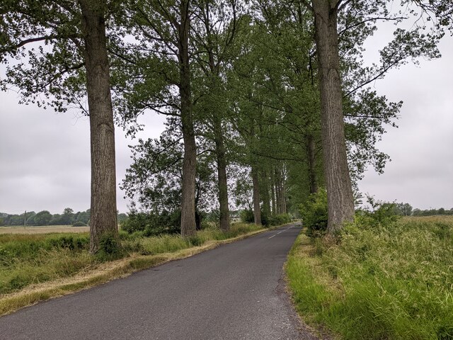
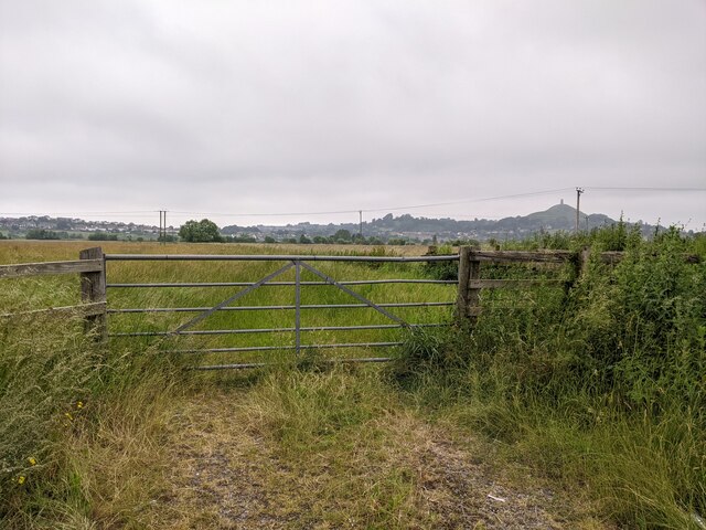
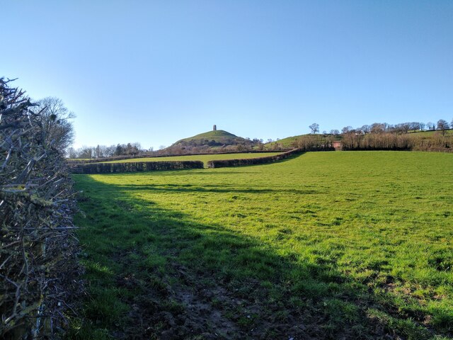
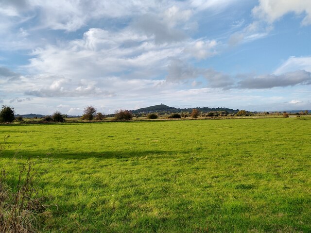
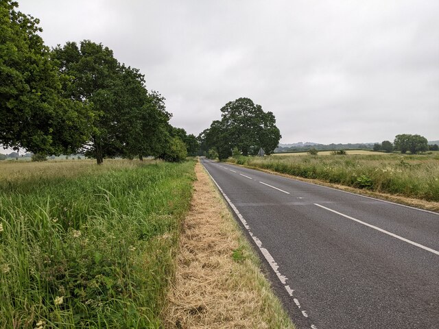
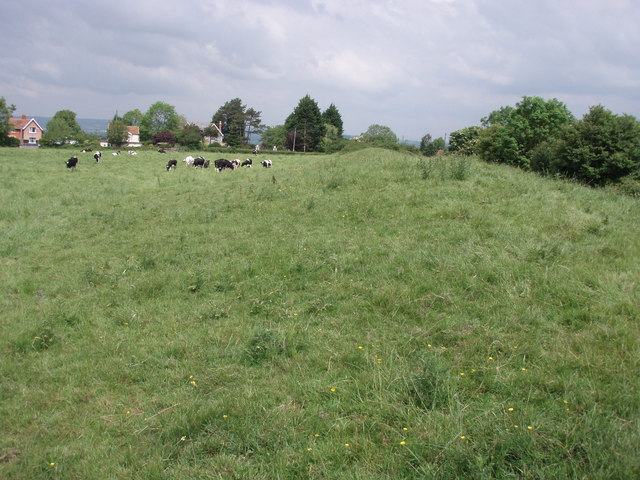
The South Moor Downs, characterized by their rolling hills and expansive grasslands, provide a haven for various wildlife species and offer breathtaking panoramic views. The area is home to an array of flora and fauna, including rare orchids, skylarks, and the iconic Exmoor ponies. The Downs also serve as a popular destination for outdoor enthusiasts, with numerous walking and cycling trails meandering through the countryside.

In addition to its Downs, South Moor boasts extensive Moorland, characterized by its open, rugged terrain. This unique landscape features vast stretches of heather and gorse, interspersed with rocky outcrops and peat bogs. Moorland is not only visually striking but also plays a crucial role in supporting biodiversity, providing habitats for a variety of wildlife, including birds of prey such as buzzards and kestrels.

South Moor offers a range of recreational activities, including hiking, horse riding, and bird watching. The area also attracts many nature photographers, drawn to its scenic beauty and abundant wildlife. Additionally, the region is dotted with charming villages and historic landmarks, such as ancient stone circles and remnants of Iron Age settlements, adding to its cultural and historical appeal.

Overall, South Moor, Somerset, with its Downs and Moorland landscapes, offers a captivating and immersive experience for nature lovers, outdoor enthusiasts, and those seeking a tranquil escape in the heart of the English countryside.

If you have any feedback on the listing, please let us know in the comments section below.
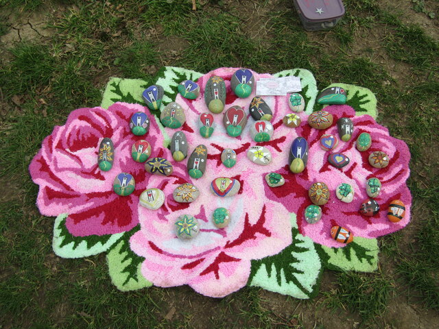
South Moor Images

Images are sourced within 2km of 51.127282/-2.6942281 or Grid Reference ST5136. Thanks to Geograph Open Source API. All images are credited.

Street Drove heading west
Looking north from Street Drove
Glastonbury Tor from Stone Down Lane NCN3 Glastonbury Tor, photographed from the NCN3 on the junction of Stone Down Lane with Basketfield Lane.
Glastonbury Tor from Stone Down Lane NCN3
Glastonbury Tor, photographed from the NCN3 on the junction of Stone Down Lane with Basketfield Lane.
Glastonbury Tor from Entrance on Stone Down Lane NCN3 The entrance from NCN3 on Stone Down Lane onto the path up to Glastonbury Tor.
Note this a footpath only - there is no access for cycles and there is no cycle rack provided.
Glastonbury Tor from Entrance on Stone Down Lane NCN3
The entrance from NCN3 on Stone Down Lane onto the path up to Glastonbury Tor. Note this a footpath only - there is no access for cycles and there is no cycle rack provided.
View over the fields from Gypsy Lane, Edgarley View from the corner of Gypsy Lane and Wick Lane near Edgarley, over the fields towards Glastonbury Tor.
View over the fields from Gypsy Lane, Edgarley
View from the corner of Gypsy Lane and Wick Lane near Edgarley, over the fields towards Glastonbury Tor.
Kennard Moor and Glastonbury Tor from NCN26 A view of Kennard Moor, with Glastonbury Tor in the distance, photographed from NCN26 Kennard Moor Drove.
Kennard Moor and Glastonbury Tor from NCN26
A view of Kennard Moor, with Glastonbury Tor in the distance, photographed from NCN26 Kennard Moor Drove.
Glastonbury Tor Fabled and landmark hill (520 feet / 158 metres amsl) east of Glastonbury town centre. The tower is all that remains of St Michael's Church.
<span class="nowrap"><a title="www.glastonbury.gov.uk" rel="nofollow ugc noopener" href="http://www.glastonbury.gov.uk">Link</a><img style="margin-left:2px;" alt="External link" title="External link - shift click to open in new window" src="https://s1.geograph.org.uk/img/external.png" width="10" height="10"/></span>
Glastonbury Tor
Fabled and landmark hill (520 feet / 158 metres amsl) east of Glastonbury town centre. The tower is all that remains of St Michael's Church. LinkExternal link
Glastonbury Tor - Tower The tower on top of The Tor is all that remains of St Michael's Church. It is a local landmark from miles around the hill.
<span class="nowrap"><a title="www.glastonbury.gov.uk" rel="nofollow ugc noopener" href="http://www.glastonbury.gov.uk">Link</a><img style="margin-left:2px;" alt="External link" title="External link - shift click to open in new window" src="https://s1.geograph.org.uk/img/external.png" width="10" height="10"/></span>
Glastonbury Tor - Tower
The tower on top of The Tor is all that remains of St Michael's Church. It is a local landmark from miles around the hill. LinkExternal link
Glastonbury Rocks Eyecatching display of painted rocks on a rose background, placed on the hillside of Glastonbury Tor.
Glastonbury Rocks
Eyecatching display of painted rocks on a rose background, placed on the hillside of Glastonbury Tor.
Glastonbury Tor - Western Approach National Trust sign by the steps leading from the town towards the hilltop.
<span class="nowrap"><a title="www.glastonbury.gov.uk" rel="nofollow ugc noopener" href="http://www.glastonbury.gov.uk">Link</a><img style="margin-left:2px;" alt="External link" title="External link - shift click to open in new window" src="https://s1.geograph.org.uk/img/external.png" width="10" height="10"/></span>
Glastonbury Tor - Western Approach
National Trust sign by the steps leading from the town towards the hilltop. LinkExternal link
Glastonbury - Former Toll House Blue painted old house on Chilkwell Street by the Chalice Well. Note the board with toll rates.
<span class="nowrap"><a title="www.glastonbury.gov.uk" rel="nofollow ugc noopener" href="http://www.glastonbury.gov.uk">Link</a><img style="margin-left:2px;" alt="External link" title="External link - shift click to open in new window" src="https://s1.geograph.org.uk/img/external.png" width="10" height="10"/></span>
Glastonbury - Former Toll House
Blue painted old house on Chilkwell Street by the Chalice Well. Note the board with toll rates. LinkExternal link
Glastonbury - Tolls Board Whimsical board on the wall of the former toll house on Chilkwell Street which stands on the old turnpike road between Glastonbury and Shepton Mallet. Maybe hippies were scalped here?
<span class="nowrap"><a title="www.glastonbury.gov.uk" rel="nofollow ugc noopener" href="http://www.glastonbury.gov.uk">Link</a><img style="margin-left:2px;" alt="External link" title="External link - shift click to open in new window" src="https://s1.geograph.org.uk/img/external.png" width="10" height="10"/></span>
Glastonbury - Tolls Board
Whimsical board on the wall of the former toll house on Chilkwell Street which stands on the old turnpike road between Glastonbury and Shepton Mallet. Maybe hippies were scalped here? LinkExternal link
Glastonbury - Chalice Well The Vessica Pool mirrors a figure of eight and the chalybeate spring water is reddish.
<span class="nowrap"><a title="www.chalicewell.org.uk" rel="nofollow ugc noopener" href="http://www.chalicewell.org.uk">Link</a><img style="margin-left:2px;" alt="External link" title="External link - shift click to open in new window" src="https://s1.geograph.org.uk/img/external.png" width="10" height="10"/></span>
Glastonbury - Chalice Well
The Vessica Pool mirrors a figure of eight and the chalybeate spring water is reddish. LinkExternal link
Glastonbury Tor The Tor is seen here on a cloudless November day in 1996. St Michael's Tower, which gives the hill its distinctive profile, is all that remains of a 14th century church. Perhaps it is unsurprising that the church did not survive given the considerable effort required to get to it.
Glastonbury Tor
The Tor is seen here on a cloudless November day in 1996. St Michael's Tower, which gives the hill its distinctive profile, is all that remains of a 14th century church. Perhaps it is unsurprising that the church did not survive given the considerable effort required to get to it.
Fields, drainage and the Tor in the distance
Road heading to Glastonbury
Road heading south
Road heading south
At Glastonbury Tor A great spot.
At Glastonbury Tor
A great spot.
Show me another place!

South Moor is located at Grid Ref: ST5136 (Lat: 51.127282, Lng: -2.6942281)

Administrative County: Somerset

District: Mendip

Police Authority: Avon and Somerset

What 3 Words

///crockery.hounded.forgiving. Near Glastonbury, Somerset

Nearby Locations

South Moor

Related Wikis

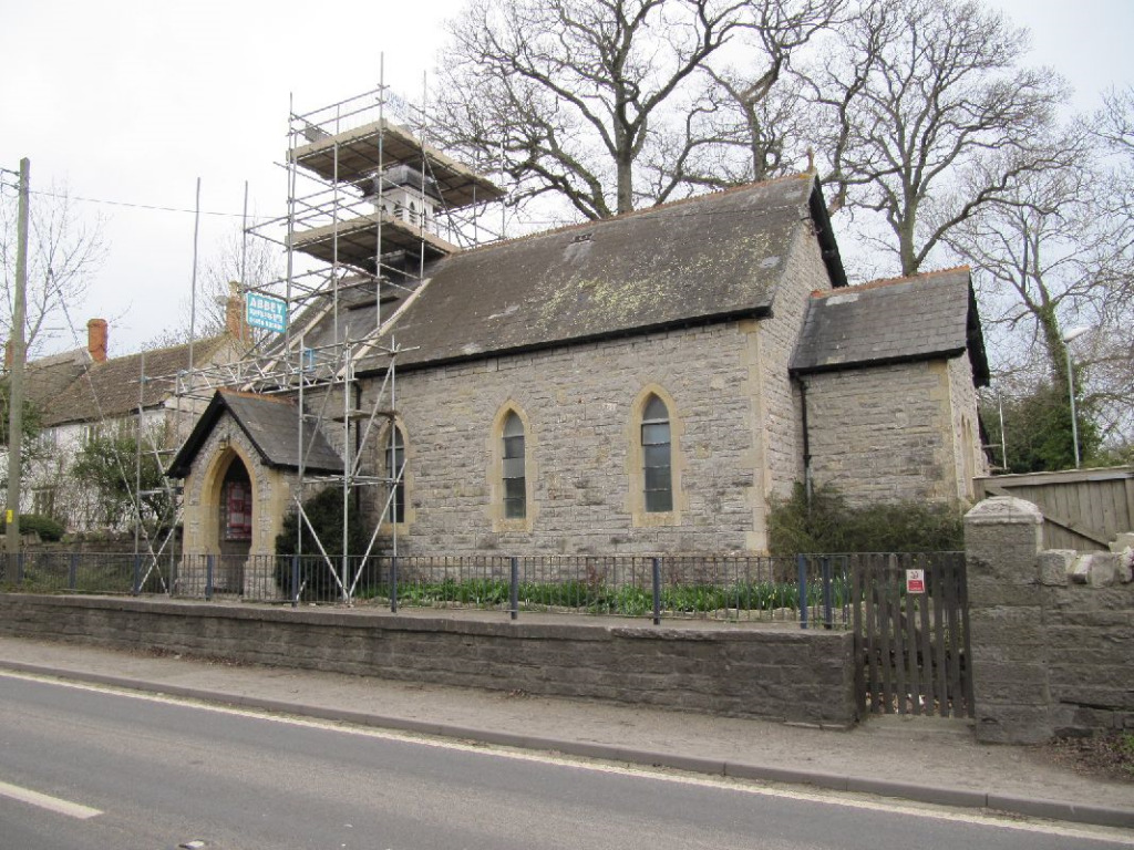
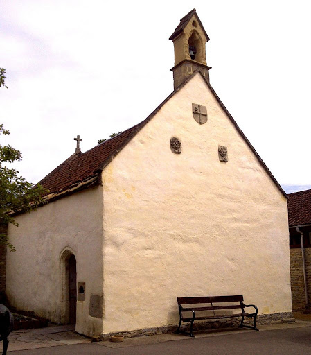
St Andrew's Church, Edgarley

St Andrew's Church is a former Church of England mission church in Edgarley, Somerset, England. It was built in 1897 and is now used as a private chapel...
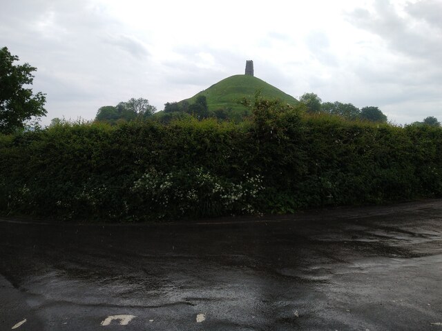
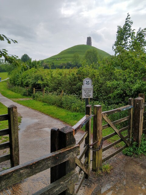
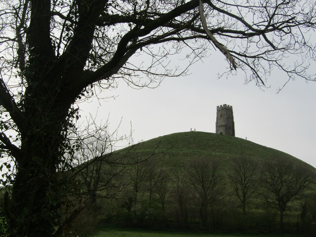
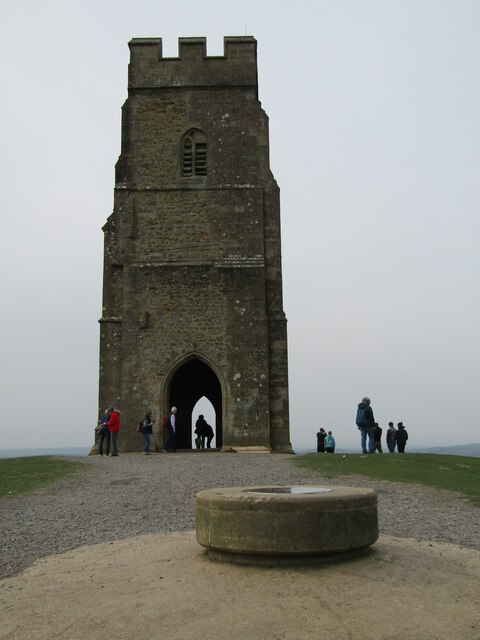
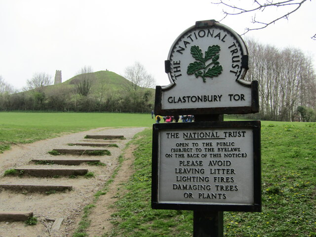
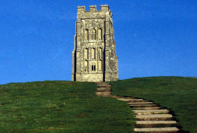
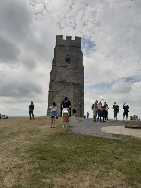
Glastonbury Tor

Glastonbury Tor is a tor near Glastonbury in the English county of Somerset, topped by the roofless St Michael's Tower, a Grade I listed building. The...
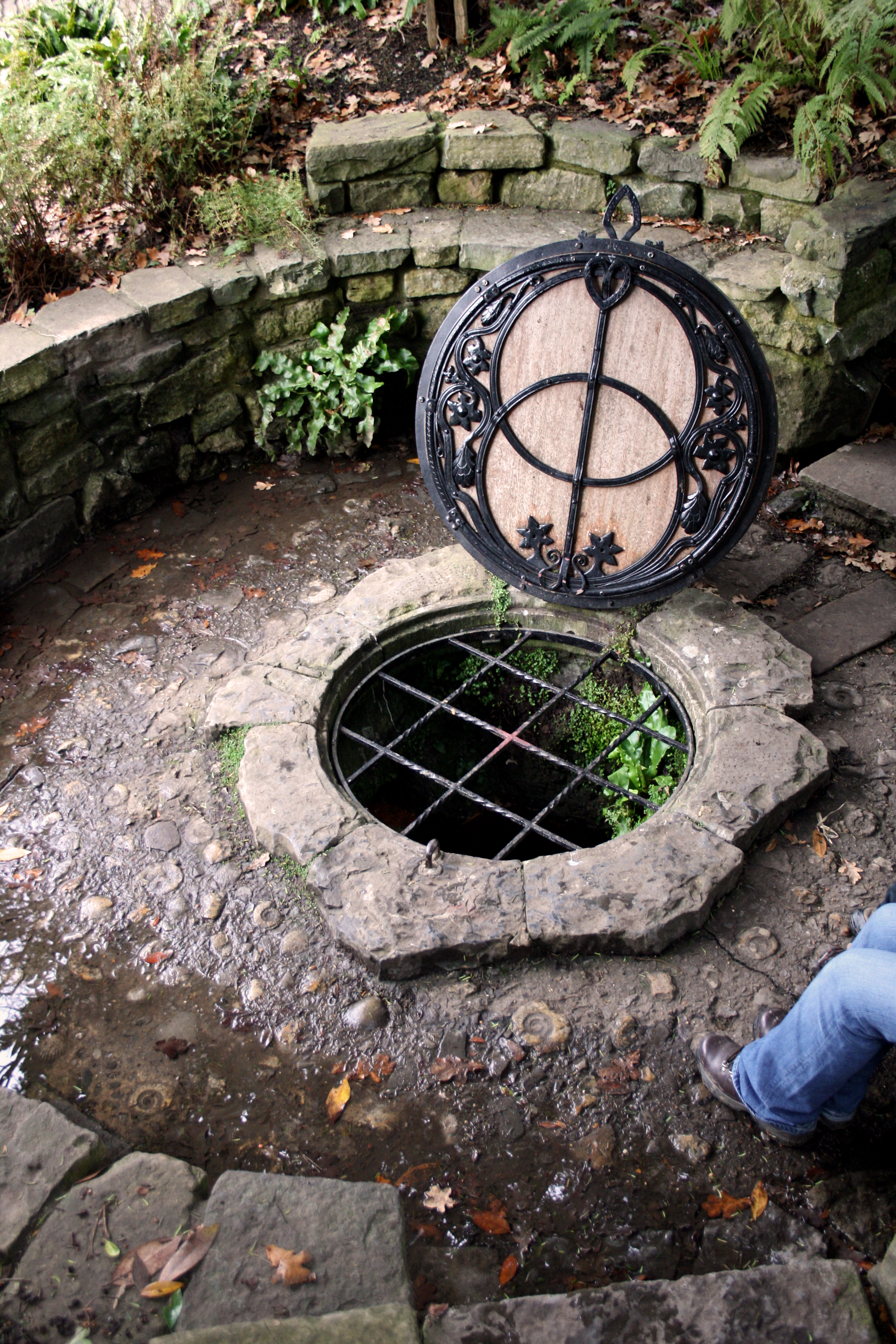
Chalice Well

The Chalice Well, also known as the Red Spring, is a well situated near the summit of Chalice Hill, a small hill next to Glastonbury Tor in Glastonbury...

Ponter's Ball Dyke

Ponter's Ball Dyke is a linear earthwork located near Glastonbury in Somerset, England. It crosses, at right angles, an ancient road that continues on...

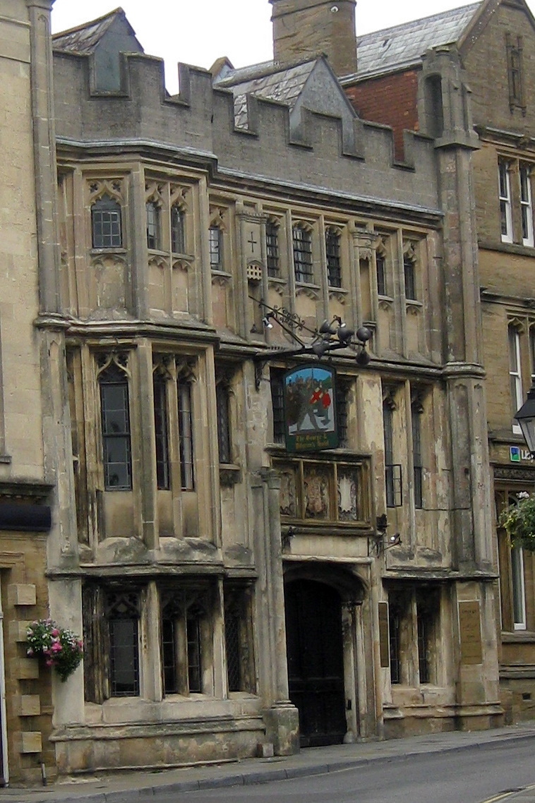
George Hotel and Pilgrims' Inn, Glastonbury

The George Hotel and Pilgrims' Inn in Glastonbury, Somerset, England, was built in the late 15th century to accommodate visitors to Glastonbury Abbey....

Millfield

Millfield is a public school (English fee-charging boarding and day school for pupils aged 13–18) located in Street, Somerset, England. It was founded...

Glastonbury Extravaganza

Glastonbury Extravaganza (also known as Glastonbury Abbey Extravaganza and previously as Glastonbury Classical Extravaganza) is an annual music event held...

St. Patrick's Chapel, Glastonbury

St. Patrick's Chapel in Glastonbury, Somerset, England, is housed within the grounds of Glastonbury Abbey, and was completed in 1517. It is a site of pilgrimage...

Nearby Amenities

Located within 500m of 51.127282,-2.6942281
Power: pole
Lat/Long: 51.1274927/-2.700169
Power: pole
Lat/Long: 51.1280707/-2.6985515
Power: pole
Lat/Long: 51.1286685/-2.6968794
Power: pole
Lat/Long: 51.1292517/-2.6952262
Power: pole
Lat/Long: 51.1296783/-2.6940261
Power: pole
Lat/Long: 51.1298455/-2.6935415
Power: pole
Lat/Long: 51.1304538/-2.6918673
The data included in this document is from www.openstreetmap.org. The data is made available under ODbL.

Have you been to South Moor?

Leave your review of South Moor below (or comments, questions and feedback).