Back Brae

Downs, Moorland in Roxburghshire

Scotland

Back Brae

Viewpoint on Gala Hill A fine view to the Eildon Hills from this seat next to the Southern Upland Way.
Viewpoint on Gala Hill Credit: Jim Barton

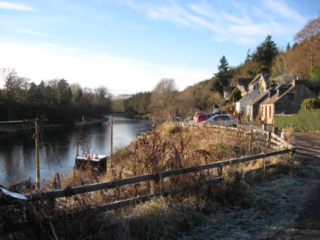
Back Brae is a picturesque region located in Roxburghshire, Scotland. Known for its stunning landscape, the area is characterized by its rolling downs and expansive moorland. Spanning approximately 200 square kilometers, Back Brae offers visitors the opportunity to immerse themselves in the natural beauty and tranquility of the Scottish countryside.

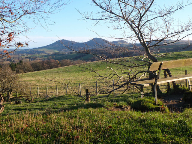
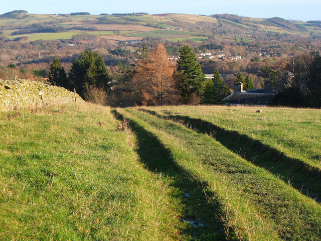
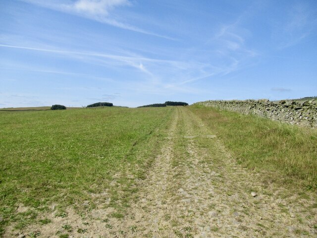
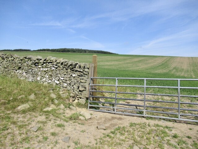
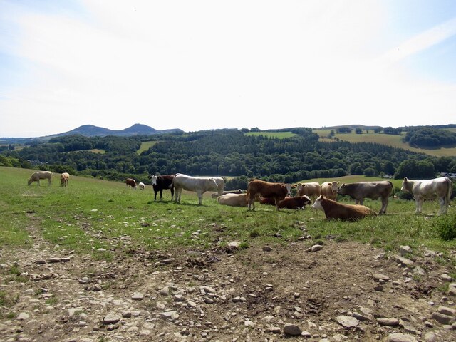
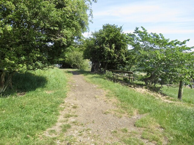
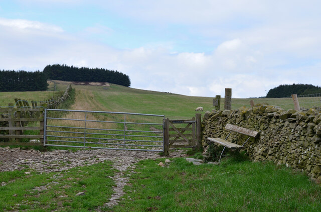
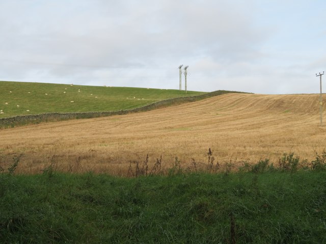
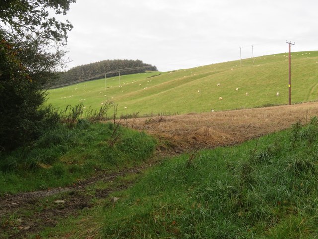
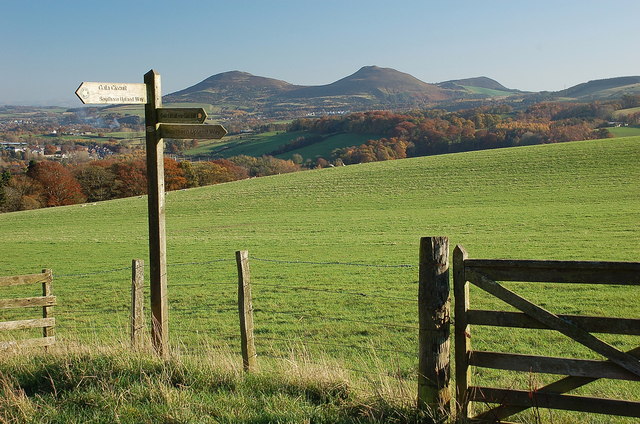
The downs of Back Brae are defined by their gentle slopes and lush green pastures. These open fields are often dotted with grazing livestock, creating a peaceful and idyllic scene. The downs provide ample space for outdoor activities such as walking, hiking, and picnicking, offering visitors a chance to reconnect with nature and enjoy breathtaking views of the surrounding countryside.

The moorland in Back Brae is equally captivating. Stretching for miles, the moors are characterized by their expansive heather-covered hills and peat bogs. This unique ecosystem is home to a diverse range of flora and fauna, including various species of birds, small mammals, and wildflowers. The moorland provides a rich habitat for wildlife enthusiasts and birdwatchers to explore and observe the natural wonders of the area.

Back Brae is also steeped in history and culture. The region is dotted with ancient ruins, including standing stones and hill forts, which offer a glimpse into its past. Additionally, the local communities in Back Brae have a strong sense of heritage, with traditional Scottish customs and festivals being celebrated throughout the year.

Overall, Back Brae in Roxburghshire is a captivating destination that showcases the beauty of the Scottish countryside. With its downs, moorland, and rich history, it offers visitors a truly immersive and unforgettable experience.

If you have any feedback on the listing, please let us know in the comments section below.

Back Brae Images

Images are sourced within 2km of 55.598576/-2.7713903 or Grid Reference NT5134. Thanks to Geograph Open Source API. All images are credited.

Viewpoint on Gala Hill A fine view to the Eildon Hills from this seat next to the Southern Upland Way.
Viewpoint on Gala Hill
A fine view to the Eildon Hills from this seat next to the Southern Upland Way.
Southern Upland Way, Gala Hill The way descends towards the River Tweed to the south of Galashiels.
Southern Upland Way, Gala Hill
The way descends towards the River Tweed to the south of Galashiels.
Track above Netherbarns
Grassland on Gala Hill During a very dry Summer.
Grassland on Gala Hill
During a very dry Summer.
Cattle above Netherbarns
Path on Gala Hill Used by the Southern Upland Way between Galashiels and the Tweed.
Path on Gala Hill
Used by the Southern Upland Way between Galashiels and the Tweed.
Gates and seat, Gala Hill The Southern Upland Way turns right here on its traverse across the east side of Gala Hill.
Gates and seat, Gala Hill
The Southern Upland Way turns right here on its traverse across the east side of Gala Hill.
Sheep pasture and stubble at Netherbarns West of the old Abbotsford Road, now bypassed by a realigned A7.
Sheep pasture and stubble at Netherbarns
West of the old Abbotsford Road, now bypassed by a realigned A7.
Sheep pasture at Netherbarns West of the old Abbotsford Road, now bypassed by a realigned A7.
Sheep pasture at Netherbarns
West of the old Abbotsford Road, now bypassed by a realigned A7.
Recrossing the Tweed at the Braw Lads' Gathering The Principals and their Attendants returning from Abbotsford, having drunk toasts to Abbotsford and Galashiels. The Braw Lads' Gathering is one of those ancient traditions the Scots are very good at inventing only recently. It dates from 1930. When first proposed, the Provost of Galashiels was at pains to point out that it was NOT a Common Riding of the sort perpetuated by other Borders towns (so no attempt by Gala to emulate its old rivals then?).
Recrossing the Tweed at the Braw Lads' Gathering
The Principals and their Attendants returning from Abbotsford, having drunk toasts to Abbotsford and Galashiels. The Braw Lads' Gathering is one of those ancient traditions the Scots are very good at inventing only recently. It dates from 1930. When first proposed, the Provost of Galashiels was at pains to point out that it was NOT a Common Riding of the sort perpetuated by other Borders towns (so no attempt by Gala to emulate its old rivals then?).
The Braw Lad and Lass Crossing the Tweed The Braw Lad (Lewis Playfair) and Braw Lass (Suzanne Henry) fording the Tweed at Boleside.
The Braw Lad and Lass Crossing the Tweed
The Braw Lad (Lewis Playfair) and Braw Lass (Suzanne Henry) fording the Tweed at Boleside.
Footpaths around Galashiels The sign indicates both the Southern Upland Way and the Gala Circuit - a 25km route encircling the town by linking hillside and woodland paths. A fine view of the Eildon Hills is obtained from this point on Gala Hill. Nearby is the Roger Quin memorial plaque <a href="https://www.geograph.org.uk/photo/1641172">NT4934 : 'Eden' The Roger Quin Memorial</a>.
Footpaths around Galashiels
The sign indicates both the Southern Upland Way and the Gala Circuit - a 25km route encircling the town by linking hillside and woodland paths. A fine view of the Eildon Hills is obtained from this point on Gala Hill. Nearby is the Roger Quin memorial plaque NT4934 : 'Eden' The Roger Quin Memorial.
The River Tweed at Boleside The cottages at Boleside would make an ideal place to stay if 
you were a dedicated fisherman.
The River Tweed at Boleside
The cottages at Boleside would make an ideal place to stay if you were a dedicated fisherman.
Two Men in a Boat Two stalwart fishermen just below Boleside on the river Tweed trying to lure Salmon on to their flies. It was cold enough walking, but to sit in a boat. Hope they had a wee dram handy.
Two Men in a Boat
Two stalwart fishermen just below Boleside on the river Tweed trying to lure Salmon on to their flies. It was cold enough walking, but to sit in a boat. Hope they had a wee dram handy.
The Southern Upland Way A corner on the Southern Upland Way near Galashiels, viewed in early March.
The Southern Upland Way
A corner on the Southern Upland Way near Galashiels, viewed in early March.
The A7 at Glenmayne The traffic is heading towards Selkirk.
The A7 at Glenmayne
The traffic is heading towards Selkirk.
River Tweed at Boleside, 1989 View southward.
River Tweed at Boleside, 1989
View southward.
Rainbow over River Tweed at Boleside, 1989 View east.
Rainbow over River Tweed at Boleside, 1989
View east.
Show me another place!

Back Brae is located at Grid Ref: NT5134 (Lat: 55.598576, Lng: -2.7713903)

Unitary Authority: The Scottish Borders

Police Authority: The Lothians and Scottish Borders

What 3 Words

///continues.zest.jacket. Near Tweedbank, Scottish Borders

Related Wikis

Related Videos

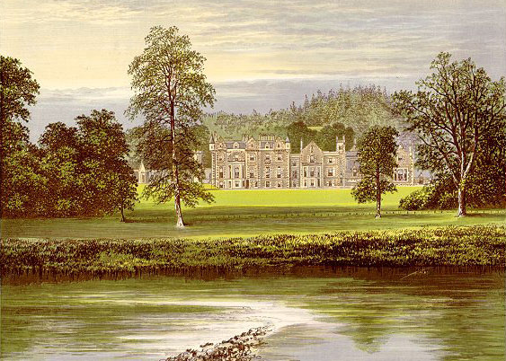
Travel to Abbotsford

On a song composed by Sir Walter Scott (Bonnie Dundee) lets travel to a magical place... Abbotsford House, home of Sir Walter ...

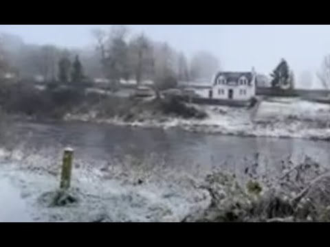
❄️ Walking on the snowy icy riverbank in Scotland

Join me for a beautiful walk on the River Tweed in Souther Scotland. Watch me skimming stones, see the gulls on the water, and ...

🦢🐟🦆🌨 Walking around the rainy loch

LIVE: Walking around the rainy loch. Subscribe at Happs: https://happs.tv/post/kKAOMh4QdQDgq61P9xUs.

Nearby Amenities

Located within 500m of 55.598576,-2.7713903
Bus Stop
Tweedbank Loch
Bench: no
Bus: yes
Departures Board: yes
Lit: yes
Local Ref: at
Naptan AtcoCode: 69001033
Naptan Bearing: E
Naptan CommonName: Tweedbank Loch
Naptan Indicator: at
Naptan NaptanCode: 72726383
Naptan Street: Tweedbank Drive
Note: surveyed and verified
Operator: Scottish Borders Council
Public Transport: platform
Ref: 69001033
Shelter: yes
Source: local knowledge;survey;NaPTAN
Lat/Long: 55.601533/-2.768841
Crossing
Crossing: unmarked
Crossing Island: yes
Tactile Paving: yes
Lat/Long: 55.6019117/-2.7666147
Crossing
Crossing: unmarked
Kerb: lowered
Tactile Paving: yes
Lat/Long: 55.6008802/-2.7731556
Crossing
Crossing: unmarked
Kerb: flush
Tactile Paving: yes
Lat/Long: 55.6009956/-2.7729635
Bauchlin Cottages
Place: hamlet
Lat/Long: 55.5962075/-2.7760014
Bus Stop
Abbotsford House
Shelter: no
Lat/Long: 55.6004534/-2.7780545
Bus Stop
Tweedbank Loch
Bench: no
Bus: yes
Departures Board: timetable
Lit: yes
Local Ref: at
Naptan AtcoCode: 69001034
Naptan Bearing: W
Naptan CommonName: Tweedbank Loch
Naptan Indicator: opp
Naptan NaptanCode: 72726382
Naptan Street: Tweedbank Drive
Note: surveyed and verified
Operator: Scottish Borders Council
Public Transport: platform
Ref: 69001034
Shelter: yes
Source: local knowledge;survey;NaPTAN
Lat/Long: 55.6014051/-2.7694434
Give Way
Direction: forward
Lat/Long: 55.6016942/-2.7667079
Power: pole
Lat/Long: 55.5978991/-2.7643732
Power: pole
Lat/Long: 55.5977898/-2.7655515
Power: pole
Lat/Long: 55.5976762/-2.7667528
Power: pole
Lat/Long: 55.5975885/-2.767809
Power: pole
Lat/Long: 55.5969472/-2.7687558
Power: pole
Lat/Long: 55.5969098/-2.7697407
Power: pole
Lat/Long: 55.5967875/-2.7710489
Power: pole
Lat/Long: 55.5966912/-2.7723189
Power: pole
Lat/Long: 55.5965776/-2.7735227
Power: pole
Lat/Long: 55.5964748/-2.7747088
Power: pole
Lat/Long: 55.5963957/-2.7756517
Power: pole
Lat/Long: 55.595658/-2.7747138
Power: pole
Lat/Long: 55.5950058/-2.7738612
Power: pole
Lat/Long: 55.5943673/-2.7730417
The data included in this document is from www.openstreetmap.org. The data is made available under ODbL.

Have you been to Back Brae?

Leave your review of Back Brae below (or comments, questions and feedback).