Turnagain Plantation

Wood, Forest in Roxburghshire

Scotland

Turnagain Plantation

Southern Upland Way, Gala Hill The way descends towards the River Tweed to the south of Galashiels.
Southern Upland Way, Gala Hill Credit: Jim Barton

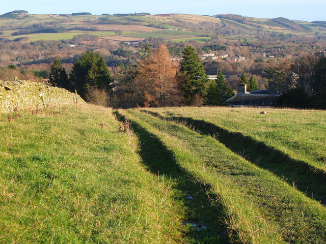
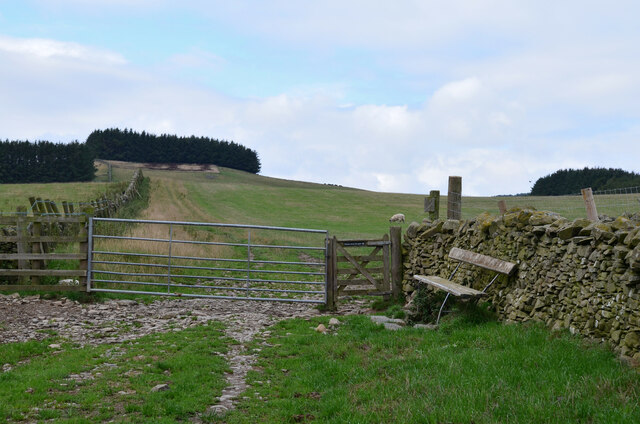
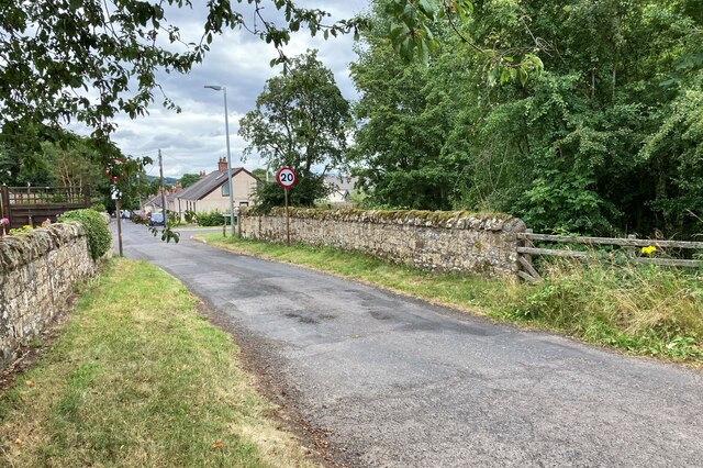
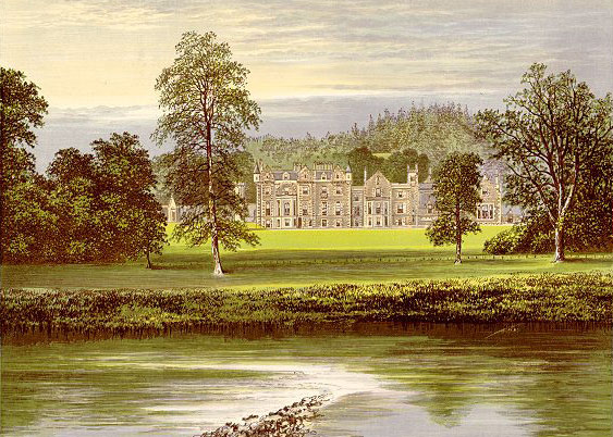
Turnagain Plantation is a picturesque woodland area located in Roxburghshire, a historic county in the Scottish Borders region of Scotland. This expansive woodland is known for its dense forests and scenic beauty, attracting nature enthusiasts and outdoor adventurers alike.

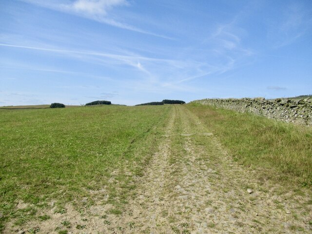
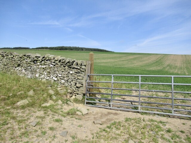
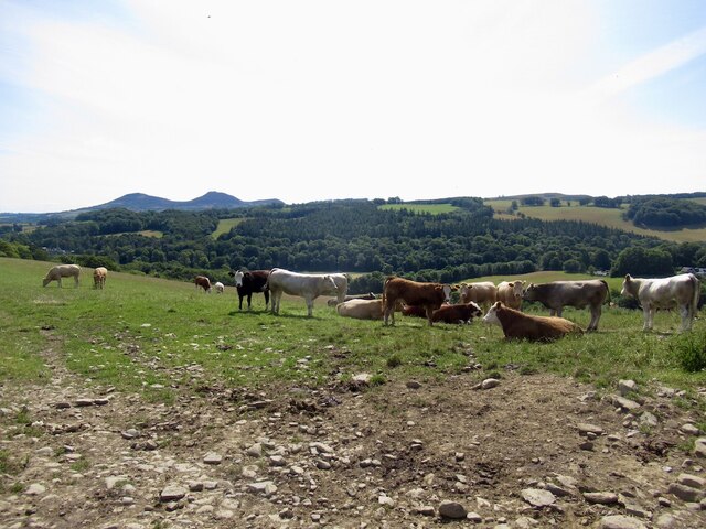
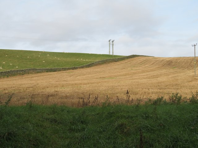
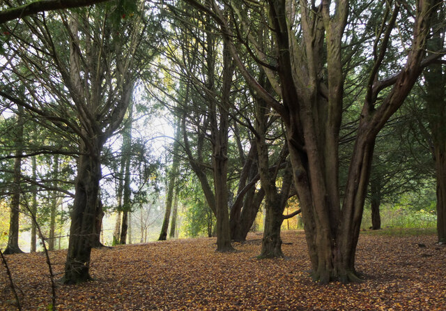
Covering an area of approximately 200 acres, Turnagain Plantation offers a diverse range of flora and fauna. The woodland is primarily composed of native species such as oak, birch, and pine trees, creating a rich and vibrant ecosystem. The forest floor is adorned with a carpet of wildflowers during the spring and summer months, adding a burst of color to the landscape.

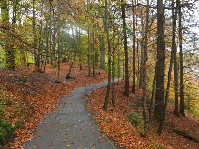
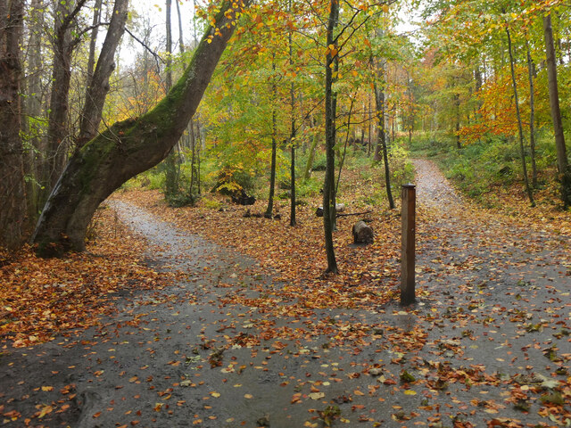
The woodland is crisscrossed with well-maintained trails, providing visitors with ample opportunities for walking, hiking, and exploring. These trails lead to various points of interest within Turnagain Plantation, including hidden streams, tranquil ponds, and breathtaking viewpoints that offer panoramic vistas of the surrounding countryside.

Wildlife is abundant in Turnagain Plantation, with deer, foxes, and a variety of bird species frequently spotted by visitors. The woodland provides a safe haven for these creatures, offering a natural habitat where they can thrive undisturbed.

In addition to its natural beauty, Turnagain Plantation also has historical significance. The area was once part of a larger estate and has been carefully managed and preserved over the years. The heritage of the plantation is celebrated through informative signposts that provide visitors with insights into the history and significance of the woodland.

Overall, Turnagain Plantation is a hidden gem in Roxburghshire, offering a serene and enchanting escape for those seeking solace in nature.

If you have any feedback on the listing, please let us know in the comments section below.

Turnagain Plantation Images

Images are sourced within 2km of 55.597704/-2.7687229 or Grid Reference NT5134. Thanks to Geograph Open Source API. All images are credited.

Southern Upland Way, Gala Hill The way descends towards the River Tweed to the south of Galashiels.
Southern Upland Way, Gala Hill
The way descends towards the River Tweed to the south of Galashiels.
Track above Netherbarns
Grassland on Gala Hill During a very dry Summer.
Grassland on Gala Hill
During a very dry Summer.
Cattle above Netherbarns
Gates and seat, Gala Hill The Southern Upland Way turns right here on its traverse across the east side of Gala Hill.
Gates and seat, Gala Hill
The Southern Upland Way turns right here on its traverse across the east side of Gala Hill.
Sheep pasture and stubble at Netherbarns West of the old Abbotsford Road, now bypassed by a realigned A7.
Sheep pasture and stubble at Netherbarns
West of the old Abbotsford Road, now bypassed by a realigned A7.
Recrossing the Tweed at the Braw Lads' Gathering The Principals and their Attendants returning from Abbotsford, having drunk toasts to Abbotsford and Galashiels. The Braw Lads' Gathering is one of those ancient traditions the Scots are very good at inventing only recently. It dates from 1930. When first proposed, the Provost of Galashiels was at pains to point out that it was NOT a Common Riding of the sort perpetuated by other Borders towns (so no attempt by Gala to emulate its old rivals then?).
Recrossing the Tweed at the Braw Lads' Gathering
The Principals and their Attendants returning from Abbotsford, having drunk toasts to Abbotsford and Galashiels. The Braw Lads' Gathering is one of those ancient traditions the Scots are very good at inventing only recently. It dates from 1930. When first proposed, the Provost of Galashiels was at pains to point out that it was NOT a Common Riding of the sort perpetuated by other Borders towns (so no attempt by Gala to emulate its old rivals then?).
The Braw Lad and Lass Crossing the Tweed The Braw Lad (Lewis Playfair) and Braw Lass (Suzanne Henry) fording the Tweed at Boleside.
The Braw Lad and Lass Crossing the Tweed
The Braw Lad (Lewis Playfair) and Braw Lass (Suzanne Henry) fording the Tweed at Boleside.
Two Men in a Boat Two stalwart fishermen just below Boleside on the river Tweed trying to lure Salmon on to their flies. It was cold enough walking, but to sit in a boat. Hope they had a wee dram handy.
Two Men in a Boat
Two stalwart fishermen just below Boleside on the river Tweed trying to lure Salmon on to their flies. It was cold enough walking, but to sit in a boat. Hope they had a wee dram handy.
The Southern Upland Way A corner on the Southern Upland Way near Galashiels, viewed in early March.
The Southern Upland Way
A corner on the Southern Upland Way near Galashiels, viewed in early March.
The A7 at Glenmayne The traffic is heading towards Selkirk.
The A7 at Glenmayne
The traffic is heading towards Selkirk.
Tweedbank station An aerial view over Tweedbank station looking towards Melrose.

Forms part of Railway Routes Blogpost <span class="nowrap"><a title="https://tinyurl.com/e94tw557" rel="nofollow ugc noopener" href="https://tinyurl.com/e94tw557">Link</a><img style="margin-left:2px;" alt="External link" title="External link - shift click to open in new window" src="https://s1.geograph.org.uk/img/external.png" width="10" height="10"/></span>
Tweedbank station
An aerial view over Tweedbank station looking towards Melrose. Forms part of Railway Routes Blogpost LinkExternal link
Tweedbank station Aerial view of Tweedbank station which forms part of "Railway Routes" BlogPost <span class="nowrap"><a title="https://tinyurl.com/e94tw557" rel="nofollow ugc noopener" href="https://tinyurl.com/e94tw557">Link</a><img style="margin-left:2px;" alt="External link" title="External link - shift click to open in new window" src="https://s1.geograph.org.uk/img/external.png" width="10" height="10"/></span>
Tweedbank station
Aerial view of Tweedbank station which forms part of "Railway Routes" BlogPost LinkExternal link
Broomilees Road. Infilled Railway cutting At this point was an over bridge on the Waverley Line, now infilled.


<span class="nowrap"><a title="https://tinyurl.com/e94tw557" rel="nofollow ugc noopener" href="https://tinyurl.com/e94tw557">Link</a><img style="margin-left:2px;" alt="External link" title="External link - shift click to open in new window" src="https://s1.geograph.org.uk/img/external.png" width="10" height="10"/></span>
Broomilees Road. Infilled Railway cutting
At this point was an over bridge on the Waverley Line, now infilled. LinkExternal link
A climbing tree, Abbotsford A dead tree now furnished with handholds in the woodland near the visitor centre.
A climbing tree, Abbotsford
A dead tree now furnished with handholds in the woodland near the visitor centre.
Yew trees, Abbotsford A grove of old yews by the woodland walk in the grounds of Abbotsford House.
Yew trees, Abbotsford
A grove of old yews by the woodland walk in the grounds of Abbotsford House.
Woodland path, Abbotsford One of the woodland walks southwest of Abbotsford House.
Woodland path, Abbotsford
One of the woodland walks southwest of Abbotsford House.
Turning point for Abbotsford The woodland path from Abbotsford turns back here to follow the Tweed back towards the house.
Turning point for Abbotsford
The woodland path from Abbotsford turns back here to follow the Tweed back towards the house.
Show me another place!

Turnagain Plantation is located at Grid Ref: NT5134 (Lat: 55.597704, Lng: -2.7687229)

Unitary Authority: The Scottish Borders

Police Authority: The Lothians and Scottish Borders

What 3 Words

///residual.shuffle.cheetahs. Near Tweedbank, Scottish Borders

Related Wikis

Tweedbank

Tweedbank is a large village south-east of Galashiels in the Scottish Borders, Scotland. It is part of the county of Roxburghshire. It is an outer suburb...

Abbotsford, Scottish Borders

Abbotsford is a historic country house in the Scottish Borders, near Galashiels, on the south bank of the River Tweed. Now open to the public, it was built...

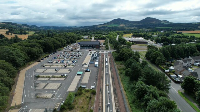
Tweedbank railway station

Tweedbank is a railway station on the Borders Railway, which runs between Edinburgh Waverley and Tweedbank. The station, situated 35 miles 34 chains (57...

Darnick

Darnick is a village near Melrose in the Scottish Borders area of Scotland, in the former Roxburghshire. The name was first recorded in 1124, and has changed...
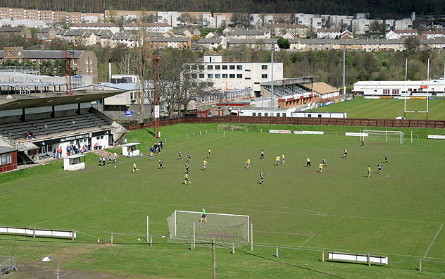
Netherdale

Netherdale is a sports complex in Galashiels, Scottish Borders, consisting of two adjacent stadiums used for rugby union and football. The rugby ground...

Borders College

Borders College (Scottish Gaelic: Colaiste nan Crìochan) is a further education institution in the Scottish Borders, Scotland. Its main campus is located...

Borders General Hospital

Borders General Hospital (BGH) is a district general hospital on the outskirts of Melrose, Scotland. It is managed by NHS Borders. == History == The hospital...

Abbotsford Ferry railway station

Abbotsford Ferry railway station was a small railway station on the branch line from Galashiels to Selkirk railway station at Selkirk in the Scottish county...

Nearby Amenities

Located within 500m of 55.597704,-2.7687229
Bus Stop
Tweedbank Loch
Bench: no
Bus: yes
Departures Board: yes
Lit: yes
Local Ref: at
Naptan AtcoCode: 69001033
Naptan Bearing: E
Naptan CommonName: Tweedbank Loch
Naptan Indicator: at
Naptan NaptanCode: 72726383
Naptan Street: Tweedbank Drive
Note: surveyed and verified
Operator: Scottish Borders Council
Public Transport: platform
Ref: 69001033
Shelter: yes
Source: local knowledge;survey;NaPTAN
Lat/Long: 55.601533/-2.768841
Crossing
Crossing: unmarked
Crossing Island: yes
Tactile Paving: yes
Lat/Long: 55.6019117/-2.7666147
Crossing
Crossing: unmarked
Kerb: lowered
Tactile Paving: yes
Lat/Long: 55.6008802/-2.7731556
Crossing
Crossing: unmarked
Kerb: flush
Tactile Paving: yes
Lat/Long: 55.6009956/-2.7729635
Sunnyside
Place: hamlet
Lat/Long: 55.597924/-2.7619832
Bauchlin Cottages
Place: hamlet
Lat/Long: 55.5962075/-2.7760014
Bus Stop
Tweedbank Loch
Bench: no
Bus: yes
Departures Board: timetable
Lit: yes
Local Ref: at
Naptan AtcoCode: 69001034
Naptan Bearing: W
Naptan CommonName: Tweedbank Loch
Naptan Indicator: opp
Naptan NaptanCode: 72726382
Naptan Street: Tweedbank Drive
Note: surveyed and verified
Operator: Scottish Borders Council
Public Transport: platform
Ref: 69001034
Shelter: yes
Source: local knowledge;survey;NaPTAN
Lat/Long: 55.6014051/-2.7694434
Noexit: yes
Lat/Long: 55.5975305/-2.7631259
Noexit: yes
Lat/Long: 55.5974532/-2.7620611
Give Way
Direction: forward
Lat/Long: 55.6016942/-2.7667079
Power: pole
Lat/Long: 55.5982974/-2.761006
Power: pole
Lat/Long: 55.598168/-2.7618688
Power: pole
Lat/Long: 55.5980645/-2.7626756
Power: pole
Lat/Long: 55.5979854/-2.763462
Power: pole
Lat/Long: 55.5978991/-2.7643732
Power: pole
Lat/Long: 55.5977898/-2.7655515
Power: pole
Lat/Long: 55.5976762/-2.7667528
Power: pole
Lat/Long: 55.5975885/-2.767809
Power: pole
Lat/Long: 55.5969472/-2.7687558
Power: pole
Lat/Long: 55.5969098/-2.7697407
Power: pole
Lat/Long: 55.5967875/-2.7710489
Power: pole
Lat/Long: 55.5966912/-2.7723189
Power: pole
Lat/Long: 55.5965776/-2.7735227
Power: pole
Lat/Long: 55.5964748/-2.7747088
Power: pole
Lat/Long: 55.5963957/-2.7756517
Power: pole
Lat/Long: 55.595658/-2.7747138
Power: pole
Lat/Long: 55.5950058/-2.7738612
Power: pole
Lat/Long: 55.5943673/-2.7730417
Power: pole
Lat/Long: 55.5937173/-2.7722158
The data included in this document is from www.openstreetmap.org. The data is made available under ODbL.

Have you been to Turnagain Plantation?

Leave your review of Turnagain Plantation below (or comments, questions and feedback).