Peat Moss

Downs, Moorland in Aberdeenshire

Scotland

Peat Moss

Trig Point Trig Point at NJ514232 taken from the path just below it to the west. The hill is un-named on the OS Explorer 420.
Trig Point Credit: Alan Batty

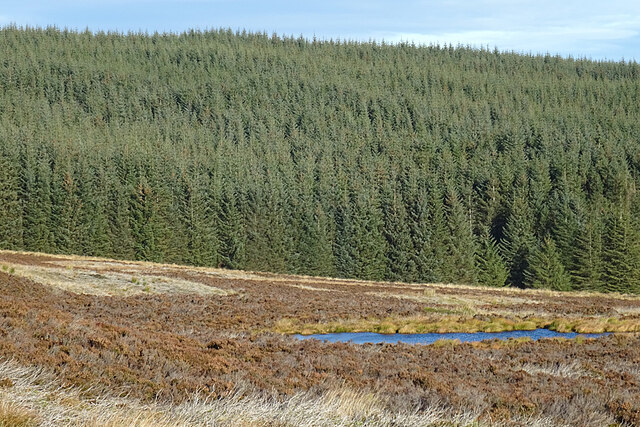
Peat Moss, located in Aberdeenshire, Scotland, is a unique and diverse natural landscape known for its downs and moorland. Covering an expansive area, Peat Moss offers a rich tapestry of habitats and features, making it a popular destination for nature enthusiasts and researchers alike.

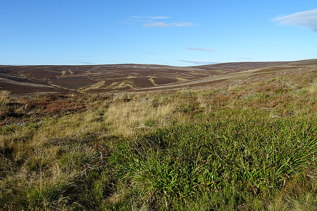
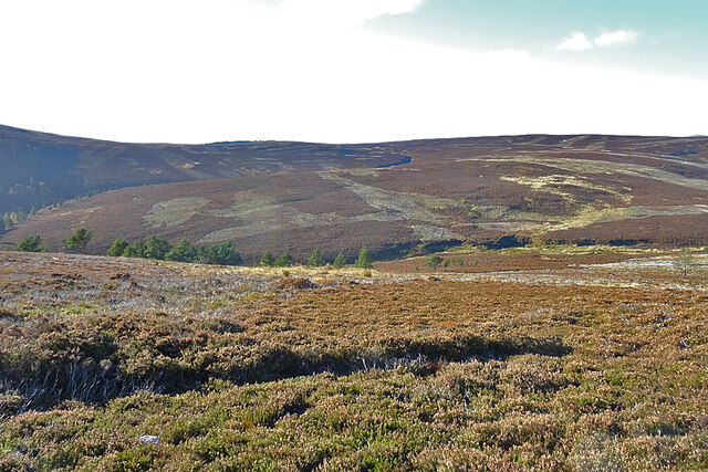
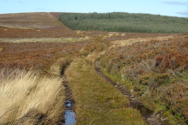
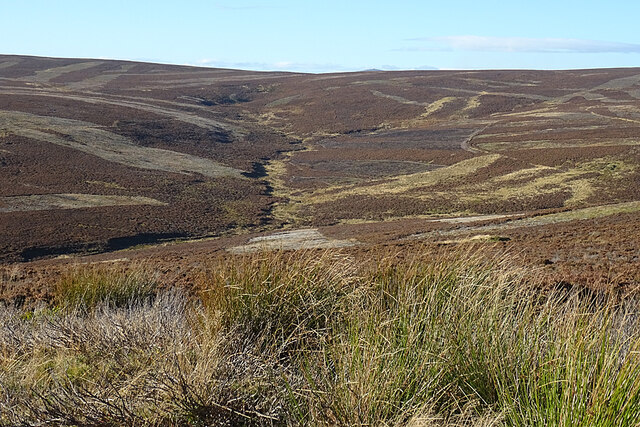
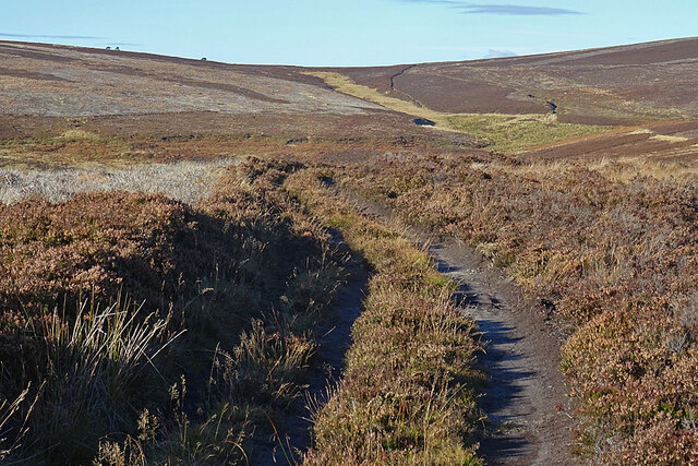
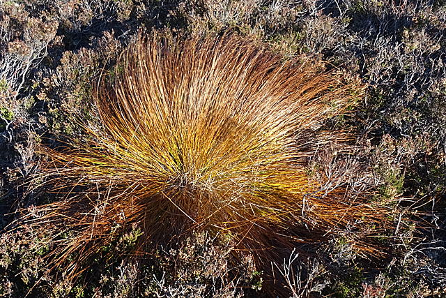
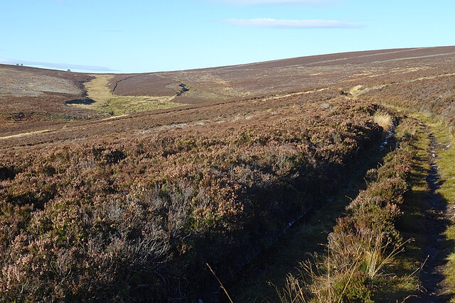
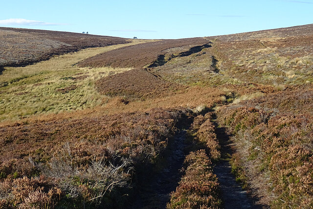
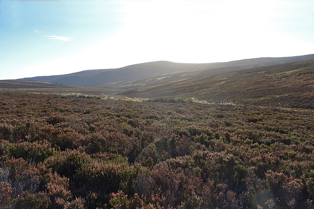
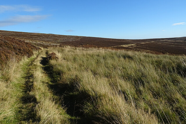
The downs of Peat Moss are characterized by gently sloping terrain and are primarily covered in heathland vegetation, consisting of heather, gorse, and grasses. These downs provide a picturesque setting, offering panoramic views of the surrounding countryside. Additionally, they support a variety of bird species, including skylarks and meadow pipits, which can be observed soaring through the clear skies.

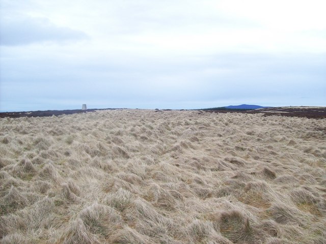
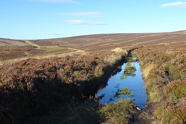
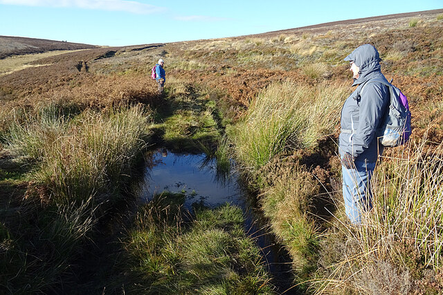
The moorland of Peat Moss is a vast expanse of wetland, characterized by its damp and waterlogged conditions. It is dominated by sphagnum moss, which gives the area its name. This unique moss plays a vital role in the formation of peat, which accumulates over time and creates the distinctive landscape of the moorland. The peat acts as a sponge, retaining water and providing a habitat for a diverse range of plant and animal species, including insectivorous plants like sundews and butterworts.

Peat Moss is also home to a variety of wildlife, including red grouse, curlews, and golden plovers. These species are well-adapted to the harsh conditions of the moorland and can often be spotted foraging for food or nesting among the heather and grasses.

Overall, Peat Moss in Aberdeenshire offers a captivating blend of downs and moorland, showcasing the beauty and biodiversity of Scotland's natural landscapes.

If you have any feedback on the listing, please let us know in the comments section below.

Peat Moss Images

Images are sourced within 2km of 57.294025/-2.8163414 or Grid Reference NJ5022. Thanks to Geograph Open Source API. All images are credited.

Trig Point Trig Point at NJ514232 taken from the path just below it to the west. The hill is un-named on the OS Explorer 420.
Trig Point
Trig Point at NJ514232 taken from the path just below it to the west. The hill is un-named on the OS Explorer 420.
Turbines at Cairnmore The two southerly wind turbines at Cairnmore with the Coreen hills behind.
Turbines at Cairnmore
The two southerly wind turbines at Cairnmore with the Coreen hills behind.
Turbine Road The access road to Cairnmore windfarm.
Turbine Road
The access road to Cairnmore windfarm.
Cairnmore Wind Farm The three turbines of Cairnmore as seen from the Fort.
Cairnmore Wind Farm
The three turbines of Cairnmore as seen from the Fort.
Correen Quarry Spoil heaps on the north side of the Quarry, surmounted by a solitary Scots Pine.
Correen Quarry
Spoil heaps on the north side of the Quarry, surmounted by a solitary Scots Pine.
The View from the Path The path stays on the level above the shallow bowl drained by the Blacklatch Burn and its tributary the Badingair Burn, whose course descends from upper left towards the foot of Baingair Hill. The slightly higher hill to the right isn't named on the maps, but is the possessor of a triangulation pillar at 487 metres above sea level.
The View from the Path
The path stays on the level above the shallow bowl drained by the Blacklatch Burn and its tributary the Badingair Burn, whose course descends from upper left towards the foot of Baingair Hill. The slightly higher hill to the right isn't named on the maps, but is the possessor of a triangulation pillar at 487 metres above sea level.
Limer Shank The heathery ridge between the two burns is Limer Shank. Limestone occurs here but it is not of good enough quality to be much worked.
Limer Shank
The heathery ridge between the two burns is Limer Shank. Limestone occurs here but it is not of good enough quality to be much worked.
Wet Ruts There was water in several stretches of the road on the top of the ridge, but it was easy enough to avoid by taking to the heather. The bald patch to the right of the forest fence beyond the trees is the Mire of Midgates.
Wet Ruts
There was water in several stretches of the road on the top of the ridge, but it was easy enough to avoid by taking to the heather. The bald patch to the right of the forest fence beyond the trees is the Mire of Midgates.
Badingair Burn The burn drains the shallow bowl between Correen Quarry and the ridge made up of Brux Hill and Badingair Hill. There is a glimpse of The Buck in the distance above the headwaters of the Badingair Burn.
Badingair Burn
The burn drains the shallow bowl between Correen Quarry and the ridge made up of Brux Hill and Badingair Hill. There is a glimpse of The Buck in the distance above the headwaters of the Badingair Burn.
Moorland Pool The map shows several small pools in the moorland, almost certainly kettle holes from the end of the last Ice Age, when slow melting blocks of ice left holes in the glacial deposits around them.
Moorland Pool
The map shows several small pools in the moorland, almost certainly kettle holes from the end of the last Ice Age, when slow melting blocks of ice left holes in the glacial deposits around them.
Moorland Track The path more or less follows the contours until it has to climb the last few metres to the highest point of at about 460 metres above sea level.
Moorland Track
The path more or less follows the contours until it has to climb the last few metres to the highest point of at about 460 metres above sea level.
Deer Grass (Trichophorum germanicum) At this time of year, the clumps of Deergrass are turning autumnal.
Deer Grass (Trichophorum germanicum)
At this time of year, the clumps of Deergrass are turning autumnal.
A Large Puddle Fortunately this puddle proved not to be an obstacle as we were able to avoid it by taking to the heather.
A Large Puddle
Fortunately this puddle proved not to be an obstacle as we were able to avoid it by taking to the heather.
Hill Track The track continues at more or less the same height until it has to rise to get to the summit.
Hill Track
The track continues at more or less the same height until it has to rise to get to the summit.
Approaching Blacklatch Well The track descends very slightly here. We wondered if it then went straight up beside the peat hagg, but it turns out that the path goes left and up between the heathery bank and the grassy strip.
Approaching Blacklatch Well
The track descends very slightly here. We wondered if it then went straight up beside the peat hagg, but it turns out that the path goes left and up between the heathery bank and the grassy strip.
Looking towards Lord Arthur's Hill Because of the low angle of the sun, I hadn't been taking southward view at all, and decided that I had to remedy that. This is the rather hazy result. Lord Arthur's Hill has a trinagulation pillar at 619 metres above sea level. Next to it is Edinbanchory Hill, at 466 metres. There is a circular route taking in both hills, but we move slowly and did not want to risk running out of daylight so had decided that we would not attempt it until next spring.
Looking towards Lord Arthur's Hill
Because of the low angle of the sun, I hadn't been taking southward view at all, and decided that I had to remedy that. This is the rather hazy result. Lord Arthur's Hill has a trinagulation pillar at 619 metres above sea level. Next to it is Edinbanchory Hill, at 466 metres. There is a circular route taking in both hills, but we move slowly and did not want to risk running out of daylight so had decided that we would not attempt it until next spring.
Contlach Shank This watery obstacle took a little bit more care to negotiate. I think it might be one end of what looks like a ditch parallel to the path.
Contlach Shank
This watery obstacle took a little bit more care to negotiate. I think it might be one end of what looks like a ditch parallel to the path.
Looking towards Correen Quarry This is looking back the way we had just come, towards the Correen Quarry, which is just out of sight.
Looking towards Correen Quarry
This is looking back the way we had just come, towards the Correen Quarry, which is just out of sight.
Show me another place!

Peat Moss is located at Grid Ref: NJ5022 (Lat: 57.294025, Lng: -2.8163414)

Unitary Authority: Aberdeenshire

Police Authority: North East

What 3 Words

///heartache.entry.sideboard. Near Alford, Aberdeenshire

Nearby Locations

Peat Moss Badingair Hill

Related Wikis

Druminnor Castle

Druminnor Castle is an L-plan castle, dating from the early 15th century, about two miles east of Rhynnie, in a steep valley by the Keron burn, in Aberdeenshire...

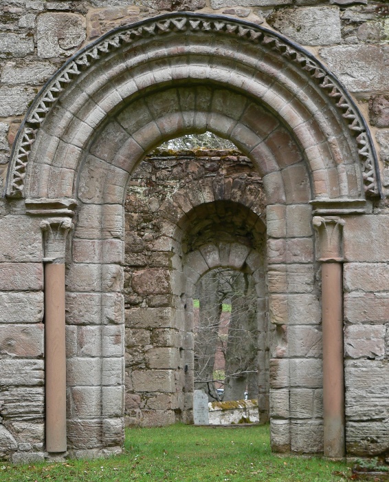
St Mary's Kirk, Auchindoir

St Mary's Kirk at Auchindoir, between Rhynie and Lumsden, in Aberdeenshire, Scotland, is one of the country's finest surviving medieval parish kirks. The...

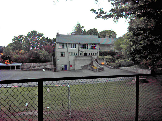
Lumsden, Aberdeenshire

Lumsden is an inland village in Aberdeenshire, Scotland on the A97 road. == Location == It crowns a rising-ground 227 m (745 ft) above sea level amid a...

Clatt

Clatt (Gaelic cleithe, 'concealed'), is a village in Aberdeenshire, Scotland. The remains of a morthouse are located in the cemetery of the old church...

Related Videos

Scottish Hillwalking: Rushing to the top of Knock Saul in the Correen hills.

Mattia wasn't feeling super well on our walk but I couldn't resist bolting up that last little hill before we headed home.

Nearby Amenities

Located within 500m of 57.294025,-2.8163414
Badingair Hill
Ele: 474
Natural: peak
Lat/Long: 57.2911027/-2.8193649
The data included in this document is from www.openstreetmap.org. The data is made available under ODbL.

Have you been to Peat Moss?

Leave your review of Peat Moss below (or comments, questions and feedback).