Shoot Rough

Downs, Moorland in Shropshire

England

Shoot Rough

Back along the ridge of The Lawley Gives a good impression of the true length of this narrow ridge; the summit lies on the pointy bit in the distance, and a good path runs all the way up from this NE end.
Back along the ridge of The Lawley Credit: Richard Law

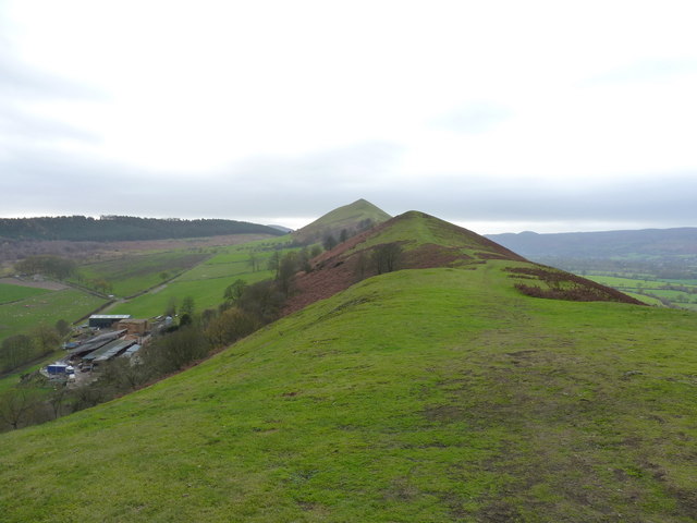
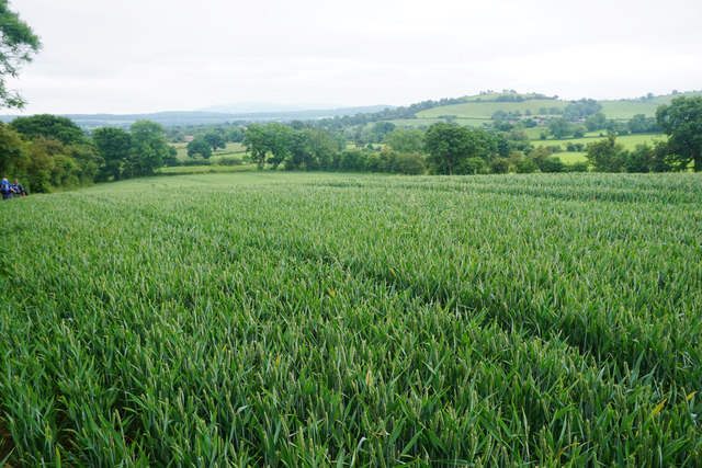
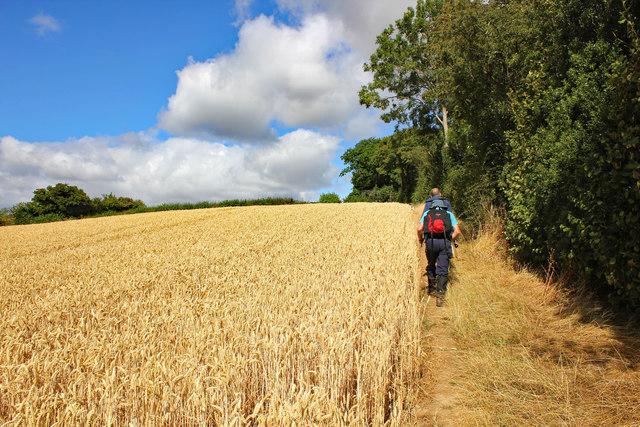
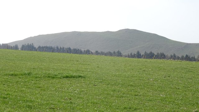
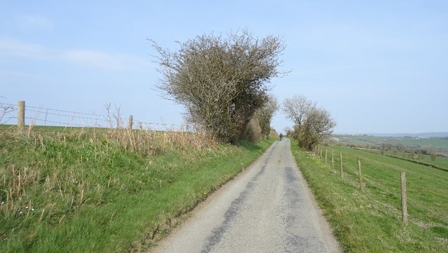
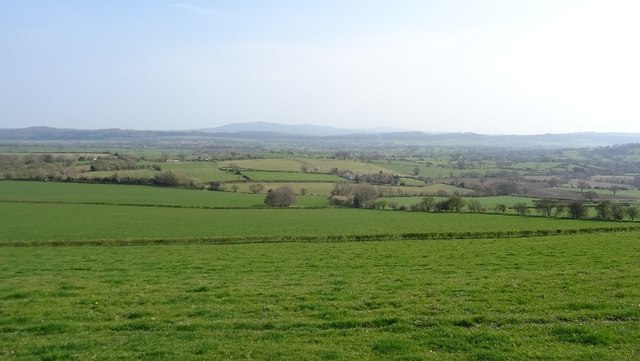
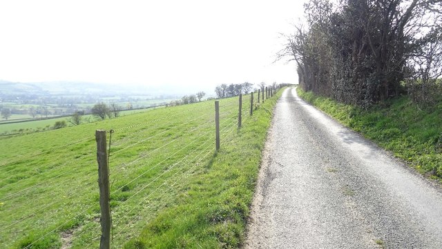
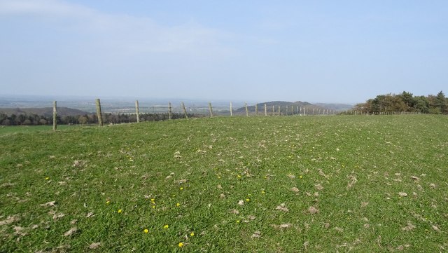
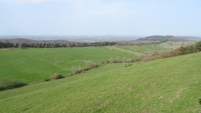
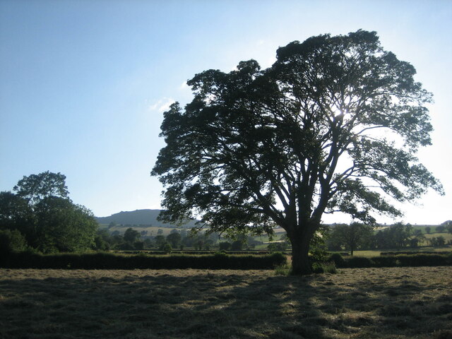
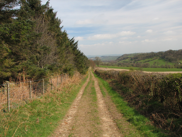
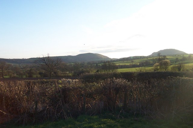
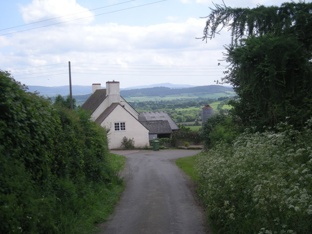
Shoot Rough is a picturesque area located in Shropshire, England, known for its stunning natural beauty and diverse landscapes. Situated in the Downs and Moorland region, it offers a unique blend of rolling hills, open fields, and vast moorlands, making it an ideal destination for nature enthusiasts and outdoor adventurers.

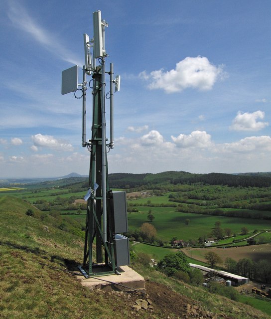
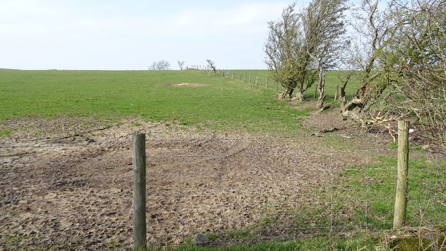
The area is characterized by its rugged terrain, with undulating hills and rocky outcrops dotting the landscape. These features provide a breathtaking panoramic view of the surrounding countryside, offering visitors a sense of tranquility and escape from the bustling city life.

Shoot Rough is home to a diverse range of flora and fauna, with heather, gorse, and bracken covering the moorlands, and various wildflowers adorning the fields. The moorlands attract a wide variety of bird species, including curlews, lapwings, and grouse, making it a haven for birdwatchers.

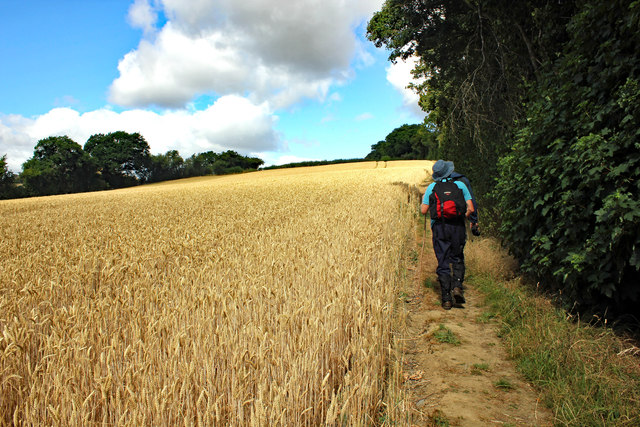
For those seeking outdoor activities, Shoot Rough offers ample opportunities for hiking, cycling, and horseback riding, with numerous trails crisscrossing the area. The challenging terrain also appeals to mountain bikers and trail runners, providing a thrilling experience for adventure enthusiasts.

The area is not only rich in natural beauty but also steeped in history. It is home to several ancient monuments, such as burial mounds and stone circles, which offer a glimpse into the region's past.

Whether it's exploring the expansive moorlands, admiring the stunning vistas, or immersing oneself in the rich history, Shoot Rough is a must-visit destination for those seeking a true connection with nature and a memorable outdoor experience.

If you have any feedback on the listing, please let us know in the comments section below.

Shoot Rough Images

Images are sourced within 2km of 52.565508/-2.7525721 or Grid Reference SO4996. Thanks to Geograph Open Source API. All images are credited.

Back along the ridge of The Lawley Gives a good impression of the true length of this narrow ridge; the summit lies on the pointy bit in the distance, and a good path runs all the way up from this NE end.
Back along the ridge of The Lawley
Gives a good impression of the true length of this narrow ridge; the summit lies on the pointy bit in the distance, and a good path runs all the way up from this NE end.
Local broadband mast A sign on this mast says “This mast has been erected to provide a broadband service to the local community”
Local broadband mast
A sign on this mast says “This mast has been erected to provide a broadband service to the local community”
Wheat field above Cardington The path to Cardington follows the field edge to the left.
Wheat field above Cardington
The path to Cardington follows the field edge to the left.
Footpath near Cardington Footpath heading northwest away from the village of Cardington.
Footpath near Cardington
Footpath heading northwest away from the village of Cardington.
Towards The Wilderness Footpath heading northwest towards The Wilderness near Caer Caradoc away from the village of Cardington.
Towards The Wilderness
Footpath heading northwest towards The Wilderness near Caer Caradoc away from the village of Cardington.
Yell Bank Hilltop pasture and a view to The Lawley. Trees beneath Hoar Edge are beginning to intrude into the view.
Yell Bank
Hilltop pasture and a view to The Lawley. Trees beneath Hoar Edge are beginning to intrude into the view.
Road on Yell Bank Some good views from up here.
Road on Yell Bank
Some good views from up here.
View off Yell Bank Towards the Clees.
View off Yell Bank
Towards the Clees.
Road on Yell Bank Towards Enchmarsh.
Road on Yell Bank
Towards Enchmarsh.
Remains of a hedge, Enchmarsh A few windbattered thorn trees remain of what would once have been a hedge. Over 320m up here.
Remains of a hedge, Enchmarsh
A few windbattered thorn trees remain of what would once have been a hedge. Over 320m up here.
Yell Bank summit Pasture just after muck spreading.
Yell Bank summit
Pasture just after muck spreading.
Between Yell Bank and Hoar Edge Two parallel ridges of Ordovecian sandstones separated by softer shales where there is an elevated valley. As usual in South Shropshire, everything is orientented southwest to northeast.
Between Yell Bank and Hoar Edge
Two parallel ridges of Ordovecian sandstones separated by softer shales where there is an elevated valley. As usual in South Shropshire, everything is orientented southwest to northeast.
Silhouetted tree north-west of Cardington An oak tree silhouetted against summer afternoon sun, north-west of Cardington village. The fortified hill of Caer Caradoc is visible in the background, nearly two miles to the west.
Silhouetted tree north-west of Cardington
An oak tree silhouetted against summer afternoon sun, north-west of Cardington village. The fortified hill of Caer Caradoc is visible in the background, nearly two miles to the west.
The Royal Oak, Cardington
Hoar Edge. Bridleway and access road along the Hoar Edge
Hoar Edge.
Bridleway and access road along the Hoar Edge
Over the road and the field towards the hill Taken from Leahill farm campsite
Over the road and the field towards the hill
Taken from Leahill farm campsite
Enchmarsh & beyond
Enchmarsh & beyond
Show me another place!

Shoot Rough is located at Grid Ref: SO4996 (Lat: 52.565508, Lng: -2.7525721)

Unitary Authority: Shropshire

Police Authority: West Mercia

What 3 Words

///vocally.slimy.depending. Near Cardington, Shropshire

Nearby Locations

Shoot Rough

Related Wikis

Comley

Comley is a hamlet in Shropshire, England. It is near the A49 road, to the northeast of Church Stretton. It is situated between two prominent hills: Caer...

Caer Caradoc

Caer Caradoc (Welsh: Caer Caradog, the fort of Caradog) is a hill in the English county of Shropshire. It overlooks the town of Church Stretton and the...

St James' Church, Cardington

St James' Church stands in an elevated position in the village of Cardington, Shropshire, England. It is an active Anglican parish church in the deanery...

Cardington, Shropshire

Cardington is a village and civil parish in Shropshire, England. It is situated south of Shrewsbury, near Caer Caradoc Hill, and the nearest town is Church...

Related Videos

Longnor, Old English Village Walk, English Countryside 4K

https://www.buymeacoffee.com/Daveswalks All support is hugely appreciated and it helps me keep the channel going! No talking ...

Hiking Caer Caradoc in England

A hike to the top of Caer Caradoc in the beautiful Shropshire countryside of England. The day was overcast but the rain luckily ...

Nearby Amenities

Located within 500m of 52.565508,-2.7525721
Barrier: cattle_grid
Lat/Long: 52.5668185/-2.7596166
Barrier: swing_gate
Foot: designated
Lat/Long: 52.5669087/-2.7583536
Barrier: stile
Lat/Long: 52.5643303/-2.7588161
Generator Method: photovoltaic
Generator Output Electricity: yes
Generator Source: solar
Generator Type: solar_photovoltaic_panel
Location: roof
Power: generator
Source: bing
Lat/Long: 52.5633684/-2.7460858
Power: pole
Ref: 841270
Source: bing
Transformer: distribution
Lat/Long: 52.5637793/-2.7457774
Barrier: swing_gate
Foot: designated
Horse: designated
Lat/Long: 52.5674056/-2.7585078
The data included in this document is from www.openstreetmap.org. The data is made available under ODbL.

Have you been to Shoot Rough?

Leave your review of Shoot Rough below (or comments, questions and feedback).