Nine Maidens' Green

Downs, Moorland in Aberdeenshire

Scotland

Nine Maidens' Green

The Burn of Linthaugh at Mossat
The Burn of Linthaugh at Mossat Credit: Gordon Brown

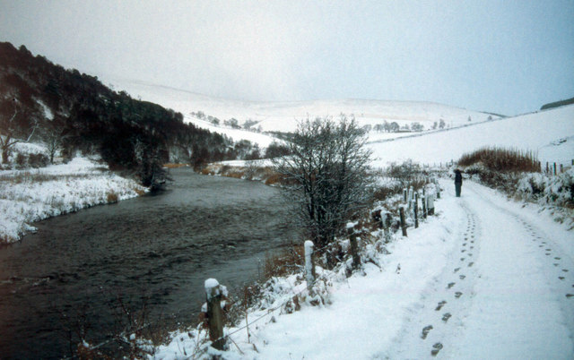
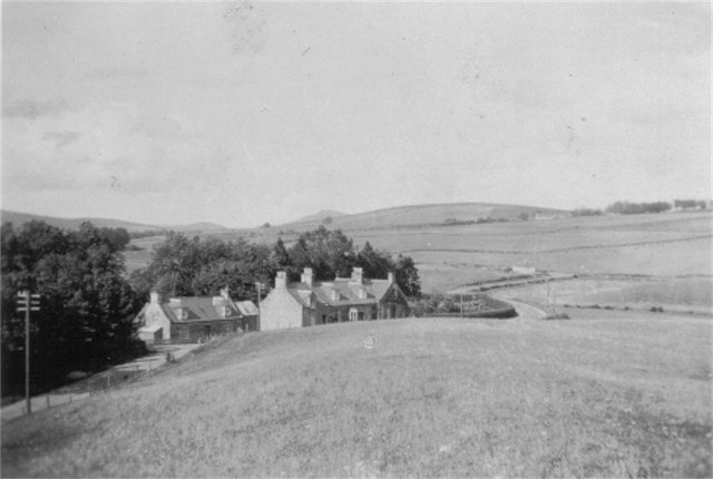
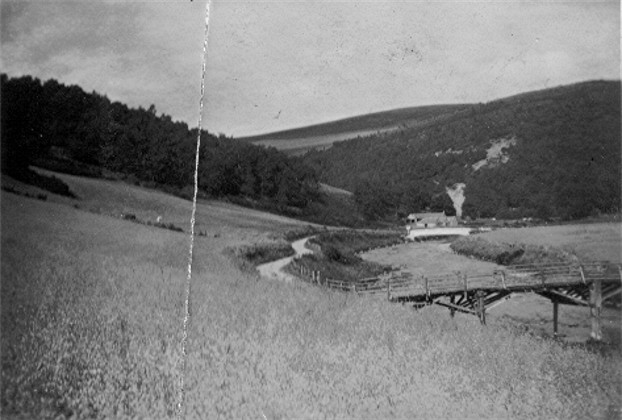
Nine Maidens' Green is a picturesque and serene moorland located in Aberdeenshire, Scotland. Nestled amidst rolling hills and verdant countryside, this natural attraction offers visitors a tranquil retreat from the hustle and bustle of everyday life. The green is named after the nine standing stones, known as the Nine Maidens, that grace the landscape, adding an air of mystery and intrigue to the area.

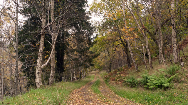
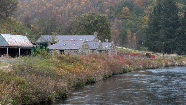
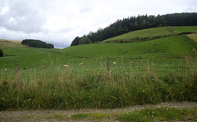
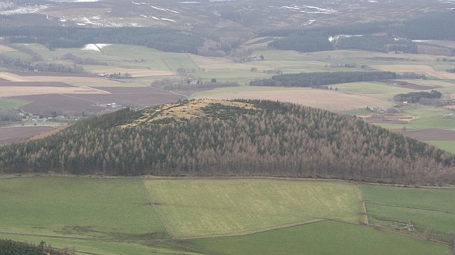
The moorland itself stretches over a vast expanse, encompassing heather-covered hills, sweeping valleys, and meandering streams. Visitors can take leisurely walks along the well-maintained trails, immersing themselves in the breathtaking beauty of the Scottish countryside. The area is particularly popular with hikers and nature enthusiasts, who can explore the diverse flora and fauna that call this place home.

The Nine Maidens' Green also holds historical significance, with the standing stones believed to date back to the Bronze Age. These ancient monuments provide a glimpse into the area's rich past and serve as a reminder of the human presence in this remote landscape for thousands of years.

Whether it's admiring the stunning views, picnicking amidst the wildflowers, or simply enjoying the peace and serenity of the moorland, Nine Maidens' Green offers a welcome escape for those seeking a connection with nature. With its rugged beauty and historical allure, this hidden gem in Aberdeenshire is a must-visit destination for anyone looking to experience the untamed charm of Scotland's countryside.

If you have any feedback on the listing, please let us know in the comments section below.

Nine Maidens' Green Images

Images are sourced within 2km of 57.25414/-2.8460396 or Grid Reference NJ4918. Thanks to Geograph Open Source API. All images are credited.

The Burn of Linthaugh at Mossat
Ferney Brae at Brux A short tributary valley of the River Don.
Ferney Brae at Brux
A short tributary valley of the River Don.
River Don at Brux
River Don at Brux
Road descending through trees to A944 The road will act now as a farm road but in the past it will surely have seen use as a quarry road; above the trees there's a sizeable disused quarry.
Road descending through trees to A944
The road will act now as a farm road but in the past it will surely have seen use as a quarry road; above the trees there's a sizeable disused quarry.
Delphorrie Delphorrie stands beside a minor road south of the A944; it's seen here from a bridge over the River Don.
Delphorrie
Delphorrie stands beside a minor road south of the A944; it's seen here from a bridge over the River Don.
Mossat bank I think the frieze above the right part of the building reads, North Scotland Bank, Photo date c1920-c1930  property now is Mossat House Bed & Breakfast Photographed by Stanley Howe in 2008
Mossat bank
I think the frieze above the right part of the building reads, North Scotland Bank, Photo date c1920-c1930 property now is Mossat House Bed & Breakfast Photographed by Stanley Howe in 2008
Hamlet of Mossat Photo c1920-c1930 of Mossat.  <a href="https://www.geograph.org.uk/photo/13834">NJ4719 : The Mossat Shop</a> shows possibly the same buildings, on a major road junction.
Hamlet of Mossat
Photo c1920-c1930 of Mossat. NJ4719 : The Mossat Shop shows possibly the same buildings, on a major road junction.
Mossat Post Photo c1920-c1930, inscribed Mossat Post!
Mossat Post
Photo c1920-c1930, inscribed Mossat Post!
Brux Lodge Photo date c1930.
 Access to Brux Lodge was over a wooden bridge <a href="https://www.geograph.org.uk/photo/2811222">NJ4918 : Wooden bridge over River Don</a> spanning the River Don in front of the Lodge, and a road entering the rear from The Corbouries.
Brux Lodge
Photo date c1930. Access to Brux Lodge was over a wooden bridge NJ4918 : Wooden bridge over River Don spanning the River Don in front of the Lodge, and a road entering the rear from The Corbouries.
Wooden bridge over River Don Photo c1930, Cannot find any evidence of this bridge on modern pictures or maps, but I have commercial photo showing Brux Lodge and this bridge from about the same period.
Wooden bridge over River Don
Photo c1930, Cannot find any evidence of this bridge on modern pictures or maps, but I have commercial photo showing Brux Lodge and this bridge from about the same period.
Delphorrie steadings Photo date c1930, this photo has been taken from across the river Don, possibly from the road to Brux.
Delphorrie steadings
Photo date c1930, this photo has been taken from across the river Don, possibly from the road to Brux.
Brux Bridge and Delphorrie Photo date c1930, nearly identical modern photo by Stanley Howe <a href="https://www.geograph.org.uk/photo/882934">NJ4818 : Brux Bridge and Delphorrie</a> Where has the wooden bridge gone?
Brux Bridge and Delphorrie
Photo date c1930, nearly identical modern photo by Stanley Howe NJ4818 : Brux Bridge and Delphorrie Where has the wooden bridge gone?
View up Ardhuncart Hill From the track to Kildrummy Kirk.
View up Ardhuncart Hill
From the track to Kildrummy Kirk.
Tree with aerial roots Looking for all the world like a headless Komodo Dragon facing up to an intruder! The site is mapped as an ancient cairn by the track to Kildrummy cemetery.
Tree with aerial roots
Looking for all the world like a headless Komodo Dragon facing up to an intruder! The site is mapped as an ancient cairn by the track to Kildrummy cemetery.
View to the summit of Ardhuncart Hill ENE from near Kildrummy cemetery; with transmission masts visible on the moor.
View to the summit of Ardhuncart Hill
ENE from near Kildrummy cemetery; with transmission masts visible on the moor.
Ardhuncart View from Coiliochbhar Hill.
Ardhuncart
View from Coiliochbhar Hill.
River Don, Ardhuncart Ardhuncart Lodge is in the wood. View from  Coiliochbhar Hill.
River Don, Ardhuncart
Ardhuncart Lodge is in the wood. View from Coiliochbhar Hill.
Drumgoudrum Hill A wooded hill above the River Don.
Drumgoudrum Hill
A wooded hill above the River Don.
Show me another place!

Nine Maidens' Green is located at Grid Ref: NJ4918 (Lat: 57.25414, Lng: -2.8460396)

Unitary Authority: Aberdeenshire

Police Authority: North East

What 3 Words

///perfume.thatched.settled. Near Alford, Aberdeenshire

Related Wikis

Brux Castle

Brux Castle was a castle of the Forbeses, about 1.5 miles (2.4 km) east of Kildrummy, Aberdeenshire, Scotland, south of the river Don. The castle was...

Mossat

Mossat is a settlement in Aberdeenshire, Scotland on the A97 road near Glenkindie and Lumsden, between Bridge of Alford and Strathdon, and is situated...

Kildrummy

Kildrummy (Scottish Gaelic: Cionn Droma) is a hamlet in Aberdeenshire, Scotland near the River Don, 7 miles (11 kilometres) west of Alford. The hamlet...

Lumsden, Aberdeenshire

Lumsden is an inland village in Aberdeenshire, Scotland on the A97 road. == Location == It crowns a rising-ground 227 m (745 ft) above sea level amid a...

Nearby Amenities

Located within 500m of 57.25414,-2.8460396
Material: wood
Power: pole
Lat/Long: 57.2570217/-2.8518225
Material: wood
Power: pole
Lat/Long: 57.2564109/-2.8503545
Material: wood
Power: pole
Lat/Long: 57.2558602/-2.8490509
Material: wood
Power: pole
Lat/Long: 57.2551904/-2.8474693
Power: pole
Lat/Long: 57.2547456/-2.8464293
Power: pole
Lat/Long: 57.254361/-2.8455103
Material: wood
Power: pole
Lat/Long: 57.2541674/-2.8450508
Material: wood
Power: pole
Lat/Long: 57.2540222/-2.8443446
Material: wood
Power: pole
Lat/Long: 57.2538809/-2.8436288
Material: wood
Power: pole
Lat/Long: 57.2537213/-2.8428331
Material: wood
Power: pole
Lat/Long: 57.2535578/-2.8420616
Material: wood
Power: pole
Lat/Long: 57.2533878/-2.841237
Material: wood
Power: pole
Lat/Long: 57.2527062/-2.8402309
Material: wood
Power: pole
Lat/Long: 57.2521096/-2.8398004
Power: pole
Lat/Long: 57.2513388/-2.8475265
Power: pole
Lat/Long: 57.2514897/-2.8481042
Power: pole
Lat/Long: 57.2517192/-2.8489328
Power: pole
Lat/Long: 57.2519729/-2.8498461
Power: pole
Lat/Long: 57.2526022/-2.8491828
Power: pole
Lat/Long: 57.2532217/-2.8485314
Power: pole
Lat/Long: 57.2538794/-2.8478496
Power: pole
Lat/Long: 57.2545748/-2.8476684
Material: wood
Power: pole
Lat/Long: 57.2532707/-2.8406626
Post Box
Brand: Royal Mail
Brand Wikidata: Q638098
Operator: Royal Mail
Operator Wikidata: Q638098
Post Box Type: lamp
Ref: AB33 269
Royal Cypher: scottish_crown
Source: survey
Lat/Long: 57.2547911/-2.846068
The data included in this document is from www.openstreetmap.org. The data is made available under ODbL.

Have you been to Nine Maidens' Green?

Leave your review of Nine Maidens' Green below (or comments, questions and feedback).