Halton View

Settlement in Lancashire

England

Halton View

Scrap metal heap
Scrap metal heap Credit: Lauren

Halton View is a small residential area located in the county of Lancashire, England. Situated within the borough of Halton, it forms part of the larger town of Widnes. With a population of around 4,000 residents, Halton View offers a peaceful and close-knit community atmosphere.

The area is primarily composed of residential properties, ranging from traditional terraced houses to modern semi-detached homes. The housing market in Halton View is relatively affordable, attracting a mix of families, young professionals, and retirees. The community is known for its friendly and welcoming nature, making it an ideal place for those seeking a tight-knit neighborhood.

Halton View benefits from its proximity to various amenities and services. The nearby town center of Widnes offers a range of shops, supermarkets, and leisure facilities, ensuring residents have easy access to all their daily needs. The area is also well-served by public transportation, with regular bus services connecting Halton View to wider areas of Lancashire and beyond.

For outdoor enthusiasts, Halton View is surrounded by green spaces and parks, providing ample opportunities for leisurely walks, picnics, and recreational activities. The nearby Spike Island Nature Reserve offers stunning views of the River Mersey and is a popular spot for birdwatching.

In terms of education, Halton View has several primary schools within its vicinity, ensuring that families have access to quality education for their children.

Overall, Halton View offers a peaceful and friendly residential environment, with a range of amenities and services easily accessible to its residents.

If you have any feedback on the listing, please let us know in the comments section below.
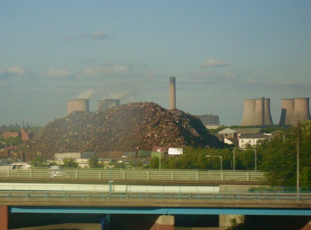
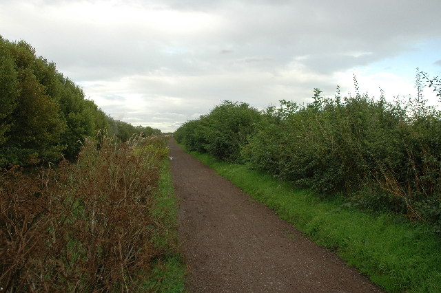
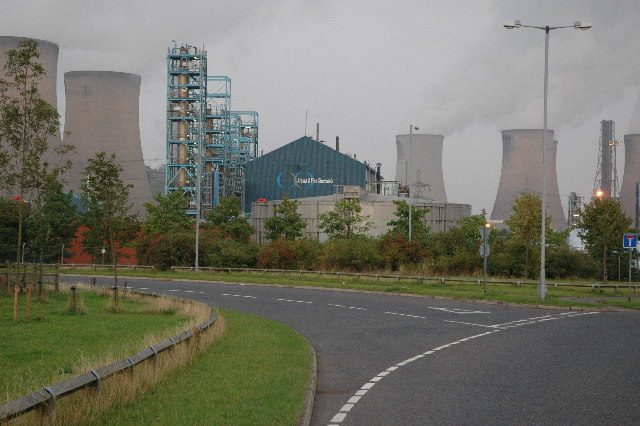
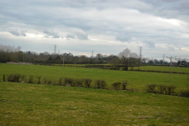
Halton View Images

Images are sourced within 2km of 53.369637/-2.714949 or Grid Reference SJ5286. Thanks to Geograph Open Source API. All images are credited.

Scrap metal heap
Scrap metal heap
Underneath Mersey Gateway Bridge looking SE
Autumn colours alongside Sankey Canal, E of Mersey Gateway Bridge
Future Flower sculpture & view to Mersey Gateway Bridge This sculpture captures the wind to create light. 120 perforate galvanised petals gently flutter and glow, lit by 60 low-voltage LED lights. Without the wind, the petals glow in the light of the sun and the sky. With different wind speeds, the lights reach different intensities, resulting in an ever changing and dynamic flower.
Future Flower sculpture & view to Mersey Gateway Bridge
This sculpture captures the wind to create light. 120 perforate galvanised petals gently flutter and glow, lit by 60 low-voltage LED lights. Without the wind, the petals glow in the light of the sun and the sky. With different wind speeds, the lights reach different intensities, resulting in an ever changing and dynamic flower.
Fiddler's Ferry Power Station, Cuerdley Cross (1) A 2000-megawatt coal-powered power station built in 1963-73 by the Central Electricity Generating Board, "a truly sublime building overpowering a flat and featureless setting". Four cooling towers stand either side of the boiler house.
The power station has been decomissioned and the whole site is due to be cleared. The four cooling towers seen here were demolished in 2023, the rest is due to follow in 2024. These magnificent structures are at risk of being completely erased from the landscape as power stations are closed. None has yet been listed, despite attempts, and they are not obvious candidates for preservation. Other countries have been more imaginative - in South Africa one has been adapted for bungee jumping and elsewhere they have been used for hosting nightclubs and festivals.
Fiddler's Ferry Power Station, Cuerdley Cross (1)
A 2000-megawatt coal-powered power station built in 1963-73 by the Central Electricity Generating Board, "a truly sublime building overpowering a flat and featureless setting". Four cooling towers stand either side of the boiler house. The power station has been decomissioned and the whole site is due to be cleared. The four cooling towers seen here were demolished in 2023, the rest is due to follow in 2024. These magnificent structures are at risk of being completely erased from the landscape as power stations are closed. None has yet been listed, despite attempts, and they are not obvious candidates for preservation. Other countries have been more imaginative - in South Africa one has been adapted for bungee jumping and elsewhere they have been used for hosting nightclubs and festivals.
Fiddler's Ferry Power Station, Cuerdley Cross (2) A 2000-megawatt coal-powered power station built in 1963-73 by the Central Electricity Generating Board, "a truly sublime building overpowering a flat and featureless setting". Four cooling towers stand either side of the boiler house.
The power station has been decomissioned and the whole site is due to be cleared. The four nearer cooling towers seen here were demolished in 2023, the rest is due to follow in 2024. These magnificent structures are at risk of being completely erased from the landscape as power stations are closed. None has yet been listed, despite attempts, and they are not obvious candidates for preservation. Other countries have been more imaginative - in South Africa one has been adapted for bungee jumping and elsewhere they have been used for hosting nightclubs and festivals.
Fiddler's Ferry Power Station, Cuerdley Cross (2)
A 2000-megawatt coal-powered power station built in 1963-73 by the Central Electricity Generating Board, "a truly sublime building overpowering a flat and featureless setting". Four cooling towers stand either side of the boiler house. The power station has been decomissioned and the whole site is due to be cleared. The four nearer cooling towers seen here were demolished in 2023, the rest is due to follow in 2024. These magnificent structures are at risk of being completely erased from the landscape as power stations are closed. None has yet been listed, despite attempts, and they are not obvious candidates for preservation. Other countries have been more imaginative - in South Africa one has been adapted for bungee jumping and elsewhere they have been used for hosting nightclubs and festivals.
View from Runcorn From Doctor's Bridge, looking over the parapet of <a href="https://www.geograph.org.uk/photo/7726122">SJ5182 : Bank House, High Street, Runcorn</a> towards the majestic sight of Fiddler's Ferry Power Station.
View from Runcorn
From Doctor's Bridge, looking over the parapet of SJ5182 : Bank House, High Street, Runcorn towards the majestic sight of Fiddler's Ferry Power Station.
Sunset over the garden wall Actually my back garden and may not be a true Geograph?
Sunset over the garden wall
Actually my back garden and may not be a true Geograph?
St Lukes C of E Church Farnworth Village
The Moorfield Arms The Moorfield Arms, Crow Wood near Widnes.
The Moorfield Arms
The Moorfield Arms, Crow Wood near Widnes.
Through the arched window A carved wooden arch marks the entrance to a conservation area to the south of the railway line. The cooling towers of Fiddlers Ferry power station rise above the roofs of some of the 60's - 70's houses on the estate to the south
Through the arched window
A carved wooden arch marks the entrance to a conservation area to the south of the railway line. The cooling towers of Fiddlers Ferry power station rise above the roofs of some of the 60's - 70's houses on the estate to the south
Sankey/St.Helens Canal between Warrington and Widnes This is a view looking along the disused Sankey/St.helens canal as it heads east towards Widnes. Picture taken at SJ 53929 85498.
Sankey/St.Helens Canal between Warrington and Widnes
This is a view looking along the disused Sankey/St.helens canal as it heads east towards Widnes. Picture taken at SJ 53929 85498.
Trans Pennine Trail and Sankey/St.Helens Canal This is a view along the Trans Pennine Trail and Sankey/St.Helens canal as they make their way east towards Warrington from Widnes. Fiddlers Ferry Power Station can be seen in the distance.
Trans Pennine Trail and Sankey/St.Helens Canal
This is a view along the Trans Pennine Trail and Sankey/St.Helens canal as they make their way east towards Warrington from Widnes. Fiddlers Ferry Power Station can be seen in the distance.
Trans Pennine Trail between Widnes and Warrington This is a view along the Trans Pennine Trail as it makes its way east from Widnes to Warrington. To the left of the path is the disused Sankey/St.Helens canal. Picture taken from SJ 52084 84881.
Trans Pennine Trail between Widnes and Warrington
This is a view along the Trans Pennine Trail as it makes its way east from Widnes to Warrington. To the left of the path is the disused Sankey/St.Helens canal. Picture taken from SJ 52084 84881.
Sankey/St.Helens Canal and Trans Pennine Trail This is a view looking west along the Sankey/St.Helens canal as they make their way towards Widnes. Spike Island is just around the corner.
Sankey/St.Helens Canal and Trans Pennine Trail
This is a view looking west along the Sankey/St.Helens canal as they make their way towards Widnes. Spike Island is just around the corner.
Open land between Sankey/St.Helens Canal and the River Mersey This is a view taken from SJ 52139 84889 looking south east over open land in between the Sankey/St.Helens Canal (behind) and the River Mersey (ahead).
Open land between Sankey/St.Helens Canal and the River Mersey
This is a view taken from SJ 52139 84889 looking south east over open land in between the Sankey/St.Helens Canal (behind) and the River Mersey (ahead).
Deacon Road, Widnes This is a view looking east along Deacon Road (aka B5178) in Widnes at the junction with Appleton Village (that's the name of the road to the left) and Frederick Street (to the right). The ever present Fiddlers Ferry Power Station can be seen in the far distance.
Deacon Road, Widnes
This is a view looking east along Deacon Road (aka B5178) in Widnes at the junction with Appleton Village (that's the name of the road to the left) and Frederick Street (to the right). The ever present Fiddlers Ferry Power Station can be seen in the far distance.
Chemical Plant, Widnes This is a view taken from SJ 53328 86484 looking east at one of the many chemical plants around Widnes. This particular one belongs to Aroma & Fine Chemical (part of the Octel Corp). In the background can be seen a rather imposing Fiddlers Ferry Power Station which is in the next grid square to the east.
Chemical Plant, Widnes
This is a view taken from SJ 53328 86484 looking east at one of the many chemical plants around Widnes. This particular one belongs to Aroma & Fine Chemical (part of the Octel Corp). In the background can be seen a rather imposing Fiddlers Ferry Power Station which is in the next grid square to the east.
Show me another place!

Halton View is located at Grid Ref: SJ5286 (Lat: 53.369637, Lng: -2.714949)

Unitary Authority: Halton

Police Authority: Cheshire

What 3 Words

///intro.freed.race. Near Widnes, Cheshire

Nearby Locations

Halton View

Related Wikis

Appleton railway station

Appleton railway station served a primarily industrial area of Widnes, England. It was located on the southern section of the former St Helens and Runcorn...

Barrow's Green

Barrow's Green is a village in Cheshire, England. == References ==

St Ambrose Church, Widnes

St Ambrose Church, in Widnes, England, was built in 1882 to a design by James Francis Doyle of Liverpool (c. 1840–1913). == The first building == Widnes...

Ubique Barracks, Widnes

Ubique Barracks, Widnes is a military installation of the British Ministry of Defence occupied by the British Army located in Widnes, Cheshire WA8 6TH...

Nearby Amenities

Located within 500m of 53.369637,-2.714949
Closed
The Albert
Closed: pub
Lat/Long: 53.3717604/-2.7204742
Crossing
Button Operated: yes
Crossing: traffic_signals
Crossing Island: no
Crossing Markings: dots
Crossing Ref: puffin
Tactile Paving: yes
Lat/Long: 53.3729862/-2.7108688
Crossing
Crossing: traffic_signals
Crossing Ref: puffin
Kerb: lowered
Tactile Paving: yes
Lat/Long: 53.3703965/-2.7142807
Barrier: bollard
Bicycle: yes
Foot: yes
Motor Vehicle: no
Lat/Long: 53.3701165/-2.7208933
Traffic Calming: table
Lat/Long: 53.3727238/-2.7129988
Mini Roundabout
Direction: clockwise
Lat/Long: 53.3669961/-2.7185368
Barrier: cycle_barrier
Bicycle: yes
Foot: yes
Horse: no
Motor Vehicle: no
Lat/Long: 53.3728564/-2.7160236
Crossing
Crossing: unmarked
Crossing Island: no
Tactile Paving: no
Lat/Long: 53.3716194/-2.70877
Barrier: bollard
Lat/Long: 53.3728137/-2.7100656
Crossing
Crossing: unmarked
Crossing Island: no
Crossing Markings: no
Kerb: lowered
Tactile Paving: yes
Lat/Long: 53.3698139/-2.7222731
Crossing
Crossing: unmarked
Crossing Island: yes
Kerb: lowered
Tactile Paving: yes
Lat/Long: 53.3657389/-2.7170764
Crossing
Crossing: unmarked
Crossing Island: yes
Kerb: lowered
Tactile Paving: yes
Lat/Long: 53.3657965/-2.7171908
Crossing
Crossing: unmarked
Crossing Island: yes
Kerb: lowered
Tactile Paving: yes
Lat/Long: 53.3660335/-2.7165396
Crossing
Crossing: unmarked
Crossing Island: yes
Kerb: lowered
Tactile Paving: yes
Lat/Long: 53.3661232/-2.7170519
Crossing
Crossing: unmarked
Crossing Island: yes
Kerb: lowered
Tactile Paving: yes
Lat/Long: 53.3660773/-2.7171682
Crossing
Crossing: unmarked
Crossing Island: no
Tactile Paving: yes
Lat/Long: 53.3664179/-2.7174219
Crossing
Crossing: unmarked
Crossing Island: yes
Kerb: lowered
Tactile Paving: yes
Lat/Long: 53.3657749/-2.7165231
Crossing
Crossing: unmarked
Crossing Island: yes
Kerb: lowered
Tactile Paving: yes
Lat/Long: 53.3657088/-2.7166112
Crossing
Crossing: unmarked
Crossing Island: yes
Kerb: lowered
Tactile Paving: yes
Lat/Long: 53.3660979/-2.716622
Crossing
Crossing: unmarked
Crossing Island: no
Kerb: lowered
Tactile Paving: yes
Lat/Long: 53.3653134/-2.7156725
Barrier: bollard
Bicycle: yes
Foot: yes
Motor Vehicle: no
Lat/Long: 53.3652613/-2.715609
Crossing
Crossing: unmarked
Crossing Island: no
Crossing Markings: no
Kerb: lowered
Tactile Paving: yes
Lat/Long: 53.369849/-2.7224253
Barrier: cycle_barrier
Bicycle: yes
Foot: yes
Motor Vehicle: no
Lat/Long: 53.3724886/-2.7165635
Crossing
Crossing: traffic_signals
Crossing Ref: puffin
Kerb: lowered
Tactile Paving: yes
Lat/Long: 53.3727405/-2.713592
Crossing
Button Operated: yes
Crossing: traffic_signals
Crossing Island: no
Crossing Markings: dots
Crossing Ref: toucan
Kerb: lowered
Tactile Paving: yes
Lat/Long: 53.3722435/-2.7170906
Lugsdale
Place: suburb
Lat/Long: 53.367245/-2.7181023
Appleton
Historic Railway: station
Railway: site
Wikidata: Q4781420
Wikipedia: en:Appleton railway station
Lat/Long: 53.3703651/-2.7191752
Traffic Calming: table
Lat/Long: 53.3727327/-2.7151332
Bus Stop
Bus: yes
Public Transport: platform
Lat/Long: 53.3688738/-2.7155698
Bus Stop
Frank Street
Bus: yes
Departures Board: timetable
Naptan AtcoCode: 068000000386
Naptan NaptanCode: haladwam
Public Transport: platform
Shelter: no
Lat/Long: 53.3702706/-2.7147149
Bus Stop
Frank Street
Bus: yes
Departures Board: timetable
Naptan AtcoCode: 068000000385
Naptan NaptanCode: haladwaj
Public Transport: platform
Shelter: no
Lat/Long: 53.3704576/-2.715031
Bus Stop
St Ambrose Road
Bus: yes
Departures Board: timetable
Public Transport: platform
Shelter: no
Lat/Long: 53.3706783/-2.7167171
Bus Stop
St Ambrose Road
Bus: yes
Departures Board: timetable
Public Transport: platform
Shelter: no
Lat/Long: 53.3705219/-2.7173676
Bus Stop
Halton View Road
Bus: yes
Departures Board: timetable
Naptan AtcoCode: 068000000382
Naptan NaptanCode: haladtwt
Public Transport: platform
Shelter: no
Lat/Long: 53.3715829/-2.7180569
Bus Stop
Halton View Road
Bus: yes
Departures Board: timetable
Naptan AtcoCode: 068000000381
Naptan NaptanCode: haladtwp
Public Transport: platform
Shelter: no
Lat/Long: 53.3712337/-2.7180662
Bus Stop
Page Lane
Bus: yes
Departures Board: timetable
Public Transport: platform
Shelter: yes
Lat/Long: 53.372439/-2.7161343
Bus Stop
Page Lane
Bus: yes
Departures Board: timetable
Naptan AtcoCode: 068000000371
Naptan NaptanCode: haladtpm
Public Transport: platform
Shelter: yes
Lat/Long: 53.3725348/-2.7161271
Bus Stop
Norlands Street
Bus: yes
Departures Board: timetable
Public Transport: platform
Shelter: yes
Lat/Long: 53.3727204/-2.7139652
Bus Stop
Norlands Street
Bus: yes
Departures Board: timetable
Naptan AtcoCode: 068000000373
Naptan NaptanCode: haladtpw
Public Transport: platform
Shelter: no
Lat/Long: 53.3727667/-2.7132278
Bus Stop
Halton View
Bus: yes
Departures Board: no
Public Transport: platform
Shelter: no
Lat/Long: 53.3720989/-2.7128214
Bus Stop
Halton View
Bus: yes
Departures Board: timetable
Naptan AtcoCode: 068000000388
Naptan NaptanCode: haladwat
Public Transport: platform
Shelter: no
Lat/Long: 53.3717392/-2.7129088
Halton View
Place: suburb
Lat/Long: 53.3709159/-2.7116785
Crossing
Crossing: unmarked
Lat/Long: 53.3730376/-2.7104242
Traffic Signals
Traffic Signals: crossing
Traffic Signals Direction: backward
Lat/Long: 53.3729725/-2.7109269
Traffic Signals
Traffic Signals: crossing
Traffic Signals Direction: forward
Lat/Long: 53.3730027/-2.7108062
Give Way
Direction: forward
Lat/Long: 53.3726447/-2.7122567
Crossing
Crossing: pavement
Lat/Long: 53.3731232/-2.7106111
Spar
Addr City: Widnes
Addr Housenumber: 55
Addr Postcode: WA8 0TT
Addr Street: Halton View Road
Brand: Spar
Brand Wikidata: Q610492
Brand Wikipedia: en:SPAR (retailer)
Phone: +44 151 424 2222
Shop: convenience
Website: https://www.spar.co.uk/store-locator/hal24040-spar-halton-view-road
Lat/Long: 53.3728272/-2.7126471
Crossing
Crossing: unmarked
Crossing Island: no
Tactile Paving: yes
Lat/Long: 53.3729067/-2.7109959
Barrier: bollard
Motor Vehicle: private
Lat/Long: 53.3724408/-2.7091695
Post Box
Operator: Royal Mail
Operator Wikidata: Q638098
Post Box Design: type_b
Post Box Type: pillar
Ref: WA8 14
Royal Cypher: EIIR
Lat/Long: 53.372776/-2.7126275
Post Box
Operator: Royal Mail
Operator Wikidata: Q638098
Post Box Type: lamp
Ref: WA8 4
Royal Cypher: EIIR
Lat/Long: 53.3700603/-2.718498
Traffic Calming: bump
Lat/Long: 53.3698397/-2.7186364
Bus Stop
Bus: yes
Public Transport: platform
Lat/Long: 53.3709164/-2.7220453
Traffic Signals
Traffic Signals: crossing
Traffic Signals Direction: backward
Lat/Long: 53.3722543/-2.7170483
Traffic Signals
Traffic Signals: crossing
Traffic Signals Direction: forward
Lat/Long: 53.3722317/-2.7171379
Traffic Calming: cushion
Lat/Long: 53.372593/-2.7156933
Traffic Calming: cushion
Lat/Long: 53.3726553/-2.7154437
Information: guidepost
Tourism: information
Lat/Long: 53.3698524/-2.7221148
Street Lamp
Lat/Long: 53.3700129/-2.7220856
Street Lamp
Lat/Long: 53.3701881/-2.7219653
Street Lamp
Lat/Long: 53.3703713/-2.7219131
Street Lamp
Lat/Long: 53.370564/-2.7219272
Street Lamp
Lat/Long: 53.3707504/-2.7219971
Street Lamp
Lat/Long: 53.3709425/-2.7220803
Street Lamp
Lat/Long: 53.369953/-2.7223784
Street Lamp
Lat/Long: 53.3698596/-2.7219953
Street Lamp
Lat/Long: 53.3698833/-2.721604
Street Lamp
Lat/Long: 53.3699118/-2.7212076
Street Lamp
Lat/Long: 53.3699445/-2.7208752
Street Lamp
Lat/Long: 53.3698542/-2.7205967
Street Lamp
Lat/Long: 53.3697614/-2.720301
Street Lamp
Lat/Long: 53.3695583/-2.7202237
Street Lamp
Lat/Long: 53.3694024/-2.7204046
Street Lamp
Lat/Long: 53.3693691/-2.720674
Street Lamp
Lat/Long: 53.3692569/-2.7205652
Street Lamp
Lat/Long: 53.3690483/-2.7206201
Street Lamp
Lat/Long: 53.3688318/-2.720675
Street Lamp
Lat/Long: 53.3690731/-2.7208529
Street Lamp
Lat/Long: 53.369058/-2.720921
Street Lamp
Lat/Long: 53.36889/-2.7208966
Street Lamp
Lat/Long: 53.3686262/-2.7207522
Street Lamp
Lat/Long: 53.3684133/-2.7208651
Street Lamp
Lat/Long: 53.3682126/-2.7209982
Street Lamp
Lat/Long: 53.3680107/-2.7211354
Street Lamp
Lat/Long: 53.3678154/-2.7212787
Street Lamp
Lat/Long: 53.3676177/-2.7214159
Street Lamp
Lat/Long: 53.3672071/-2.721173
Street Lamp
Lat/Long: 53.3675739/-2.7209373
Street Lamp
Lat/Long: 53.3679208/-2.7207084
Street Lamp
Lat/Long: 53.368283/-2.7204644
Street Lamp
Lat/Long: 53.3686285/-2.7202403
Street Lamp
Lat/Long: 53.368972/-2.7200196
Street Lamp
Lat/Long: 53.3693175/-2.7198048
Street Lamp
Lat/Long: 53.3696672/-2.7195865
Street Lamp
Lat/Long: 53.3700287/-2.7193728
Street Lamp
Lat/Long: 53.3707162/-2.7189619
Street Lamp
Lat/Long: 53.3710631/-2.7187646
Street Lamp
Lat/Long: 53.3714149/-2.7185649
Street Lamp
Lat/Long: 53.3717645/-2.7183793
Street Lamp
Lat/Long: 53.37211/-2.7182263
Street Lamp
Lat/Long: 53.3724729/-2.7181037
Street Lamp
Lat/Long: 53.37284/-2.7180092
Street Lamp
Lat/Long: 53.373198/-2.717952
Street Lamp
Lat/Long: 53.3735602/-2.7179158
The data included in this document is from www.openstreetmap.org. The data is made available under ODbL.

Have you been to Halton View?

Leave your review of Halton View below (or comments, questions and feedback).