Halton Shields
Settlement in Northumberland
England
Halton Shields

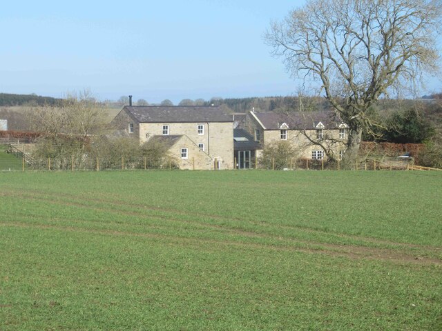
Halton Shields is a small village located in the county of Northumberland, in the North East of England. Situated just north of the town of Hexham, it is nestled in the picturesque countryside of the Tyne Valley.
The village is known for its tranquil and idyllic setting, surrounded by rolling hills and lush green fields. It offers a peaceful retreat for residents and visitors alike, with a strong sense of community and a close-knit atmosphere.
Historically, Halton Shields has a rich past, dating back to medieval times. The area was once part of the Barony of Bolbec, and remnants of this heritage can still be seen today. The village is home to several historic buildings, including a 14th-century church, which serves as a reminder of its long-standing history.
The surrounding countryside provides ample opportunities for outdoor activities and exploration. The nearby Northumberland National Park offers breathtaking views and is a haven for hikers, cyclists, and nature enthusiasts. The iconic Hadrian's Wall, a UNESCO World Heritage Site, is also within easy reach, attracting many visitors keen to discover its ancient history.
Although small in size, Halton Shields benefits from its close proximity to Hexham, where residents can access a range of amenities, including shops, restaurants, and schools. The village itself offers a peaceful and tranquil lifestyle, making it an attractive place to live for those seeking a rural retreat with easy access to urban conveniences.
In summary, Halton Shields is a charming village in Northumberland, offering a slice of rural beauty and a strong sense of community. With its rich history and stunning surroundings, it is a place that appeals to both residents and visitors looking to immerse themselves in the tranquility of the countryside.
If you have any feedback on the listing, please let us know in the comments section below.
Halton Shields Images
Images are sourced within 2km of 55.011886/-1.972132 or Grid Reference NZ0168. Thanks to Geograph Open Source API. All images are credited.


Halton Shields is located at Grid Ref: NZ0168 (Lat: 55.011886, Lng: -1.972132)
Unitary Authority: Northumberland
Police Authority: Northumbria
What 3 Words
///confining.domestic.awoke. Near Corbridge, Northumberland
Nearby Locations
Related Wikis

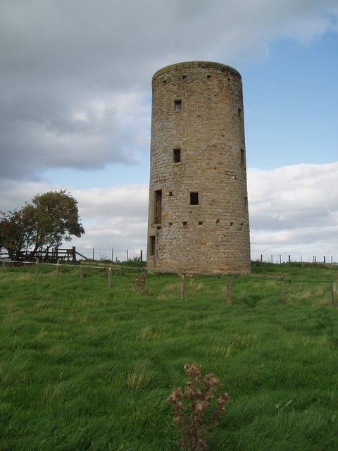
Milecastle 20
Milecastle 20 (Halton Shields) was one of the milecastles on Hadrian's Wall (grid reference NZ01886868). It is situated in the hamlet of Halton Shields...
Milecastle 21
Milecastle 21 (Down Hill) was a milecastle of the Roman Hadrian's Wall. The site was identified by measurement only, as the milecastle's remains have...

Milecastle 19
Milecastle 19 (Matfen Piers) was a milecastle of the Roman Hadrian's Wall. Sited just to the east of the hamlet of Matfen Piers, the milecastle is today...

Hunnum
Hunnum (also known as Onnum, and with the modern name of Halton Chesters) was a Roman fort north of the modern-day village of Halton, Northumberland in...
Halton, Northumberland
Halton is a village and former civil parish, now in the parish of Whittington, in the southern part of Northumberland, England. It is situated 3 miles...
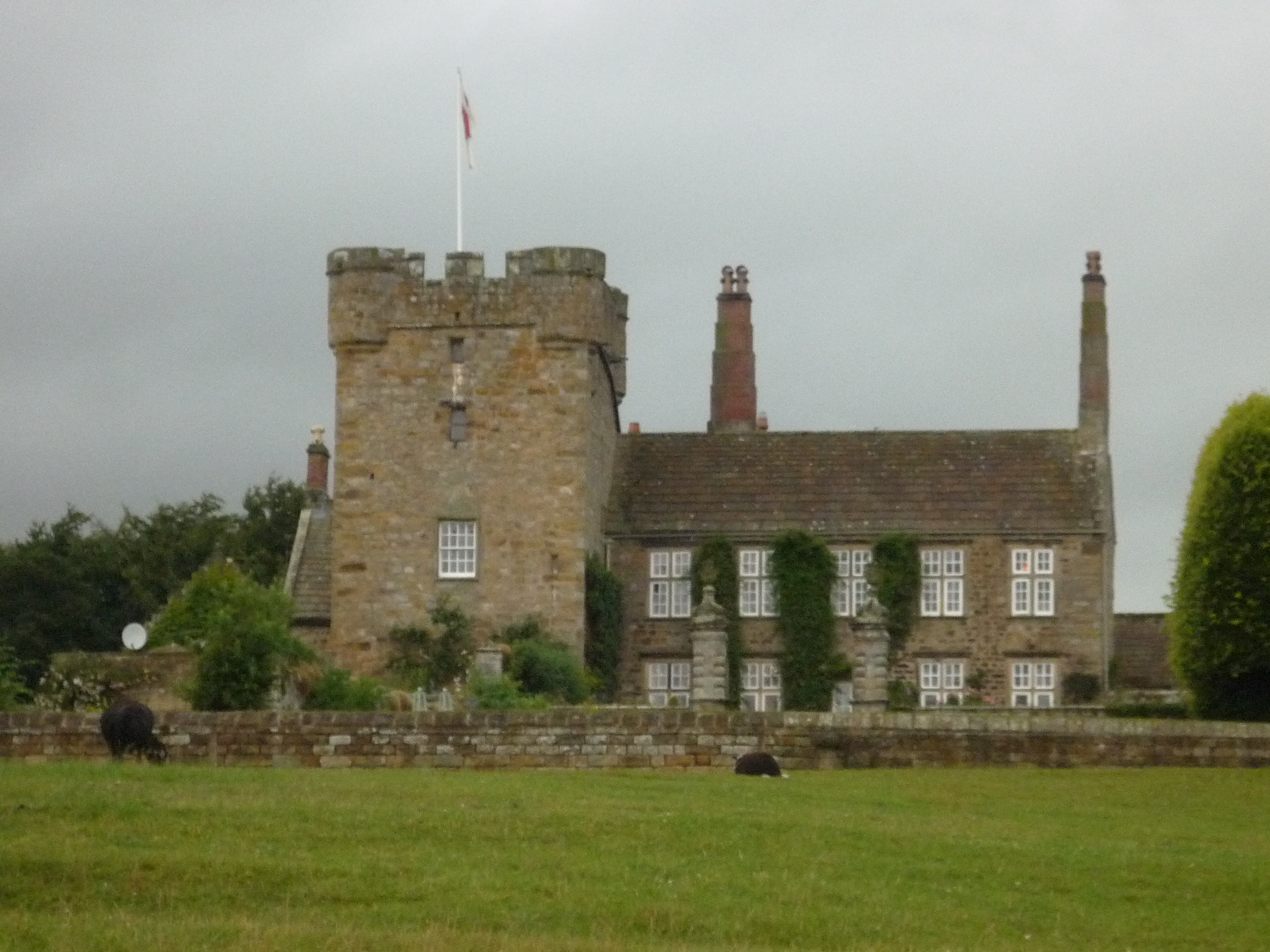
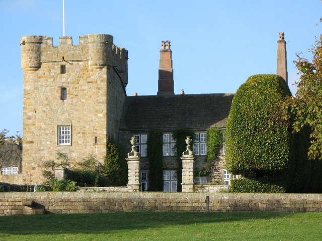
Halton Castle, Northumberland
Halton Castle is a pele tower and grade I listed building situated close to Hadrian's Wall to the north of the village of Corbridge in Northumberland,...

Great Whittington
Great Whittington is a village and former civil parish, now in the parish of Whittington, in Northumberland, England, 7 miles NE of Hexham. In 1951 the...

Aydon
Aydon is a village and former civil parish, now in the parish of Corbridge, in Northumberland, England. It is about 2 miles (3 km) northeast of Corbridge...
Nearby Amenities
Located within 500m of 55.011886,-1.972132Have you been to Halton Shields?
Leave your review of Halton Shields below (or comments, questions and feedback).