Halton Lea Gate

Settlement in Northumberland

England

Halton Lea Gate

A689 at Midgeholme
A689 at Midgeholme Credit: Peter Moore

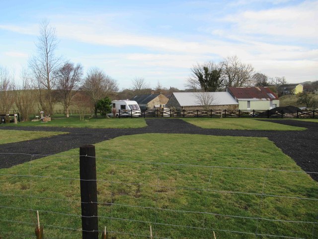
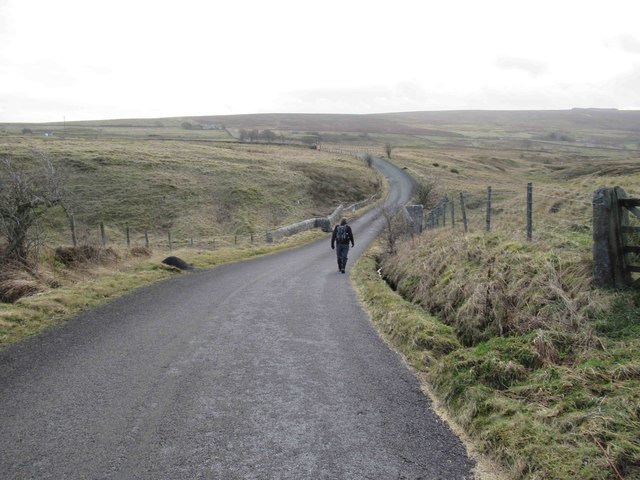
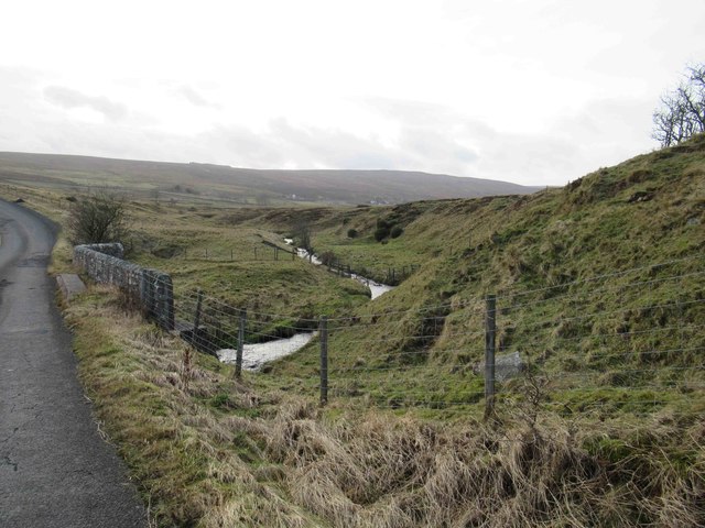
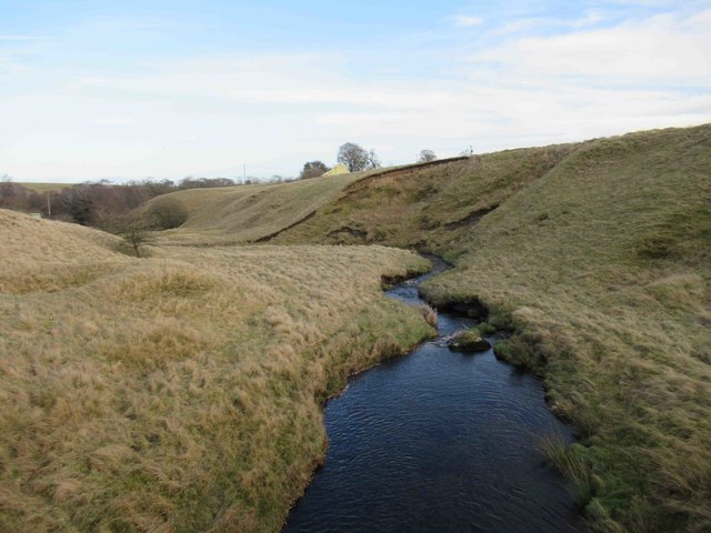
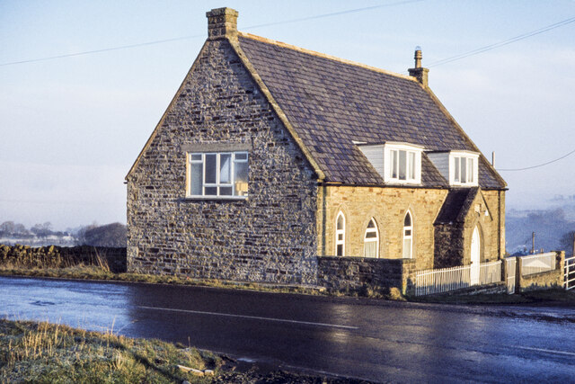
Halton Lea Gate is a small hamlet located in the county of Northumberland, England. Situated in the picturesque Tyne Valley, it lies approximately 4 miles west of the market town of Hexham. The hamlet is nestled amidst rolling hills and verdant countryside, offering residents and visitors a tranquil and idyllic setting.

Despite its small size, Halton Lea Gate has a rich history dating back centuries. It was originally a small farming community, and evidence of its agricultural past can still be seen in the surrounding fields and farmhouses. The name "Halton" is believed to derive from the Old English words "halh," meaning a nook or corner, and "tun," meaning a settlement or farmstead.

In terms of amenities, Halton Lea Gate is relatively limited. However, its close proximity to Hexham ensures that residents have easy access to a wider range of services, including shops, supermarkets, schools, and healthcare facilities. The hamlet is well-connected to the surrounding areas by road, with the A69 trunk road passing nearby.

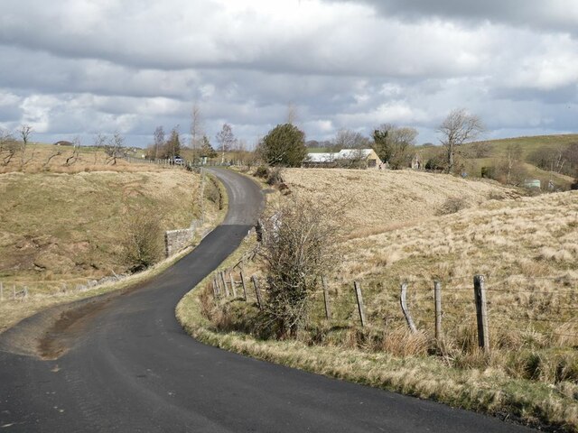
The natural beauty of the area makes Halton Lea Gate an attractive destination for outdoor enthusiasts. The nearby Tyne Valley offers ample opportunities for hiking, cycling, and exploring the stunning Northumberland countryside. Additionally, the historic Hadrian's Wall is just a short drive away, providing visitors with a chance to explore one of the most iconic landmarks in the country.

In summary, Halton Lea Gate is a small and picturesque hamlet in Northumberland, offering a peaceful and rural lifestyle, with easy access to nearby amenities and the stunning natural beauty of the Tyne Valley.

If you have any feedback on the listing, please let us know in the comments section below.

Halton Lea Gate Images

Images are sourced within 2km of 54.921896/-2.541679 or Grid Reference NY6558. Thanks to Geograph Open Source API. All images are credited.

A689 at Midgeholme
A689 at Midgeholme
Old Milestone by the A689, Lambley, Coanwood parish Carved stone post by the A689, in parish of COANWOOD (TYNEDALE District), Lambley, opposite junction with road to Coanwood, on grass verge, on West side of road. Erected by the Alston turnpike trust in the 18th century. 

Inscription once read:-
: (BRAMPTON / 9) : : (ALSTON / 9) : 

Milestone Society National ID: NB_ASBT09.
Old Milestone by the A689, Lambley, Coanwood parish
Carved stone post by the A689, in parish of COANWOOD (TYNEDALE District), Lambley, opposite junction with road to Coanwood, on grass verge, on West side of road. Erected by the Alston turnpike trust in the 18th century. Inscription once read:- : (BRAMPTON / 9) : : (ALSTON / 9) : Milestone Society National ID: NB_ASBT09.
Welcome to Cumbria: A689 enters Midgeholme
On Haltonlea Fell looking towards Halton-Lea-Gate
Greenriggs Caravan Site
Country Lane towards A689
Black Burn
Black Burn
Black Burn
Black Burn
Line of the Lambley to Carlisle Railway Line. Footbridge over the track?
Line of the Lambley to Carlisle Railway Line.
Footbridge over the track?
Lambley village Looking across the River South Tyne with a somewhat waterlogged field in the floor of the valley.
Lambley village
Looking across the River South Tyne with a somewhat waterlogged field in the floor of the valley.
Harpertown Bridge parapet Harpertown Bridge crossed the former railway to Lambley Colliery, which closed in 1958. There is an Ordnance Survey pivot benchmark on one of the coping stones.
Harpertown Bridge parapet
Harpertown Bridge crossed the former railway to Lambley Colliery, which closed in 1958. There is an Ordnance Survey pivot benchmark on one of the coping stones.
Benchmark, Harpertown Bridge Detail of the Ordnance Survey pivot banchmark on the north west parapet of Harpertown Bridge. The benchmark marks a height of 628.4ft above sea level (Ordnance Datum).
Benchmark, Harpertown Bridge
Detail of the Ordnance Survey pivot banchmark on the north west parapet of Harpertown Bridge. The benchmark marks a height of 628.4ft above sea level (Ordnance Datum).
Methodist Church walls The sandstone wall of the former Lambley Methodist Church to the right contrasts with the lower quality masonry of the garden wall to the left.
The mortar filled hole below the large stone quoin in the centre of the photograph was the fixing point of Ordnance Survey flush bracket benchmark number 11316, marking a height of 218.599m above sea level (Ordnance Datum).
Methodist Church walls
The sandstone wall of the former Lambley Methodist Church to the right contrasts with the lower quality masonry of the garden wall to the left. The mortar filled hole below the large stone quoin in the centre of the photograph was the fixing point of Ordnance Survey flush bracket benchmark number 11316, marking a height of 218.599m above sea level (Ordnance Datum).
View to the north east from Lambley Common View to the north east from the Pennine Way on Lambley Common.
View to the north east from Lambley Common
View to the north east from the Pennine Way on Lambley Common.
Converted church at Lambley The building is at the road junction at Lambley where the A689 makes a fairly sharp bend between north / south and west / east. Even at the end of 1978 when the image was recorded the church had been converted to a dwelling.
Converted church at Lambley
The building is at the road junction at Lambley where the A689 makes a fairly sharp bend between north / south and west / east. Even at the end of 1978 when the image was recorded the church had been converted to a dwelling.
Moorland on Lambley Common The moorland lies to the east of a path which is the route of the Pennine Way and the Maiden Way.
Beyond the fence the ground falls away to the valley of the River South Tyne; more distantly a pall of cloud lies over the valley of the same river as it turns eastwards, which probably meant mist or fog there.
Moorland on Lambley Common
The moorland lies to the east of a path which is the route of the Pennine Way and the Maiden Way. Beyond the fence the ground falls away to the valley of the River South Tyne; more distantly a pall of cloud lies over the valley of the same river as it turns eastwards, which probably meant mist or fog there.
The road from Lambley to Burnfoot Although this might be the shortest way from Lambley to Haltwhistle, it includes some vicious little hills where it crosses side valleys of the South Tyne.
The road from Lambley to Burnfoot
Although this might be the shortest way from Lambley to Haltwhistle, it includes some vicious little hills where it crosses side valleys of the South Tyne.
Minor road crossing the Black Burn Greenriggs Cottage can be seen  in the middle distance.
Minor road crossing the Black Burn
Greenriggs Cottage can be seen in the middle distance.
Show me another place!

Halton Lea Gate is located at Grid Ref: NY6558 (Lat: 54.921896, Lng: -2.541679)

Unitary Authority: Northumberland

Police Authority: Northumbria

What 3 Words

///equipping.utensil.spits. Near Greenhead, Northumberland

Related Wikis

Halton Lea Gate

Halton Lea Gate is a small village in Northumberland, England, on the A689 road close to the boundary of the counties of Northumberland and Cumbria. The...

Midgeholme Coalfield

The Midgeholme Coalfield is a coalfield in Midgeholme, on the border of Cumbria with Northumberland in northern England. It is the largest of a series...

Lambley railway station

Lambley was a railway station on the Alston Branch Line, which ran between Haltwhistle and Alston. The station, situated 4+3⁄4 miles (8 km) south-west...

Lambley, Northumberland

Lambley, formerly known as Harper Town, is a village and former civil parish, now in the parish of Coanwood, in Northumberland, England about four miles...

Coanwood railway station

Coanwood was a railway station on the Alston Branch Line, which ran between Haltwhistle and Alston. The station, situated 4 miles (6 km) south-west of...

Coanwood

Coanwood is a village in Northumberland, England, and is part of the Parish of Haltwhistle. It is about four miles (6 km) to the south-west of Haltwhistle...

Featherstone Castle

Featherstone Castle, a Grade I listed building, is a large Gothic style country mansion situated on the bank of the River South Tyne about 3 miles (5 km...

Featherstone, Northumberland

Featherstone is a village in Northumberland, England about 17 miles (27 km) west of Hexham, and about 3 kilometres (2 mi) south of Greenhead. == Featherstone... ==

Nearby Amenities

Located within 500m of 54.921896,-2.541679
Halton Lea Gate
Place: village
Wikidata: Q16993595
Wikipedia: en:Halton Lea Gate
Lat/Long: 54.9201437/-2.5420055
Haltonlea Gate
Historic Railway: station
Railway: site
Source: http://www.cumbria-railways.co.uk/brampton_railway.html
Lat/Long: 54.9196024/-2.5401832
Noexit: yes
Lat/Long: 54.9218504/-2.5441048
Crossing
Crossing: unmarked
Lat/Long: 54.9198008/-2.5387257
Bus Stop
Bench: no
Covered: yes
Shelter: no
Lat/Long: 54.9221185/-2.5454289
Bench
Lat/Long: 54.9220908/-2.5454308
Waste Basket
Lat/Long: 54.9220743/-2.5454269
Post Box
Ref: CA8 247
Lat/Long: 54.9217471/-2.5469981
Addr City: Brampton
Addr Housenumber: 17
Addr Postcode: CA8 7LB
Addr Street: Pennine Road
Addr Suburb: Halton Lea Gate
Lat/Long: 54.9202171/-2.5423779
Addr City: Brampton
Addr Housenumber: 2
Addr Postcode: CA8 7LB
Addr Street: Pennine Road
Addr Suburb: Halton Lea Gate
Lat/Long: 54.9206807/-2.5444971
Addr City: Brampton
Addr Housenumber: 9
Addr Postcode: CA8 7LB
Addr Street: Pennine Road
Addr Suburb: Halton Lea Gate
Lat/Long: 54.9204175/-2.5429047
Addr City: Brampton
Addr Housenumber: 13
Addr Postcode: CA8 7LB
Addr Street: Pennine Road
Addr Suburb: Halton Lea Gate
Lat/Long: 54.9203152/-2.5426384
Noexit: yes
Lat/Long: 54.9224662/-2.5440913
Generator Method: photovoltaic
Generator Output Electricity: yes
Generator Source: solar
Generator Type: solar_photovoltaic_panel
Location: roof
Power: generator
Lat/Long: 54.9197668/-2.5415527
The data included in this document is from www.openstreetmap.org. The data is made available under ODbL.

Have you been to Halton Lea Gate?

Leave your review of Halton Lea Gate below (or comments, questions and feedback).