Bargain Cleugh

Valley in Northumberland

England

Bargain Cleugh

Lambley Viaduct A former railway viaduct, built in 1852 to take the line across the South Tyne valley.  There is a footpath along the top, but it is not open to cyclists, who can however use the old railway trackbed further up the valley from where this photo was taken. The viaduct is Grade 2* listed (list entry number 1042918).
Lambley Viaduct Credit: Stephen Craven

Bargain Cleugh is a picturesque valley nestled in the county of Northumberland, England. Located in the heart of the North Pennines Area of Outstanding Natural Beauty, it offers a serene and tranquil retreat for nature lovers and outdoor enthusiasts.

The valley is characterized by its rolling hills, lush green meadows, and a meandering river that flows through its center. With its unspoiled beauty and diverse flora and fauna, Bargain Cleugh is a haven for wildlife, making it a popular destination for birdwatchers and nature photographers.

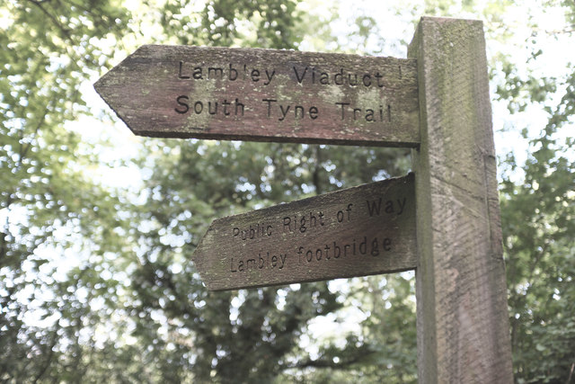
Visitors to Bargain Cleugh can explore its numerous walking trails, offering breathtaking panoramic views of the surrounding countryside. The valley is also home to a variety of historical landmarks, including the ruins of an old lead mine, which provide a glimpse into the region's rich mining heritage.

For those seeking a peaceful escape, Bargain Cleugh offers several secluded picnic spots along the riverbank, where visitors can relax and enjoy the sounds of nature. The valley is also a popular spot for camping and fishing, with several designated areas for these activities.

In addition to its natural beauty, Bargain Cleugh is conveniently located near several charming villages and towns, offering a range of amenities such as quaint pubs, cozy accommodations, and local shops selling traditional crafts and produce.

Overall, Bargain Cleugh is a hidden gem in Northumberland, offering a perfect blend of scenic landscapes, outdoor activities, and historical charm, making it a must-visit destination for nature enthusiasts and those seeking a peaceful retreat.

If you have any feedback on the listing, please let us know in the comments section below.

Bargain Cleugh Images

Images are sourced within 2km of 54.917935/-2.5321638 or Grid Reference NY6558. Thanks to Geograph Open Source API. All images are credited.

Lambley Viaduct A former railway viaduct, built in 1852 to take the line across the South Tyne valley.  There is a footpath along the top, but it is not open to cyclists, who can however use the old railway trackbed further up the valley from where this photo was taken. The viaduct is Grade 2* listed (list entry number 1042918).
Lambley Viaduct
A former railway viaduct, built in 1852 to take the line across the South Tyne valley. There is a footpath along the top, but it is not open to cyclists, who can however use the old railway trackbed further up the valley from where this photo was taken. The viaduct is Grade 2* listed (list entry number 1042918).
A689 at Midgeholme
A689 at Midgeholme
Lambley Viaduct
Lambley Viaduct
Lambley Viaduct, 1966 View northward along the River South Tyne. At that time (1966), the ex-NER branch line, Haltwhistle - Alston, was still working, being closed 3/5/76. Since 1983 the railway has been partly restored from Alston as the heritage narrow-gauge South Tynedale Railway, albeit not yet over this viaduct.
Lambley Viaduct, 1966
View northward along the River South Tyne. At that time (1966), the ex-NER branch line, Haltwhistle - Alston, was still working, being closed 3/5/76. Since 1983 the railway has been partly restored from Alston as the heritage narrow-gauge South Tynedale Railway, albeit not yet over this viaduct.
Lambley Viaduct on the South Tyne Trail or National Cycle Network Route 68
Panorama of Lambley viaduct
Fingerpost for Lambley Viaduct There are two ways to cross the river at Lambley - the old railway viaduct, and a footbridge in the bottom of the valley.  The path to the two diverges here.
Fingerpost for Lambley Viaduct
There are two ways to cross the river at Lambley - the old railway viaduct, and a footbridge in the bottom of the valley. The path to the two diverges here.
Footpath The former railway line leaves the station site at Coanwood
Footpath
The former railway line leaves the station site at Coanwood
House at Coanwood The former station at Coanwood
House at Coanwood
The former station at Coanwood
The house at Coanwood The former station location on the South Tyne Trail
The house at Coanwood
The former station location on the South Tyne Trail
Former railway platform Coanwood station, as was
Former railway platform
Coanwood station, as was
Coming up to Coanwood Former railway station site
Coming up to Coanwood
Former railway station site
Former weighing scale The remains of a weighing device at Coanwood station
Former weighing scale
The remains of a weighing device at Coanwood station
Gateposts Adjacent to the goods entrance to the former Coanwood station, these frame a track to farmland up the hill
Gateposts
Adjacent to the goods entrance to the former Coanwood station, these frame a track to farmland up the hill
Steps to Herdley Bank A private entrance to the railway from an adjacent farm
Steps to Herdley Bank
A private entrance to the railway from an adjacent farm
A glimpse of Coanwood Looking toward the former station
A glimpse of Coanwood
Looking toward the former station
Lambley Viaduct Taken from the South Tyne Trail
Lambley Viaduct
Taken from the South Tyne Trail
An apology from Ordnance Survey Taken from close to <a href="https://www.geograph.org.uk/photo/5703742">NY6758 : Lambley Viaduct</a> the notice refers to an error on OL43 regarding the alignment of the South Tyne Trail in the vicinity of the former railway station at the end of Lambley Viaduct.
An apology from Ordnance Survey
Taken from close to NY6758 : Lambley Viaduct the notice refers to an error on OL43 regarding the alignment of the South Tyne Trail in the vicinity of the former railway station at the end of Lambley Viaduct.
Show me another place!

Bargain Cleugh is located at Grid Ref: NY6558 (Lat: 54.917935, Lng: -2.5321638)

Unitary Authority: Northumberland

Police Authority: Northumbria

What 3 Words

///endearing.partied.engulfing. Near Greenhead, Northumberland

Related Wikis

Halton Lea Gate

Halton Lea Gate is a small village in Northumberland, England, on the A689 road close to the boundary of the counties of Northumberland and Cumbria. The...

Lambley railway station

Lambley was a railway station on the Alston Branch Line, which ran between Haltwhistle and Alston. The station, situated 4+3⁄4 miles (8 km) south-west...

Lambley, Northumberland

Lambley, formerly known as Harper Town, is a village and former civil parish, now in the parish of Coanwood, in Northumberland, England about four miles...

Coanwood railway station

Coanwood was a railway station on the Alston Branch Line, which ran between Haltwhistle and Alston. The station, situated 4 miles (6 km) south-west of...

Midgeholme Coalfield

The Midgeholme Coalfield is a coalfield in Midgeholme, on the border of Cumbria with Northumberland in northern England. It is the largest of a series...

Coanwood

Coanwood is a village in Northumberland, England, and is part of the Parish of Haltwhistle. It is about four miles (6 km) to the south-west of Haltwhistle...

Featherstone, Northumberland

Featherstone is a village in Northumberland, England about 17 miles (27 km) west of Hexham, and about 3 kilometres (2 mi) south of Greenhead. == Featherstone... ==

Featherstone Castle

Featherstone Castle, a Grade I listed building, is a large Gothic style country mansion situated on the bank of the River South Tyne about 3 miles (5 km...

Nearby Amenities

Located within 500m of 54.917935,-2.5321638
Crossing
Crossing: unmarked
Lat/Long: 54.9198008/-2.5387257
Barrier: stile
Lat/Long: 54.9211302/-2.5267639
Barrier: stile
Lat/Long: 54.9210326/-2.5267312
Information: guidepost
Tourism: information
Lat/Long: 54.9211131/-2.5268078
Green Hole
Place: locality
Lat/Long: 54.9152837/-2.5309981
The data included in this document is from www.openstreetmap.org. The data is made available under ODbL.

Have you been to Bargain Cleugh?

Leave your review of Bargain Cleugh below (or comments, questions and feedback).