Halton Holegate

Settlement in Lincolnshire East Lindsey

England

Halton Holegate

The Old Rectory, Northorpe Road, Halton Holegate Grade II Listed former rectory. Early 18th century altered in the early and mid 19th century. A large house with 4 reception rooms and ballroom. Above 4 or 5 bedrooms and 5 attic rooms.
The Old Rectory, Northorpe Road, Halton Holegate Credit: Jo and Steve Turner

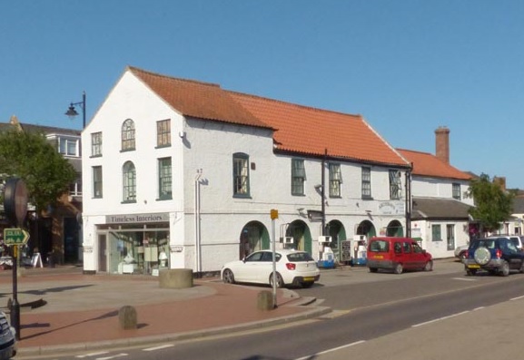
Halton Holegate is a small village located in the East Lindsey district of Lincolnshire, England. Situated approximately 10 miles east of the market town of Spilsby, it is nestled in the heart of the picturesque Lincolnshire Wolds, an Area of Outstanding Natural Beauty.

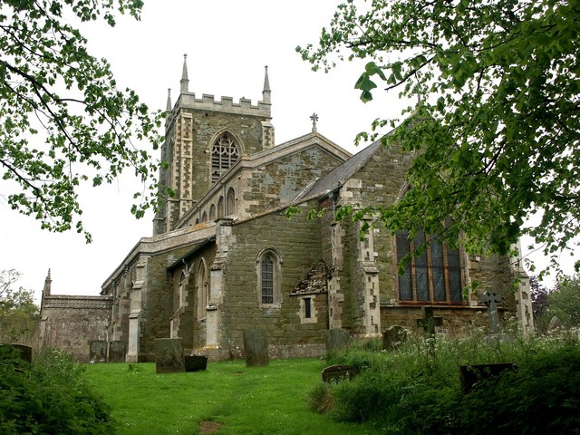
With a population of around 600 residents, Halton Holegate exudes a peaceful and close-knit community atmosphere. The village is characterized by its quaint and well-preserved buildings, many of which date back to the 18th and 19th centuries. The local St. Andrew's Church, a Grade II listed building, stands as a prominent historical landmark.

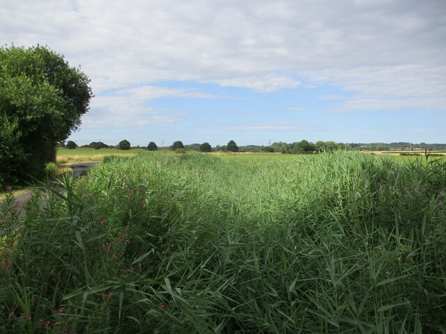
Agriculture has been a significant part of Halton Holegate's economy for centuries, and the village is surrounded by fertile farmland. This agricultural heritage is celebrated annually with the Halton Holegate Ploughing Match, a popular event attracting participants and visitors from far and wide.

Despite its small size, the village boasts several amenities, including a primary school, a village hall, and a traditional pub, the Ship Inn, which has been serving locals and visitors alike for many years. The surrounding countryside offers a wealth of opportunities for outdoor activities, such as walking, cycling, and birdwatching.

Overall, Halton Holegate offers a tranquil and idyllic setting, perfect for those seeking a peaceful retreat in the heart of the Lincolnshire countryside.

If you have any feedback on the listing, please let us know in the comments section below.

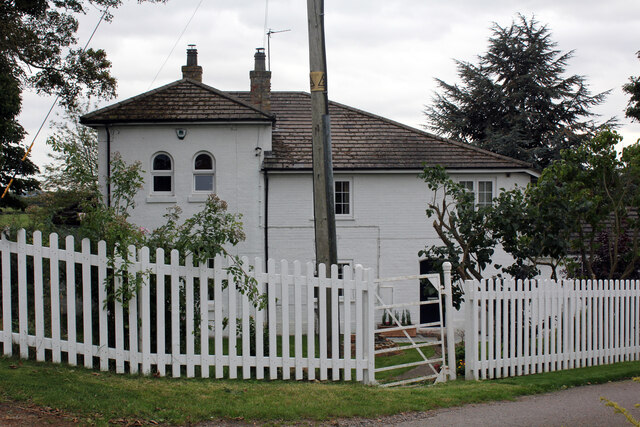
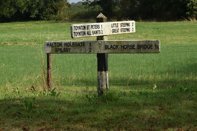
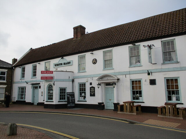
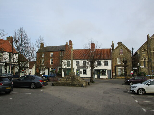
Halton Holegate Images

Images are sourced within 2km of 53.165084/0.118119 or Grid Reference TF4165. Thanks to Geograph Open Source API. All images are credited.

The Old Rectory, Northorpe Road, Halton Holegate Grade II Listed former rectory. Early 18th century altered in the early and mid 19th century. A large house with 4 reception rooms and ballroom. Above 4 or 5 bedrooms and 5 attic rooms.
The Old Rectory, Northorpe Road, Halton Holegate
Grade II Listed former rectory. Early 18th century altered in the early and mid 19th century. A large house with 4 reception rooms and ballroom. Above 4 or 5 bedrooms and 5 attic rooms.
St Andrew's Church, Firsby Road, Halton Holegate Grade II* Listed Parish church dating back to the 14th and 15th centuries. A church is mentioned in the Domesday Book 1080-1086 but the present church was built in the late 14th century. The porch was rebuilt in 1831 by Colonel Maddison of Partney Hall. Following damage in a bad storm in 1846 it was considerably rebuilt and improved under the direction of Rector Thomas Hardwicke Rawnsley. His son Drummond carried out further restoration and the tower was rebuilt 1866 by J. Fowler described in contemporary reports as 'Part of the tower was taken down and rebuilt with enlarged buttresses from designs by Mr. Street. Old tower was higher than the present one'. The crenellations were probably added at this time, not being shown in a 1790 sketch. Rev Thomas W Sale commissioned the rebuilding of the Chantry chapel, now the vestry, in 1894-5. It has a Sanctus and 6 other bells. Sanctus plus three 1717 by Henry Penn, one 1791 by Thomas Osborn, two 1867 by John Taylor & Co. Pictures show National Lottery funded restoration in 2015 and in December 2020 £25k was awarded for essential repairs from the government’s £1.57 billion COVID-19 Culture Recovery Fund. A wooden bridge over the road from the rectory to the then rectory vegetable garden and the church existed from the 1860s until the 1950s when it fell into disrepair and was demolished.
St Andrew's Church, Firsby Road, Halton Holegate
Grade II* Listed Parish church dating back to the 14th and 15th centuries. A church is mentioned in the Domesday Book 1080-1086 but the present church was built in the late 14th century. The porch was rebuilt in 1831 by Colonel Maddison of Partney Hall. Following damage in a bad storm in 1846 it was considerably rebuilt and improved under the direction of Rector Thomas Hardwicke Rawnsley. His son Drummond carried out further restoration and the tower was rebuilt 1866 by J. Fowler described in contemporary reports as 'Part of the tower was taken down and rebuilt with enlarged buttresses from designs by Mr. Street. Old tower was higher than the present one'. The crenellations were probably added at this time, not being shown in a 1790 sketch. Rev Thomas W Sale commissioned the rebuilding of the Chantry chapel, now the vestry, in 1894-5. It has a Sanctus and 6 other bells. Sanctus plus three 1717 by Henry Penn, one 1791 by Thomas Osborn, two 1867 by John Taylor & Co. Pictures show National Lottery funded restoration in 2015 and in December 2020 £25k was awarded for essential repairs from the government’s £1.57 billion COVID-19 Culture Recovery Fund. A wooden bridge over the road from the rectory to the then rectory vegetable garden and the church existed from the 1860s until the 1950s when it fell into disrepair and was demolished.
Former station buildings, 60 Station Road, Halton Holegate Spilsby & Firsby Railway Company obtained parliamentary permission in 1865 and consequently opened a four mile branch line to Spilsby on 1st May 1868. Halton Holegate was the only intermediate station on the short branch line and never generated much revenue. Operated by them, Great Northern Railway bought out the Spilsby & Firsby Railway Company and ran it from 1st January 1891. The station had a station master's residence, a booking office, a small waiting room, single platform, a loop line with cattle pen and goods shed. Passenger services were suspended for WWII on 10th September 1939 and never resumed but goods continued and finally stopped on 30th November 1958 because the bridge over Steeping River needed a £20k replacement. The Station building was extended and is now a 3 reception 5 bedroom, 2,319 sq ft (216 sq m) home. The goods shed is now 521 sq ft (48 sq m) stables and tack room.
Former station buildings, 60 Station Road, Halton Holegate
Spilsby & Firsby Railway Company obtained parliamentary permission in 1865 and consequently opened a four mile branch line to Spilsby on 1st May 1868. Halton Holegate was the only intermediate station on the short branch line and never generated much revenue. Operated by them, Great Northern Railway bought out the Spilsby & Firsby Railway Company and ran it from 1st January 1891. The station had a station master's residence, a booking office, a small waiting room, single platform, a loop line with cattle pen and goods shed. Passenger services were suspended for WWII on 10th September 1939 and never resumed but goods continued and finally stopped on 30th November 1958 because the bridge over Steeping River needed a £20k replacement. The Station building was extended and is now a 3 reception 5 bedroom, 2,319 sq ft (216 sq m) home. The goods shed is now 521 sq ft (48 sq m) stables and tack room.
Direction Sign – Signpost north of Halton Fenside Located north of Halton Fenside on the northeast side of the crossroads of Fen Road, Toynton Lane, Steeping Road and Halton Fenside, Halton Holgate parish. 4 arms and no finial.

Milestone Society National ID: LI_TF4263
Direction Sign – Signpost north of Halton Fenside
Located north of Halton Fenside on the northeast side of the crossroads of Fen Road, Toynton Lane, Steeping Road and Halton Fenside, Halton Holgate parish. 4 arms and no finial. Milestone Society National ID: LI_TF4263
The White Hart Hotel, Spilsby Much altered seventeenth century building <span class="nowrap"><a title="https://historicengland.org.uk/listing/the-list/list-entry/1146652?section=official-list-entry" rel="nofollow ugc noopener" href="https://historicengland.org.uk/listing/the-list/list-entry/1146652?section=official-list-entry">Link</a><img style="margin-left:2px;" alt="External link" title="External link - shift click to open in new window" src="https://s1.geograph.org.uk/img/external.png" width="10" height="10"/></span>
The White Hart Hotel, Spilsby
Much altered seventeenth century building LinkExternal link
Grass field at Halton Holegate
Spilsby, Market Place and Buttercross Apart from the modern cross at the top, the Buttercross dates from the fifteenth century <span class="nowrap"><a title="https://historicengland.org.uk/listing/the-list/list-entry/1359735?section=official-list-entry" rel="nofollow ugc noopener" href="https://historicengland.org.uk/listing/the-list/list-entry/1359735?section=official-list-entry">Link</a><img style="margin-left:2px;" alt="External link" title="External link - shift click to open in new window" src="https://s1.geograph.org.uk/img/external.png" width="10" height="10"/></span>
Spilsby, Market Place and Buttercross
Apart from the modern cross at the top, the Buttercross dates from the fifteenth century LinkExternal link
The Red Lion, Spilsby
Spilsby, the south-east corner of the Market Place The Methodist church <span class="nowrap"><a title="https://historicengland.org.uk/listing/the-list/list-entry/1063551?section=official-list-entry" rel="nofollow ugc noopener" href="https://historicengland.org.uk/listing/the-list/list-entry/1063551?section=official-list-entry">Link</a><img style="margin-left:2px;" alt="External link" title="External link - shift click to open in new window" src="https://s1.geograph.org.uk/img/external.png" width="10" height="10"/></span> on the left. To its right the former Manse <span class="nowrap"><a title="https://historicengland.org.uk/listing/the-list/list-entry/1359732?section=official-list-entry" rel="nofollow ugc noopener" href="https://historicengland.org.uk/listing/the-list/list-entry/1359732?section=official-list-entry">Link</a><img style="margin-left:2px;" alt="External link" title="External link - shift click to open in new window" src="https://s1.geograph.org.uk/img/external.png" width="10" height="10"/></span>
The building on the right dates from the eighteenth century with later alterations <span class="nowrap"><a title="https://historicengland.org.uk/listing/the-list/list-entry/1146730?section=official-list-entry" rel="nofollow ugc noopener" href="https://historicengland.org.uk/listing/the-list/list-entry/1146730?section=official-list-entry">Link</a><img style="margin-left:2px;" alt="External link" title="External link - shift click to open in new window" src="https://s1.geograph.org.uk/img/external.png" width="10" height="10"/></span>
Spilsby, the south-east corner of the Market Place
The Methodist church LinkExternal link on the left. To its right the former Manse LinkExternal link The building on the right dates from the eighteenth century with later alterations LinkExternal link
Statue of "The man who ate his boots" One of Sir John Franklin's nicknames according to Wikipedia, and definitely not whilst he lived in this part of the world!
<span class="nowrap"><a title="https://en.wikipedia.org/wiki/John_Franklin" rel="nofollow ugc noopener" href="https://en.wikipedia.org/wiki/John_Franklin">Link</a><img style="margin-left:2px;" alt="External link" title="External link - shift click to open in new window" src="https://s1.geograph.org.uk/img/external.png" width="10" height="10"/></span>
Statue of "The man who ate his boots"
One of Sir John Franklin's nicknames according to Wikipedia, and definitely not whilst he lived in this part of the world! LinkExternal link
Reed choked drain near Ashby by Partney
River Lymm below Northorpe Bridge
Peasgate Lane A bridleway to Halton Holegate.
Peasgate Lane
A bridleway to Halton Holegate.
Spilsby Christian Fellowship
Longland's Field, Halton Holgate
Spilsby Church The church of St James stands in a prominent position just to the west of Spilsby town centre and is seen here from Sainsbury's car park. It is grade I listed.
Spilsby Church
The church of St James stands in a prominent position just to the west of Spilsby town centre and is seen here from Sainsbury's car park. It is grade I listed.
The Red Lion, Spilsby  The Red Lion is on Market Street in Spilsby town centre. Red Lion is the most common name for pubs in England but they are especially numerous in this area because it was an heraldic emblem of the 14th century John of Gaunt, Earl of Lancaster, Lord of the Manor of Bolingbroke Castle.
The Red Lion, Spilsby
The Red Lion is on Market Street in Spilsby town centre. Red Lion is the most common name for pubs in England but they are especially numerous in this area because it was an heraldic emblem of the 14th century John of Gaunt, Earl of Lancaster, Lord of the Manor of Bolingbroke Castle.
Show me another place!

Halton Holegate is located at Grid Ref: TF4165 (Lat: 53.165084, Lng: 0.118119)

Division: Parts of Lindsey

Administrative County: Lincolnshire

District: East Lindsey

Police Authority: Lincolnshire

What 3 Words

///epidemics.forehand.incur. Near Spilsby, Lincolnshire

Related Wikis

Halton Holegate

Halton Holegate is a small village in the East Lindsey district of Lincolnshire, England. It is situated 1 mile (1.6 km) east from Spilsby. The village...

Halton Holegate railway station

Halton Holegate Railway Station is a former station in Halton Holegate, Lincolnshire. It was on a short branch from Firsby to Spilsby. == History of... ==

Spilsby Rural District

Spilsby was a rural district in Lincolnshire, parts of Lindsey from 1894 to 1974. It was created by the Local Government Act 1894 from the Spilsby rural...

Spilsby railway station

Spilsby railway station was a railway station in the market town of Spilsby, Lincolnshire, England. The station stood on a four mile long branch line between...

Old Town Hall, Spilsby

The Old Town Hall is a municipal building in the High Street in Spilsby, Lincolnshire, England. The structure, which accommodates some shops and a petrol...

Ashby by Partney

Ashby by Partney is a village and former civil parish, now in the parish of Ashby with Scremby, in the East Lindsey district of Lincolnshire, England....
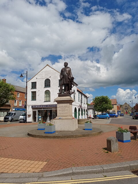
Spilsby

Spilsby is a market town and civil parish in the East Lindsey district of Lincolnshire, England. The town is adjacent to the main A16, 33 miles (53 km...

King Edward VI Academy

King Edward VI Academy (formerly King Edward VI Humanities College) is a coeducational bi-lateral secondary school and sixth form with academy status,...

Nearby Amenities

Located within 500m of 53.165084,0.118119
Halton Holegate
Is In: Lincolnshire, England, UK
Place: village
Source: Bing
Lat/Long: 53.1645304/0.117023
Pub
Bell
Addr City: Spilsby
Addr Country: GB
Addr Postcode: PE23 5PA
Addr Street: Firsby Road
Addr Village: Halton Holegate
Fhrs Authority: East Lindsey
Fhrs Id: 155806
Fhrs Local Authority Id: EHFDI/00919/08
Lat/Long: 53.1654989/0.1178379
HALTONHOLEGATE2
Disused: yes
Man Made: petroleum_well
Ref GB Decc: L47/21-2
Source: DECC
Lat/Long: 53.1688047/0.1140781
Bus Stop
Bell Inn
Naptan AtcoCode: 270000014387
Naptan Bearing: W
Naptan CommonName: Bell Inn
Naptan Indicator: opp
Naptan Landmark: Bell Inn
Naptan NaptanCode: linjpmga
Naptan Street: Holegate
Naptan Verified: no
Source: naptan_import
Lat/Long: 53.1650223/0.1175758
Bus Stop
Bell Inn
Naptan AtcoCode: 2700LHH00371
Naptan Bearing: E
Naptan CommonName: Bell Inn
Naptan Indicator: adj
Naptan Landmark: Bell Inn
Naptan NaptanCode: linadmtd
Naptan Street: Holegate
Naptan Verified: no
Source: naptan_import
Lat/Long: 53.1650968/0.1175691
Jubilee Farm
Place: farm
Source: Bing
Lat/Long: 53.1617113/0.1156817
The Wongs
Place: locality
Source: Bing
Lat/Long: 53.1628675/0.1198298
Post Box
Lat/Long: 53.1651638/0.1184193
Power: pole
Lat/Long: 53.1621443/0.1218161
Power: pole
Lat/Long: 53.1626826/0.1203794
Power: pole
Lat/Long: 53.1627311/0.1175558
Power: pole
Lat/Long: 53.1638631/0.115835
Power: pole
Lat/Long: 53.164241/0.1146077
Power: pole
Lat/Long: 53.1646614/0.1131967
Power: pole
Lat/Long: 53.1650389/0.1119579
Turning Circle
Lat/Long: 53.164678/0.1181616
Turning Circle
Lat/Long: 53.1645261/0.1177413
The data included in this document is from www.openstreetmap.org. The data is made available under ODbL.

Have you been to Halton Holegate?

Leave your review of Halton Holegate below (or comments, questions and feedback).