Pigmore Common

Downs, Moorland in Herefordshire

England

Pigmore Common

Eardisland Village Hall The former village school, the subject of a long fight to prevent its closure which made national headlines. The fight was lost and the school closed in 1979. The building was saved and became the village hall. The house to the left was the school master's house.
Eardisland Village Hall Credit: Philip Pankhurst

Pigmore Common is a picturesque area located in Herefordshire, England. Spread across rolling hills and valleys, it is primarily known for its stunning downs and moorland landscapes. Covering an area of approximately 500 hectares, Pigmore Common is a popular destination for nature enthusiasts and outdoor adventurers.

The common is characterized by its diverse range of flora and fauna, making it a haven for wildlife. Visitors can spot various species of birds, including skylarks, curlews, and lapwings, as they soar through the clear blue skies. The moorland is adorned with vibrant heather and gorse, adding splashes of color to the landscape throughout the year.

The Downs of Pigmore Common offer breathtaking panoramic views of the surrounding countryside. On a clear day, one can see the distant rolling hills and farmland stretching as far as the eye can see. The gentle slopes and undulating terrain make it a perfect spot for leisurely walks and hikes, allowing visitors to immerse themselves in the serene beauty of the area.

Pigmore Common also holds historical significance. The remnants of ancient settlements and burial mounds can be found scattered across the moorland, providing glimpses into the area's rich past. Archaeological enthusiasts can explore these intriguing sites and delve into the history and heritage of the region.

Overall, Pigmore Common is a true gem of Herefordshire, offering a tranquil escape from the hustle and bustle of modern life. With its stunning downs, moorland, and abundant wildlife, it is a must-visit destination for nature lovers and those seeking solace in the beauty of the natural world.

If you have any feedback on the listing, please let us know in the comments section below.

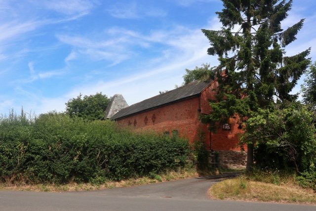
Pigmore Common Images

Images are sourced within 2km of 52.203014/-2.8499869 or Grid Reference SO4256. Thanks to Geograph Open Source API. All images are credited.

Eardisland Village Hall The former village school, the subject of a long fight to prevent its closure which made national headlines. The fight was lost and the school closed in 1979. The building was saved and became the village hall. The house to the left was the school master's house.
Eardisland Village Hall
The former village school, the subject of a long fight to prevent its closure which made national headlines. The fight was lost and the school closed in 1979. The building was saved and became the village hall. The house to the left was the school master's house.
A4112 in Stockingfield
Oast House Twin round kiln oast house.
Oast House
Twin round kiln oast house.
View to Oast House
View to Oast House
View to Oast House
View to Oast House
View to Oast House
View to Oast House
Knight's tomb, Dilwyn church The identity of this knight is not certain, it may be Sir Gilbert Talbot, 3rd Baron Talbot of Goodrich.  He served under John of Gaunt during his invasion of Castille; he died in Castille in 1387.
Knight's tomb, Dilwyn church
The identity of this knight is not certain, it may be Sir Gilbert Talbot, 3rd Baron Talbot of Goodrich. He served under John of Gaunt during his invasion of Castille; he died in Castille in 1387.
Knight's memorial, Dilwyn church The identity of this knight is not certain, it may be Sir Gilbert Talbot, 3rd Baron Talbot of Goodrich.  He served under John of Gaunt during his invasion of Castille; he died in Castille in 1387. Note the ball flowers, a particular feature of the English Decorated style of architect in Herefordshire.
Knight's memorial, Dilwyn church
The identity of this knight is not certain, it may be Sir Gilbert Talbot, 3rd Baron Talbot of Goodrich. He served under John of Gaunt during his invasion of Castille; he died in Castille in 1387. Note the ball flowers, a particular feature of the English Decorated style of architect in Herefordshire.
St Mary’s C of E Primary School The school building in Dilwyn was building in the early 19th century.  The building has a rather grand porch which appears a little oversized when compared with the building.  The school is Grade II listed, see: <span class="nowrap"><a title="https://historicengland.org.uk/listing/the-list/list-entry/1301584?section=official-list-entry" rel="nofollow ugc noopener" href="https://historicengland.org.uk/listing/the-list/list-entry/1301584?section=official-list-entry">Link</a><img style="margin-left:2px;" alt="External link" title="External link - shift click to open in new window" src="https://s1.geograph.org.uk/img/external.png" width="10" height="10"/></span>
St Mary’s C of E Primary School
The school building in Dilwyn was building in the early 19th century. The building has a rather grand porch which appears a little oversized when compared with the building. The school is Grade II listed, see: LinkExternal link
Porch of Dilwyn church The late C15 or early C16 porch of St Mary's church, Dilwyn.  The church is Grade I listed, see: <span class="nowrap"><a title="https://historicengland.org.uk/listing/the-list/list-entry/1349814?section=official-list-entry" rel="nofollow ugc noopener" href="https://historicengland.org.uk/listing/the-list/list-entry/1349814?section=official-list-entry">Link</a><img style="margin-left:2px;" alt="External link" title="External link - shift click to open in new window" src="https://s1.geograph.org.uk/img/external.png" width="10" height="10"/></span>
Porch of Dilwyn church
The late C15 or early C16 porch of St Mary's church, Dilwyn. The church is Grade I listed, see: LinkExternal link
The village of Dilwyn View across the village green in Dilwyn to a row of timber-framed cottages.
The village of Dilwyn
View across the village green in Dilwyn to a row of timber-framed cottages.
The spire of Dilwyn church A glimpse of the spire of St Mary's church, Dilwyn.
The spire of Dilwyn church
A glimpse of the spire of St Mary's church, Dilwyn.
The Great House The Great House is probably timber-framed and dating from the 17th century, with an 18th century Georgian brick facade.  The house is Grade II listed, see: <span class="nowrap"><a title="https://historicengland.org.uk/listing/the-list/list-entry/1349815?section=official-list-entry" rel="nofollow ugc noopener" href="https://historicengland.org.uk/listing/the-list/list-entry/1349815?section=official-list-entry">Link</a><img style="margin-left:2px;" alt="External link" title="External link - shift click to open in new window" src="https://s1.geograph.org.uk/img/external.png" width="10" height="10"/></span>  The Tyler family lived here in the 18th century, the poet Robert Southey was a distant relative through marriage and stayed here.
The Great House
The Great House is probably timber-framed and dating from the 17th century, with an 18th century Georgian brick facade. The house is Grade II listed, see: LinkExternal link The Tyler family lived here in the 18th century, the poet Robert Southey was a distant relative through marriage and stayed here.
Henwood Henwood, an 18th century Georgian house near Dilwyn.  The house is Grade II listed, see: <span class="nowrap"><a title="https://historicengland.org.uk/listing/the-list/list-entry/1081929?section=official-list-entry" rel="nofollow ugc noopener" href="https://historicengland.org.uk/listing/the-list/list-entry/1081929?section=official-list-entry">Link</a><img style="margin-left:2px;" alt="External link" title="External link - shift click to open in new window" src="https://s1.geograph.org.uk/img/external.png" width="10" height="10"/></span>
Henwood
Henwood, an 18th century Georgian house near Dilwyn. The house is Grade II listed, see: LinkExternal link
Timber Framed houses and barn at Karen Court <span class="nowrap"><a title="https://historicengland.org.uk/listing/the-list/list-entry/1081941?section=official-list-entry" rel="nofollow ugc noopener" href="https://historicengland.org.uk/listing/the-list/list-entry/1081941?section=official-list-entry">Link</a><img style="margin-left:2px;" alt="External link" title="External link - shift click to open in new window" src="https://s1.geograph.org.uk/img/external.png" width="10" height="10"/></span>
Timber Framed houses and barn at Karen Court
Church of St Mary <span class="nowrap"><a title="https://historicengland.org.uk/listing/the-list/list-entry/1349814?section=official-list-entry" rel="nofollow ugc noopener" href="https://historicengland.org.uk/listing/the-list/list-entry/1349814?section=official-list-entry">Link</a><img style="margin-left:2px;" alt="External link" title="External link - shift click to open in new window" src="https://s1.geograph.org.uk/img/external.png" width="10" height="10"/></span>
Church of St Mary
Old Milestone by the former A4112, Dilwyn Metal plate detached from post, by the UC road (was A4112), in parish of Dilwyn (District), by North entrance to churchyard, high on the stone retaining wall, on West side of road. Previously located further North, and still shown at that location on maps up to 1983/4. Parton Stone, erected by the Monkland & Parton turnpike trust in the 19th century. 

Inscription reads:-
Lemster
6
Miles

Herefordshire SMR listed.
SMR Number: 56720 <span class="nowrap"><a title="https://www.heritagegateway.org.uk/Gateway/Results_Single.aspx?uid=MHE28476&resourceID=101" rel="nofollow ugc noopener" href="https://www.heritagegateway.org.uk/Gateway/Results_Single.aspx?uid=MHE28476&resourceID=101">Link</a><img style="margin-left:2px;" alt="External link" title="External link - shift click to open in new window" src="https://s1.geograph.org.uk/img/external.png" width="10" height="10"/></span>

Milestone Society National ID: HF_LMHY06
Old Milestone by the former A4112, Dilwyn
Metal plate detached from post, by the UC road (was A4112), in parish of Dilwyn (District), by North entrance to churchyard, high on the stone retaining wall, on West side of road. Previously located further North, and still shown at that location on maps up to 1983/4. Parton Stone, erected by the Monkland & Parton turnpike trust in the 19th century. Inscription reads:- Lemster 6 Miles Herefordshire SMR listed. SMR Number: 56720 LinkExternal link Milestone Society National ID: HF_LMHY06
A44 - Golden Cross junction As at Barons Cross junction in Leominster, through traffic on the A44 must perform a "TOTSO" (turn off to stay on) manoeuvre to continue on that route.
A44 - Golden Cross junction
As at Barons Cross junction in Leominster, through traffic on the A44 must perform a "TOTSO" (turn off to stay on) manoeuvre to continue on that route.
Show me another place!

Pigmore Common is located at Grid Ref: SO4256 (Lat: 52.203014, Lng: -2.8499869)

Unitary Authority: County of Herefordshire

Police Authority: West Mercia

What 3 Words

///revamped.paintings.painting. Near Weobley, Herefordshire

Related Wikis

Burton Court, Eardisland

Burton Court is a Grade II* listed English country manor house in the Parish of Eardisland, southwest of Leominster, Herefordshire, England. The manor...

Dilwyn

Dilwyn is a village in Herefordshire, England located about 18 km (11 mi) from the city of Hereford and 9 km (6 mi) from its nearest town, Leominster....

Eardisland

Eardisland ( URDZ-lənd) is a village and civil parish on the River Arrow, about 5 miles (8 km) west of the market town of Leominster, Herefordshire. The...

St Cosmas and St Damian's Church, Stretford

St Cosmas and St Damian's Church is a redundant Anglican church standing in a farmyard in Stretford, Herefordshire, England. It is recorded in the National...

Nearby Amenities

Located within 500m of 52.203014,-2.8499869
Lower Burton
Place: hamlet
Source: NPE
Lat/Long: 52.2043521/-2.8460697
Information: guidepost
Tourism: information
Lat/Long: 52.2044041/-2.8516709
Power: pole
Source: bing
Lat/Long: 52.2066994/-2.8489244
Barrier: stile
Material: wood
Stile: stepover
Lat/Long: 52.2060332/-2.8510156
Barrier: stile
Material: wood
Stile: stepover
Lat/Long: 52.2058055/-2.8516208
Barrier: wicket_gate
Lat/Long: 52.2056453/-2.8519783
Barrier: stile
Material: wood
Stile: stepover
Lat/Long: 52.2058104/-2.8516078
Barrier: wicket_gate
Fixme: 2021: continue
Lat/Long: 52.2048364/-2.8542376
Information: guidepost
Tourism: information
Lat/Long: 52.2048225/-2.8542381
The data included in this document is from www.openstreetmap.org. The data is made available under ODbL.

Have you been to Pigmore Common?

Leave your review of Pigmore Common below (or comments, questions and feedback).