Little Moor

Downs, Moorland in Somerset South Somerset

England

Little Moor

Lane heading towards Wick
Lane heading towards Wick Credit: Rob Purvis

Little Moor is a charming and idyllic area located in Somerset, England. Situated amidst the picturesque Downs and Moorland, this region offers a captivating fusion of natural beauty and rural tranquility.

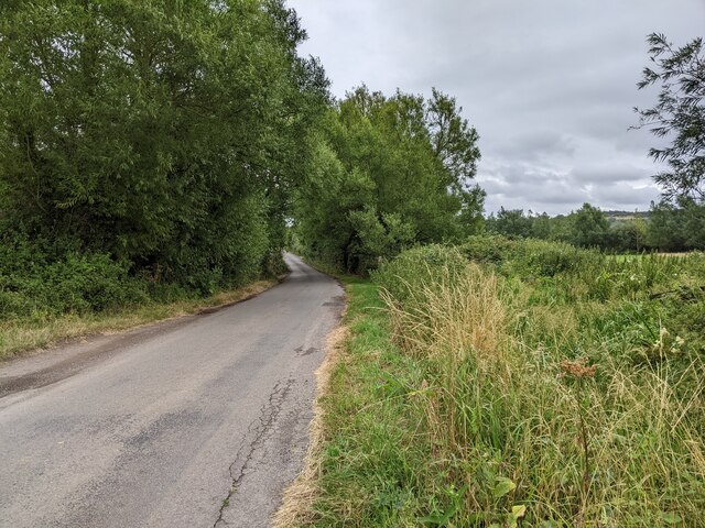
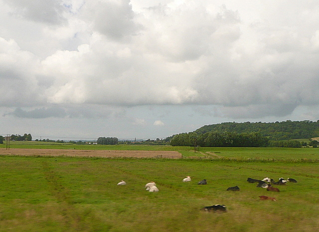
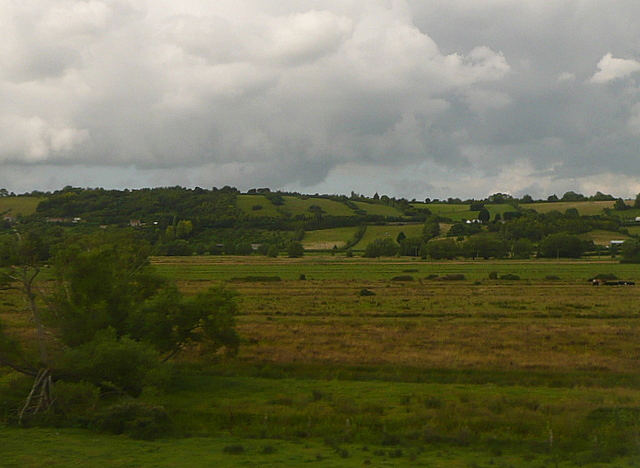
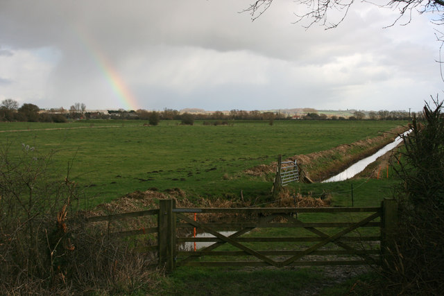
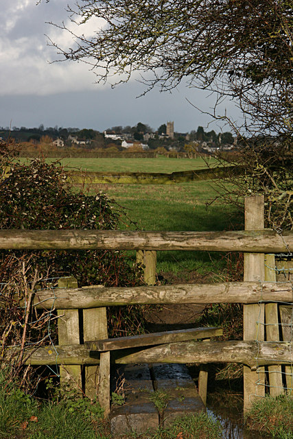
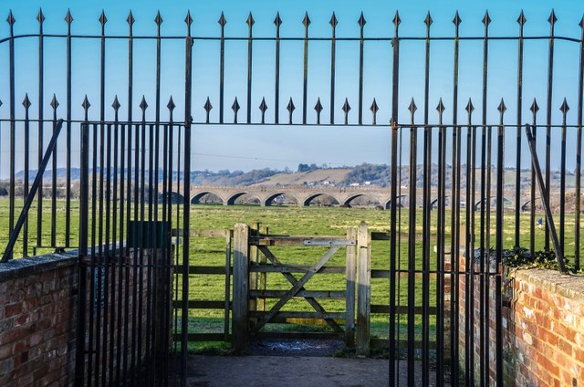
The landscape of Little Moor is characterized by rolling hills and expansive fields, covered with a tapestry of vibrant wildflowers and lush grasses. The area is home to a diverse range of wildlife, with rare species such as the Exmoor Pony and red deer frequently spotted in the vicinity. The enchanting sights and sounds of nature make Little Moor a haven for nature enthusiasts and wildlife photographers alike.

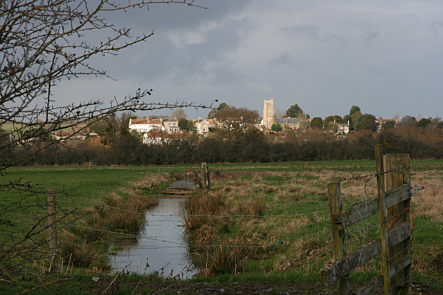
In addition to its natural splendor, Little Moor boasts a rich history and heritage. The region is dotted with ancient monuments, including burial mounds and standing stones, which serve as a testament to its historical significance. Visitors can explore these archaeological wonders and unravel the mysteries of the past.

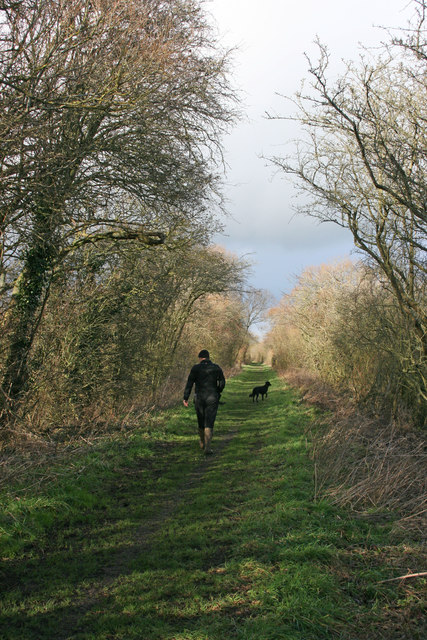
For outdoor enthusiasts, Little Moor offers a plethora of activities to enjoy. The expansive moorland provides ample opportunities for hiking, cycling, and horse riding, allowing visitors to immerse themselves in the breathtaking scenery. The area is also a popular destination for birdwatching, with numerous species of birds making their home in the diverse habitats of Little Moor.

With its unspoiled landscapes and peaceful ambiance, Little Moor provides a welcome escape from the hustle and bustle of modern life. Whether one seeks solace in nature, craves adventure, or yearns to delve into the region's rich history, Little Moor offers a truly immersive and unforgettable experience.

If you have any feedback on the listing, please let us know in the comments section below.
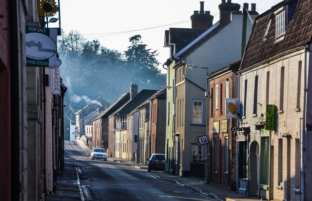
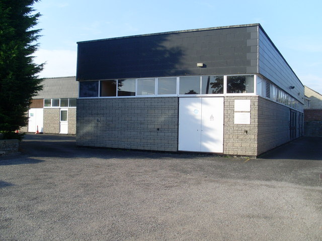
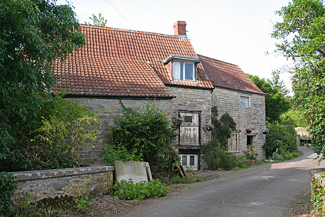
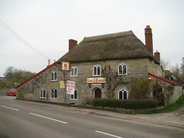
Little Moor Images

Images are sourced within 2km of 51.038822/-2.8335517 or Grid Reference ST4126. Thanks to Geograph Open Source API. All images are credited.

Lane heading towards Wick
Signposts, Huish Episcopi, Somerset
St. Mary's, Huish Episcopi, Somerset
The Post Office at Langport
Port Moor Part of the Somerset Levels, where all the lines you see are one sort of ditch or another.  Looking north towards Aller Hill <a href="https://www.geograph.org.uk/gridref/ST4029">ST4029</a>
This photo was taken from the 1158 Penzance to London Paddington train, having left Taunton at 1529.
Port Moor
Part of the Somerset Levels, where all the lines you see are one sort of ditch or another. Looking north towards Aller Hill ST4029 This photo was taken from the 1158 Penzance to London Paddington train, having left Taunton at 1529.
Poolmead An area of what looks like particularly wet and poor quality pasture to the north-west of Langport, despite the many drainage ditches.  On the map this has almost a paddy field quality.
This photo was taken from the 1158 Penzance to London Paddington train, having left Taunton at 1529.
Poolmead
An area of what looks like particularly wet and poor quality pasture to the north-west of Langport, despite the many drainage ditches. On the map this has almost a paddy field quality. This photo was taken from the 1158 Penzance to London Paddington train, having left Taunton at 1529.
Muchelney. The disused railway Now a cycle track across Perry Moor to Langport.
Muchelney. The disused railway
Now a cycle track across Perry Moor to Langport.
Langport across Huish Level
Huish Level, Langport
Langport from the footpath to Drayton
Langport: Bow Street
Langport: View across Little Moor towards the Viaduct
Langport: Bow Street
Langport Telephone Exchange Situated in Old Market Square off the A378 North Street, this modern TE would have replaced a smaller building from the GPO era during the early 1970s. Besides Langport, this TE also serves Aller, Bramwell, Curry Rivel, Drayton, Henley, High Ham, Huish Episcopi, Low Ham, Muchelney, Pibsbury, Pitney and Wearne nearby. This TE has (01458) 25xxxx numbers, the (01458) referring to the Glastonbury group of TEs, and its postcode is TA10 9RP.
Langport Telephone Exchange
Situated in Old Market Square off the A378 North Street, this modern TE would have replaced a smaller building from the GPO era during the early 1970s. Besides Langport, this TE also serves Aller, Bramwell, Curry Rivel, Drayton, Henley, High Ham, Huish Episcopi, Low Ham, Muchelney, Pibsbury, Pitney and Wearne nearby. This TE has (01458) 25xxxx numbers, the (01458) referring to the Glastonbury group of TEs, and its postcode is TA10 9RP.
High Ham: Paradise Mill Watermill, disused, in a parish which in earlier centuries had several windmills. With miller's cottage attached. Paradise Mill may have served the villagers of nearby Wearne
High Ham: Paradise Mill
Watermill, disused, in a parish which in earlier centuries had several windmills. With miller's cottage attached. Paradise Mill may have served the villagers of nearby Wearne
Langport: Road from Langport during the Floods
Eli's or the Rose and Crown Huish Episcopi Built in the 17C the pub has been in the same family for 120 years. 
For the history please see <span class="nowrap"><a title="http://www.huishepiscopi.org.uk/business-services/food-and-drink/107-rose-a-crown" rel="nofollow ugc noopener" href="http://www.huishepiscopi.org.uk/business-services/food-and-drink/107-rose-a-crown">Link</a><img style="margin-left:2px;" alt="External link" title="External link - shift click to open in new window" src="https://s1.geograph.org.uk/img/external.png" width="10" height="10"/></span>

The tree behind the pub in the other photographs has disappeared!
Eli's or the Rose and Crown Huish Episcopi
Built in the 17C the pub has been in the same family for 120 years. For the history please see LinkExternal link The tree behind the pub in the other photographs has disappeared!
The Town Hall, Langport
Show me another place!

Little Moor is located at Grid Ref: ST4126 (Lat: 51.038822, Lng: -2.8335517)

Administrative County: Somerset

District: South Somerset

Police Authority: Avon and Somerset

What 3 Words

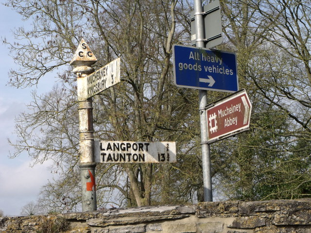
///declares.classed.reseller. Near Langport, Somerset

Related Wikis

Warehouse, Langport

The Warehouse in Great Bow Yard Langport, Somerset, England is an example of Victorian industrial architecture. The Warehouse was built in the late 18th...
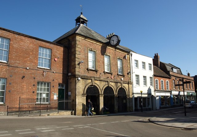
Langport Town Hall

Langport Town Hall is a municipal building in Bow Street in Langport, Somerset, England. The building, which is the meeting place of Langport Town Council...

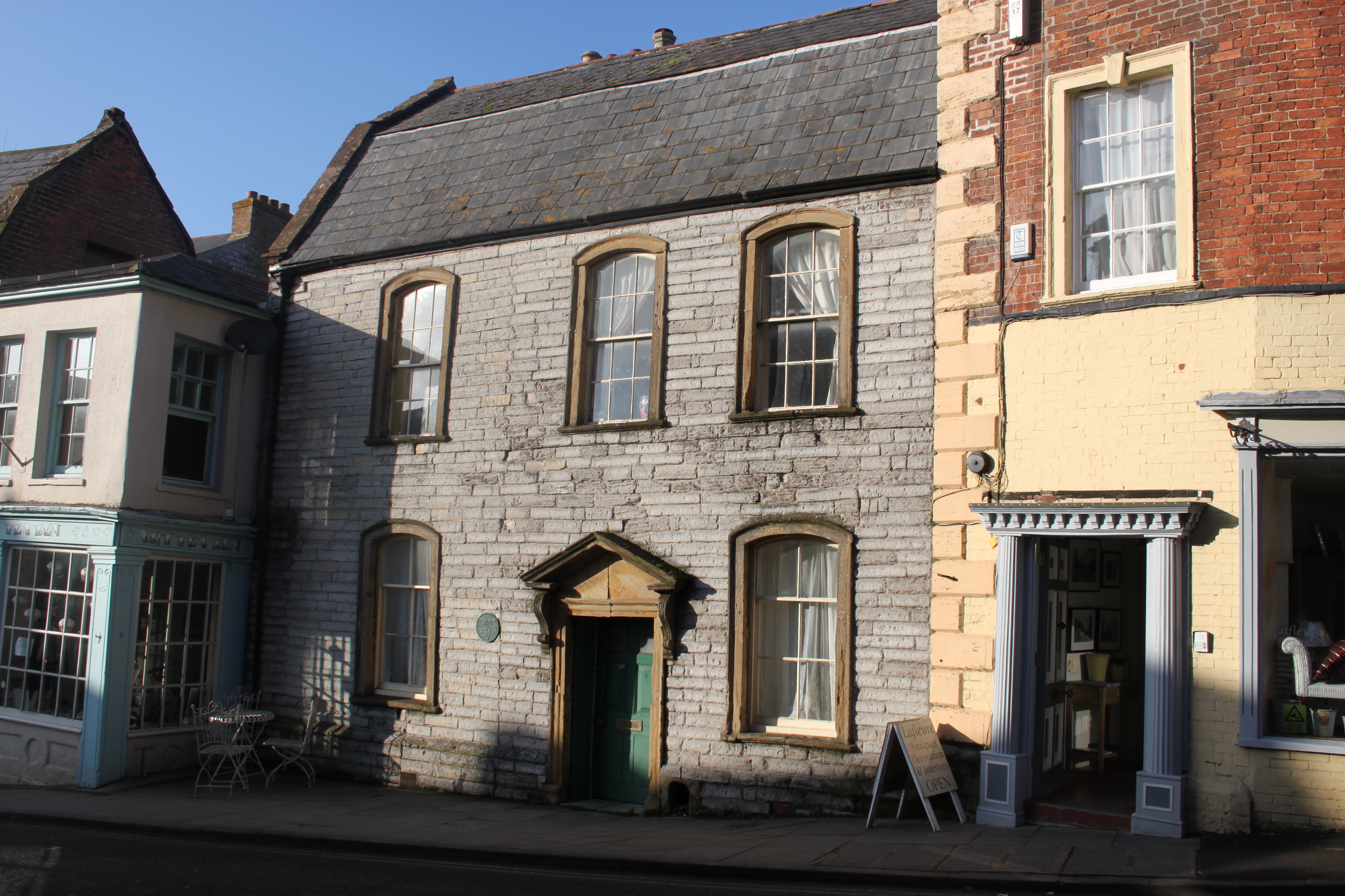
Tudor House, Langport

The Tudor House is an 18th-century house in Langport, Somerset, England. It was built in 1776 but had fallen into disrepair until it was bought and restored...
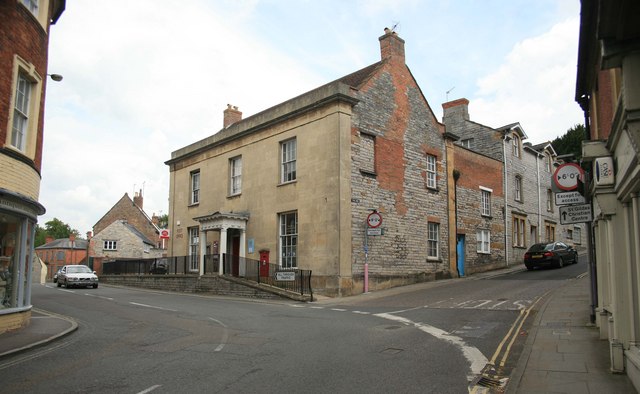
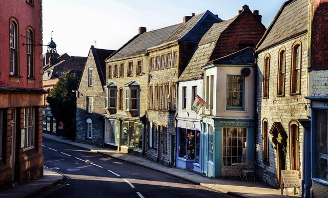
Langport

Langport is a town and civil parish in Somerset, England, 5 miles (8 km) west of Somerton. The parish, which covers only part of the town, has a population...

Nearby Amenities

Located within 500m of 51.038822,-2.8335517
Langport
Is In: Somerset, England, UK
Place: town
Wikidata: Q784252
Wikipedia: en:Langport
Lat/Long: 51.0375727/-2.8280084
Langport West
Historic Railway: station
Railway: site
Source: NPE
Lat/Long: 51.0353914/-2.8365438
Crossing
Crossing: zebra
Kerb: lowered
Tactile Paving: yes
Lat/Long: 51.0374631/-2.8292615
Parking
Lat/Long: 51.0368379/-2.8289582
Pub
Langport Arms Hotel
Addr City: Langport
Addr Country: GB
Addr Postcode: TA10 9PD
Addr Street: Cheapside
Email: info@langportarmshotel.co.uk
Phone: +44 1458250530
Tourism: hotel
Website: www.langportarmshotel.co.uk
Wikidata: Q17553753
Lat/Long: 51.0374959/-2.8285406
Power: pole
Lat/Long: 51.0393116/-2.8283867
Power: pole
Lat/Long: 51.0399873/-2.828811
Power: pole
Lat/Long: 51.0406766/-2.8292364
Power: pole
Lat/Long: 51.0410729/-2.8292986
Power: pole
Lat/Long: 51.0416399/-2.8293789
Power: pole
Lat/Long: 51.039258/-2.8278375
Crossing
Crossing: uncontrolled
Crossing Ref: zebra
Lat/Long: 51.0396213/-2.8268541
Crossing
Crossing: uncontrolled
Crossing Ref: zebra
Lat/Long: 51.0396919/-2.8273743
Power: pole
Ref: KD103
Source: bing
Source Ref: interpolation
Lat/Long: 51.0388008/-2.8318007
Power: pole
Ref: KD104
Source: bing
Source Ref: interpolation
Lat/Long: 51.0389107/-2.8306218
Power: pole
Ref: KD105
Source: bing
Source Ref: interpolation
Lat/Long: 51.0390239/-2.829403
Power: pole
Ref: KD106
Source: bing
Lat/Long: 51.0390863/-2.8287386
Power: pole
Source: bing
Lat/Long: 51.0382731/-2.8380242
Power: pole
Source: bing
Lat/Long: 51.0383539/-2.8370966
Power: pole
Source: bing
Lat/Long: 51.038455/-2.8358776
Power: pole
Source: bing
Lat/Long: 51.0385263/-2.8350246
Power: pole
Ref: KD101
Source: bing
Lat/Long: 51.0385881/-2.834286
Power: pole
Ref: KD102
Source: bing
Source Ref: interpolation
Lat/Long: 51.038691/-2.8330634
Power: pole
Source: bing
Lat/Long: 51.0380791/-2.8402293
Power: pole
Source: bing
Lat/Long: 51.0381311/-2.8396381
Toilets
Public conveniences
Lat/Long: 51.0371599/-2.8291377
Give Way
Lat/Long: 51.0376508/-2.8279853
Power: pole
Ref: ZDM112
Lat/Long: 51.0392859/-2.8287479
Power: pole
Lat/Long: 51.0409017/-2.8391871
Power: pole
Lat/Long: 51.0406882/-2.8377948
Power: pole
Lat/Long: 51.0404568/-2.8363807
Power: pole
Lat/Long: 51.0402016/-2.8347043
Power: pole
Lat/Long: 51.0399531/-2.8330347
Power: pole
Lat/Long: 51.0397023/-2.8314078
Power: pole
Lat/Long: 51.0394758/-2.8299559
Power: pole
Lat/Long: 51.0391586/-2.827854
Bank
NatWest
Brand: NatWest
Brand Wikidata: Q2740021
Lat/Long: 51.0373663/-2.8291724
Library
The Library
Lat/Long: 51.0369675/-2.8288208
Townhall
Langport Town Council
Lat/Long: 51.0374954/-2.8294096
Clock
Support: wall_mounted
Lat/Long: 51.0374775/-2.8293933
Stonegate Farmers LTD
Building: yes
Lat/Long: 51.0375041/-2.8397583
The White House
Building: yes
Lat/Long: 51.0362131/-2.837937
West Retreat
Building: yes
Lat/Long: 51.0357733/-2.8377093
Old Side Cottage
Building: yes
Lat/Long: 51.0356787/-2.8373922
Rose Cottage
Building: yes
Lat/Long: 51.0355893/-2.837258
Power: transformer
Lat/Long: 51.0391239/-2.8276129
Power: transformer
Lat/Long: 51.039236/-2.8275941
Post Box
Operator: Royal Mail
Operator Wikidata: Q638098
Post Box Design: type_k
Post Box Type: pillar
Ref: TA10 590
Royal Cypher: EIIR
Royal Cypher Wikidata: Q33102113
Lat/Long: 51.0371552/-2.8294785
Atm
Booth: KXPlus
Colour: red
Lat/Long: 51.0372986/-2.8293042
Bench
Lat/Long: 51.037253/-2.8292747
Bench
Lat/Long: 51.0372733/-2.8295295
Bicycle Parking
Bicycle Parking: stands
Capacity: 6
Covered: no
Lat/Long: 51.0371248/-2.8290682
Bench
Lat/Long: 51.0370472/-2.829044
Cafe
Art Tea Zen
Addr City: Langport
Addr Housenumber: 105
Addr Postcode: TA10 9PW
Addr Street: Cheapside
Website: https://artteazen.co.uk/
Lat/Long: 51.0377003/-2.8282875
Cafe
Kitchen at the Wharf
Addr City: Langport
Addr Postcode: TA10 9PN
Addr Street: Great Bow Yard
Lat/Long: 51.0364907/-2.8342045
Pharmacy
Boots
Addr City: Langport
Addr Postcode: TA10 9PW
Addr Street: Cheapside
Brand: Boots
Brand Wikidata: Q6123139
Brand Wikipedia: en:Boots UK
Dispensing: yes
Drive Through: no
Healthcare: pharmacy
Opening Hours: Mo-Fr 09:00-18:00, Sa 09:00-13:00
Operator: Boots
Website: https://www.boots.com/stores/5366-langport-cheapside-ta10-9pw
Lat/Long: 51.0376181/-2.8286249
Pub
The Black Swan
Internet Access: wlan
Wikidata: Q26308324
Lat/Long: 51.0385064/-2.8273353
Post Box
Collection Times: Mo-Fr 16:45; Sa 11:00
Operator: Royal Mail
Operator Wikidata: Q638098
Post Box Type: pillar
Ref: TA10 60
Royal Cypher: EIIR
Royal Cypher Wikidata: Q33102113
Lat/Long: 51.0351789/-2.8350748
Cafe
The Bridge
Addr City: Langport
Addr Country: GB
Addr County: Somerset
Addr Parentstreet: Bow Street
Addr Postcode: TA10 9RB
Addr Street: Westover Trading Estate
Check Date Opening Hours: 2022-01-29
Diet Vegan: yes
Diet Vegetarian: yes
Email: hello@thebridgelangport.co.uk
Opening Hours: We-Fr 08:00-20:00; Sa-Su 08:00-16:00
Phone: +44 1458 897100
Website: https://www.thebridgelangport.co.uk/
Wheelchair: yes
Lat/Long: 51.0358637/-2.835217
Bicycle Parking
Bicycle Parking: stands
Capacity: 6
Covered: no
Lat/Long: 51.036106/-2.8342518
Barrier: swing_gate
Lat/Long: 51.0401177/-2.8267691
Power: pole
Source: bing
Transformer: distribution
Lat/Long: 51.0396442/-2.8362738
Generator Method: photovoltaic
Generator Output Electricity: yes
Generator Source: solar
Generator Type: solar_photovoltaic_panel
Location: roof
Power: generator
Lat/Long: 51.0386601/-2.8274506
Generator Method: photovoltaic
Generator Output Electricity: yes
Generator Source: solar
Generator Type: solar_photovoltaic_panel
Location: roof
Power: generator
Lat/Long: 51.035221/-2.8358647
Generator Method: photovoltaic
Generator Output Electricity: yes
Generator Source: solar
Generator Type: solar_photovoltaic_panel
Location: roof
Power: generator
Lat/Long: 51.0360239/-2.8362778
Power: pole
Lat/Long: 51.037625/-2.8315721
Power: pole
Lat/Long: 51.0378081/-2.8356486
Power: pole
Lat/Long: 51.0370781/-2.8354256
Power: pole
Lat/Long: 51.0357701/-2.8342266
Power: pole
Lat/Long: 51.0349849/-2.8337867
Power: pole
Lat/Long: 51.0394262/-2.8402649
Power: pole
Lat/Long: 51.0387665/-2.8397258
Power: pole
Source: bing
Lat/Long: 51.0381625/-2.8392494
Fixme: exact location?
Leisure: slipway
Lat/Long: 51.0352446/-2.8348846
Parrett Trail Bikes
Opening Hours: We-Sa 09:00-16:00
Service Bicycle Rental: yes
Shop: bicycle
Wheelchair: yes
Lat/Long: 51.0358183/-2.8352185
Canoe: put_in
Lat/Long: 51.0359707/-2.8346874
Post Box
Collection Times: Mo-Fr 17:00; Sa 11:30
Operator: Royal Mail
Operator Wikidata: Q638098
Lat/Long: 51.0376968/-2.8279156
Canoe: put_in
Lat/Long: 51.0355699/-2.8299602
Defibrillator
Defibrillator
Emergency: defibrillator
Lat/Long: 51.0373715/-2.8294556
Defibrillator
Emergency: defibrillator
Indoor: no
Operator: aadefib.com
Lat/Long: 51.0358247/-2.8354322
The data included in this document is from www.openstreetmap.org. The data is made available under ODbL.

Have you been to Little Moor?

Leave your review of Little Moor below (or comments, questions and feedback).