Flanders Moss

Downs, Moorland in Orkney

Scotland

Flanders Moss

The Muckle Water on Rousay's southside Overlooking from Novan the Muckle (Big) Water with the Peerie (little) Water also in view, situated in the characteristic heather moorland of the higher parts of Rousay.
The Muckle Water on Rousay's southside Credit: s allison

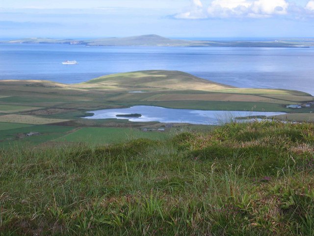
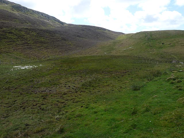
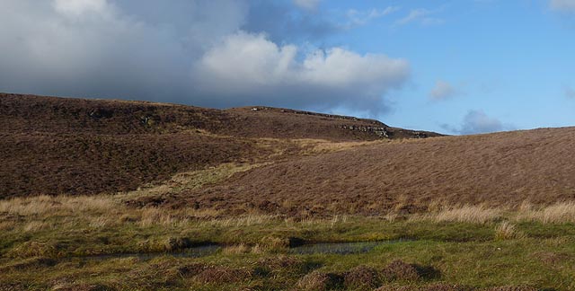
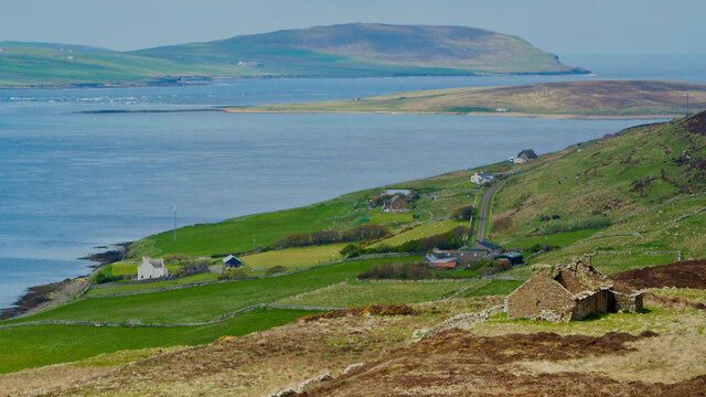
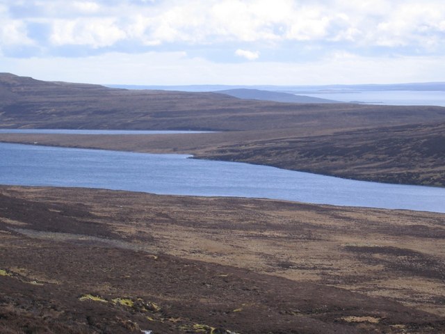
Flanders Moss, located in Orkney, Scotland, is a unique and captivating landscape characterized by its downs and moorland. Stretching over an area of approximately 500 hectares, it is a significant ecological site renowned for its biodiversity and natural beauty.

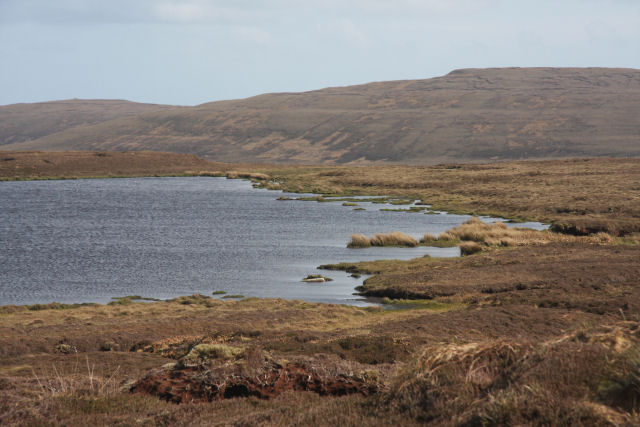
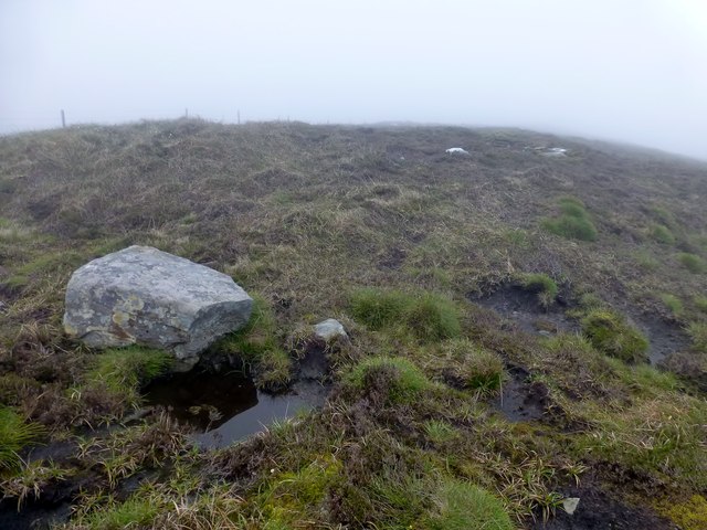
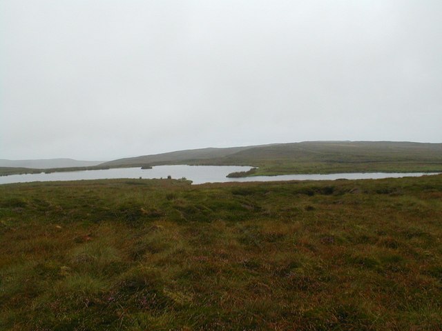
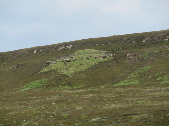
The moss is composed of a variety of habitats, including wetland, peat bog, and heathland. These habitats support a rich array of plant and animal species, making Flanders Moss a haven for wildlife enthusiasts and nature lovers. The bog is home to an assortment of aquatic plants such as sphagnum moss, bog cotton, and heather, which thrive in the acidic and waterlogged conditions.

The area is also a sanctuary for many bird species. Visitors can spot rare and migratory birds, including hen harriers, curlews, and lapwings, as they nest and feed in the moss. The presence of these birds adds to the unique charm and appeal of Flanders Moss.

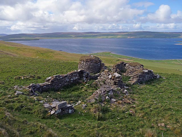
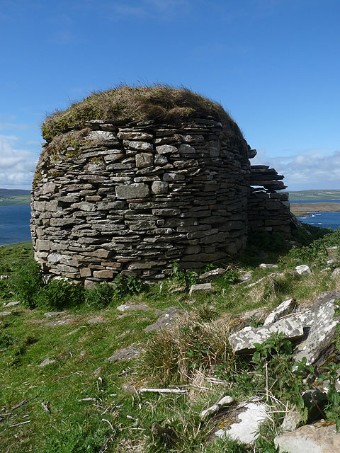
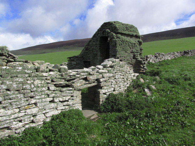
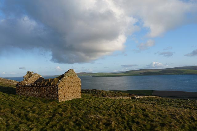
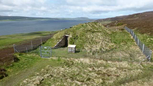
In addition to its ecological significance, Flanders Moss holds historical importance. The remains of ancient settlements, including Bronze Age and Neolithic artifacts, have been discovered in the vicinity, providing a glimpse into the area's past.

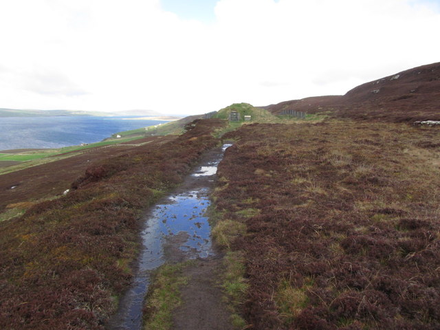
To preserve its ecological and historical value, Flanders Moss is designated as a Site of Special Scientific Interest (SSSI) and is managed by nature conservation organizations. Visitors can explore the moss through a network of trails and boardwalks, allowing them to appreciate its beauty while minimizing any negative impact on the delicate ecosystem.

Overall, Flanders Moss in Orkney offers a captivating blend of natural beauty, biodiversity, and historical significance, making it a must-visit destination for those interested in exploring Scotland's diverse landscapes.

If you have any feedback on the listing, please let us know in the comments section below.

Flanders Moss Images

Images are sourced within 2km of 59.1451/-3.0646083 or Grid Reference HY3929. Thanks to Geograph Open Source API. All images are credited.

The Muckle Water on Rousay's southside Overlooking from Novan the Muckle (Big) Water with the Peerie (little) Water also in view, situated in the characteristic heather moorland of the higher parts of Rousay.
The Muckle Water on Rousay's southside
Overlooking from Novan the Muckle (Big) Water with the Peerie (little) Water also in view, situated in the characteristic heather moorland of the higher parts of Rousay.
Twelve hour tower on Rousay The mossy heathery top of Twelve hour tower on Rousay looking over Wester on to Skaviskaill Head then on to Westray
Twelve hour tower on Rousay
The mossy heathery top of Twelve hour tower on Rousay looking over Wester on to Skaviskaill Head then on to Westray
Loch of Loomachun The advice given in a leaflet describing walks on Rousay advises not to venture too close to this loch, as it is a breeding area for red-throated divers, several of which could be seen on the surface of the loch.
Loch of Loomachun
The advice given in a leaflet describing walks on Rousay advises not to venture too close to this loch, as it is a breeding area for red-throated divers, several of which could be seen on the surface of the loch.
Ruins of Hallgate farmstead, Rousay, Orkney Looking towards Eynhallow Sound and Orkney mainland.

When the first edition OS six inch map was surveyed in 1879-80 the farmstead comprised two roofed buildings, one unroofed building, an enclosure and a field.  A close up of the grain kiln is shown at <a href="https://www.geograph.org.uk/photo/2980235">HY3830 : Grain kiln, Hallgate farmstead, Rousay, Orkney</a>.
Ruins of Hallgate farmstead, Rousay, Orkney
Looking towards Eynhallow Sound and Orkney mainland. When the first edition OS six inch map was surveyed in 1879-80 the farmstead comprised two roofed buildings, one unroofed building, an enclosure and a field. A close up of the grain kiln is shown at HY3830 : Grain kiln, Hallgate farmstead, Rousay, Orkney.
Grain kiln, Hallgate farmstead, Rousay, Orkney Looking towards Eynhallow Sound, Eynhallow island and Orkney mainland.

<a href="https://www.geograph.org.uk/photo/2980225">HY3830 : Ruins of Hallgate farmstead, Rousay, Orkney</a> shows an overview of the farmstead.
Grain kiln, Hallgate farmstead, Rousay, Orkney
Looking towards Eynhallow Sound, Eynhallow island and Orkney mainland. HY3830 : Ruins of Hallgate farmstead, Rousay, Orkney shows an overview of the farmstead.
Site of Loch of Wasday, Rousay, Orkney The loch is shown on the OS 1:25,000 map (as viewed on Get a Map 6/6/12), but was dry when visited.

The loch outflow is at the rocks half way up on the right hand side of the photo.

The fenceline shown on the 1:25,000 map running along the south side of the loch is an old earth dyke (running upwards from bottom right of photo). The fence running along behind the loch is not shown on the map.
Site of Loch of Wasday, Rousay, Orkney
The loch is shown on the OS 1:25,000 map (as viewed on Get a Map 6/6/12), but was dry when visited. The loch outflow is at the rocks half way up on the right hand side of the photo. The fenceline shown on the 1:25,000 map running along the south side of the loch is an old earth dyke (running upwards from bottom right of photo). The fence running along behind the loch is not shown on the map.
Rousay; Ruinous kiln oven on farm at Westside
Twelve Hours Tower A longer walked than it initially seemed with Chris Bienkowski, Jim Bloomer and Tricky Speirs.
Name: Twelve Hours Tower
Hill number: 12193
Height: 210m / 689ft
Parent (Ma/M): 1553  Blotchnie Fiold
Area:23: Orkney Islands
Class: 2
Grid ref: HY390311 (est)
Drop: 54m
Col: 156m  HY408310
Twelve Hours Tower
A longer walked than it initially seemed with Chris Bienkowski, Jim Bloomer and Tricky Speirs. Name: Twelve Hours Tower Hill number: 12193 Height: 210m / 689ft Parent (Ma/M): 1553 Blotchnie Fiold Area:23: Orkney Islands Class: 2 Grid ref: HY390311 (est) Drop: 54m Col: 156m HY408310
Loch of Loomachun Looking West-Southwest across the small but significant Loch of Loomachun on Rousay in Orkney. High on the island at 190m amongst the moss and heather the habitat supports a community of Red-throated divers.
Loch of Loomachun
Looking West-Southwest across the small but significant Loch of Loomachun on Rousay in Orkney. High on the island at 190m amongst the moss and heather the habitat supports a community of Red-throated divers.
Moorland pool below Sinclair's Hill, Rousay, Orkney Fulmars breed on the inland cliffs in this area.
Moorland pool below Sinclair's Hill, Rousay, Orkney
Fulmars breed on the inland cliffs in this area.
Ruined cottage, Newhouse, Rousay, Orkney The cottage lies on the southern slopes of Sinclair's Hill.  The Knowe of Ramsay chambered cairn can be seen below the cottage and Eynhallow Sound and Orkney mainland are beyond.

The OS six-inch map published in 1882 shows the cottage to be called London.
Ruined cottage, Newhouse, Rousay, Orkney
The cottage lies on the southern slopes of Sinclair's Hill. The Knowe of Ramsay chambered cairn can be seen below the cottage and Eynhallow Sound and Orkney mainland are beyond. The OS six-inch map published in 1882 shows the cottage to be called London.
Rousay; Path leading to Knowe of Yarso Cairn
Rousay: postbox № KW17 52, Frotoft A fairly modern postbox (1994 at the earliest, otherwise it would have POST OFFICE instead of ROYAL MAIL) serving this small hamlet on the southern side of the island.
Rousay: postbox № KW17 52, Frotoft
A fairly modern postbox (1994 at the earliest, otherwise it would have POST OFFICE instead of ROYAL MAIL) serving this small hamlet on the southern side of the island.
Knowe Of Yarso Chambered Cairn An Orkney-Cromarty stalled cairn. <span class="nowrap"><a title="https://canmore.org.uk/site/2623/rousay-knowe-of-yarso" rel="nofollow ugc noopener" href="https://canmore.org.uk/site/2623/rousay-knowe-of-yarso">Link</a><img style="margin-left:2px;" alt="External link" title="External link - shift click to open in new window" src="https://s1.geograph.org.uk/img/external.png" width="10" height="10"/></span>
Knowe Of Yarso Chambered Cairn
An Orkney-Cromarty stalled cairn. LinkExternal link
Eynhallow Sound from Rousay The photo shows the standing waves between Eynhallow and the Mainland which occur at a particular state of the tide. The admiralty chart shows a ridge of shallows across the sound at this point. I understand the standing waves are called ‘roosts’ from Nordic ‘rösts’.
Eynhallow Sound from Rousay
The photo shows the standing waves between Eynhallow and the Mainland which occur at a particular state of the tide. The admiralty chart shows a ridge of shallows across the sound at this point. I understand the standing waves are called ‘roosts’ from Nordic ‘rösts’.
Knowe of Yarso By the time this contributor had reached the track leading up to the third chambered tomb on this stretch of coast, it was clear that a walk up to the tomb would be a waste of energy as like the others it was closed to the public.
Knowe of Yarso
By the time this contributor had reached the track leading up to the third chambered tomb on this stretch of coast, it was clear that a walk up to the tomb would be a waste of energy as like the others it was closed to the public.
Rich Orkney soil
Rich Orkney soil
Looking down to Moa Ness
Show me another place!

Flanders Moss is located at Grid Ref: HY3929 (Lat: 59.1451, Lng: -3.0646083)

Unitary Authority: Orkney Islands

Police Authority: Highlands and Islands

What 3 Words

///times.stall.founders. Near Brinian, Orkney Islands

Nearby Locations

Flanders Moss Peerie Water

Related Wikis

Muckle Water

Muckle Water is a long, narrow fresh water loch on Ward Hill on Rousay, Orkney, Scotland. It is the biggest loch on the island and is popular for fishing...

Eynhallow Sound

Eynhallow Sound is a seaway lying between Mainland Orkney and the island of Rousay in the Orkney Islands, Scotland. The tidal indraught is "scarcely felt...

Knowe of Swandro

The Knowe of Swandro is an archaeological site located on the Bay of Swandro on Rousay in Orkney, Scotland. The site consists of a 5000-year-old Neolithic...

Knowe of Yarso chambered cairn

Knowe of Yarso chambered cairn is a Neolithic burial monument located on the island of Rousay in Orkney, Scotland. The site was excavated in the 1930s...

Midhowe Chambered Cairn

Midhowe Chambered Cairn is a large Neolithic chambered cairn located on the south shore of the island of Rousay, Orkney, Scotland. The name "Midhowe" comes...

Midhowe Broch

Midhowe Broch () is an Iron Age broch located on the west coast of the island of Rousay in the Orkney Islands, in Scotland. == Description == Midhowe...

Point of Hellia

The Point of Hellia is a headland on the northwest coast of the Orkney Mainland, Scotland. This landform extends into the southern part of Eynhallow Sound...

Broch of Gurness

The Broch of Gurness is an Iron Age broch village on the northeast coast of Mainland Orkney in Scotland overlooking Eynhallow Sound, about 15 miles north...

Nearby Amenities

Located within 500m of 59.1451,-3.0646083
Swarta Fiold
Place: locality
Lat/Long: 59.140776/-3.0645215
The data included in this document is from www.openstreetmap.org. The data is made available under ODbL.

Have you been to Flanders Moss?

Leave your review of Flanders Moss below (or comments, questions and feedback).