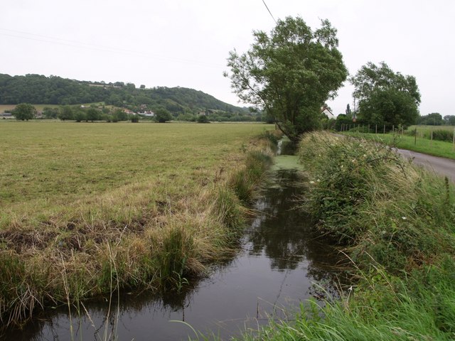
North Moor

Downs, Moorland in Somerset South Somerset

England

North Moor

The Old Pound Inn at Aller
The Old Pound Inn at Aller Credit: Nick Chipchase

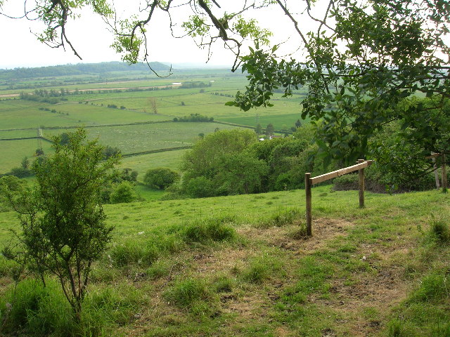
North Moor is a picturesque area located in Somerset, England, known for its stunning landscape and natural beauty. Spanning across a vast expanse, North Moor primarily consists of downs and moorland, offering visitors a unique and diverse environment to explore.

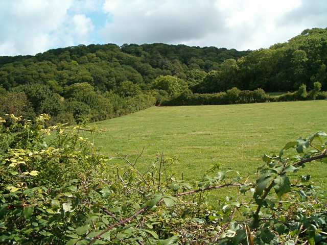
The downs of North Moor are characterized by gently rolling hills and grassy meadows, providing breathtaking views of the surrounding countryside. These areas are rich in wildlife, with an abundance of bird species and small mammals, making it a popular destination for nature enthusiasts and birdwatchers.

The moorland of North Moor offers a stark contrast to the downs, with its rugged terrain and open expanses. Dominated by heather, gorse, and grasses, the moorland is a haven for hikers and walkers, who can traverse the numerous footpaths and trails that crisscross the area. The rolling hills and vast open spaces make it an ideal location for outdoor activities such as cycling, horse riding, and picnicking.

North Moor is also home to several archaeological sites, including ancient burial mounds and standing stones, providing a glimpse into the area's rich history. The moorland has been inhabited for thousands of years, and evidence of human settlement can be traced back to prehistoric times.

Overall, North Moor in Somerset is a captivating destination that offers visitors a chance to immerse themselves in the natural beauty and tranquility of the British countryside. With its stunning downs, rugged moorland, and rich history, it is a must-visit location for those seeking a true taste of rural England.

If you have any feedback on the listing, please let us know in the comments section below.

North Moor Images

Images are sourced within 2km of 51.07488/-2.8695422 or Grid Reference ST3930. Thanks to Geograph Open Source API. All images are credited.

The Old Pound Inn at Aller
Aller The Old Pound Inn
Aller
The Old Pound Inn
Sowy River, Somerset Levels View looking southwest towards Stathe from Aller Drove Road. The "river" is better described as a large drainage ditch.
Sowy River, Somerset Levels
View looking southwest towards Stathe from Aller Drove Road. The "river" is better described as a large drainage ditch.
Othery Cemetery Clinging to the edge of the higher land above the Levels, the cemetery looks peaceful and pretty. However the busy A361 runs along the left hand side and behind the photographer is a mixture of modern pylons and ugly industrial development.
Othery Cemetery
Clinging to the edge of the higher land above the Levels, the cemetery looks peaceful and pretty. However the busy A361 runs along the left hand side and behind the photographer is a mixture of modern pylons and ugly industrial development.
The London Inn. Othery
Sowey River On King's Sedge Moor
Sowey River
On King's Sedge Moor
Wet Levels Flooded plains on King's Sedge Moor, Somerset
Wet Levels
Flooded plains on King's Sedge Moor, Somerset
Nightingale Farm at Beer The old Nightingale Farm has been subdivided into a number of smaller units, but retains its historical identity to the locals.
Nightingale Farm at Beer
The old Nightingale Farm has been subdivided into a number of smaller units, but retains its historical identity to the locals.
Field looking to Middlezoy
Aller Wood View from the A372 near Beer Corner.
Aller Wood
View from the A372 near Beer Corner.
Cows Crossing Cows Crossing near Shride farm
Cows Crossing
Cows Crossing near Shride farm
Allerdrove Rhyne This runs beside Aller Drove on the right, which divides North Moor from Aller Moor and connects Pathe to Aller across this narrow stretch of the Somerset Levels. Seen from the junction with Leazeway Drove.
Allerdrove Rhyne
This runs beside Aller Drove on the right, which divides North Moor from Aller Moor and connects Pathe to Aller across this narrow stretch of the Somerset Levels. Seen from the junction with Leazeway Drove.
Rhyne at Longstone This continuation of Black Withies Rhyne bends at Longstone to run beside Aller Drove, the lane on the right. In the distance are buildings at Aller, and Aller Hill.
Rhyne at Longstone
This continuation of Black Withies Rhyne bends at Longstone to run beside Aller Drove, the lane on the right. In the distance are buildings at Aller, and Aller Hill.
North Moor Cattle graze near a conventional-looking haystack on the eastern part of North Moor, seen from Northmoor Drove.  According to <span class="nowrap"><a title="http://webapp1.somerset.gov.uk/her/details.asp?prn=18892" rel="nofollow ugc noopener" href="http://webapp1.somerset.gov.uk/her/details.asp?prn=18892">Link</a><img style="margin-left:2px;" alt="External link" title="External link - shift click to open in new window" src="https://s1.geograph.org.uk/img/external.png" width="10" height="10"/></span> , this area was actually the site of a number of medieval stack stands.

The building in the background is Black Withies. Aller Wood, on the slopes of Aller Hill, is in ST4030.
North Moor
Cattle graze near a conventional-looking haystack on the eastern part of North Moor, seen from Northmoor Drove. According to LinkExternal link , this area was actually the site of a number of medieval stack stands. The building in the background is Black Withies. Aller Wood, on the slopes of Aller Hill, is in ST4030.
North Moor A meadow at the southeast edge of North Moor, beside Aller Drove. On the left is a barn at Longstone Farm. As elsewhere on the Somerset levels, rhynes, with scattered willows along them, form the field boundaries.
North Moor
A meadow at the southeast edge of North Moor, beside Aller Drove. On the left is a barn at Longstone Farm. As elsewhere on the Somerset levels, rhynes, with scattered willows along them, form the field boundaries.
North Moor Another view of the area shown in <a href="https://www.geograph.org.uk/photo/560686">ST3929 : North Moor</a>, from near Longstone Cottage on Aller Drove - the group of cattle is the same.
North Moor
Another view of the area shown in ST3929 : North Moor, from near Longstone Cottage on Aller Drove - the group of cattle is the same.
Willow on North Moor The weed-covered rhyne by which this willow stands can just be seen at bottom left, but the roadside rhyne (the one shown in <a href="https://www.geograph.org.uk/photo/485751">ST3929 : Rhyne at Longstone</a>) is just out of sight below. Beyond, the levels stretch away for about 7 kilometres to Moorlinch.
Willow on North Moor
The weed-covered rhyne by which this willow stands can just be seen at bottom left, but the roadside rhyne (the one shown in ST3929 : Rhyne at Longstone) is just out of sight below. Beyond, the levels stretch away for about 7 kilometres to Moorlinch.
Longstone Lodge One of several cottages scattered along the southwest side of Aller Drove.
Longstone Lodge
One of several cottages scattered along the southwest side of Aller Drove.
Show me another place!

North Moor is located at Grid Ref: ST3930 (Lat: 51.07488, Lng: -2.8695422)

Administrative County: Somerset

District: South Somerset

Police Authority: Avon and Somerset

What 3 Words

///vegetable.guests.lawfully. Near Langport, Somerset

Nearby Locations

North Moor

Related Wikis

Othery

The parish and village of Othery, established in 1515, sits on a detached extension of Sowy island on the Somerset Levels. It is 7 miles (11 km) east of...

Aller and Beer Woods

Aller and Beer Woods (grid reference ST404305) is a 56.9 hectares (141 acres) biological Site of Special Scientific Interest. off the A372 Othery to Langport...

The Breeze (Bridgwater & West Somerset)

The Breeze (Bridgwater & West Somerset) formerly Quay West and Total Star Somerset was an Independent Local Radio station serving the Sedgemoor District...

King's Sedgemoor

King's Sedgemoor is a piece of rich animal habitat and farming land, that forms part of the Somerset Levels and Moors in South West England. The area of...

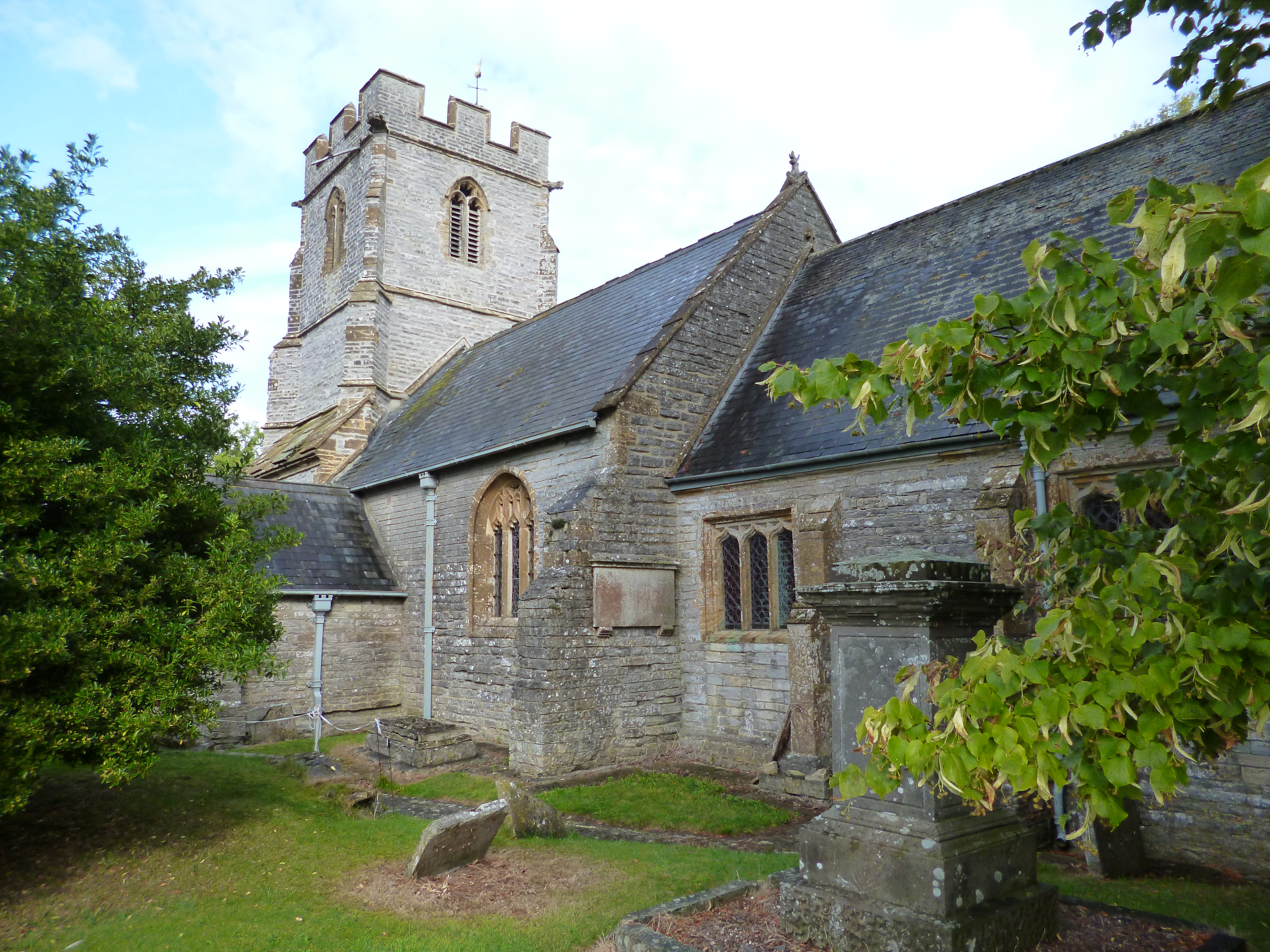
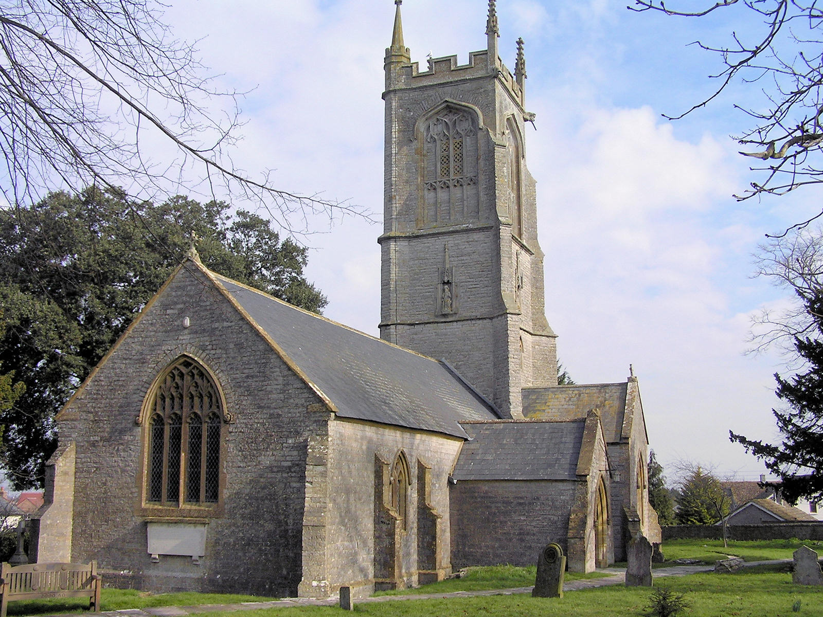
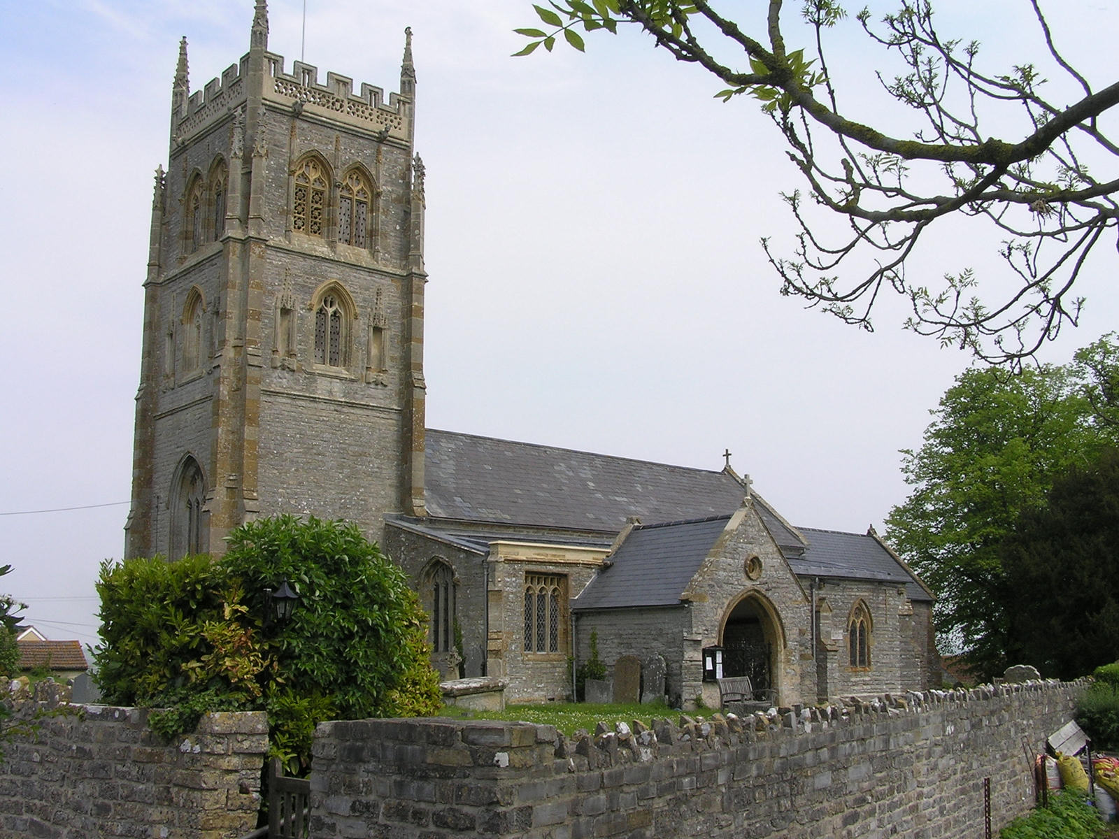
Church of St Andrew, Aller

The Anglican Church of St Andrew in Aller, Somerset, England, was built in the 11th century. It is a Grade II* listed building. == History == The Church...

Middlezoy

Middlezoy is a village and civil parish on the Somerset Levels in Somerset, England. Situated between the two other villages of Westonzoyland and Othery...

Southlake Moor

Southlake Moor (grid reference ST370300) is a 196.1 hectare (484.6 acre) biological Site of Special Scientific Interest near Burrow Mump and Burrowbridge...

Aller Hill

Aller Hill (grid reference ST408291) is an 18.4 hectare (45.4 acre) biological Site of Special Scientific Interest near Aller in Somerset, notified in...

Nearby Amenities

Located within 500m of 51.07488,-2.8695422
Waterway: weir
Lat/Long: 51.079217/-2.8679504
The data included in this document is from www.openstreetmap.org. The data is made available under ODbL.

Have you been to North Moor?

Leave your review of North Moor below (or comments, questions and feedback).