Caldicot Level

Downs, Moorland in Monmouthshire

Wales

Caldicot Level

Cock Street Reen, North Row Roadside drain, Caldicot Level.
Cock Street Reen, North Row Credit: M J Roscoe

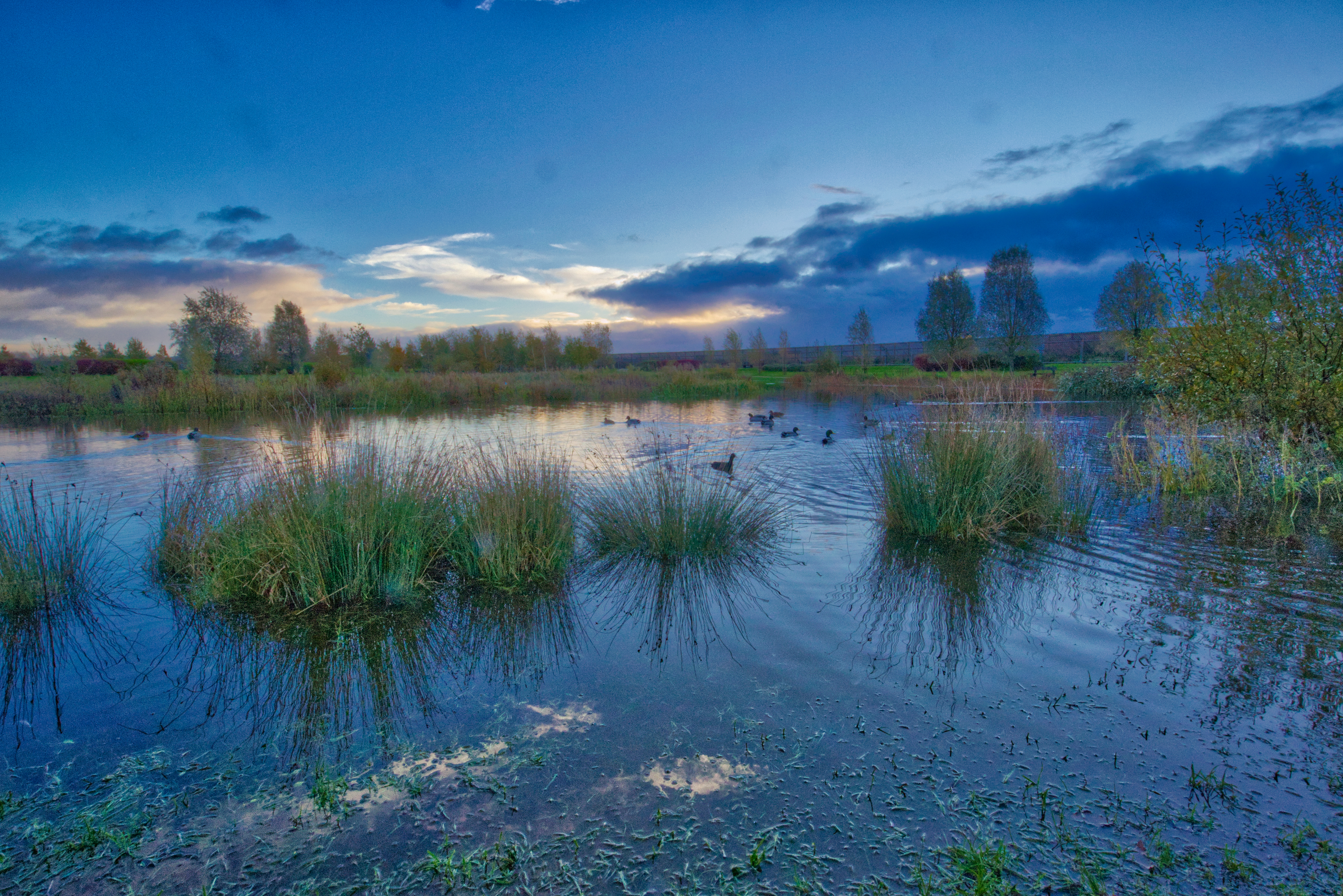
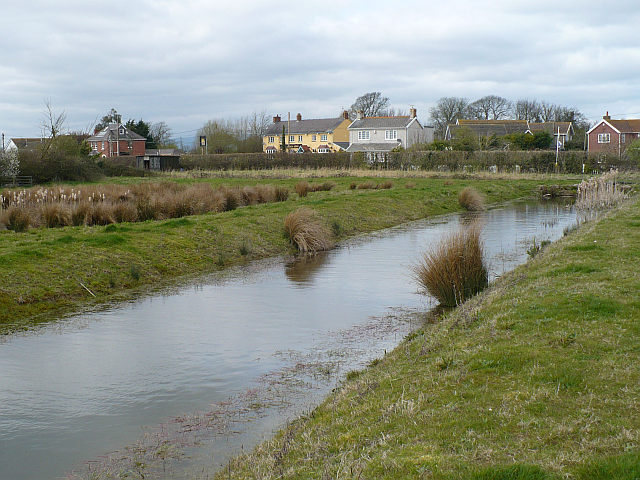
Caldicot Level, located in Monmouthshire, Wales, is a picturesque landscape characterized by its downs and moorland features. Covering an area of approximately 5 square miles, it is situated within the lower reaches of the River Severn floodplain.

The level is primarily composed of gently undulating downs, interspersed with areas of moorland. The downs, also known as grassy or chalky hills, consist of rolling grassland that provides a habitat for a diverse range of plant and animal species. These open areas offer stunning panoramic views of the surrounding countryside and are often used for grazing livestock.

In contrast, the moorland areas of Caldicot Level are characterized by wet, acidic soil and are home to a different range of flora and fauna. These wetland habitats support a variety of plant species, including heathers, mosses, and sedges, and provide a vital breeding ground for several bird species, such as the snipe and curlew.

Caldicot Level is also recognized for its important historical and cultural significance. The area is home to the medieval Caldicot Castle, a Grade I listed building, which attracts tourists and history enthusiasts. Additionally, the level is crisscrossed by a network of footpaths and trails, making it a popular destination for walkers, hikers, and nature lovers.

Overall, Caldicot Level in Monmouthshire showcases a unique blend of downs and moorland, offering visitors a chance to explore diverse habitats and enjoy the natural beauty of the Welsh countryside.

If you have any feedback on the listing, please let us know in the comments section below.

Caldicot Level Images

Images are sourced within 2km of 51.558283/-2.887099 or Grid Reference ST3884. Thanks to Geograph Open Source API. All images are credited.

Cock Street Reen, North Row Roadside drain, Caldicot Level.
Cock Street Reen, North Row
Roadside drain, Caldicot Level.
Cock Street Reen east of North Row Drain, looking upstream, Caldicot Level.
Cock Street Reen east of North Row
Drain, looking upstream, Caldicot Level.
Cattle at gate, North Row
Reen One of the many reens to be found in this area. Greenmoor Farm can just be seen in the distance.
Reen
One of the many reens to be found in this area. Greenmoor Farm can just be seen in the distance.
North Court Farm, near Redwick
Roadside and wind turbine near Llandevenny
North Row, near Redwick
North Row Farm, Redwick
Wheat field near North Court Farm Looking north towards the wind turbine at Llandevenny.  The characteristic rounded form of Wilcrick Hill can be seen in the distance on the right hand side.
Wheat field near North Court Farm
Looking north towards the wind turbine at Llandevenny. The characteristic rounded form of Wilcrick Hill can be seen in the distance on the right hand side.
Not yet updated A4810 road sign near Magor Viewed in early September 2013 when the formerly private steelworks road several hundred metres 
ahead had only recently opened (after upgrading) as a public road from Magor to Newport.
The obliterated parts of the sign were later replaced by Newport and A4810.
The wind turbine <a title="https://www.geograph.org.uk/photo/4410575" href="https://www.geograph.org.uk/photo/4410575">Link</a> is 100 metres high.
Not yet updated A4810 road sign near Magor
Viewed in early September 2013 when the formerly private steelworks road several hundred metres ahead had only recently opened (after upgrading) as a public road from Magor to Newport. The obliterated parts of the sign were later replaced by Newport and A4810. The wind turbine Link is 100 metres high.
Reen bridge to a field south of A4810 near Magor  Reen is the local word for a drainage channel.
Reen bridge to a field south of A4810 near Magor
Reen is the local word for a drainage channel.
Field on the south side of the A4810 near Magor Accessed from the A4810 across this <a title="https://www.geograph.org.uk/photo/4410671" href="https://www.geograph.org.uk/photo/4410671">Link</a> bridge.
Field on the south side of the A4810 near Magor
Accessed from the A4810 across this Link bridge.
Newport District : Grassy Field A right of way crosses through the field.
Newport District : Grassy Field
A right of way crosses through the field.
Newport District : Footpath A footpath and bridge takes you into the next field.
Newport District : Footpath
A footpath and bridge takes you into the next field.
Newport District : Drain A drain heading along the side of the field.
Newport District : Drain
A drain heading along the side of the field.
Newport District : Grassy Field A field of crops in the Newport District.
Newport District : Grassy Field
A field of crops in the Newport District.
No Parking - Access Required At All Times, Whitson The notice is on the gate at the entrance to the National Grid Whitson Substation site. No entry to the site without authority.
No Parking - Access Required At All Times, Whitson
The notice is on the gate at the entrance to the National Grid Whitson Substation site. No entry to the site without authority.
National Grid information board, Whitson Located near this <a title="https://www.geograph.org.uk/photo/7041909" href="https://www.geograph.org.uk/photo/7041909">Link</a> gate. Text on the board in December 2021 includes "Whitson Substation - South West Area" and "Danger 400,000 volts".
National Grid information board, Whitson
Located near this Link gate. Text on the board in December 2021 includes "Whitson Substation - South West Area" and "Danger 400,000 volts".
Show me another place!

Caldicot Level is located at Grid Ref: ST3884 (Lat: 51.558283, Lng: -2.887099)

Unitary Authority: Newport

Police Authority: Gwent

What 3 Words

///tangent.hospitals.darkens. Near Bishton, Newport

Nearby Locations

Caldicot Level

Related Wikis

Whitson

Whitson is a village on the outskirts of the city of Newport, South Wales. It is located about 7 miles (11 km) south east of Newport city centre on the...

Llanwern (electoral ward)

Llanwern is the name of an electoral ward for Newport City Council in south Wales. It covers several rural communities to the east of the city. It is represented...
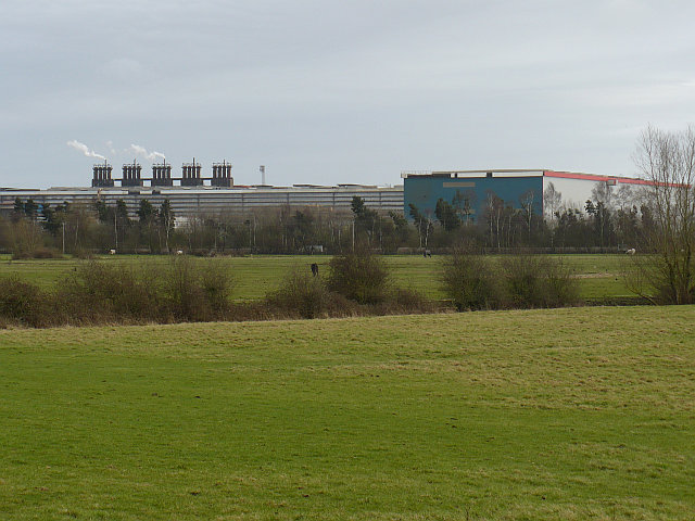
Llanwern steelworks

Llanwern steelworks is located in Llanwern, east of the City of Newport, South Wales. == History == Built for Richard Thomas & Baldwins Ltd, the works...

Llanwern

Llanwern is a community in the eastern part of the City of Newport, South East Wales. Llanwern is bounded by the M4 and Langstone to the north, Ringland...

Glan Llyn

Glan Llyn is the name of a mixed-use community development, to the south-east of Newport, South Wales, at the western end of the former Llanwern steelworks...

Goldcliff, Newport

Goldcliff (Welsh: Allteuryn) is a village, parish and community to the south east of the city of Newport in South Wales. It lies within the Newport city...

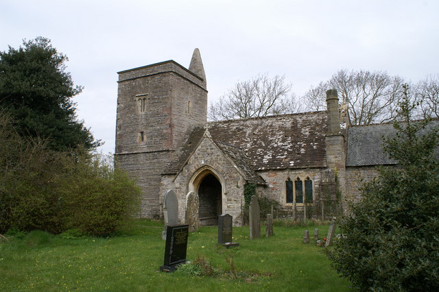
Church of St Thomas, Redwick

The Church of St Thomas is the parish church of the village of Redwick, to the south east of the city of Newport, South Wales, Great Britain. A medieval...

CAF Newport

CAF Newport is a rolling stock factory located at Celtic Business Park, near Llanwern steelworks in Newport. The site was announced as a train-building...

Nearby Amenities

Located within 500m of 51.558283,-2.887099
Power: tower
Lat/Long: 51.5613648/-2.8884741
Power: tower
Lat/Long: 51.5598314/-2.8917874
Power: tower
Lat/Long: 51.5589004/-2.8876788
Power: tower
Lat/Long: 51.5594373/-2.882599
Power: tower
Lat/Long: 51.5606596/-2.8887069
Power: tower
Lat/Long: 51.5616681/-2.8852105
The data included in this document is from www.openstreetmap.org. The data is made available under ODbL.

Have you been to Caldicot Level?

Leave your review of Caldicot Level below (or comments, questions and feedback).