Hallthwaites

Settlement in Cumberland Copeland

England

Hallthwaites

The Punch Bowl Inn, The Green, Millom
The Punch Bowl Inn, The Green, Millom Credit: Colin Park

Hallthwaites is a small village located in the county of Cumberland in northwest England. Situated on the western edge of the Lake District National Park, it is nestled amidst picturesque surroundings, surrounded by rolling hills and lush greenery.

The village is known for its quaint and peaceful atmosphere, making it a popular destination for those seeking a tranquil retreat. The local community is tight-knit, with a close bond among its residents who take pride in their village.

Hallthwaites boasts a rich history, with evidence of human settlement dating back to prehistoric times. The area was once known for its mining industry, particularly coal mining, which played a significant role in the village's development during the 19th and early 20th centuries.

Today, Hallthwaites is primarily a residential area, with a small number of houses and cottages scattered throughout the village. The village features a charming village green, where locals often gather for community events and festivities.

Although Hallthwaites may not offer a wide range of amenities, it benefits from its proximity to larger towns and cities nearby. Residents have easy access to essential services, schools, and shopping facilities in the surrounding areas.

For nature enthusiasts, Hallthwaites serves as an ideal base for exploring the natural beauty of the Lake District. The village is surrounded by numerous walking trails and scenic spots, offering breathtaking views of the countryside and nearby lakes.

In summary, Hallthwaites is a charming village in Cumberland, offering a peaceful and picturesque setting, rich history, and easy access to the stunning landscapes of the Lake District.

If you have any feedback on the listing, please let us know in the comments section below.

Hallthwaites Images

Images are sourced within 2km of 54.257566/-3.25428 or Grid Reference SD1885. Thanks to Geograph Open Source API. All images are credited.

The Punch Bowl Inn, The Green, Millom
Ordnance Survey Cut Mark This OS cut mark can be found adjacent to the letter box at Broadgate. It marks a point 107.274m above mean sea level.
Ordnance Survey Cut Mark
This OS cut mark can be found adjacent to the letter box at Broadgate. It marks a point 107.274m above mean sea level.
Ordnance Survey Cut Mark This OS cut mark can be found on Old Hall Cottage. It marks a point 39.156m above mean sea level.
Ordnance Survey Cut Mark
This OS cut mark can be found on Old Hall Cottage. It marks a point 39.156m above mean sea level.
Ordnance Survey Cut Mark This OS cut mark can be found on Briar Dene. It marks a point 19.020m above mean sea level.
Ordnance Survey Cut Mark
This OS cut mark can be found on Briar Dene. It marks a point 19.020m above mean sea level.
Start of the track to the Swinside Stone Circle The track branching off to the left leads to the Stone Circle and Swinside Farm.
Start of the track to the Swinside Stone Circle
The track branching off to the left leads to the Stone Circle and Swinside Farm.
SRPS Cumbrian Coast Railtour 2018 : Green Road Station
SRPS Cumbrian Coast Railtour 2018 : Signal Post Before Duddon Viaduct
SRPS Cumbrian Coast Railtour 2018 : Approaching Duddon Viaduct
Boundary Stone Toppled and damaged, over stream, south side of the A595.
Boundary Stone
Toppled and damaged, over stream, south side of the A595.
Ordnance Survey Cut Mark This OS cut mark can be found on the gatepost south side of the road. It marks a point 59.576m above mean sea level.
Ordnance Survey Cut Mark
This OS cut mark can be found on the gatepost south side of the road. It marks a point 59.576m above mean sea level.
Ordnance Survey Cut Mark This OS cut mark can be found on the large boulder in the wall SE side of the road. It marks a point 99.048m above mean sea level.
Ordnance Survey Cut Mark
This OS cut mark can be found on the large boulder in the wall SE side of the road. It marks a point 99.048m above mean sea level.
Ordnance Survey OSBM Bolt This OS Bolt can be found on the large boulder at the side of the barn at Low Broadgate. It marks a point 81.764m above mean sea level.
Ordnance Survey OSBM Bolt
This OS Bolt can be found on the large boulder at the side of the barn at Low Broadgate. It marks a point 81.764m above mean sea level.
Ordnance Survey Cut Mark This OS cut mark can be found on the wall NW side of the road. It marks a point 98.207m above mean sea level.
Ordnance Survey Cut Mark
This OS cut mark can be found on the wall NW side of the road. It marks a point 98.207m above mean sea level.
Ordnance Survey Cut Mark This OS cut mark can be found on a gatepost SE side of the track. It marks a point 6.172m above mean sea level.
Ordnance Survey Cut Mark
This OS cut mark can be found on a gatepost SE side of the track. It marks a point 6.172m above mean sea level.
Ordnance Survey Flush Bracket (G3077) This OS Flush Bracket can be found on The Oaks. It marks a point 35.752m above mean sea level.
Ordnance Survey Flush Bracket (G3077)
This OS Flush Bracket can be found on The Oaks. It marks a point 35.752m above mean sea level.
Ordnance Survey Cut Mark This OS cut mark can be found on the gatepost NE side of the road. It marks a point 59.489m above mean sea level.
Ordnance Survey Cut Mark
This OS cut mark can be found on the gatepost NE side of the road. It marks a point 59.489m above mean sea level.
Railway near Lady Hall Lancaster to Barrow line near Green Road.
Railway near Lady Hall
Lancaster to Barrow line near Green Road.
Green Road Station sign at Green Road, Cumbria.
Green Road
Station sign at Green Road, Cumbria.
Show me another place!

Hallthwaites is located at Grid Ref: SD1885 (Lat: 54.257566, Lng: -3.25428)

Administrative County: Cumbria

District: Copeland

Police Authority: Cumbria

What 3 Words

///regime.showcases.melons. Near Millom, Cumbria

Related Wikis

Thwaites, Cumbria

Thwaites is a small village near Duddon Valley and on the edge of the Duddon Estuary in the Lake District National Park in the Borough of Copeland, Cumbria...

St Anne's Church, Thwaites

St Anne's Church is in the village of Thwaites, Cumbria, England. It is an active Anglican parish church in the deanery of Millom, the archdeaconry of...

Millom Without

Millom Without is a civil parish in the county of Cumbria, England. It had a population of 1,638 in 2001, decreasing to 859 at the 2011 Census. Millom...

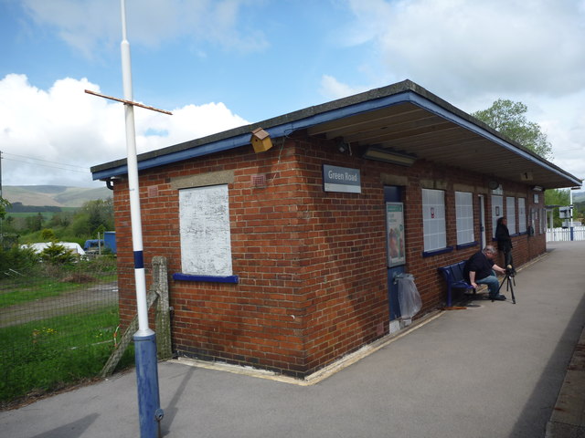
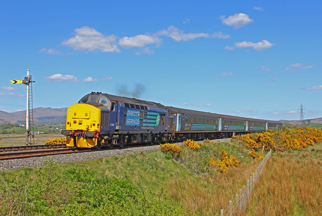
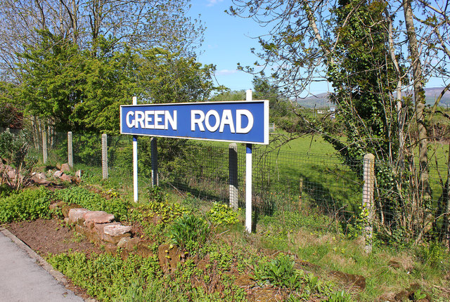
Green Road railway station

Green Road is a railway station on the Cumbrian Coast Line, which runs between Carlisle and Barrow-in-Furness. The station, situated 13+1⁄2 miles (22 km...

Nearby Amenities

Located within 500m of 54.257566,-3.25428
Power: tower
Lat/Long: 54.2558021/-3.2474733
Barrier: stile
Lat/Long: 54.2572656/-3.255224
Barrier: stile
Lat/Long: 54.2574335/-3.2524996
Barrier: stile
Lat/Long: 54.26068/-3.2572356
Post Box
Post Box Type: lamp
Lat/Long: 54.257875/-3.2592547
Power: pole
Lat/Long: 54.2541222/-3.2589635
Power: pole
Lat/Long: 54.2547512/-3.2587609
Power: pole
Lat/Long: 54.2555122/-3.2583672
Power: pole
Lat/Long: 54.2572235/-3.2578461
Power: pole
Lat/Long: 54.2581772/-3.2578403
Power: pole
Lat/Long: 54.2589955/-3.2577998
Power: pole
Lat/Long: 54.2590632/-3.2567114
Power: pole
Lat/Long: 54.2590564/-3.259693
Power: pole
Lat/Long: 54.2591443/-3.2556577
Power: pole
Lat/Long: 54.2592154/-3.2539035
Power: pole
Lat/Long: 54.2582888/-3.2506846
Power: pole
Lat/Long: 54.2575091/-3.2588399
Fire Hydrant
Emergency: fire_hydrant
Fire Hydrant Position: lane
Fire Hydrant Type: underground
Lat/Long: 54.257473/-3.2587153
Power: pole
Lat/Long: 54.2574139/-3.2583819
Power: pole
Lat/Long: 54.2572236/-3.2571756
Power: pole
Lat/Long: 54.2579126/-3.2602099
Power: pole
Lat/Long: 54.257864/-3.2592416
Power: pole
Lat/Long: 54.2580755/-3.2608053
Power: pole
Lat/Long: 54.2591778/-3.250739
Power: pole
Lat/Long: 54.2604024/-3.249375
Power: pole
Lat/Long: 54.2593818/-3.2517356
Power: pole
Lat/Long: 54.2598639/-3.2508335
Power: pole
Lat/Long: 54.2614476/-3.2578746
Power: pole
Lat/Long: 54.2605966/-3.2577978
Power: pole
Lat/Long: 54.259767/-3.2577937
Hallthwaites
Place: village
Source: OS_OpenData_StreetView
Lat/Long: 54.2580677/-3.2595921
The data included in this document is from www.openstreetmap.org. The data is made available under ODbL.

Have you been to Hallthwaites?

Leave your review of Hallthwaites below (or comments, questions and feedback).